Whitewater Township, Hamilton County, Ohio

Last updated

Whitewater Township, Hamilton County, Ohio
Wesley Butler Archeological District, blue sky.jpg
Countryside along U.S. Route 50
Hamilton County Ohio Incorporated and Unincorporated areas Whitewater township highlighted.svg
Location in Hamilton County and the state of Ohio.
Coordinates: 39°11′50″N84°45′51″W / 39.19722°N 84.76417°W / 39.19722; -84.76417
Country United States
State Ohio
County Hamilton
Area
  Total26.3 sq mi (68.2 km2)
  Land25.4 sq mi (65.7 km2)
  Water1.0 sq mi (2.6 km2)
Elevation
[1]
509 ft (155 m)
Population
 (2020) [2]
  Total6,375
  Density251.31/sq mi (97.03/km2)
Time zone UTC-5 (Eastern (EST))
  Summer (DST) UTC-4 (EDT)
FIPS code 39-84938 [3]
GNIS feature ID1086235 [1]
Website www.whitewatertwp.org

Whitewater Township is one of the twelve townships of Hamilton County, Ohio, United States. The population was 6,375 as of the 2020 census.

Contents

Name and history

It is the only Whitewater Township statewide. [4]

Geography

Located in the western part of the county, it borders the following townships:

No municipalities are located in Whitewater Township, although four unincorporated census-designated places lie in the township: Elizabethtown in the southwest, Hooven in the southeast, Blue Jay in the north, and Miamitown in the east.

Demographics

Historical population
CensusPop.Note
1820 1,661
1850 1,344
1860 1,4215.7%
1870 1,60913.2%
1880 1,575−2.1%
1890 1,317−16.4%
1900 1,291−2.0%
1910 1,3373.6%
1920 1,4679.7%
1930 1,5676.8%
1940 1,96425.3%
1950 2,0916.5%
1960 2,88337.9%
1970 3,31815.1%
1980 4,66240.5%
1990 5,17811.1%
2000 5,5647.5%
2010 5,519−0.8%
2020 6,37515.5%
Sources: [5] [2]

2020 census

As of the census of 2020, there were 6,375 people living in the township, for a population density of 251.3 people per square mile (97.0/km2). There were 2,791 housing units. The racial makeup of the township was 90.3% White, 1.8% Black or African American, 0.2% Native American, 0.3% Asian, 0.1% Pacific Islander, 1.5% from some other race, and 5.9% from two or more races. 3.6% of the population were Hispanic or Latino of any race. [2]

There were 2,562 households, out of which 30.2% had children under the age of 18 living with them, 41.9% were married couples living together, 21.0% had a male householder with no spouse present, and 24.9% had a female householder with no spouse present. 30.4% of all households were made up of individuals, and 15.5% were someone living alone who was 65 years of age or older. The average household size was 2.43, and the average family size was 3.15. [2]

25.2% of the township's population were under the age of 18, 57.8% were 18 to 64, and 17.0% were 65 years of age or older. The median age was 38.5. For every 100 females, there were 87.4 males. [2]

According to the U.S. Census American Community Survey, for the period 2016-2020 the estimated median annual income for a household in the township was $55,957 , and the median income for a family was $66,878. About 17.3% of the population were living below the poverty line, including 27.4% of those under age 18 and 6.0% of those age 65 or over. About 60.1% of the population were employed, and 16.0% had a bachelor's degree or higher. [2]

Government

The township is governed by a three-member board of trustees, who are elected in November of odd-numbered years to a four-year term beginning on the following January 1. Two are elected in the year after the presidential election and one is elected in the year before it. There is also an elected township fiscal officer, [6] who serves a four-year term beginning on April 1 of the year after the election, which is held in November of the year before the presidential election. Vacancies in the fiscal officership or on the board of trustees are filled by the remaining trustees.

See also

Related Research Articles

<span class="mw-page-title-main">Hamilton County, Ohio</span> County in Ohio, United States

Hamilton County is located in the southwestern corner of the U.S. state of Ohio. As of the 2020 census, the population was 830,639, making it the third-most populous county in Ohio. The county seat and largest city is Cincinnati. The county is named for the first Secretary of the Treasury, Alexander Hamilton. Hamilton County is part of the Cincinnati-Middletown, OH-KY-IN Metropolitan Statistical Area.

<span class="mw-page-title-main">Ohio County, Indiana</span> County in Indiana, United States

Ohio County is a county located in southeastern Indiana. With a 2020 population of 5,940, and an area of just 87 square miles, Ohio County is the smallest county in Indiana by area and the least populous. The county seat and only incorporated municipality is Rising Sun. The county was officially established in 1844 and was one of the last Indiana counties to be created. Ohio County borders the state of Kentucky across the Ohio River for which it was named. It is part of the Cincinnati, OH-KY-IN Metropolitan Statistical Area. The county is divided into four townships which provide local services. Three state roads pass through or into the county.

<span class="mw-page-title-main">Franklin County, Indiana</span> County in Indiana, United States

Franklin County is a county on the eastern border of the U.S. state of Indiana. In the 2020 United States Census, the county population was 22,785. The county seat is the town of Brookville. Franklin County is part of the Cincinnati, OH–KY–IN Metropolitan Statistical Area. The only incorporated city in Franklin County is Batesville, which lies mostly in adjoining Ripley County.

<span class="mw-page-title-main">Fayette County, Indiana</span> County in Indiana, United States

Fayette County is one of 92 counties in U.S. state of Indiana located in the east central portion of the state. As of 2020, the population was 23,398. Most of the county is rural; land use is farms, pasture and unincorporated woodland. The county seat and only incorporated town is Connersville, which holds a majority of the county's population.

<span class="mw-page-title-main">Ross, Ohio</span> Census-designated place in Ohio, United States

Ross is a census-designated place (CDP) in Ross Township, Butler County, Ohio, United States. The population was 3,478 at the 2020 census. Ross sits along U.S. Route 27 between Cincinnati, Ohio and Oxford, Ohio. Ross is part of the Cincinnati metropolitan area.

<span class="mw-page-title-main">Grandview, Hamilton County, Ohio</span> Census-designated place in Ohio, United States

Grandview is a census-designated place (CDP) in Hamilton County, Ohio, United States. The population was 1,312 at the 2020 census.

<span class="mw-page-title-main">Harrison, Ohio</span> City in Ohio, United States

Harrison is a city in western Hamilton County, Ohio, United States. The population was 12,563 at the 2020 census. It is part of the Cincinnati metropolitan area.

<span class="mw-page-title-main">White Oak, Ohio</span> Census-designated place in Ohio, United States

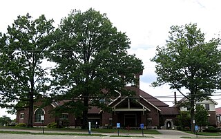
White Oak is a census-designated place (CDP) in Hamilton County, Ohio, United States. It is seven miles northwest of Cincinnati. The population was 19,541 at the 2020 census. White Oak is situated in both Green Township and Colerain Township.

<span class="mw-page-title-main">Colerain Township, Hamilton County, Ohio</span> Township in Ohio, United States

Colerain Township is one of the twelve townships of Hamilton County, Ohio, United States. The population of the township was 59,037 at the 2020 census. It is the second-largest township in Ohio by area, surpassed by Madison Township, Lake County, Ohio.

<span class="mw-page-title-main">Crosby Township, Ohio</span> Township in Ohio, United States

Crosby Township is one of the twelve townships of Hamilton County, Ohio, United States. The 2020 census found 6,030 people in the township.

<span class="mw-page-title-main">Green Township, Hamilton County, Ohio</span> Township in Ohio, United States

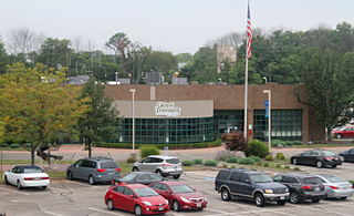
Green Township is one of the twelve townships of Hamilton County, Ohio, United States. It is a suburb of the neighboring city of Cincinnati. With a population of 60,424 at the 2020 census, Green Township is the most populous township in Hamilton County, and the second most populous township in Ohio. It was founded in 1809.

<span class="mw-page-title-main">Harrison Township, Hamilton County, Ohio</span> Township in Ohio, United States

Harrison Township is one of the twelve townships of Hamilton County, Ohio, United States. The 2020 census found 14,288 people in the township.

<span class="mw-page-title-main">Miami Township, Hamilton County, Ohio</span> Township in Ohio, United States

Miami Township is one of the twelve townships of Hamilton County, Ohio, United States. The population was 15,969 as of the 2020 census.

<span class="mw-page-title-main">Springfield Township, Hamilton County, Ohio</span> Township in Ohio, United States

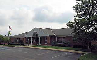
Springfield Township is one of the twelve townships of Hamilton County, Ohio, United States. The population was 35,862 as of the 2020 census. Springfield Township is home to the largest private school in Ohio, the largest lake in Hamilton County, and the Cincinnati area's annual Greek Festival.

<span class="mw-page-title-main">Symmes Township, Hamilton County, Ohio</span> Township in Ohio, United States

Symmes Township is one of the twelve townships of Hamilton County, Ohio, United States. The population was 15,642 as of the 2020 census.

<span class="mw-page-title-main">Sycamore Township, Hamilton County, Ohio</span> Township in Ohio, United States

Sycamore Township is one of the twelve townships of Hamilton County, Ohio, United States. The population was 19,563 as of the 2020 census.

<span class="mw-page-title-main">Dunlap, Ohio</span> Census-designated place in Ohio, United States

Dunlap is a census-designated place (CDP) in Colerain Township, Hamilton County, Ohio, United States. The population was 1,658 at the 2020 census. The siege of Dunlap's Station was a battle that took place near here on the Great Miami in 1791 during the Northwest Indian War.

<span class="mw-page-title-main">Dry Ridge, Ohio</span> Census-designated place in Ohio, United States

Dry Ridge is a census-designated place (CDP) in Colerain Township, Hamilton County, Ohio, United States. The population was 2,698 at the 2020 census.

<span class="mw-page-title-main">Shawnee, Hamilton County, Ohio</span> Census-designated place in Ohio, United States

Shawnee is a census-designated place (CDP) in Miami Township, Hamilton County, Ohio, United States, 21 miles (34 km) west of downtown Cincinnati. The population of Shawnee was 747 at the 2020 census.

<span class="mw-page-title-main">Taylor Creek, Ohio</span> Census-designated place in Ohio, United States

Taylor Creek is a census-designated place (CDP) in Colerain Township, Hamilton County, Ohio, United States. The population was 4,056 at the 2020 census.

References

  1. 1 2 "US Board on Geographic Names". United States Geological Survey. October 25, 2007. Retrieved January 31, 2008.
  2. 1 2 3 4 5 6 "Whitewater township, Hamilton County, Ohio - Census Bureau Profile". United States Census Bureau. Retrieved November 2, 2023.
  3. "U.S. Census website". United States Census Bureau . Retrieved January 31, 2008.
  4. "Detailed map of Ohio" (PDF). United States Census Bureau. 2000. Retrieved February 16, 2007.
  5. "Decennial Census by Decade". United States Census Bureau. Retrieved November 2, 2023.
  6. §503.24, §505.01, and §507.01 of the Ohio Revised Code. Accessed 4/30/2009.