North Bend, Ohio

Last updated

North Bend, Ohio
Harrison tomb.jpg
Flag of North Bend, Ohio.png
Hamilton County Ohio Incorporated and Unincorporated areas North Bend highlighted.svg
Location in Hamilton County and the state of Ohio
Coordinates: 39°09′02″N84°44′40″W / 39.15056°N 84.74444°W / 39.15056; -84.74444
Country United States
State Ohio
County Hamilton
Township Miami
Government
  Type Mayor-council government
   Mayor Doug Sammons [1]
Area
[2]
  Total1.15 sq mi (2.98 km2)
  Land1.09 sq mi (2.83 km2)
  Water0.06 sq mi (0.15 km2)
Elevation
[3]
614 ft (187 m)
Population
 (2020)
  Total835
  Density763.95/sq mi (294.97/km2)
Time zone UTC-5 (Eastern (EST))
  Summer (DST) UTC-4 (EDT)
ZIP code
45052
Area code 513
FIPS code 39-56182 [4]
GNIS feature ID2399511 [3]
Website www.northbendohio.org

North Bend is a village in Miami Township, Hamilton County, Ohio, United States, along the Ohio River. It is a part of the Greater Cincinnati area. The population was 835 at the 2020 census.

Contents

History

Early map of Symmes City Hand Map of Symmes.jpg
Early map of Symmes City
William Henry Harrison greets a visitor at the "First building on North Bend" in an 1840 lithograph Harrison at cabin on North Bend of Ohio - 1840 lithograph.jpg
William Henry Harrison greets a visitor at the “First building on North Bend” in an 1840 lithograph

North Bend was founded in 1789. It was platted as Symmes City but ultimately never took that name. [5] Instead, it was incorporated as the village of North Bend in 1845. [6] It is named for its location, where the Ohio River meanders to the north. [7]

President Benjamin Harrison was born in North Bend. It was the home of his grandfather, President William Henry Harrison. North Bend is the location of the grave of John Cleves Symmes at Congress Green Cemetery and of the William Henry Harrison Tomb State Memorial, the grave of William Henry Harrison. [8] John Scott Harrison, the only man in U.S. history to be the son of a president and the father of a president, was born in North Bend and is buried in his father's vault in North Bend. Eliza Hendricks, wife of U.S. Vice President Thomas A. Hendricks, also was born in North Bend.

On May 5, 1865, North Bend was the site of an early hold-up of a railway train. [9]

Geography

According to the United States Census Bureau, the village has a total area of 1.15 square miles (2.98 km2), of which 1.07 square miles (2.77 km2) is land and 0.08 square miles (0.21 km2) is water. [10]

Demographics

Historical population
CensusPop.Note
1880 412
1900 532
1910 5605.3%
1920 5976.6%
1930 5970.0%
1940 67913.7%
1950 7114.7%
1960 622−12.5%
1970 6382.6%
1980 546−14.4%
1990 541−0.9%
2000 60311.5%
2010 85742.1%
2020 835−2.6%
U.S. Decennial Census [11]

2020 census

As of the census of 2020, there were 835 people living in the village, for a population density of 763.95 people per square mile (294.97/km2). There were 423 housing units. The racial makeup of the village was 93.4% White, 0.5% Black or African American, 0.8% Native American, 0.0% Asian, 0.0% Pacific Islander, 1.0% from some other race, and 4.3% from two or more races. 0.7% of the population were Hispanic or Latino of any race. [12]

There were 430 households, out of which 28.8% had children under the age of 18 living with them, 62.3% were married couples living together, 9.8% had a male householder with no spouse present, and 25.3% had a female householder with no spouse present. 14.9% of all households were made up of individuals, and 9.8% were someone living alone who was 65 years of age or older. The average household size was 2.46, and the average family size was 2.73. [12]

22.1% of the village's population were under the age of 18, 43.9% were 18 to 64, and 34.0% were 65 years of age or older. The median age was 53.9. For every 100 females, there were 120.0 males. [12]

According to the U.S. Census American Community Survey, for the period 2016-2020 the estimated median annual income for a household in the village was $88,910, and the median income for a family was $103,333. About 11.9% of the population were living below the poverty line, including 26.6% of those under age 18 and 4.2% of those age 65 or over. About 50.6% of the population were employed, and 38.4% had a bachelor's degree or higher. [12]

2010 census

As of the census [13] of 2010, there were 857 people, 370 households, and 278 families living in the village. The population density was 800.9 inhabitants per square mile (309.2/km2). There were 412 housing units at an average density of 385.0 per square mile (148.6/km2). The racial makeup of the village was 97.3% White, 0.6% African American, 0.1% Native American, 0.5% Asian, 0.8% from other races, and 0.7% from two or more races. Hispanic or Latino of any race were 1.2% of the population.

There were 370 households, of which 20.8% had children under the age of 18 living with them, 61.9% were married couples living together, 8.9% had a female householder with no husband present, 4.3% had a male householder with no wife present, and 24.9% were non-families. 21.6% of all households were made up of individuals, and 10.6% had someone living alone who was 65 years of age or older. The average household size was 2.32 and the average family size was 2.63.

The median age in the village was 52.7 years. 15.9% of residents were under the age of 18; 7.3% were between the ages of 18 and 24; 15.8% were from 25 to 44; 37.3% were from 45 to 64; and 23.7% were 65 years of age or older. The gender makeup of the village was 50.1% male and 49.9% female.

2000 census

As of the census [4] of 2000, there were 603 people, 253 households, and 182 families living in the village. The population density was 560.3 inhabitants per square mile (216.3/km2). There were 290 housing units at an average density of 269.5 per square mile (104.1/km2). The racial makeup of the village was 99.83% White and 0.17% African American.

There were 253 households, out of which 28.1% had children under the age of 18 living with them, 58.1% were married couples living together, 8.7% had a female householder with no husband present, and 27.7% were non-families. 24.1% of all households were made up of individuals, and 11.9% had someone living alone who was 65 years of age or older. The average household size was 2.38 and the average family size was 2.80.

In the village, the population was spread out, with 22.2% under the age of 18, 7.3% from 18 to 24, 23.4% from 25 to 44, 31.2% from 45 to 64, and 15.9% who were 65 years of age or older. The median age was 43 years. For every 100 females, there were 93.3 males. For every 100 females age 18 and over, there were 92.2 males.

The median income for a household in the village was $51,979, and the median income for a family was $60,833. Males had a median income of $45,000 versus $26,563 for females. The per capita income for the village was $28,792. About 4.9% of families and 6.5% of the population were below the poverty line, including 10.1% of those under age 18 and 4.5% of those age 65 or over.

See also

Related Research Articles

<span class="mw-page-title-main">McCord Bend, Missouri</span> Village in Missouri, United States

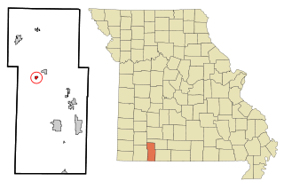
McCord Bend is a village in Stone County, Missouri, United States. The population was 212 at the 2020 census. It is part of the Branson, Missouri Micropolitan Statistical Area.

<span class="mw-page-title-main">Fort Shawnee, Ohio</span> CDP in Ohio, United States

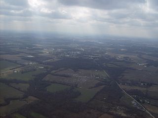
Fort Shawnee is census-designated place (CDP) in Allen County, Ohio, United States. The population was 6,263 at the 2020 census. It is included in the Lima, Ohio Metropolitan Statistical Area. Fort Shawnee is adjacent to the city of Lima and the village of Cridersville in Auglaize County. In 2012, village residents voted to disincorporate the village. According to the United States Census Bureau, the village had a total area of 7.25 square miles (18.78 km2), of which 7.21 square miles (18.67 km2) is land and 0.04 square miles (0.10 km2) is water.

<span class="mw-page-title-main">Fayetteville, Ohio</span> Village in Ohio, United States

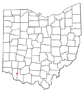
Fayetteville is a village in Perry Township, Brown County, Ohio, United States. The population was 317 at the 2020 census.

<span class="mw-page-title-main">Hamersville, Ohio</span> Village in Ohio, United States

Hamersville is a village in Clark Township, Brown County, Ohio, United States. The population was 485 at the 2020 census.

<span class="mw-page-title-main">Williamsburg, Ohio</span> Village in Ohio, United States

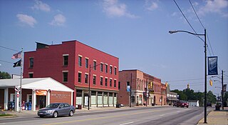
Williamsburg is a village in Clermont County, Ohio, United States. The population was 2,570 at the 2020 census.

<span class="mw-page-title-main">Nellie, Ohio</span> Village in Ohio, United States

Nellie is a village in Coshocton County, Ohio, United States, along the Walhonding River. The population was 122 at the 2020 census.

<span class="mw-page-title-main">North Robinson, Ohio</span> Village in Ohio, United States

North Robinson is a village in Crawford County, Ohio, United States. The population was 219 at the 2020 census.

<span class="mw-page-title-main">Berlin Heights, Ohio</span> Village in Ohio, United States

Berlin Heights is a village in Berlin Township, Erie County, Ohio, United States. The population was 651 at the 2020 census. It is part of the Sandusky, Ohio Metropolitan Statistical Area.

<span class="mw-page-title-main">Lockbourne, Ohio</span> Village in Ohio, United States

Lockbourne is a village in Franklin County and Pickaway County, Ohio, United States. The population was 236 at the 2020 census. Lockbourne is located near Rickenbacker International Airport, and had initially provided its original name of Lockbourne Air Force Base.

<span class="mw-page-title-main">Addyston, Ohio</span> Village in Ohio, United States

Addyston is a village in Miami Township, Hamilton County, Ohio, United States. Located along the Ohio River, it is a western suburb of the neighboring city of Cincinnati. The population was 927 at the 2020 census.

<span class="mw-page-title-main">Cleves, Ohio</span> City in Ohio, United States

Cleves is a village in Miami Township, Hamilton County, Ohio, United States. Located along the Ohio River, it is a western suburb of Cincinnati. The population was 3,414 at the 2020 census.

<span class="mw-page-title-main">Grandview, Hamilton County, Ohio</span> Census-designated place in Ohio, United States

Grandview is a census-designated place (CDP) in Hamilton County, Ohio, United States. The population was 1,312 at the 2020 census.

<span class="mw-page-title-main">Monroeville, Ohio</span> Village in Ohio, United States

Monroeville is a village in Huron County, Ohio, United States. The population was 1,300 at the 2020 census.

<span class="mw-page-title-main">North Fairfield, Ohio</span> Village in Ohio, United States

North Fairfield is a village in Huron County, Ohio, United States. The population was 465 at the 2020 census.

<span class="mw-page-title-main">North Perry, Ohio</span> Village in Ohio, United States

North Perry is a village in Lake County, Ohio, United States. The population was 915 at the 2020 census.

<span class="mw-page-title-main">South Point, Ohio</span> Village in Ohio, United States

South Point is a village in Lawrence County, Ohio, United States, along the Ohio River. The population was 3,836 at the 2020 census. It is part of the Huntington–Ashland metropolitan area.

<span class="mw-page-title-main">South Solon, Ohio</span> Village in Ohio, United States

South Solon is a village in Madison County, Ohio, United States. The population was 329 at the 2020 census. Despite their similar names, South Solon is not adjacent to the city of Solon, Ohio, a suburb of Cleveland in Cuyahoga County. The two towns are approximately 170 miles (270 km) apart.

<span class="mw-page-title-main">New Boston, Ohio</span> Village in Ohio, United States

New Boston is a village in Scioto County, Ohio, United States, along the Ohio River. The population was 2,298 at the 2020 census. Apart from its southern boundary on the Ohio River, New Boston is entirely surrounded by the city of Portsmouth.

<span class="mw-page-title-main">Port Jefferson, Ohio</span> Village in Ohio, United States

Port Jefferson is a village in Salem Township, Shelby County, Ohio, United States. The population was 308 at the 2020 census.

<span class="mw-page-title-main">Congress, Ohio</span> Village in Ohio, United States

Congress is a village in Wayne County, Ohio, United States. The population was 132 at the 2020 census.

References

  1. "Village Officials". North Bend, Ohio History and Government. Village of North Bend, Ohio. Retrieved July 23, 2020.
  2. "ArcGIS REST Services Directory". United States Census Bureau. Retrieved September 20, 2022.
  3. 1 2 U.S. Geological Survey Geographic Names Information System: North Bend, Ohio
  4. 1 2 "U.S. Census website". United States Census Bureau . Retrieved January 31, 2008.
  5. Compton, Harvey Wilson (January 1933). "The Beginnings of Ohio Cities" (PDF). Northwest Ohio Quarterly. 1 (5). The Historical Society of Northwestern Ohio.
  6. Hellmann, Paul T. (May 13, 2013). Historical Gazetteer of the United States. Routledge. p. 868. ISBN   978-1135948597 . Retrieved November 30, 2013.
  7. Knepper, George W. (2003). Ohio and Its People. Kent State University Press. p. 64. ISBN   9780873387910 . Retrieved December 2, 2013.
  8. Clarke, S. J. (1912). Cincinnati, the Queen City, 1788-1912, Volume 2. The S. J. Clarke Publishing Company. p. 532. Retrieved May 20, 2013.
  9. northbendohio.org. "Village of North Bend, Ohio history and government". www.northbendohio.org. Retrieved April 25, 2017.
  10. "US Gazetteer files 2010". United States Census Bureau. Archived from the original on January 31, 2013. Retrieved January 6, 2013.
  11. "Census of Population and Housing". Census.gov. Retrieved June 4, 2015.
  12. 1 2 3 4 "North Bend village, Ohio - Census Bureau Profile". United States Census Bureau. Retrieved October 21, 2023.
  13. "U.S. Census website". United States Census Bureau . Retrieved January 6, 2013.