Adams County, Ohio

Last updated

Adams County
AdamsCountyOHCourthouse1.JPG
Adams county seal.png
Map of Ohio highlighting Adams County.svg
Location within the U.S. state of Ohio
Ohio in United States.svg
Ohio's location within the U.S.
Coordinates: 38°50′N83°29′W / 38.84°N 83.48°W / 38.84; -83.48
CountryFlag of the United States.svg United States
StateFlag of Ohio.svg  Ohio
FoundedJuly 10, 1797 [1]
Named for John Adams
Seat West Union
Largest villageWest Union
Area
  Total586 sq mi (1,520 km2)
  Land584 sq mi (1,510 km2)
  Water2.4 sq mi (6 km2)  0.4%
Population
 (2020)
  Total27,477 Decrease2.svg
  Density47/sq mi (18/km2)
Time zone UTC−5 (Eastern)
  Summer (DST) UTC−4 (EDT)
Congressional district 2nd
Website www.adamscountyoh.gov OOjs UI icon edit-ltr-progressive.svg

Adams County is a county in the U.S. state of Ohio. As of the 2020 census, the population was 27,477. [2] Its county seat and largest village is West Union. [3] The county is named after John Adams, the second President of the United States. [4]

Contents

Geography

According to the U.S. Census Bureau, the county has an area of 586 square miles (1,520 km2), of which 584 square miles (1,510 km2) is land and 2.4 square miles (6.2 km2) (0.4%) is water. [5] It includes many parks and preserves, including one of Ohio's greatest archeological wonders, the Serpent Mound at the Serpent Mound State Memorial in Locust Grove. Serpent Mound lends its name to the Serpent Mound crater, the eroded remnant of a huge ancient meteorite impact crater. Other areas of note include parks and natural areas like The Edge of Appalachia Preserve, Shawnee State Park, Adams Lake State Park, and Robert H. Whipple State Nature Preserve. [6]

Adjacent counties

State protected areas

Demographics

Historical population
CensusPop.Note
1800 3,432
1810 9,434174.9%
1820 10,40610.3%
1830 12,28118.0%
1840 13,1837.3%
1850 18,88343.2%
1860 20,3097.6%
1870 20,7502.2%
1880 24,00515.7%
1890 26,0938.7%
1900 26,3280.9%
1910 24,755−6.0%
1920 22,403−9.5%
1930 20,381−9.0%
1940 21,7056.5%
1950 20,499−5.6%
1960 19,982−2.5%
1970 18,957−5.1%
1980 24,32828.3%
1990 25,3714.3%
2000 27,3307.7%
2010 28,5504.5%
2020 27,477−3.8%
U.S. Decennial Census [7]
1790–1960 [8] 1900–1990 [9]
1990–2000 [10] 2020 [2]

2000 census

As of the census [11] of 2000, 27,330 people, 10,501 households, and 7,613 families resided in the county. The population density was 47 people per square mile (18 people/km2). There were 11,822 housing units at an average density of 20 per square mile (7.7/km2). The racial makeup of the county was 97.77% White, 0.18% Black or African American, 0.68% Native American, 0.12% Asian, 0.03% Pacific Islander, 0.11% from other races, and 1.10% from two or more races. 0.64% of the population were Hispanic or Latino of any race. 38.5% were of American, 19.8% German, 11.7% Irish and 8.9% English ancestry according to Census 2000.

There were 10,501 households, out of which 34.00% had children under the age of 18 living with them, 57.10% were married couples living together, 10.40% had a female householder with no husband present, and 27.50% were non-families. 24.00% of all households were made up of individuals, and 11.00% had someone living alone who was 65 years of age or older. The average household size was 2.57 and the average family size was 3.03.

In the county, the population was spread out, with 26.40% under the age of 18, 8.70% from 18 to 24, 28.20% from 25 to 44, 23.40% from 45 to 64, and 13.30% who were 65 years of age or older. The median age was 36 years. For every 100 females there were 96.10 males. For every 100 females age 18 and over, there were 94.80 males.

The median income for a household in the county was $29,315, and the median income for a family was $34,714. Males had a median income of $30,000 versus $20,433 for females. The per capita income for the county was $14,515. About 12.80% of families and 17.40% of the population were below the poverty line, including 20.30% of those under age 18 and 16.00% of those age 65 or over.

2010 census

As of the 2010 United States Census, 28,550 people, 11,147 households, and 7,793 families resided in the county. [12] The population density was 48.9 inhabitants per square mile (18.9/km2). There were 12,978 housing units at an average density of 22.2 per square mile (8.6/km2). [13] The racial makeup of the county was 97.7% white, 0.4% American Indian, 0.3% black or African American, 0.1% Asian, 0.2% from other races, and 1.3% from two or more races. Those of Hispanic or Latino origin made up 0.9% of the population. [12] In terms of ancestry, 17.6% were German, 16.5% were American, 15.3% were Irish, and 9.8% were English. [14]

Of the 11,147 households, 33.5% had children under the age of 18 living with them, 52.2% were married couples living together, 12.1% had a female householder with no husband present, 30.1% were non-families, and 25.9% of all households were made up of individuals. The average household size was 2.53 and the average family size was 3.01. The median age was 39.6 years. [12]

The median income for a household in the county was $32,791 and the median income for a family was $40,305. Males had a median income of $37,277 versus $25,746 for females. The per capita income for the county was $17,693. About 18.8% of families and 23.0% of the population were below the poverty line, including 30.0% of those under age 18 and 16.8% of those age 65 or over. [15]

Economy

The economy of Adams County employs 10,100 people. Its largest industries are manufacturing (1,774 people), retail trade (1,618 people), and health care and social assistance (1,599 people), and the highest paying industries are utilities ($69,063), and finance and insurance ($56,938). [16] A 2019 report identified Adams County as the poorest in Ohio with a 23.8% poverty rate and median household income of $36,320 ($16,000 less than the state average). The county also has the state's highest unemployment rate at 6.8%. Poor economic conditions led to a 2.1% decrease in the county's population during the previous five years. [17]

Politics

Prior to 1936, Adams County was a swing county in presidential elections, holding bellwether status from 1896 to 1932. From 1936 on, the county has become strongly Republican and failed to back Republican candidates only in 1964 and 1976 since then, which also enabled it to regain bellwether status from 1964 to 1988.

United States presidential election results for Adams County, Ohio [18]
Year Republican Democratic Third party
No.%No.%No.%
2020 9,87081.27%2,15617.75%1190.98%
2016 8,65975.88%2,32620.38%4273.74%
2012 6,86561.75%3,97635.76%2772.49%
2008 6,91460.57%4,17036.53%3302.89%
2004 7,65363.78%4,28135.67%660.55%
2000 6,38062.34%3,58134.99%2742.68%
1996 4,76345.88%4,31741.59%1,30112.53%
1992 4,72243.89%3,99837.16%2,03818.94%
1988 5,91660.71%3,74038.38%880.90%
1984 6,11362.83%3,53436.32%820.84%
1980 5,33653.75%4,16141.91%4314.34%
1976 4,19747.80%4,45050.68%1331.51%
1972 4,98063.18%2,70934.37%1932.45%
1968 3,97351.54%2,68534.83%1,05013.62%
1964 3,70242.52%5,00557.48%00.00%
1960 5,99660.59%3,90039.41%00.00%
1956 5,63759.14%3,89440.86%00.00%
1952 5,64858.93%3,93741.07%00.00%
1948 5,10354.24%4,29345.63%120.13%
1944 5,59058.30%3,99841.70%00.00%
1940 6,18055.24%5,00744.76%00.00%
1936 5,91050.21%5,83249.55%280.24%
1932 4,85744.43%5,90954.06%1651.51%
1928 5,66565.23%3,00034.54%200.23%
1924 4,31552.46%3,76245.73%1491.81%
1920 4,97454.07%4,19445.59%310.34%
1916 2,81948.21%2,88749.38%1412.41%
1912 1,86338.03%2,27946.52%75715.45%
1908 3,43252.11%3,04846.28%1061.61%
1904 3,25251.98%2,79644.69%2083.32%
1900 3,53551.81%3,16946.45%1191.74%
1896 3,33850.13%3,24848.78%731.10%
1892 2,90348.44%2,83247.26%2584.31%
1888 2,87047.71%3,02250.24%1232.04%
1884 2,83349.05%2,88649.97%570.99%
1880 2,56348.39%2,72551.44%90.17%
1876 2,14145.47%2,54654.07%220.47%
1872 1,87748.63%1,97251.09%110.28%
1868 2,04447.63%2,24752.37%00.00%
1864 2,09451.99%1,93448.01%00.00%
1860 1,66743.33%2,01052.25%1704.42%
1856 1,40740.49%1,79051.51%2788.00%

Government

Adams County has a three-member Board of County Commissioners who manage the various County departments. Adams County's elected commissioners are: Ty Pell, Diane Ward, and Barbara Moore. [19]

Library

The Adams County Public Library serves the communities of Adams County, Ohio from its administrative location in Peebles and branches in Manchester, West Union, and Seaman.

In 2005, the library system loaned more than 264,000 items to its 14,000 cardholders. Total holdings (as of 2005) were over 101,000 volumes with over 250 periodical subscriptions. [20]

Hospital

Adams County is served by the Adams County Regional Medical Center near Seaman. The hospital was previously known as Adams County Hospital, and was in West Union. It was renamed and relocated to Seaman, and is easily accessible from the Appalachian Highway.

Communities

Map of Adams County, Ohio With Municipal and Township Labels Map of Adams County Ohio With Municipal and Township Labels.PNG
Map of Adams County, Ohio With Municipal and Township Labels

Villages

Townships

Census-designated places

Other unincorporated communities

Places of interest

Notable people

See also

Related Research Articles

<span class="mw-page-title-main">Lawrence County, Alabama</span> County in Alabama, United States

Lawrence County is a county in the northern part of the U.S. state of Alabama. As of the 2020 census, the population was 33,073. The county seat is Moulton. The county was named after James Lawrence, a captain in the United States Navy from New Jersey.

<span class="mw-page-title-main">Washington County, Ohio</span> County in Ohio, United States

Washington County is a county located in the southeastern part of the U.S. state of Ohio. As of the 2020 census, the population was 59,711. Its county seat is Marietta. The county, the oldest in the state, is named for George Washington. Washington County comprises the Marietta, OH Micropolitan Statistical Area, which is also included in the Parkersburg-Marietta-Vienna, WV-OH Combined Statistical Area.

<span class="mw-page-title-main">Van Wert County, Ohio</span> County in Ohio, United States

Van Wert County is a county located in the U.S. state of Ohio. As of the 2020 census, the population was 28,931. Its county seat is Van Wert. The county was created on February 12, 1820, and later organized on March 18, 1837. It is named for Isaac Van Wart, one of the captors of John André in the American Revolutionary War.

<span class="mw-page-title-main">Pike County, Ohio</span> County in Ohio, United States

Pike County is a county located in the Appalachian (southern) region of the U.S. state of Ohio. As of the 2020 census, the population was 27,088. Its county seat is Waverly. The county is named for explorer Zebulon Pike.

<span class="mw-page-title-main">Muskingum County, Ohio</span> County in Ohio, United States

Muskingum County is a county located in the U.S. state of Ohio. As of the 2020 census, the population was 86,410. Its county seat is Zanesville. Nearly bisected by the Muskingum River, the county name is based on a Delaware American Indian word translated as "town by the river" or "elk's eye".

<span class="mw-page-title-main">Monroe County, Ohio</span> County in Ohio, United States

Monroe County is a county located on the eastern border of the U.S. state of Ohio, across the Ohio River from West Virginia. As of the 2020 census, the population was 13,385, making it the second-least populous county in Ohio. Its county seat is Woodsfield. The county was created in 1813 and later organized in 1815.

<span class="mw-page-title-main">Lake County, Ohio</span> County in Ohio, United States

Lake County is a county in the U.S. state of Ohio. As of the 2020 census, the population was 232,603. Its county seat is Painesville, and its largest city is Mentor.

<span class="mw-page-title-main">Highland County, Ohio</span> County in Ohio, United States

Highland County is a county located in the U.S. state of Ohio. As of the 2020 census, the population was 43,317. Its county seat is Hillsboro. The county is named for the topography which is hilly and divides the watersheds of the Little Miami and Scioto Rivers.

<span class="mw-page-title-main">Fulton County, Ohio</span> County in Ohio, United States

Fulton County is a county located in the U.S. state of Ohio west of Toledo. As of the 2020 census, the population was 42,713. Its county seat and largest city is Wauseon. The county was created in 1850 with land from Henry, Lucas, and Williams counties and is named for Robert Fulton, inventor of the steamboat. Fulton County is a part of the Toledo metropolitan area.

<span class="mw-page-title-main">Crawford County, Ohio</span> County in Ohio, United States

Crawford County is a county located in the north central portion of the U.S. state of Ohio. As of the 2020 census, the population was 42,025. Its county seat and largest city is Bucyrus. The county was created in 1820 and later organized in 1836. It was named for Colonel William Crawford, a soldier during the American Revolution.

<span class="mw-page-title-main">Coshocton County, Ohio</span> County in Ohio, United States

Coshocton County is a county located in the U.S. state of Ohio. As of the 2020 census, the population was 36,612. Its county seat and largest city is Coshocton. The county lies within the Appalachian region of the state. The county was formed on January 31, 1810, from portions of Muskingum and Tuscarawas Counties and later organized in 1811. Its name comes from the Delaware Indian language and has been translated as "union of waters" or "black bear crossing". Coshocton was mentioned by David Zeisberger in his diary from the 1780s using the German spelling "Goschachgünk". The Coshocton, OH Micropolitan Statistical Area includes all of Coshocton County.

<span class="mw-page-title-main">Champaign County, Ohio</span> County in Ohio, United States

Champaign County is a county located in the U.S. state of Ohio. As of the 2020 census, the population was 38,714. Its county seat and largest city is Urbana. The county takes its name from the French word for "open level country". Champaign County became the 18th of 88 Ohio counties on March 1, 1805. It was formed from parts of Greene and Franklin counties by legislative action.

<span class="mw-page-title-main">Athens County, Ohio</span> County in Ohio, United States

Athens County is a county in southeastern Ohio. As of the 2020 census, the population was 62,431. Its county seat and largest city is Athens. The county was formed in 1805 from Washington County. Because Ohio's first state university, Ohio University, was established here in 1804, the town and the county are named for the ancient center of learning, Athens, Greece.

<span class="mw-page-title-main">Pulaski County, Illinois</span> County in Illinois, United States

Pulaski County is a county located in the U.S. state of Illinois. According to the 2020 census, it had a population of 5,193. Its county seat is Mound City. Its largest city is Mounds. It is located along the Ohio River in the southwestern portion of the state, known locally as "Little Egypt".

<span class="mw-page-title-main">Mound City, Illinois</span> City in Illinois, United States

Mound City is a city and the county seat of Pulaski County, Illinois, United States. It is located along the Ohio River just north of its confluence with the Mississippi River. As of the 2010 census, the city population was 588.

<span class="mw-page-title-main">Peebles, Ohio</span> Village in Ohio, United States

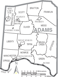
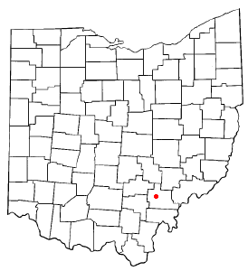
Peebles is a village in Adams County, Ohio, United States. It is 64 miles (103 km) east of Cincinnati. The population was 1,774 at the 2020 census.

<span class="mw-page-title-main">Seaman, Ohio</span> Village in Ohio, United States

Seaman is a village in Scott Township, Adams County, Ohio, United States. The population was 973 at the 2020 census.

<span class="mw-page-title-main">The Plains, Ohio</span> Census-designated place in Ohio, United States

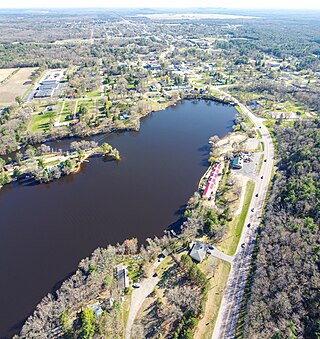
The Plains is a census-designated place (CDP) in Athens County, Ohio, United States. The population was 3,140 at the 2020 census.

<span class="mw-page-title-main">Zaleski, Ohio</span> Village in Ohio, United States

Zaleski is a village in Vinton County, Ohio, United States. The population was 230 at the 2020 census.

<span class="mw-page-title-main">Friendship (village), Wisconsin</span> Village in Wisconsin, United States

Friendship is a village in Adams County in the U.S. state of Wisconsin. It is the county seat of Adams County. The population was 725 at the 2010 census.

References

  1. "Ohio County Profiles: Adams County" (PDF). Ohio Department of Development. Archived from the original (PDF) on June 21, 2007. Retrieved April 28, 2007.
  2. 1 2 2020 census
  3. "Find a County". National Association of Counties. Archived from the original on May 31, 2011. Retrieved June 7, 2011.
  4. Taylor, William Alexander (1899). Ohio Statesmen and Annals of Progress. Press of the Westbote Company. p. 243.
  5. "2010 Census Gazetteer Files". United States Census Bureau. August 22, 2012. Archived from the original on May 4, 2014. Retrieved February 7, 2015.
  6. Volkman, Claire. "The 10 Best Midwest Foliage Drives to Leaf Peep Like a Champ". iExplore.com. Inside-Out Media. Retrieved September 21, 2016.
  7. "U.S. Decennial Census". United States Census Bureau. Retrieved February 7, 2015.
  8. "Historical Census Browser". University of Virginia Library. Retrieved February 7, 2015.
  9. Forstall, Richard L., ed. (March 27, 1995). "Population of Counties by Decennial Census: 1900 to 1990". United States Census Bureau. Retrieved February 7, 2015.
  10. "Census 2000 PHC-T-4. Ranking Tables for Counties: 1990 and 2000" (PDF). United States Census Bureau. April 2, 2001. Retrieved February 7, 2015.
  11. "U.S. Census website". United States Census Bureau . Retrieved January 31, 2008.
  12. 1 2 3 "DP-1 Profile of General Population and Housing Characteristics: 2010 Demographic Profile Data". United States Census Bureau. Archived from the original on February 13, 2020. Retrieved December 27, 2015.
  13. "Population, Housing Units, Area, and Density: 2010 - County". United States Census Bureau. Archived from the original on February 13, 2020. Retrieved December 27, 2015.
  14. "DP02 SELECTED SOCIAL CHARACTERISTICS IN THE UNITED STATES – 2006-2010 American Community Survey 5-Year Estimates". United States Census Bureau. Archived from the original on February 13, 2020. Retrieved December 27, 2015.
  15. "DP03 SELECTED ECONOMIC CHARACTERISTICS – 2006-2010 American Community Survey 5-Year Estimates". United States Census Bureau. Archived from the original on February 13, 2020. Retrieved December 27, 2015.
  16. "Adams County Economic Data". Data USA. Retrieved November 21, 2019.
  17. Stebbins, Samuel. "Poorest counties in the US: A state-by-state look at where median household income is low". USA Today. Retrieved November 21, 2019.
  18. Leip, David. "Dave Leip's Atlas of U.S. Presidential Elections". uselectionatlas.org. Retrieved May 1, 2018.
  19. "Adams County Commissioners". Adams County Ohio Government Portal. Archived from the original on April 30, 2015. Retrieved March 21, 2019.
  20. "2005 Ohio Public Library Statistics:Statistics by County and Town". State Library of Ohio. Archived from the original on September 24, 2006. Retrieved November 6, 2006.
  21. "Ohio Township Websites". Ohio Township Association. Archived from the original on July 15, 2016. Retrieved January 17, 2022.
  22. Homren, Wayne. "E-Sylum v11n07 - Article #28". www.coinbooks.org. Retrieved May 1, 2018.
  23. "Brushcreek Motorsports Complex » Peebles, OH". www.brushcreekmotorsports.com. Retrieved May 1, 2018.

38°50′N83°29′W / 38.84°N 83.48°W / 38.84; -83.48