Seaman, Ohio

Last updated

Seaman, Ohio
SeamanOH2.JPG
Adams County Ohio incorporated and unincorporated areas Seaman highlighted.svg
Location in Adams County and the state of Ohio.
Coordinates: 38°55′59″N83°34′04″W / 38.93306°N 83.56778°W / 38.93306; -83.56778
Country United States
State Ohio
County Adams
Township Scott
Area
[1]
  Total1.07 sq mi (2.76 km2)
  Land1.07 sq mi (2.76 km2)
  Water0.00 sq mi (0.00 km2)
Elevation
[2]
899 ft (274 m)
Population
 (2020)
  Total973
  Density911.90/sq mi (351.94/km2)
Time zone UTC-5 (Eastern (EST))
  Summer (DST) UTC-4 (EDT)
ZIP code
45679
Area code(s) 937, 326
FIPS code 39-71206 [3]
GNIS feature ID2399778 [2]

Seaman is a village in Scott Township, Adams County, Ohio, United States. The population was 973 at the 2020 census.

Contents

State Route 247 passes through Seaman. Seaman is adjacent to Ohio State Route 32, a four lane divided highway known as the Appalachian Highway. The Appalachian Highway links Seaman to Cincinnati. A traffic signal is at the intersection of Routes 32 and 247.

Seaman is served by North Adams High School, the Adams County/Ohio Valley School District, and the North Adams Public Library, [4] a branch of the Adams County Public Library. Seaman is also home to the Adams County Regional Medical Center, a county hospital built in 2007.

History

Seaman was laid out in 1888 when the railroad was extended to that point. [5] The Cincinnati & Eastern Railroad today is the Cincinnati Eastern Railroad (CCET). The village was named after the local Seaman family. [6]

Geography

According to the United States Census Bureau, the village has a total area of 1.07 square miles (2.77 km2), all land. [7]

Demographics

Historical population
CensusPop.Note
1920 553
1930 71729.7%
1940 7261.3%
1950 7361.4%
1960 714−3.0%
1970 86621.3%
1980 1,03920.0%
1990 1,013−2.5%
2000 1,0392.6%
2010 944−9.1%
2020 9733.1%
U.S. Decennial Census [8]

2010 census

As of the census [9] of 2010, 944 people, 368 households, and 254 families resided in the village. The population density was 882.2 inhabitants per square mile (340.6/km2). There were 425 housing units at an average density of 397.2 per square mile (153.4/km2). The racial makeup of the village was 99.9% White, 0.01% African American, 0.03% Native American, 0.01% Asian, 0.03% from other races, and 0.01% from two or more races. Hispanic or Latino of any race were 0.01% of the population.

There were 368 households, of which 36.7% had children under the age of 18 living with them, 47.3% were married couples living together, 17.1% had a female householder with no husband present, 4.6% had a male householder with no wife present, and 31.0% were non-families. 27.4% of all households were made up of individuals, and 15.2% had someone living alone who was 65 years of age or older. The average household size was 2.57 and the average family size was 3.09.

The median age in the village was 35.5 years. 26.9% of residents were under the age of 18; 8.7% were between the ages of 18 and 24; 26.3% were from 25 to 44; 21.8% were from 45 to 64; and 16.3% were 65 years of age or older. The gender makeup of the village was 47.7% male and 52.3% female.

2000 census

As of the census [3] of 2000, there were 1,039 people, 407 households, and 271 families residing in the village. The population density was 1,017.6 inhabitants per square mile (392.9/km2). There were 443 housing units at an average density of 433.9 per square mile (167.5/km2). The racial makeup of the village was 98.56% White, 0.48% Native American, 0.10% Asian, 0.10% from other races, and 0.77% from two or more races. Hispanic or Latino of any race were 0.77% of the population.

There were 407 households, out of which 33.9% had children under the age of 18 living with them, 52.1% were married couples living together, 11.1% had a female householder with no husband present, and 33.2% were non-families. 29.5% of all households were made up of individuals, and 15.5% had someone living alone who was 65 years of age or older. The average household size was 2.55 and the average family size was 3.18.

In the village, the population was spread out, with 29.4% under the age of 18, 8.9% from 18 to 24, 26.7% from 25 to 44, 19.0% from 45 to 64, and 16.2% who were 65 years of age or older. The median age was 35 years. For every 100 females there were 84.5 males. For every 100 females age 18 and over, there were 85.4 males.

The median income for a household in the village was $24,938, and the median income for a family was $34,375. Males had a median income of $31,328 versus $17,381 for females. The per capita income for the village was $13,138. About 17.1% of families and 21.7% of the population were below the poverty line, including 29.5% of those under age 18 and 17.8% of those age 65 or over.

Hospital

Seaman is served by the Adams County Regional Medical Center, located at 230 Medical Center Drive. The hospital was known as Adams County Hospital, and was in West Union, but was renamed and relocated to Seaman.

Notable people

Related Research Articles

<span class="mw-page-title-main">Adams County, Ohio</span> County in Ohio, United States

Adams County is a county in the U.S. state of Ohio. As of the 2020 census, the population was 27,477. Its county seat and largest village is West Union. The county is named after John Adams, the second President of the United States.

<span class="mw-page-title-main">Cherry Fork, Ohio</span> Unincorporated community and Census-designated place in Ohio, United States

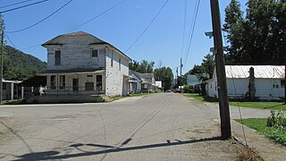
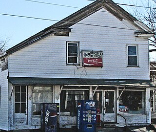
Cherry Fork is an unincorporated community and former village in Wayne Township, Adams County, Ohio, United States. The population was 170 at the 2020 census. In 2014, voters chose to disincorporate the village.

<span class="mw-page-title-main">Manchester, Ohio</span> Village in Ohio, United States

Manchester is a village in Manchester Township, Adams County, Ohio, United States, along the Ohio River. The population was 1,839 at the 2020 census.

<span class="mw-page-title-main">Rome, Ohio</span> Village in Ohio, United States

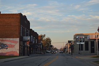
Rome, also known as Stout, is a village in Green Township, Adams County, Ohio, United States, along the Ohio River. The population was 83 at the 2020 census.

<span class="mw-page-title-main">West Union, Ohio</span> Village in Ohio, United States

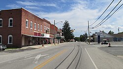
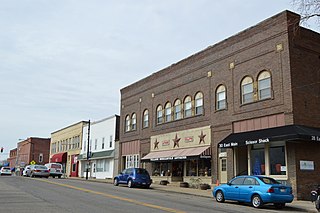
West Union is a village in Adams County, Ohio, United States, about 55 miles (89 km) southeast of Cincinnati. The population was 3,004 at the 2020 census. It is the county seat of Adams County. West Union is served by West Union High School, the Adams County/Ohio Valley School District, and the West Union Public Library, a branch of the Adams County Public Library.

<span class="mw-page-title-main">Plainfield, Ohio</span> Village in Ohio, United States

Plainfield is a village in Coshocton County, Ohio, United States, along Wills Creek. The population was 141 at the 2020 census.

<span class="mw-page-title-main">Warsaw, Ohio</span> Village in Ohio, United States

Warsaw is a village in Coshocton County, Ohio, United States, along the Walhonding River. The population was 624 at the 2020 census.

<span class="mw-page-title-main">Gordon, Ohio</span> Village in Ohio, United States

Gordon is a village in Darke County, Ohio, United States. The population was 245 at the 2020 census.

<span class="mw-page-title-main">Lyons, Ohio</span> Village in Ohio, United States

Lyons is a village in Fulton County, Ohio, United States. The population was 602 at the 2020 census.

<span class="mw-page-title-main">Addyston, Ohio</span> Village in Ohio, United States

Addyston is a village in Miami Township, Hamilton County, Ohio, United States. Located along the Ohio River, it is a western suburb of the neighboring city of Cincinnati. The population was 927 at the 2020 census.

<span class="mw-page-title-main">Cleves, Ohio</span> City in Ohio, United States

Cleves is a village in Miami Township, Hamilton County, Ohio, United States. Located along the Ohio River, it is a western suburb of Cincinnati. The population was 3,414 at the 2020 census.

<span class="mw-page-title-main">Evendale, Ohio</span> Village in Ohio, United States

Evendale is a village in Hamilton County, Ohio, United States, within the Cincinnati metropolitan area. The population was 2,669 at the 2020 census.

<span class="mw-page-title-main">Tiltonsville, Ohio</span> Village in Ohio, United States

Tiltonsville is a village in southern Jefferson County, Ohio, United States, along the Ohio River. The population was 1,259 at the 2020 census. It is a part of the Weirton–Steubenville metropolitan area.

<span class="mw-page-title-main">Centerburg, Ohio</span> Village in Ohio, United States

Centerburg is a village in Knox County, Ohio, United States, along the North Fork of the Licking River. As of the 2020 census, the village population was 1,690. Centerburg is located near the geographical center of Ohio.

<span class="mw-page-title-main">Danville, Ohio</span> Village in Ohio, United States

Danville is a village in Knox County, Ohio, United States. The population was 1,019 at the 2020 census.

<span class="mw-page-title-main">Hebron, Ohio</span> Village in Ohio, USA

Hebron is a village in Licking County, Ohio, United States. The population was 2,326 at the 2020 census.

<span class="mw-page-title-main">Adamsville, Ohio</span> Village in Ohio, United States

Adamsville is a village in Muskingum County, Ohio, United States. The population was 140 at the 2020 census. It is part of the Zanesville micropolitan area.

<span class="mw-page-title-main">Bairdstown, Ohio</span> Village in Ohio, United States

Bairdstown is a village in Wood County, Ohio, United States. The population was 115 at the 2020 census.

<span class="mw-page-title-main">Bradford, Ohio</span> Village in Ohio, United States

Bradford is a village in Darke and Miami counties in the U.S. state of Ohio. The population was 1,796 at the 2020 census.

<span class="mw-page-title-main">Winchester, Adams County, Ohio</span> Village in Ohio, United States

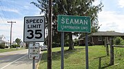
Winchester is a village in Adams County, Ohio, United States. The population was 987 at the 2020 census. The name of the surrounding township is also named Winchester.

References

  1. "ArcGIS REST Services Directory". United States Census Bureau. Retrieved September 20, 2022.
  2. 1 2 U.S. Geological Survey Geographic Names Information System: Seaman, Ohio
  3. 1 2 "U.S. Census website". United States Census Bureau . Retrieved January 31, 2008.
  4. "Locations & Hours". Adams County Public Library. Retrieved February 25, 2018.
  5. Evans, Nelson Wiley (1900). A History of Adams County, Ohio: From Its Earliest Settlement to the Present Time. E B. Stivers. pp.  458.
  6. Overman, William Daniel (1958). Ohio Town Names. Akron, OH: Atlantic Press. p. 124.
  7. "US Gazetteer files 2010". United States Census Bureau. Archived from the original on January 25, 2012. Retrieved January 6, 2013.
  8. "Census of Population and Housing". Census.gov. Retrieved June 4, 2015.
  9. "U.S. Census website". United States Census Bureau . Retrieved January 6, 2013.