Hiramsburg, Ohio

Last updated
Methodist church on State Route 340 Hiramsburg UMC.jpg
Methodist church on State Route 340

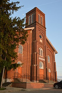
Hiramsburg is an unincorporated community in Noble County, in the U.S. state of Ohio. [1]

Noble County, Ohio County in the United States

Noble County is a county located in the U.S. state of Ohio. As of the 2010 census, the population was 14,645, making it the third-least populous county in Ohio. Its county seat is Caldwell. The county is named for Rep. Warren P. Noble of the Ohio House of Representatives, who was an early settler there.

U.S. state constituent political entity of the United States

In the United States, a state is a constituent political entity, of which there are currently 50. Bound together in a political union, each state holds governmental jurisdiction over a separate and defined geographic territory and shares its sovereignty with the federal government. Due to this shared sovereignty, Americans are citizens both of the federal republic and of the state in which they reside. State citizenship and residency are flexible, and no government approval is required to move between states, except for persons restricted by certain types of court orders. Four states use the term commonwealth rather than state in their full official names.

Ohio State of the United States of America

Ohio is a Midwestern state in the Great Lakes region of the United States. Of the fifty states, it is the 34th largest by area, the seventh most populous, and the tenth most densely populated. The state's capital and largest city is Columbus.

History

Hiramsburg was platted in 1836 by Hiram Calvert, and named for him. [2] A post office was established at Hiramsburg in 1837, and remained in operation until 1920. [3]

Plat scale map showing the divisions of a piece of land

In the United States, a plat is a map, drawn to scale, showing the divisions of a piece of land. United States General Land Office surveyors drafted township plats of Public Lands Surveys to show the distance and bearing between section corners, sometimes including topographic or vegetation information. City, town or village plats show subdivisions into blocks with streets and alleys. Further refinement often splits blocks into individual lots, usually for the purpose of selling the described lots; this has become known as subdivision.

Related Research Articles

Harriettsville, Ohio human settlement in Ohio, United States of America

Harriettsville is an unincorporated community in western Elk Township, Noble County, Ohio, United States. It lies along State Route 145 at its intersection with County Road 46. The East Fork of Duck Creek, a subsidiary of the Ohio River that meets the river near Marietta, runs along State Route 145 past the community. It lies 8 miles (13 km) northeast of Lower Salem by road, and 13 miles (21 km) directly southeast of Caldwell, the county seat of Noble County.

Fulda, Ohio unincorporated community in Ohio, United States

Fulda is an unincorporated community in Noble County, Ohio, United States.

Dungannon, Noble County, Ohio human settlement in United States of America

Dungannon is an unincorporated community in Noble County, Ohio, United States.

Carlisle is an unincorporated community in Noble County, in the U.S. state of Ohio.

Dudley is an unincorporated community in Noble County, in the U.S. state of Ohio.

Elk is an unincorporated community in Noble County, in the U.S. state of Ohio.

Gem is an unincorporated community in Noble County, in the U.S. state of Ohio.

Honesty is an unincorporated community in Noble County, in the U.S. state of Ohio.

Hoskinsville is an unincorporated community in Noble County, in the U.S. state of Ohio.

Keith is an unincorporated community in Noble County, in the U.S. state of Ohio.

Kennonsburg is an unincorporated community in Noble County, in the U.S. state of Ohio.

Middleburg is an unincorporated community in Noble County, in the U.S. state of Ohio.

Moundsville is an unincorporated community in Noble County, in the U.S. state of Ohio.

South Olive is an unincorporated community in Noble County, in the U.S. state of Ohio.

Olive Green is an unincorporated community in Noble County, in the U.S. state of Ohio.

Rochester is an unincorporated community in Noble County, in the U.S. state of Ohio.

Sharon, Ohio human settlement in United States of America

Sharon is an unincorporated community in Noble County, in the U.S. state of Ohio.

Steamtown is an unincorporated community in Noble County, in the U.S. state of Ohio.

Newman Creek is a stream in the U.S. state of Ohio.

Ten Mile is an unincorporated community in Macon County, in the U.S. state of Missouri.

References

  1. U.S. Geological Survey Geographic Names Information System: Hiramsburg, Ohio
  2. History of Noble County, Ohio. L. H. Watkins. 1887. p. 496.
  3. "Noble County". Jim Forte Postal History. Retrieved 10 December 2015.

Coordinates: 39°48′30″N81°35′44″W / 39.80833°N 81.59556°W / 39.80833; -81.59556

Geographic coordinate system Coordinate system

A geographic coordinate system is a coordinate system that enables every location on Earth to be specified by a set of numbers, letters or symbols. The coordinates are often chosen such that one of the numbers represents a vertical position and two or three of the numbers represent a horizontal position; alternatively, a geographic position may be expressed in a combined three-dimensional Cartesian vector. A common choice of coordinates is latitude, longitude and elevation. To specify a location on a plane requires a map projection.