Spring Valley, Ohio

Last updated

Spring Valley, Ohio
Main Street Historic District in Spring Valley.jpg
Downtown Spring Valley
OHMap-doton-Spring Valley.png
Location of Spring Valley, Ohio
Map of Greene County Ohio Highlighting Spring Valley Village.png
Location of Spring Valley in Greene County
Coordinates: 39°36′37″N84°00′25″W / 39.61028°N 84.00694°W / 39.61028; -84.00694
Country United States
State Ohio
County Greene
Area
[1]
  Total0.27 sq mi (0.69 km2)
  Land0.27 sq mi (0.69 km2)
  Water0.00 sq mi (0.00 km2)
Elevation
[2]
778 ft (237 m)
Population
 (2020)
  Total415
  Density1,560.15/sq mi (601.80/km2)
Time zone UTC-5 (Eastern (EST))
  Summer (DST) UTC-4 (EDT)
ZIP code
45370
Area code(s) 937, 326
FIPS code 39-74216 [3]
GNIS feature ID2399878 [2]

Spring Valley is a village in Greene County, Ohio, United States. The population was 415 at the 2020 census. It is part of the Dayton Metropolitan Statistical Area.

Contents

History

Spring Valley had its start in the early 1840s by the building of the Little Miami Railroad through that territory. The town was platted in 1844. [4]

Geography

According to the United States Census Bureau, the village has a total area of 0.27 square miles (0.70 km2), all of it land. [5]

Demographics

Historical population
CensusPop.Note
1870 290
1880 37629.7%
1890 53843.1%
1900 522−3.0%
1910 443−15.1%
1920 4440.2%
1930 4787.7%
1940 468−2.1%
1950 64537.8%
1960 6785.1%
1970 667−1.6%
1980 541−18.9%
1990 507−6.3%
2000 5100.6%
2010 479−6.1%
2020 415−13.4%
U.S. Decennial Census [6]

2010 census

As of the census [7] of 2010, there were 479 people, 198 households, and 136 families living in the village. The population density was 1,774.1 inhabitants per square mile (685.0/km2). There were 221 housing units at an average density of 818.5 per square mile (316.0/km2). The racial makeup of the village was 97.3% White, 0.2% African American, 0.2% Native American, 0.2% from other races, and 2.1% from two or more races. Hispanic or Latino of any race were 0.8% of the population.

There were 198 households, of which 26.8% had children under the age of 18 living with them, 54.0% were married couples living together, 9.6% had a female householder with no husband present, 5.1% had a male householder with no wife present, and 31.3% were non-families. 23.7% of all households were made up of individuals, and 5% had someone living alone who was 65 years of age or older. The average household size was 2.42 and the average family size was 2.83.

The median age in the village was 43.8 years. 19.4% of residents were under the age of 18; 6.9% were between the ages of 18 and 24; 24.7% were from 25 to 44; 34.7% were from 45 to 64; and 14.4% were 65 years of age or older. The gender makeup of the village was 50.3% male and 49.7% female.

2000 census

As of the census [3] of 2000, there were 510 people, 195 households, and 147 families living in the village. The population density was 1,832.9 inhabitants per square mile (707.7/km2). There were 211 housing units at an average density of 758.3 per square mile (292.8/km2). The racial makeup of the village was 95.88% White, 1.76% African American, 0.39% Native American, 0.20% Asian, and 1.76% from two or more races.

There were 195 households, out of which 33.3% had children under the age of 18 living with them, 60.5% were married couples living together, 8.2% had a female householder with no husband present, and 24.6% were non-families. 20.0% of all households were made up of individuals, and 6.2% had someone living alone who was 65 years of age or older. The average household size was 2.62 and the average family size was 2.99.

In the village, the population was spread out, with 23.7% under the age of 18, 10.2% from 18 to 24, 30.8% from 25 to 44, 23.7% from 45 to 64, and 11.6% who were 65 years of age or older. The median age was 38 years. For every 100 females there were 103.2 males. For every 100 females age 18 and over, there were 98.5 males.

The median income for a household in the village was $42,500, and the median income for a family was $44,231. Males had a median income of $31,382 versus $26,250 for females. The per capita income for the village was $26,071. About 1.4% of families and 2.8% of the population were below the poverty line, including 3.4% of those under age 18 and none of those age 65 or over.

Related Research Articles

<span class="mw-page-title-main">Marlborough, Missouri</span> Village in Missouri, United States

Marlborough is a village in St. Louis County, Missouri, United States. The population was 2,179 at the 2010 census.

<span class="mw-page-title-main">Wilbur Park, Missouri</span> Village in Missouri, United States

Wilbur Park is a village in St. Louis County, Missouri, United States. The population was 439 at the 2020 census.

<span class="mw-page-title-main">Uplands Park, Missouri</span> Village in Missouri, United States

Uplands Park is a village in St. Louis County, Missouri, United States. The population was 445 at the 2010 census. The village is one of many small majority black communities located in the Natural Bridge corridor of mid-St. Louis County, characterized by small homes on small lots.

<span class="mw-page-title-main">Nellie, Ohio</span> Village in Ohio, United States

Nellie is a village in Coshocton County, Ohio, United States, along the Walhonding River. The population was 122 at the 2020 census.

<span class="mw-page-title-main">Cuyahoga Heights, Ohio</span> Village in Ohio, United States

Cuyahoga Heights is a village in Cuyahoga County, Ohio, United States. The population was 573 at the 2020 census. A suburb of Cleveland, it is a part of the Cleveland metropolitan area.

<span class="mw-page-title-main">Walton Hills, Ohio</span> Village in Ohio, United States

Walton Hills is a village in Cuyahoga County, Ohio, United States. The population was 2,033 at the 2020 census. A suburb of Cleveland, it is a part of the Cleveland metropolitan area.

<span class="mw-page-title-main">Gordon, Ohio</span> Village in Ohio, United States

Gordon is a village in Darke County, Ohio, United States. The population was 245 at the 2020 census.

<span class="mw-page-title-main">Wayne Lakes, Ohio</span> Village in Ohio, United States

Wayne Lakes is a village in Darke County, Ohio, United States. The population was 693 at the 2020 census.

<span class="mw-page-title-main">Valleyview, Ohio</span> Village in Ohio, United States

Valleyview is a village in Franklin County, Ohio, United States. The population was 669 at the 2020 census.

<span class="mw-page-title-main">Addyston, Ohio</span> Village in Ohio, United States

Addyston is a village in Miami Township, Hamilton County, Ohio, United States. Located along the Ohio River, it is a western suburb of the neighboring city of Cincinnati. The population was 927 at the 2020 census.

<span class="mw-page-title-main">Cleves, Ohio</span> City in Ohio, United States

Cleves is a village in Miami Township, Hamilton County, Ohio, United States. Located along the Ohio River, it is a western suburb of Cincinnati. The population was 3,414 at the 2020 census.

<span class="mw-page-title-main">Evendale, Ohio</span> Village in Ohio, United States

Evendale is a village in Hamilton County, Ohio, United States, within the Cincinnati metropolitan area. The population was 2,669 at the 2020 census.

<span class="mw-page-title-main">Tarlton, Ohio</span> Village in Ohio, United States

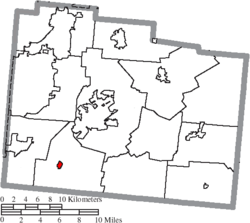
Tarlton is a village in Fairfield and Pickaway counties in the U.S. state of Ohio. The population was 254 at the 2020 census.

<span class="mw-page-title-main">Hartville, Ohio</span> Village in Ohio, United States

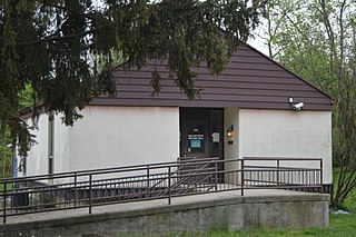
Hartville is a village in northern Stark County, Ohio, United States. The population was 3,329 at the 2020 census. It is part of the Canton–Massillon metropolitan area. Hartville lies halfway between Akron and Canton at the intersection of State Routes 43 and 619.

<span class="mw-page-title-main">Burbank, Ohio</span> Village in Ohio, United States

Burbank is a village in Wayne County, Ohio, United States, along Killbuck Creek. The population was 296 at the 2020 census.

<span class="mw-page-title-main">Harpster, Ohio</span> Village in Ohio, United States

Harpster is a village in Wyandot County, Ohio, United States. The population was 160 at the 2020 census.

<span class="mw-page-title-main">Friesland, Wisconsin</span> Village in Wisconsin, United States

Friesland is a village in Columbia County, Wisconsin, United States. The population was 320 at the 2020 census. It is part of the Madison Metropolitan Statistical Area, and was named after Friesland, one of the twelve provinces of the Netherlands.

<span class="mw-page-title-main">Avoca, Wisconsin</span> Village in Wisconsin, United States

Avoca is a village in Iowa County, Wisconsin, United States. The population was 637 at the 2010 census. It is part of the Madison Metropolitan Statistical Area. It is named after Avoca in Ireland.

<span class="mw-page-title-main">Verona, Ohio</span> Village in Ohio, United States

Verona is a village in Montgomery and Preble counties in the U.S. state of Ohio. The population was 403 at the 2020 census. It is part of the Dayton Metropolitan Statistical Area.

<span class="mw-page-title-main">Lowell, Wisconsin</span> Village in Wisconsin, United States

Lowell is a village in Dodge County, Wisconsin, United States, along the Beaver Dam River. The population was 340 at the 2010 census. The village is located within the Town of Lowell.

References

  1. "ArcGIS REST Services Directory". United States Census Bureau. Retrieved September 20, 2022.
  2. 1 2 U.S. Geological Survey Geographic Names Information System: Spring Valley, Ohio
  3. 1 2 "U.S. Census website". United States Census Bureau . Retrieved January 31, 2008.
  4. Broadstone, Michael A. (1918). History of Greene County, Ohio: Its People, Industries and Institutions, Volume 1. B.F. Bowen. p. 347.
  5. "US Gazetteer files 2010". United States Census Bureau. Archived from the original on January 25, 2012. Retrieved January 6, 2013.
  6. "Census of Population and Housing". Census.gov. Retrieved June 4, 2015.
  7. "U.S. Census website". United States Census Bureau . Retrieved January 6, 2013.