Lakemore, Ohio | |
---|---|
Coordinates: 41°01′17″N81°25′35″W / 41.02139°N 81.42639°W | |
Country | United States |
State | Ohio |
County | Summit |
Area | |
• Total | 1.66 sq mi (4.30 km2) |
• Land | 1.45 sq mi (3.76 km2) |
• Water | 0.21 sq mi (0.54 km2) |
Elevation | 1,102 ft (336 m) |
Population (2020) | |
• Total | 2,926 |
• Density | 2,017.93/sq mi (779.04/km2) |
Time zone | UTC-5 (Eastern (EST)) |
• Summer (DST) | UTC-4 (EDT) |
ZIP code | 44250 |
Area code | 330 |
FIPS code | 39-41454 [3] |
GNIS feature ID | 1087005 [2] |
Website | http://www.lakemoreohio.org |
Lakemore is a village in Summit County, Ohio, United States. The population was 2,926 at the 2020 census. It is part of the Akron metropolitan area.
According to the United States Census Bureau, the village has a total area of 1.67 square miles (4.33 km2), of which 1.48 square miles (3.83 km2) is land and 0.19 square miles (0.49 km2) is water. [4]
Census | Pop. | Note | %± |
---|---|---|---|
1930 | 1,670 | — | |
1940 | 1,832 | 9.7% | |
1950 | 2,463 | 34.4% | |
1960 | 2,765 | 12.3% | |
1970 | 2,708 | −2.1% | |
1980 | 2,744 | 1.3% | |
1990 | 2,684 | −2.2% | |
2000 | 2,561 | −4.6% | |
2010 | 3,068 | 19.8% | |
2020 | 2,926 | −4.6% | |
U.S. Decennial Census [5] |
As of the census [6] of 2010, there were 3,068 people, 1,237 households, and 833 families living in the village. The population density was 2,073.0 inhabitants per square mile (800.4/km2). There were 1,368 housing units at an average density of 924.3 per square mile (356.9/km2). The racial makeup of the village was 95.4% White, 2.0% African American, 0.2% Native American, 0.7% Asian, 0.2% from other races, and 1.4% from two or more races. Hispanic or Latino of any race were 1.1% of the population.
There were 1,237 households, of which 30.3% had children under the age of 18 living with them, 44.7% were married couples living together, 16.3% had a female householder with no husband present, 6.3% had a male householder with no wife present, and 32.7% were non-families. 24.7% of all households were made up of individuals, and 9.6% had someone living alone who was 65 years of age or older. The average household size was 2.47 and the average family size was 2.91.
The median age in the village was 40.3 years. 21.3% of residents were under the age of 18; 8.7% were between the ages of 18 and 24; 26.2% were from 25 to 44; 29.5% were from 45 to 64; and 14.2% were 65 years of age or older. The gender makeup of the village was 47.2% male and 52.8% female.
As of the census [3] of 2000, there were 2,561 people, 969 households, and 704 families living in the village. The population density was 1,751.8 inhabitants per square mile (676.4/km2). There were 1,018 housing units at an average density of 696.3 per square mile (268.8/km2). The racial makeup of the village was 97.81% White, 0.47% African American, 0.35% Native American, 0.04% Asian, 0.04% Pacific Islander, 0.16% from other races, and 1.13% from two or more races. Hispanic or Latino of any race were 0.51% of the population.
There were 969 households, out of which 32.1% had children under the age of 18 living with them, 52.3% were married couples living together, 13.5% had a female householder with no husband present, and 27.3% were non-families. 21.7% of all households were made up of individuals, and 8.9% had someone living alone who was 65 years of age or older. The average household size was 2.64 and the average family size was 3.07.
In the village, the population was spread out, with 24.9% under the age of 18, 9.1% from 18 to 24, 29.9% from 25 to 44, 24.7% from 45 to 64, and 11.4% who were 65 years of age or older. The median age was 36 years. For every 100 females there were 97.9 males. For every 100 females age 18 and over, there were 96.2 males.
The median income for a household in the village was $34,129, and the median income for a family was $37,174. Males had a median income of $31,288 versus $22,019 for females. The per capita income for the village was $14,837. About 7.4% of families and 10.1% of the population were below the poverty line, including 15.3% of those under age 18 and 2.6% of those age 65 or over
Lakemore is governed by a mayor and six-member council, all of whom are elected at-large to four-year terms.
The current Mayor is Richard Cole (D).
The current members of council are:
Lakemore is part of the school district of neighboring Springfield Township.
Lakemore is home to Springfield Junior High School and Springfield Senior High School.
Lakemore is also home to a private, faith-based K-12 school, SUPER Learning Center.
Lakemore has a public library, a branch of the Akron-Summit County Public Library. [7]
Holloway is a village in Belmont County, Ohio, United States. The population was 330 at the 2020 census. It is part of the Wheeling metropolitan area. Holloway was laid out in 1883, and named after the local Holloway family.
Clarksville is a village in Clinton County, Ohio, United States. The population was 534 at the 2020 census. It is served by the Clinton Massie branch of the Wilmington Public Library of Clinton County.
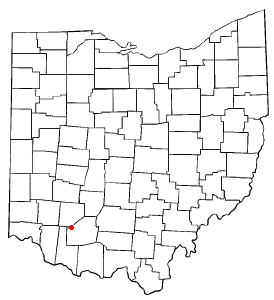
Addyston is a village in Miami Township, Hamilton County, Ohio, United States. Located along the Ohio River, it is a western suburb of the neighboring city of Cincinnati. The population was 927 at the 2020 census.
Highland is a village in Fairfield Township, Highland County, Ohio, United States. The population was 232 at the 2020 census.
Laurelville is a village in Hocking County, Ohio, United States. The population was 512 at the 2020 census.
Madison is a village in Lake County, Ohio, United States. The population was 3,435 at the 2020 census.
Athalia is a village in Lawrence County, Ohio, United States, along the Ohio River. The population was 279 at the 2020 census.
Shawnee is a village in Perry County, Ohio, United States. The population was 505 at the 2020 census. It is 9 miles (14 km) south of the county seat of New Lexington.
Tarlton is a village in Fairfield and Pickaway counties in the U.S. state of Ohio. The population was 254 at the 2020 census.
Camden is a village in Preble County, Ohio, United States. The population was 1,989 at the 2020 census.
Gratis is a village in Preble County, Ohio, United States. The population was 842 at the 2020 census. It is part of the Dayton Metropolitan Statistical Area.
Clarksburg is a village in Ross County, Ohio, United States. The population was 409 at the 2020 census.
Wilmot is a village in southwestern Stark County, Ohio, United States. The population was 282 at the 2020 census. It is part of the Canton–Massillon metropolitan area.
Clinton is a village in southwestern Summit County, Ohio, United States. The population was 1,197 at the 2020 Census. It is part of the Akron metropolitan area.
Fairlawn is a city in western Summit County, Ohio, United States, and a suburb of Akron. The population was 7,710 at the 2020 census. It is part of the Akron metropolitan area.
Parral is a village in Tuscarawas County, Ohio, United States. The population was 205 at the 2020 census.
Apple Creek is a village in East Union Township, Wayne County, Ohio, United States. The population was 1,188 at the 2020 census.
Marshallville is a village in Wayne County, Ohio. The population was 789 at the time of the 2020 census. Marshallville was originally called Bristol, and under the latter name was laid out in 1817.
Smithville is a village in Wayne County, Ohio, United States. The population was 1,338 at the time of the 2020 census. The village derives its name from Thomas Smith, a pioneer settler.
Lynchburg is a village in Clinton and Highland counties in the U.S. state of Ohio. The population was 1,510 at the 2020 census.