Twinsburg, Ohio

Last updated

Twinsburg, Ohio
Twinsburg Historical Society.jpg
Motto: 
\
Summit County Ohio incorporated and unincorporated areas Twinsburg highlighted.svg
Location in Summit County and the state of Ohio.
Coordinates: 41°19′19″N81°26′42″W / 41.32194°N 81.44500°W / 41.32194; -81.44500
Country United States
State Ohio
County Summit
Government
   Mayor Sam Scaffide
Area
[1]
  Total13.79 sq mi (35.72 km2)
  Land13.76 sq mi (35.63 km2)
  Water0.03 sq mi (0.09 km2)
Elevation
[2]
974 ft (297 m)
Population
 (2020)
  Total19,248
  Density1,398.94/sq mi (540.14/km2)
Time zone UTC-5 (Eastern (EST))
  Summer (DST) UTC-4 (EDT)
ZIP code
44087
Area code 330
FIPS code 39-78050 [3]
GNIS feature ID1087020 [2]
Website http://www.mytwinsburg.com/

Twinsburg is a suburban city in Summit County, Ohio, United States, located midway between Akron and Cleveland. The population was 19,248 as of the 2020 census. It is part of the Akron metropolitan area.

Contents

History

In 1817 Ethan Alling, then aged 16, came to Township Five in the tenth range of the Connecticut Land Company, also known as Millsville. Alling was to survey the 400 acres (1.6 km2) of land his Connecticut family had purchased. He is considered the first settler of the town that would be renamed Twinsburg, and later he became the postmaster of the town, as well as a merchant, stagecoach operator, and hotel proprietor. A pair of identical twins named Moses and Aaron Wilcox, from Killingworth, Connecticut, purchased some 4,000 acres (16 km2) of land in 1819. They sold tracts at low prices to attract other settlers. The twins offered 6 acres (24,000 m2) of land for a public square and $20 to support the town's first school on the condition that the community would change its name from Millsville to Twinsburg. [4]

In 1963, the Twinsburg Historical Society was founded. It was housed in the building formerly occupied by the Twinsburg Institute (founded by Samuel Bissell and built in 1863). The museum run by the Historical Society holds pictures, papers and documents related to the area's history. Tools and artifacts used by early artisans and farmers, furniture, including domestic items, clothes, and books, as well as letters and records of Twinsburg's early days, are all showcased. [4] The Mail Pouch Tobacco sign displayed on the barn was one of the last ones painted by the famous barn painter Harley Warrick.[ citation needed ]

Geography

According to the United States Census Bureau, the city has a total area of 32.3 km² (12.5 mi²). 32.2 km2 (12.4 mi2) of it is land and 0.1 km2 (0.04 mi2) of it (0.24%) is water.

Demographics

Historical population
CensusPop.Note
1880 201
1930 1,240
1940 1,74740.9%
1950 2,68953.9%
1960 4,09852.4%
1970 6,43257.0%
1980 7,62718.6%
1990 9,60625.9%
2000 17,00677.0%
2010 18,79510.5%
2020 19,2482.4%
2021 (est.)19,3280.4%
Sources: [5] [6] [3] [7]

2010 census

As of the census [8] of 2010, there were 18,795 people, 7,507 households, and 5,124 families residing in the city. The population density was 1,364.9 inhabitants per square mile (527.0/km2). There were 7,898 housing units at an average density of 573.6 per square mile (221.5/km2). The racial makeup of the city was 78.5% White, 13.4% African American, 0.1% Native American, 5.7% Asian, 0.3% from other races, and 1.9% from two or more races. Hispanic or Latino of any race were 1.2% of the population.

There were 7,507 households, of which 35.5% had children under the age of 18 living with them, 56.9% were married couples living together, 8.9% had a female householder with no husband present, 2.5% had a male householder with no wife present, and 31.7% were non-families. 27.8% of all households were made up of individuals, and 12.1% had someone living alone who was 65 years of age or older. The average household size was 2.49 and the average family size was 3.09.

The median age in the city was 41.4 years. 25.4% of residents were under the age of 18; 5.7% were between the ages of 18 and 24; 24.8% were from 25 to 44; 29.4% were from 45 to 64; and 14.5% were 65 years of age or older. The gender makeup of the city was 46.8% male and 53.2% female.

Of the city's population over the age of 25, 44.1% holds a bachelor's degree or higher. [9]

2000 census

As of the census [3] of 2000, there were 17,006 people, 6,641 households, and 4,695 families residing in the city. The population density was 1,366.7 inhabitants per square mile (527.7/km2). There were 6,871 housing units at an average density of 552.2 per square mile (213.2/km2). The racial makeup of the city was 86.93% White, 8.73% African American, 0.11% Native American, 2.95% Asian, 0.01% Pacific Islander, 0.31% from other races, and 0.96% from two or more races. Hispanic or Latino of any race were 1.03% of the population.

There were 6,641 households, out of which 35.5% had children under the age of 18 living with them, 60.7% were married couples living together, 7.7% had a female householder with no husband present, and 29.3% were non-families. 24.9% of all households were made up of individuals, and 8.6% had someone living alone who was 65 years of age or older. The average household size was 2.54 and the average family size was 3.08.

In the city the population was spread out, with 26.7% under the age of 18, 5.1% from 18 to 24, 35.5% from 25 to 44, 21.6% from 45 to 64, and 11.2% who were 65 years of age or older. The median age was 36 years. For every 100 females, there were 92.0 males. For every 100 females age 18 and over, there were 88.2 males.

Culture

Twinsburg holds a yearly festival for twins, and other multiple births, called Twins Days. The festival started in 1976 and has grown to be the world's largest annual gathering of twins, with around 3,000 sets attending annually. The festival attracts twins, multiples, and their families from much of the world, with many sets returning year after year. [10]

Government

MayorYears in officeNotes
FirstLast
Anthony Perici19791987First full-time mayor [11]
James Karabec19871999
Katherine Procop19992015
Ted Yates20152022
Sam Scaffide2022

Education

Kent State University Twinsburg Academic Center Twinsburg kent state 8.jpg
Kent State University Twinsburg Academic Center

The Twinsburg City School District is composed of five schools, 4,069 students, 234 classified staff, and 272 certified staff. [12] The schools have received the "Excellent with Distinction" rating for the Ohio state tests for the 2010–11 school year. [13] Schools in the city are as follows:

According to the Twinsburg City Schools, [14] The "Old School" located on Darrow Road [15] was the only school building in Twinsburg until 1957, and was closed as a public school in 1992. [16] The Twinsburg campus of Kent State Geauga occupied the "Old School" building until building a new facility in 2012. [15] Supporters of the "Old School" have tried to have the building placed on the National Register of Historic Places, to prevent it from being torn down for redevelopment. The building has since been torn down. As of 2024, a vacant lot stands where the school once did. [17] [16]

Twinsburg is served by the Twinsburg Public Library.

Notable people

Related Research Articles

<span class="mw-page-title-main">Preble County, Ohio</span> County in Ohio, United States

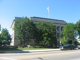
Preble County is a county located in the U.S. state of Ohio. As of the 2020 census, the population was 40,999, down 3.0% from the 2010 census population of 42,270. Its county seat is Eaton. The county was formed on February 15, 1808, from portions of Butler and Montgomery Counties. It is named for Edward Preble, a naval officer who fought in the American Revolutionary War and against the Barbary Pirates.

<span class="mw-page-title-main">McCracken, Kansas</span> City in Rush County, Kansas

McCracken is a city in Rush County, Kansas, United States. As of the 2020 census, the population of the city was 152.

<span class="mw-page-title-main">Rock Creek, Ohio</span> Village in Ohio, United States

Rock Creek is a village in Ashtabula County, Ohio, United States. The population was 667 at the 2020 census. It is part of the Ashtabula micropolitan area, 45 miles (72 km) northeast of Cleveland.

<span class="mw-page-title-main">Napoleon, Ohio</span> City in Ohio, United States

Napoleon is a city in and the county seat of Henry County, Ohio, United States, along the Maumee River 44 miles (71 km) southwest of Toledo. As of the 2020 census, the city had a total population of 8,862.

<span class="mw-page-title-main">Empire, Ohio</span> Village in Ohio, United States

Empire is a village in northeastern Jefferson County, Ohio, United States, along the Ohio River. The population was 232 at the 2020 census. It is part of the Weirton–Steubenville metropolitan area.

<span class="mw-page-title-main">Toronto, Ohio</span> City in Ohio, United States

Toronto is a city in eastern Jefferson County, Ohio, located along the Ohio River 6 miles (9.7 km) northeast of Steubenville. The population was 5,303 at the time of the 2020 census, making it the second-largest city in Jefferson County. It is part of the Weirton–Steubenville metropolitan area.

<span class="mw-page-title-main">Craig Beach, Ohio</span> Village in Ohio, United States

Craig Beach is a village in northwestern Mahoning County, Ohio, United States. Located along the shores of Lake Milton, the population was 1,076 at the 2020 census. It is part of the Youngstown–Warren metropolitan area.

<span class="mw-page-title-main">Middleport, Ohio</span> Village in Ohio, United States

Middleport is the largest village in Meigs County, Ohio, along the Ohio River. The population was 2,208 at the time of the 2020 census.

<span class="mw-page-title-main">Tipp City, Ohio</span> City in Ohio, United States

Tipp City is a city in southern Miami County, Ohio, United States, just outside Dayton. The population was 10,274 at the 2020 census. Originally known as Tippecanoe, and then Tippecanoe City, it was renamed to Tipp City in 1938 because another town in Ohio was likewise named Tippecanoe. The city lies in the Miami Valley and sits along Interstate 75 near the Interstate 70 interchange. Tipp City is part of the Dayton metropolitan area.

<span class="mw-page-title-main">Centerville, Ohio</span> City in Ohio, United States

Centerville is a city in Montgomery County, Ohio, United States. A core suburb of Metro Dayton, its population was 24,240 as of the 2020 census.

<span class="mw-page-title-main">Aurora, Ohio</span> City in Ohio, United States

Aurora is a city in northwestern Portage County, Ohio, United States. A suburb in between Akron and Cleveland, the population was 17,239 at the 2020 census. It is part of the Akron metropolitan area.

<span class="mw-page-title-main">Streetsboro, Ohio</span> City in Ohio, United States

Streetsboro is a city in western Portage County, Ohio, United States. The population was 17,260 at the 2020 census. It is part of the Akron metropolitan area. The city was formed from the former Streetsboro Township of the Connecticut Western Reserve.

<span class="mw-page-title-main">Clyde, Ohio</span> City in Ohio, United States

Clyde is a city in Sandusky County, Ohio, located eight miles southeast of Fremont. The population was 6,294 at the time of the 2020 census. The National Arbor Day Foundation has designated Clyde as a Tree City USA.

<span class="mw-page-title-main">Fairlawn, Ohio</span> City in Ohio, United States

Fairlawn is a city in western Summit County, Ohio, United States, and a suburb of Akron. The population was 7,710 at the 2020 census. It is part of the Akron metropolitan area.

<span class="mw-page-title-main">Reminderville, Ohio</span> City in Ohio, United States

Reminderville is a city in northeastern Summit County, Ohio, United States. The population was 5,412 at the 2020 census. It is part of the Akron metropolitan area.

<span class="mw-page-title-main">Dover, Ohio</span> City in Ohio, United States

Dover is a city in Tuscarawas County, Ohio, United States, along the Tuscarawas River. The population was 13,112 at the 2020 census. It is a principal city of the New Philadelphia–Dover micropolitan area, approximately 68 miles (109 km) south of Cleveland and borders the city of New Philadelphia.

<span class="mw-page-title-main">Northwood, Ohio</span> City in Ohio, United States

Northwood is a city and eastern suburb in Wood County, Ohio, United States, within the Toledo metropolitan area. The population was 5,160 at the 2020 census.

<span class="mw-page-title-main">Bridgewater, Pennsylvania</span> Borough in Pennsylvania, United States

Bridgewater is a borough in central Beaver County, Pennsylvania, United States, at the confluence of the Beaver and Ohio rivers. The population was 745 at the 2020 census. It is part of the Pittsburgh metropolitan area. The borough is best known as the home of the Bruster's Ice Cream chain. A few scenes in the 1986 movie Gung Ho were also shot in Bridgewater. Much of Bridgewater, including its two major streets, are included in the Bridgewater Historic District.

<span class="mw-page-title-main">Shippingport, Pennsylvania</span> Borough in Pennsylvania, United States

Shippingport is a borough in western Beaver County, Pennsylvania, United States, located along the Ohio River. The population was 160 at the 2020 census. It is part of the Pittsburgh metropolitan area. Shippingport is home to the Beaver Valley Nuclear Power Station, and formerly the Bruce Mansfield Power Plant and Shippingport Atomic Power Station, the world's first full-scale atomic electric power plant devoted exclusively to peacetime uses.

<span class="mw-page-title-main">Chester, West Virginia</span> City in West Virginia, United States

Chester is a city in northern Hancock County, West Virginia, United States, along the Ohio River. The population was 2,214 at the 2020 census. Located immediately south of Ohio and just west of Pennsylvania, Chester is the northernmost city in West Virginia. It is a part of the Weirton–Steubenville metropolitan area, and is home to the World's Largest Teapot.

References

  1. "ArcGIS REST Services Directory". United States Census Bureau. Retrieved September 20, 2022.
  2. 1 2 U.S. Geological Survey Geographic Names Information System: Twinsburg, Ohio
  3. 1 2 3 "U.S. Census website". United States Census Bureau . Retrieved January 31, 2008.
  4. 1 2 "About Twinsburg". City of Twinsburg, Ohio. Archived from the original on December 23, 2005. Retrieved August 21, 2018.
  5. "Number of Inhabitants: Ohio" (PDF). 18th Census of the United States. U.S. Census Bureau. 1960. Retrieved May 17, 2020.
  6. "Ohio: Population and Housing Unit Counts" (PDF). U.S. Census Bureau. Retrieved May 17, 2020.
  7. "Twinsburg city, Ohio". census.gov. Retrieved July 6, 2022.
  8. "U.S. Census website". United States Census Bureau . Retrieved January 6, 2013.
  9. "Twinsburg (City) QuickFacts from the US Census Bureau". Archived from the original on June 9, 2012. Retrieved August 14, 2012.
  10. Mühl, Melanie. "Doppelt gemoppelt: Zwillingsfestival in Twinsburg". Frankfurter Allgemeine Zeitung (in German). ISSN   0174-4909 . Retrieved August 22, 2019.
  11. Schunk, Andrew (April 15, 2010). "Anthony Perici, city's first full-time mayor, dies". Twinsburg Bulletin . Archived from the original on July 17, 2011. Retrieved April 18, 2010.
  12. Twinsburg City Schools - District Home
  13. 2011 Ohio school report cards: searchable database | cleveland.com
  14. Twinsburg City Schools - Profile
  15. 1 2 [ dead link ]
  16. 1 2 "Twinsburg seeking bids for demolition of Old School".
  17. "Google Maps". Google Maps. Retrieved April 10, 2024.