Related Research Articles
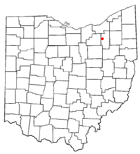
Summit County is an urban county in the U.S. state of Ohio. As of the 2020 census, the population was 540,428, making it the fourth-most populous county in Ohio. Its county seat and largest city is Akron. The county was formed on March 3, 1840, from portions of Medina, Portage and Stark Counties. It was named Summit County because the highest elevation on the Ohio and Erie Canal is located in the county.
Montrose is an unincorporated community on the border between Bath Township, Copley Township, and the city of Fairlawn in Summit County, Ohio, United States. It is an area of restaurants, stores, and businesses located along a stretch of State Route 18 near Interstate 77. The community is served by the Fairlawn (44333) post office. It is included in the Montrose-Ghent census-designated place. It had been a quiet hamlet for much of its history, with such establishments as a drive-in theater, golf courses, and a church. It became a busy retail area in the 1990s as new commercial development moved in.

Bath is an unincorporated community in the northern part of Bath Township, Summit County, Ohio, United States. It is centered at the intersection of Cleveland-Massillon and Ira roads. It was developed 'circa 1820.
Copley is an unincorporated community in Summit County, in the U.S. state of Ohio.
The Hagerstown and Frederick Railway, now defunct, was an American railroad of central Maryland built in the 19th and 20th centuries.

Antrim is an unincorporated community in Guernsey County, in the U.S. state of Ohio.
Texas is an unincorporated community in Henry County, in the U.S. state of Ohio.
Helmick is an unincorporated community in Coshocton County, in the U.S. state of Ohio.
Maysville is an unincorporated community in Coshocton County, in the U.S. state of Ohio.
Birds Run is an unincorporated community in Guernsey County, in the U.S. state of Ohio.

Londonderry is an unincorporated community in Londonderry Township, Guernsey County, Ohio, United States.
Bayard is an unincorporated community in Columbiana County, in the U.S. state of Ohio.
Moultrie is an unincorporated community in Columbiana County, in the U.S. state of Ohio.
Reading is an unincorporated community in Columbiana County, in the U.S. state of Ohio.
West Lebanon is an unincorporated community in Wayne County, in the U.S. state of Ohio.
Freeburg is an unincorporated community in Washington Township, Stark County, in the U.S. state of Ohio.

Boston is an unincorporated community in Summit County, in the U.S. state of Ohio.
Brandywine is an unincorporated community in Summit County, in the U.S. state of Ohio.
Everett is an unincorporated community in Summit County, in the U.S. state of Ohio.
Greensburg is an unincorporated community in Summit County, in the U.S. state of Ohio.
References
- ↑ U.S. Geological Survey Geographic Names Information System: Myersville, Ohio
- ↑ Doyle, William B. (1908). Centennial History of Summit County, Ohio and Representative Citizens. Biographical Publishing Company. p. 120.
- ↑ Perrin, William Henry (1881). History of Summit County: With an Outline Sketch of Ohio. Baskin & Battey. p. 608.
- ↑ "Summit County". Jim Forte Postal History. Retrieved January 23, 2016.
Municipalities and communities of Summit County, Ohio, United States | ||
|---|---|---|
| Cities |  | |
| Villages | ||
| Townships | ||
| CDPs | ||
| Unincorporated communities | ||
| Footnotes | ‡This populated place also has portions in an adjacent county or counties | |
40°58′34″N81°25′25″W / 40.97611°N 81.42361°W
| | This Summit County, Ohio state location article is a stub. You can help Wikipedia by expanding it. |