Summit County is an urban county in the U.S. state of Ohio. As of the 2020 census, the population was 540,428, making it the fourth-most populous county in Ohio. Its county seat and largest city is Akron. The county was formed on March 3, 1840, from portions of Medina, Portage and Stark Counties. It was named Summit County because the highest elevation on the Ohio and Erie Canal is located in the county.
The region Northeast Ohio, in the US state of Ohio, in its most expansive usage contains six metropolitan statistical areas: Cleveland–Elyria, Akron, Canton–Massillon, Youngstown–Warren, Mansfield, and Weirton–Steubenville along with eight micropolitan statistical areas. Most of the region is considered either part of the Cleveland–Akron–Canton, OH Combined Statistical Area and media market or the Youngstown–Warren, OH–PA Combined Statistical Area and media market. In all, the region is home to: 4,502,460 residents. It is also a part of the Great Lakes megalopolis, containing over 54 million people. Northeast Ohio also includes most of the area known historically as the Connecticut Western Reserve.

Cuyahoga Valley National Park is an American national park that preserves and reclaims the rural landscape along the Cuyahoga River between Akron and Cleveland in Northeast Ohio.

Bath Township is one of the nine townships of Summit County, Ohio, United States. A suburb of Akron, the 2020 census found 10,024 people in the township.

The Ohio and Erie Canal was a canal constructed during the 1820s and early 1830s in Ohio. It connected Akron with the Cuyahoga River near its outlet on Lake Erie in Cleveland, and a few years later, with the Ohio River near Portsmouth. It also had connections to other canal systems in Pennsylvania.
Northampton was one of the 16 original townships in Summit County, Ohio. It was in the middle of Summit County, bordering Akron and Cuyahoga Falls. No incorporated areas were formed within the township but Akron and Cuyahoga Falls expanded into Northampton via annexation. In 1986, Northampton Township merged with Cuyahoga Falls, the first time a township and city merged in Ohio. When created it occupied survey Town 3, Range 11 in the Western Reserve and was about 25 square miles (65 km2) in area. Its first settler, Simeon Prior named the township for the Hampshire County, Massachusetts village of Northampton.
Tinker's Creek, in Cuyahoga, Summit and Portage counties of Ohio, is the largest tributary of the Cuyahoga River, providing about a third of its flow into Lake Erie.

Old Brooklyn is a neighborhood on the West Side of Cleveland, Ohio, United States, located approximately five miles south of downtown Cleveland. It extends east-to-west from the Cuyahoga River to the city of Brooklyn and north-to-south from the Brookside Park Valley to the city of Parma. It is home to the Cleveland Metroparks, including the Cleveland Zoo; the Jesse Owens tree at James Ford Rhodes High School; and the Benjamin Franklin Community Garden, the largest urban community garden in Cuyahoga County. Old Brooklyn has recently adopted the slogan "Old Brooklyn, a great place to grow" to commemorate its history and potential growth.
Summit Metro Parks is a Metroparks system serving the citizens of Summit County, Ohio by managing 14,000 acres (5,700 ha) in 16 developed parks, six conservation areas and more than 150 miles (240 km) of trails, with 22.4 miles (36.0 km) of the Ohio & Erie Canal Towpath Trail.

This is a list of properties and districts in Ohio that are listed on the National Register of Historic Places. There are over 4.000 in total. Of these, 73 are National Historic Landmarks. There are listings in each of Ohio's 88 counties.

The Pennsylvania and Ohio Canal, also known as the P & O Canal, the Cross Cut Canal and the Mahoning Canal, was a shipping canal which operated from 1840 until 1877, though the canal was completely abandoned by 1872. It connected canals in two states, the Ohio and Erie Canal in Ohio and the Beaver and Erie Canal in Pennsylvania, and was funded by private interests.

Tinkers Creek Aqueduct is an aqueduct that was constructed to bridge the Ohio and Erie Canal over Tinkers Creek near its confluence with the Cuyahoga River in Valley View, Ohio. It is a relatively rare surviving example of an Ohio and Erie Canal aqueduct. It was originally constructed in 1825-1827 by, and re-built due to flood damage in 1845 and 1905. Tinkers Creek Aqueduct was included in a National Historic Landmark district established in 1966, and it was separately listed on the National Register of Historic Places in 1979. The original Tinkers Creek Aqueduct was a wood plank, steel truss, and Ashlar-sandstone structure constructed in 1827, south of the present aqueduct's location. Cuyahoga River and Tinkers Creek flooding caused continual damage to the original aqueduct, so successive structures were built in 1845 and 1905 in the present location. Today, Tinkers Creek Aqueduct is the only aqueduct which remains of the four original aqueducts in the Cuyahoga Valley. Of Furnace Run Aqueduct, Mill Creek Aqueduct, Peninsula Aqueduct, and Aqueduct; Mill Creek Aqueduct, of newer construction, is the only aqueduct which still carries Ohio and Erie Canal water. After 102 years of flooding, weathering, and deterioration, Tinkers Creek Aqueduct was removed in 2007. The National Park Service is currently working on Phase II of the project to reconstruct it from newer materials.

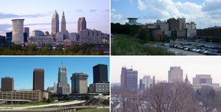
The Akron, OH Metropolitan Statistical Area, sometimes referred to as Greater Akron, is defined by the United States Office of Management and Budget as an area consisting of two counties, Summit and Portage, in Northeast Ohio and anchored by the city of Akron. As of the 2020 census, the MSA had a population of 702,219. The Akron MSA is also part of the larger Cleveland–Akron–Canton, OH Combined Statistical Area, which has a population of 3,633,962 people as of the 2020 census, the largest metropolitan area in Ohio.
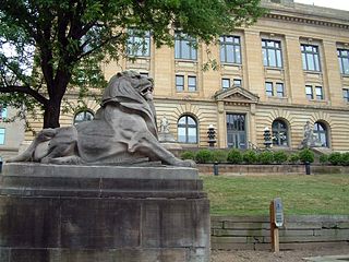
The Summit County Historical Society of Akron, Ohio, abbreviated SCHS, is a 501(c)(3) non-profit organization located in Akron, Ohio. It focuses on the history of the City of Akron and Summit County, Ohio.

The Cascade Locks Historic District is a historic district located in Akron, Ohio. It was added to the National Register of Historic Places in 1992.

Indigo Lake is a small, roughly triangular lake in Summit County, Ohio, in the United States. It is not a natural lake, having been created by the park service in Cuyahoga Valley National Park. It is a popular fishing location, with several species present including the Largemouth bass.

The Ohio and Erie Canal Towpath Trail is a multi-use trail that follows part of the former route of the Ohio & Erie Canal in Northeast Ohio.
The Valley Railway was a shortline railroad which operated between the city of Cleveland and small town of Zoarville in the state of Ohio in the United States. The railroad was founded in 1871, but the first segment of track did not open until 1880 and the line was not completed until 1884. The Baltimore and Ohio Railroad (B&O) obtained a controlling interest in the Valley Railway in 1890. The railroad went bankrupt in 1895, at which time it was reorganized as The Cleveland Terminal and Valley Railroad Company (CT&V). The B&O took over operation of the CT&V in 1909, and the company was merged with the B&O in 1915.

The Cleveland and Mahoning Valley Railroad (C&MV) was a shortline railroad operating in the state of Ohio in the United States. Originally known as the Cleveland and Mahoning Railroad (C&M), it was chartered in 1848. Construction of the line began in 1853 and was completed in 1857. After an 1872 merger with two small railroads, the corporate name was changed to "Cleveland and Mahoning Valley Railroad". The railroad leased itself to the Atlantic and Great Western Railway in 1863. The C&MV suffered financial instability, and in 1880 its stock was sold to a company based in London in the United Kingdom. A series of leases and ownership changes left the C&MV in the hands of the Erie Railroad in 1896. The CM&V's corporate identity ended in 1942 after the Erie Railroad completed purchasing the railroad's outstanding stock from the British investors.
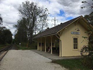
Botzum is a Cuyahoga Valley Scenic Railroad train station in Cuyahoga Falls, Ohio, with a street address in Akron, Ohio. It is located adjacent to the Cuyahoga River and Riverview Road in the Cuyahoga Valley National Park.


