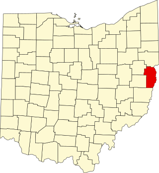
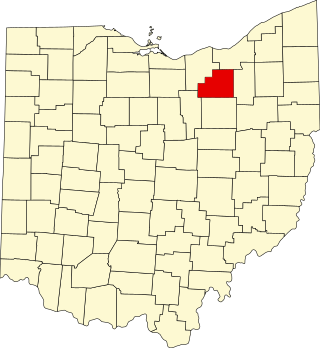
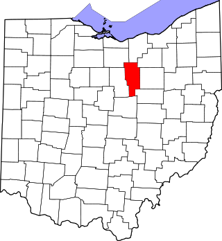
[3] Name on the Register [4] Image Date listed [5] Location City or town Description 1 Francis D. Alling House Francis D. Alling House November 30, 1987 (# 87002093 323 East Ave. 41°06′06″N 81°25′43″W / 41.101667°N 81.428611°W / 41.101667; -81.428611 (Francis D. Alling House ) Tallmadge 2 Anna-Dean Farm Anna-Dean Farm July 14, 1977 (# 77001086 State Route 619 41°00′24″N 81°37′38″W / 41.006667°N 81.627222°W / 41.006667; -81.627222 (Anna-Dean Farm ) Barberton 3 O. C. Barber Barn No. 1 O. C. Barber Barn No. 1 February 28, 1973 (# 73001538 115 3rd St. 41°00′26″N 81°35′37″W / 41.007222°N 81.593611°W / 41.007222; -81.593611 (O. C. Barber Barn No. 1 ) Barberton 4 O. C. Barber Colt Barn O. C. Barber Colt Barn October 9, 1974 (# 74001626 Austin Dr. 41°00′18″N 81°34′44″W / 41.005°N 81.578889°W / 41.005; -81.578889 (O. C. Barber Colt Barn ) Barberton 5 O. C. Barber Creamery O. C. Barber Creamery May 22, 1973 (# 73001539 365 Portsmouth Ave. 41°00′25″N 81°35′33″W / 41.006944°N 81.5925°W / 41.006944; -81.5925 (O. C. Barber Creamery ) Barberton 6 O. C. Barber Machine Barn Upload image October 9, 1974 (# 74001627 Austin Dr. 41°00′22″N 81°34′42″W / 41.006111°N 81.578333°W / 41.006111; -81.578333 (O. C. Barber Machine Barn ) Barberton 7 O. C. Barber Piggery O. C. Barber Piggery May 22, 1973 (# 73001540 248 Robinson Ave. 41°00′35″N 81°35′49″W / 41.009722°N 81.596944°W / 41.009722; -81.596944 (O. C. Barber Piggery ) Barberton 8 Barberton Downtown Historic District Upload image May 23, 2022 (# 100007724 Roughly bounded by West Lake and West Tuscarawas Aves., 2nd St. NW, 1st St. NW, 3rd St. NW, 6th St. NW, and 8th St. NW 41°00′50″N 81°36′31″W / 41.01377°N 81.6087°W / 41.01377; -81.6087 (Barberton Downtown Historic District ) Barberton 9 Barker Village Site Barker Village Site April 19, 1978 (# 78000379 Just north of the old railroad station at Botzum [6] 41°09′56″N 81°34′39″W / 41.165556°N 81.577500°W / 41.165556; -81.577500 (Barker Village Site ) Cuyahoga Falls Discovered when the Ohio and Erie Canal was constructed through the site [7] 10 William Barker Residence William Barker Residence June 11, 1979 (# 79002797 805 Wye Rd. in Ghent 41°09′27″N 81°38′12″W / 41.1575°N 81.636667°W / 41.1575; -81.636667 (William Barker Residence ) Bath Township 11 Bath Township Hall Bath Township Hall June 11, 1979 (# 79002805 1241 N. Cleveland-Massilon Rd. 41°11′21″N 81°38′10″W / 41.189167°N 81.636111°W / 41.189167; -81.636111 (Bath Township Hall ) Bath Township 12 Bath Township School Bath Township School June 11, 1979 (# 79002801 4655 Akron-Medina Rd., southeast of Ghent 41°08′13″N 81°40′09″W / 41.136944°N 81.669167°W / 41.136944; -81.669167 (Bath Township School ) Bath Township 13 Francis Becker House Francis Becker House June 24, 2002 (# 02000672 3010 Hickory St. 40°55′33″N 81°38′28″W / 40.925833°N 81.641111°W / 40.925833; -81.641111 (Francis Becker House ) Clinton 14 Berkshire Park Historic District Upload image February 4, 2021 (# 100006088 Roughly Bounded by Oakwood Dr., Roosevelt Ave., Elmwood St., 4th St., 3rd St., Miller Ct. 41°08′29″N 81°29′01″W / 41.1415°N 81.4835°W / 41.1415; -81.4835 (Berkshire Park Historic District ) Cuyahoga Falls 15 Boston Mills Historic District Boston Mills Historic District November 9, 1992 (# 92001490 Roughly Riverview, Boston Mills, and Stanford Rds. and Main St. 41°15′52″N 81°33′34″W / 41.264444°N 81.559444°W / 41.264444; -81.559444 (Boston Mills Historic District ) Boston Township 16 Botzum Farm Botzum Farm October 21, 1999 (# 99001271 3486 Riverview Rd. 41°10′26″N 81°34′53″W / 41.173889°N 81.581389°W / 41.173889; -81.581389 (Botzum Farm ) Cuyahoga Falls 17 Brecksville-Northfield High Level Bridge Brecksville-Northfield High Level Bridge January 17, 1986 (# 86000078 State Route 82 and the Cuyahoga River 41°19′16″N 81°35′11″W / 41.321111°N 81.586389°W / 41.321111; -81.586389 (Brecksville-Northfield High Level Bridge ) Sagamore Hills Township Extends into Brecksville in Cuyahoga County 18 Brookdale Farm Brookdale Farm December 7, 2010 (# 10000975 1148 N. Cleveland-Massillon Rd., north of Akron 41°10′00″N 81°38′14″W / 41.166667°N 81.637222°W / 41.166667; -81.637222 (Brookdale Farm ) Bath Township 19 Jim Brown House Jim Brown House March 2, 1979 (# 79000299 South of Peninsula at 3491 Akron Peninsula Rd. 41°10′54″N 81°34′42″W / 41.181667°N 81.578333°W / 41.181667; -81.578333 (Jim Brown House ) Cuyahoga Falls 20 Jim Brown Tavern Jim Brown Tavern December 11, 1979 (# 79000300 Boston Mills Rd. 41°15′48″N 81°33′31″W / 41.263333°N 81.558611°W / 41.263333; -81.558611 (Jim Brown Tavern ) Boston Township 21 John Brown Farmhouse John Brown Farmhouse September 22, 1977 (# 77001088 1842 Hines Hill Rd. 41°15′48″N 81°26′54″W / 41.263333°N 81.448333°W / 41.263333; -81.448333 (John Brown Farmhouse ) Hudson 22 H. Karl Butler Memorial H. Karl Butler Memorial January 2, 1997 (# 96001510 Truxell Rd., southeast of its junction with Peninsula Rd., Camp Manatoc 41°13′19″N 81°31′49″W / 41.221944°N 81.530278°W / 41.221944; -81.530278 (H. Karl Butler Memorial ) Boston Township 23 Camp Manatoc Concord Lodge and Adirondacks Historic District Camp Manatoc Concord Lodge and Adirondacks Historic District January 2, 1997 (# 96001513 Truxell Rd., southeast of its junction with Peninsula Rd., Camp Manatoc 41°13′07″N 81°31′46″W / 41.218611°N 81.529444°W / 41.218611; -81.529444 (Camp Manatoc Concord Lodge and Adirondacks Historic District ) Boston Township 24 Camp Manatoc Dining Hall Camp Manatoc Dining Hall January 2, 1997 (# 96001511 Truxell Rd., southeast of its junction with Peninsula Rd., Camp Manatoc 41°13′15″N 81°31′44″W / 41.220833°N 81.528889°W / 41.220833; -81.528889 (Camp Manatoc Dining Hall ) Boston Township 25 Camp Manatoc Foresters Lodge and Kit Carson-Dan Boone Cabins Historic District Camp Manatoc Foresters Lodge and Kit Carson-Dan Boone Cabins Historic District January 2, 1997 (# 96001514 Truxell Rd., southeast of its junction with Peninsula Rd., Camp Manatoc 41°13′39″N 81°31′58″W / 41.2275°N 81.532778°W / 41.2275; -81.532778 (Camp Manatoc Foresters Lodge and Kit Carson-Dan Boone Cabins Historic District ) Boston Township 26 Camp Manatoc Legion Lodge Camp Manatoc Legion Lodge January 2, 1997 (# 96001512 Truxell Rd., southeast of its junction with Peninsula Rd., Camp Manatoc 41°13′07″N 81°31′46″W / 41.218611°N 81.529444°W / 41.218611; -81.529444 (Camp Manatoc Legion Lodge ) Boston Township 27 Case-Barlow Farm Upload image August 15, 2019 (# 100003498 1931 Barlow Rd. 41°12′59″N 81°25′30″W / 41.2163°N 81.4251°W / 41.2163; -81.4251 (Case-Barlow Farm ) Hudson 28 Chuckery Race Chuckery Race December 15, 1972 (# 72001047 South of and in Cuyahoga Falls 41°07′06″N 81°29′30″W / 41.118333°N 81.491667°W / 41.118333; -81.491667 (Chuckery Race ) Cuyahoga Falls 29 Clinton Ohio and Erie Canal Historic District-Clinton Lock 2 and 3-Clinton Upper (Lock 2) and Clinton Lower (Lock 3) Clinton Ohio and Erie Canal Historic District-Clinton Lock 2 and 3-Clinton Upper (Lock 2) and Clinton Lower (Lock 3) March 16, 2003 (# 03000111 Approximately along the canal channel parallel to Water St. 40°55′44″N 81°37′47″W / 40.928889°N 81.629722°W / 40.928889; -81.629722 (Clinton Ohio and Erie Canal Historic District-Clinton Lock 2 and 3-Clinton Upper (Lock 2) and Clinton Lower (Lock 3) ) Clinton 30 Albert Cofta Farmstead Albert Cofta Farmstead November 4, 2004 (# 04001214 2966 Brush Rd., northeast of Richfield 41°15′13″N 81°36′56″W / 41.253611°N 81.615556°W / 41.253611; -81.615556 (Albert Cofta Farmstead ) Richfield Township 31 Copley Depot Copley Depot May 31, 2001 (# 01000563 3772 Copley Rd. 41°05′57″N 81°39′13″W / 41.099028°N 81.653611°W / 41.099028; -81.653611 (Copley Depot ) Copley Township 32 Copley Township Cemetery Receiving Vault Copley Township Cemetery Receiving Vault July 13, 2017 (# 100001333 3772 Copley Rd. 41°05′57″N 81°39′07″W / 41.099269°N 81.652066°W / 41.099269; -81.652066 (Copley Township Cemetery Receiving Vault ) Copley Township 33 John William Creswell Corbusier House John William Creswell Corbusier House October 5, 1989 (# 89001451 226 College St. 41°14′57″N 81°26′18″W / 41.249167°N 81.438333°W / 41.249167; -81.438333 (John William Creswell Corbusier House ) Hudson 34 Edward Cranz Farm Edward Cranz Farm March 12, 1993 (# 93000077 2780 Oak Hill Dr., south of Peninsula 41°11′50″N 81°35′31″W / 41.197222°N 81.591944°W / 41.197222; -81.591944 (Edward Cranz Farm ) Bath Township 35 William and Eugene Cranz Farm William and Eugene Cranz Farm March 12, 1993 (# 93000078 2401 Ira Rd., south of Peninsula 41°11′15″N 81°35′31″W / 41.1875°N 81.591944°W / 41.1875; -81.591944 (William and Eugene Cranz Farm ) Bath Township 36 Cuyahoga Falls Downtown Historic District Upload image September 6, 2018 (# 100002881 111-245 Portage Trail, 138 Stowe Ave., 2035 Oldetown Loop, and 2091-2250 Front, 2044-2220 2nd, and 2055-2253 3rd Sts. 41°08′11″N 81°29′03″W / 41.1364°N 81.4843°W / 41.1364; -81.4843 (Cuyahoga Falls Downtown Historic District ) Cuyahoga Falls 37 Diamond Match Historic District Diamond Match Historic District February 29, 1996 (# 96000218 3, 21, and 27 4th St., NW., and 8 2nd St., NW. 41°00′39″N 81°36′31″W / 41.010833°N 81.608611°W / 41.010833; -81.608611 (Diamond Match Historic District ) Barberton 38 Michael Duffy Farm Michael Duffy Farm March 12, 1993 (# 93000079 4965 Quick Rd., southeast of Peninsula 41°12′15″N 81°30′58″W / 41.204167°N 81.516111°W / 41.204167; -81.516111 (Michael Duffy Farm ) Boston Township 39 East Liberty School, District No. 11 East Liberty School, District No. 11 July 3, 2017 (# 100001271 3492 S. Arlington St. 40°58′33″N 81°29′36″W / 40.975972°N 81.493365°W / 40.975972; -81.493365 (East Liberty School, District No. 11 ) Green 40 Everett Historic District Everett Historic District January 14, 1993 (# 93001467 4731-4642 Riverview Rd. and 2151-2279 Everett Rd., south of Peninsula, in the Cuyahoga Valley National Park 41°12′16″N 81°34′29″W / 41.204444°N 81.574722°W / 41.204444; -81.574722 (Everett Historic District ) Boston Township 41 Everett Knoll Complex Everett Knoll Complex May 25, 1977 (# 77000157 Southern side of Everett Rd., west of its junction with Riverview Rd. [8] 41°12′16″N 81°34′33″W / 41.204306°N 81.575764°W / 41.204306; -81.575764 (Everett Knoll Complex ) Boston Township 42 Falls Stamping and Welding Building Falls Stamping and Welding Building February 23, 2016 (# 16000045 1701 S. Front St. 41°07′41″N 81°29′06″W / 41.128056°N 81.485000°W / 41.128056; -81.485000 (Falls Stamping and Welding Building ) Cuyahoga Falls 43 First Congregational Church of Cuyahoga Falls First Congregational Church of Cuyahoga Falls November 3, 1975 (# 75001538 130 Broad Boulevard 41°08′01″N 81°29′03″W / 41.133611°N 81.484167°W / 41.133611; -81.484167 (First Congregational Church of Cuyahoga Falls ) Cuyahoga Falls 44 Fort Island Works Fort Island Works December 2, 1970 (# 70000087 In Fort Island Park, at 413 Tunko Rd. [9] 41°07′10″N 81°37′02″W / 41.119306°N 81.617361°W / 41.119306; -81.617361 (Fort Island Works ) Fairlawn 45 Furnace Run Aqueduct Furnace Run Aqueduct December 11, 1979 (# 79000301 Furnace Run 41°12′06″N 81°34′20″W / 41.201667°N 81.572361°W / 41.201667; -81.572361 (Furnace Run Aqueduct ) Cuyahoga Falls 46 Ghent Historic District Ghent Historic District December 7, 2010 (# 10000974 Western side of Wye Rd. between Granger and Yellow Creek Rd. in Ghent 41°09′26″N 81°38′13″W / 41.157361°N 81.637083°W / 41.157361; -81.637083 (Ghent Historic District ) Bath Township 47 Elijah Hale Residence Elijah Hale Residence June 11, 1979 (# 79002795 3243 Ira Rd. 41°11′22″N 81°37′15″W / 41.189444°N 81.620833°W / 41.189444; -81.620833 (Elijah Hale Residence ) Bath Township 48 Jonathan Hale Homestead Jonathan Hale Homestead April 23, 1973 (# 73000258 2686 Oak Hill Rd. 41°11′35″N 81°35′33″W / 41.193056°N 81.5925°W / 41.193056; -81.5925 (Jonathan Hale Homestead ) Bath Township 49 John Harshey Residence John Harshey Residence June 11, 1979 (# 79002804 4270 Bath Rd. 41°10′07″N 81°39′07″W / 41.168611°N 81.651944°W / 41.168611; -81.651944 (John Harshey Residence ) Bath Township 50 Levi J. Hartong House and Farm Levi J. Hartong House and Farm October 17, 2007 (# 07001089 6521 Mt. Pleasant Rd. 40°54′29″N 81°28′10″W / 40.908039°N 81.469325°W / 40.908039; -81.469325 (Levi J. Hartong House and Farm ) Green 51 Edward Heller Residence Edward Heller Residence June 11, 1979 (# 79002798 3891 Granger Rd., west of Ghent 41°09′40″N 81°39′02″W / 41.161111°N 81.650556°W / 41.161111; -81.650556 (Edward Heller Residence ) Bath Township 52 J. Hershey Residence J. Hershey Residence June 11, 1979 (# 79002802 286 Cleveland-Massilon Rd., south of Ghent 41°08′37″N 81°38′15″W / 41.143611°N 81.6375°W / 41.143611; -81.6375 (J. Hershey Residence ) Bath Township 53 Roswell Hopkins Residence Roswell Hopkins Residence June 11, 1979 (# 79002799 299 Hametown Rd., southeast of Ghent 41°08′38″N 81°40′13″W / 41.143889°N 81.670278°W / 41.143889; -81.670278 (Roswell Hopkins Residence ) Bath Township 54 Hudson Historic District Hudson Historic District November 28, 1973 (# 73001542 Roughly bounded by College, Streetsboro, S. Main, and Baldwin Sts.; also roughly bounded by Hudson St., Old Orchard Dr., Aurora St., Oviatt St., Streetsboro St., and College St. to Aurora; also Roslyn Ave., Elm, Aurora, Baldwin, Chapel, Church, Division, Hudson, North Main, North Oviatt, Owen, Brown, and West. Prospect Sts. 41°14′37″N 81°26′31″W / 41.243611°N 81.441944°W / 41.243611; -81.441944 (Hudson Historic District ) Hudson Second set of boundaries represents a boundary increase of October 5, 1989 ; third set represent a boundary increase of June 30, 2022 55 Humberger House Humberger House October 11, 2002 (# 02001122 7616 N. 2nd Ave. 40°55′30″N 81°38′27″W / 40.925°N 81.640833°W / 40.925; -81.640833 (Humberger House ) Clinton 56 Hunt-Wilke Farm Hunt-Wilke Farm March 12, 1993 (# 93000080 2049 Bolanz Rd. 41°12′03″N 81°34′19″W / 41.200833°N 81.571944°W / 41.200833; -81.571944 (Hunt-Wilke Farm ) Cuyahoga Falls 57 Grace Goulder Izant House Grace Goulder Izant House October 4, 1989 (# 89001450 250 College St. 41°15′02″N 81°26′17″W / 41.250556°N 81.438056°W / 41.250556; -81.438056 (Grace Goulder Izant House ) Hudson 58 Jaite Mill Historic District Jaite Mill Historic District May 21, 1979 (# 79000288 Southeast of Brecksville at Riverview and Vaughan Rds. 41°17′03″N 81°33′47″W / 41.284167°N 81.563056°W / 41.284167; -81.563056 (Jaite Mill Historic District ) Sagamore Hills Township Extends into Brecksville in Cuyahoga County 59 Dustin Johnson Residence Dustin Johnson Residence June 11, 1979 (# 79002806 1946 Cleveland-Massilon Rd. 41°11′18″N 81°38′12″W / 41.188333°N 81.636667°W / 41.188333; -81.636667 (Dustin Johnson Residence ) Bath Township 60 Jyurovat Farmstead Jyurovat Farmstead May 25, 1995 (# 95000588 696 Streetsboro Rd., southeast of Peninsula 41°13′54″N 81°31′05″W / 41.231667°N 81.518056°W / 41.231667; -81.518056 (Jyurovat Farmstead ) Boston Heights 61 Virginia Kendall State Park Historic District Virginia Kendall State Park Historic District January 2, 1997 (# 96001515 701, 801, and 1000 Truxell Rd. and 434 W. Streetsboro, southeast of Peninsula 41°13′04″N 81°31′15″W / 41.217778°N 81.520833°W / 41.217778; -81.520833 (Virginia Kendall State Park Historic District ) Boston Township 62 J. Kent Residence J. Kent Residence June 11, 1979 (# 79002792 1727 Medina Line Rd. 41°11′00″N 81°41′07″W / 41.183333°N 81.685278°W / 41.183333; -81.685278 (J. Kent Residence ) Bath Township 63 James Kirby Mill James Kirby Mill December 14, 1978 (# 78002197 West of West Richfield off State Route 303 41°14′26″N 81°40′44″W / 41.240556°N 81.678889°W / 41.240556; -81.678889 (James Kirby Mill ) Richfield Township 64 David Kittinger Residence Upload image June 11, 1979 (# 79002808 1904 Cleveland-Massilon Rd. 41°11′14″N 81°38′12″W / 41.187222°N 81.636667°W / 41.187222; -81.636667 (David Kittinger Residence ) Bath Township 65 Jeremiah Lambert House and Barn Jeremiah Lambert House and Barn December 7, 2010 (# 10000977 2138 Cleveland-Massillon Rd. in Ghent 41°11′37″N 81°38′12″W / 41.193611°N 81.636667°W / 41.193611; -81.636667 (Jeremiah Lambert House and Barn ) Bath Township 66 J. Ligget Residence J. Ligget Residence June 11, 1979 (# 79002803 481 Cleveland-Massilon Rd., south of Ghent 41°08′55″N 81°38′12″W / 41.148611°N 81.636667°W / 41.148611; -81.636667 (J. Ligget Residence ) Bath Township 67 Limbach Block Historic District Limbach Block Historic District November 29, 2001 (# 01001280 7843, 7845, 7847, 7849, 7851, and 7853 Main St. 40°55′38″N 81°37′48″W / 40.927222°N 81.63°W / 40.927222; -81.63 (Limbach Block Historic District ) Clinton 68 Lock No. 26 Lock No. 26 December 11, 1979 (# 79000302 3.3 mi (5.3 km) north of Ira Rd. 41°11′08″N 81°34′53″W / 41.185556°N 81.581389°W / 41.185556; -81.581389 (Lock No. 26 ) Cuyahoga Falls 69 Lock No. 27 Lock No. 27 December 11, 1979 (# 79000303 Approximately 400 ft (120 m) east of the intersection of Riverview and Everett Rds. at Everett 41°12′11″N 81°34′15″W / 41.203056°N 81.570833°W / 41.203056; -81.570833 (Lock No. 27 ) Boston Township 70 Lock No. 28 Lock No. 28 December 11, 1979 (# 79000304 Deep Lock Q Quarry Metro Park 41°13′58″N 81°33′09″W / 41.232778°N 81.5525°W / 41.232778; -81.5525 (Lock No. 28 ) Peninsula Originally listed as "Ohio and Erie Canal Deep Lock" in 1974; relisted under the present name in 1979 [4] 71 Lock No. 29 and Aqueduct Lock No. 29 and Aqueduct December 11, 1979 (# 79000305 Off State Route 303 41°14′34″N 81°33′02″W / 41.242778°N 81.550556°W / 41.242778; -81.550556 (Lock No. 29 and Aqueduct ) Peninsula 72 Lock No. 30 and Feeder Dam Lock No. 30 and Feeder Dam December 11, 1979 (# 79000306 Off State Route 303 41°14′41″N 81°33′14″W / 41.244722°N 81.553889°W / 41.244722; -81.553889 (Lock No. 30 and Feeder Dam ) Peninsula 73 Lock No. 31 Lock No. 31 December 11, 1979 (# 79000307 200 ft (61 m) east of the Cuyahoga River and approximately 0.5 mi (0.80 km) south of the Ohio Turnpike 41°15′06″N 81°32′46″W / 41.251667°N 81.546111°W / 41.251667; -81.546111 (Lock No. 31 ) Peninsula 74 Lock No. 32 Lock No. 32 December 11, 1979 (# 79000308 800 ft (240 m) north of Boston Mills 41°15′58″N 81°33′32″W / 41.266111°N 81.558889°W / 41.266111; -81.558889 (Lock No. 32 ) Boston Township 75 Lock No. 33 Lock No. 33 December 11, 1979 (# 79000309 1 mi (1.6 km) south of Highland Rd. 41°16′36″N 81°33′40″W / 41.276667°N 81.561111°W / 41.276667; -81.561111 (Lock No. 33 ) Boston Township 76 Lock No. 34 Lock No. 34 December 17, 1979 (# 79000310 Highland Rd. 41°17′21″N 81°33′53″W / 41.289167°N 81.564722°W / 41.289167; -81.564722 (Lock No. 34 ) Sagamore Hills Township 77 Lock No. 35 Lock No. 35 December 11, 1979 (# 79000311 Off State Route 82 41°18′38″N 81°34′56″W / 41.310556°N 81.582222°W / 41.310556; -81.582222 (Lock No. 35 ) Sagamore Hills Township 78 Longwood Manor Longwood Manor September 3, 2014 (# 14000548 1634 E. Aurora Rd. 41°18′26″N 81°28′53″W / 41.3071°N 81.4814°W / 41.3071; -81.4814 (Longwood Manor ) Macedonia 79 Lutz-Martin Farm Lutz-Martin Farm July 3, 2003 (# 03000608 2470 Martin Rd. 41°10′32″N 81°35′33″W / 41.175556°N 81.592500°W / 41.175556; -81.592500 (Lutz-Martin Farm ) Bath Township 80 Frank H. Mason House Upload image April 20, 1995 (# 95000499 615 Latham Ln. 40°57′49″N 81°32′44″W / 40.963611°N 81.545556°W / 40.963611; -81.545556 (Frank H. Mason House ) New Franklin 81 Robert McKisson House Robert McKisson House December 4, 1974 (# 74001632 7878 N. Gannett Rd. 41°19′23″N 81°33′51″W / 41.323056°N 81.564167°W / 41.323056; -81.564167 (Robert McKisson House ) Sagamore Hills Township 82 Mentzer-Sorrick Farm Upload image August 22, 2022 (# 100008020 365 Center Rd. 40°57′00″N 81°32′50″W / 40.9501°N 81.5473°W / 40.9501; -81.5473 (Mentzer-Sorrick Farm ) New Franklin 83 Harvey Miller Residence Harvey Miller Residence June 11, 1979 (# 79002800 188 Hametown Rd., southeast of Ghent 41°08′27″N 81°40′15″W / 41.1408°N 81.6708°W / 41.1408; -81.6708 (Harvey Miller Residence ) Bath Township 84 Northfield Town Hall Northfield Town Hall August 10, 2000 (# 00000962 9546 Brandywine Rd. at Northfield Center 41°18′54″N 81°32′23″W / 41.3150°N 81.5397°W / 41.3150; -81.5397 (Northfield Town Hall ) Northfield Center Township 85 Oakwood Cemetery Chapel Oakwood Cemetery Chapel November 12, 1999 (# 99001334 2420 Oakwood Dr. 41°08′34″N 81°29′12″W / 41.1428°N 81.4868°W / 41.1428; -81.4868 (Oakwood Cemetery Chapel ) Cuyahoga Falls 86 Ohio and Erie Canal Ohio and Erie Canal November 13, 1966 (# 66000607 State Route 631 (Valley View Rd.) 41°13′31″N 81°33′22″W / 41.2253°N 81.5561°W / 41.2253; -81.5561 (Ohio and Erie Canal ) Boston Township , Cuyahoga Falls , Peninsula , and Sagamore Hills Township Extends into Cuyahoga County 87 Orson Minot Oviatt House Upload image February 16, 2021 (# 100006141 3758 Brecksville Rd. 41°14′17″N 81°38′17″W / 41.2380°N 81.6381°W / 41.2380; -81.6381 (Orson Minot Oviatt House ) Richfield 88 Isaac and Maria Ozmun Farmstead Isaac and Maria Ozmun Farmstead December 28, 2000 (# 00001556 6928 Olde Eight Rd. 41°15′15″N 81°30′28″W / 41.2542°N 81.5078°W / 41.2542; -81.5078 (Isaac and Maria Ozmun Farmstead ) Boston Heights 89 Palmer House Palmer House August 13, 1974 (# 74001628 9370 Olde Eight Rd. 41°18′56″N 81°32′22″W / 41.3156°N 81.5394°W / 41.3156; -81.5394 (Palmer House ) Northfield Center Township 90 Peninsula Village Historic District Peninsula Village Historic District August 23, 1974 (# 74000346 Both sides of State Route 303 ; also Stine and Dell Rds., Emerson St., Boston Run, and Deep Lock Quarry Metro Park 41°14′24″N 81°33′03″W / 41.2400°N 81.5508°W / 41.2400; -81.5508 (Peninsula Village Historic District ) Peninsula Second set of boundaries represents a boundary increase of May 8, 2017 91 Nathaniel Point Farm Nathaniel Point Farm September 3, 1999 (# 99001084 4606 and 4631 Akron-Peninsula Rd., south of Peninsula 41°12′20″N 81°33′46″W / 41.2056°N 81.5628°W / 41.2056; -81.5628 (Nathaniel Point Farm ) Boston Township 92 Orin Porter House Orin Porter House October 5, 1989 (# 89001449 240 College St. 41°14′59″N 81°26′20″W / 41.2497°N 81.4389°W / 41.2497; -81.4389 (Orin Porter House ) Hudson 93 Porter-Aue House Porter-Aue House September 6, 2002 (# 02000947 2798 North St. 40°55′40″N 81°37′44″W / 40.9278°N 81.6289°W / 40.9278; -81.6289 (Porter-Aue House ) Clinton 94 Jonathan Price House Jonathan Price House October 7, 2002 (# 02001103 7903 Main St. 40°55′36″N 81°37′40″W / 40.926667°N 81.627778°W / 40.926667; -81.627778 (Jonathan Price House ) Clinton 95 Dr. Rufus Randall Residence Dr. Rufus Randall Residence June 11, 1979 (# 79002796 3675 Ira Rd. 41°11′21″N 81°38′06″W / 41.189167°N 81.635°W / 41.189167; -81.635 (Dr. Rufus Randall Residence ) Bath Township 96 Luther B. Ranney Farm Luther B. Ranney Farm December 1, 1988 (# 88002749 6484 Old State Route 8 41°14′35″N 81°30′04″W / 41.243056°N 81.501111°W / 41.243056; -81.501111 (Luther B. Ranney Farm ) Boston Heights 97 Frank Mason Raymond House Frank Mason Raymond House April 20, 1995 (# 95000500 655 Latham Ln. 40°57′59″N 81°32′42″W / 40.966389°N 81.545°W / 40.966389; -81.545 (Frank Mason Raymond House ) New Franklin 98 John Richard Residence John Richard Residence June 11, 1979 (# 79002807 1924 Cleveland-Massilon Rd. 41°11′15″N 81°39′38″W / 41.1875°N 81.660556°W / 41.1875; -81.660556 (John Richard Residence ) Bath Township 99 Moses and Minerva Roach House Upload image March 22, 2021 (# 100006293 9044 Church St. 41°18′42″N 81°26′31″W / 41.3118°N 81.4420°W / 41.3118; -81.4420 (Moses and Minerva Roach House ) Twinsburg 100 Louis Schmitt House and Store Louis Schmitt House and Store February 14, 2002 (# 02000084 2967 Hickory St. 40°55′32″N 81°38′21″W / 40.925556°N 81.639167°W / 40.925556; -81.639167 (Louis Schmitt House and Store ) Clinton 101 Samuel Shaw Residence Samuel Shaw Residence June 11, 1979 (# 79002794 1588 Hametown Rd. 41°10′51″N 81°39′59″W / 41.180833°N 81.666389°W / 41.180833; -81.666389 (Samuel Shaw Residence ) Bath Township 102 Sylvester Shaw Residence Sylvester Shaw Residence June 11, 1979 (# 79002793 1786 Hametown Rd. 41°11′09″N 81°39′58″W / 41.185833°N 81.666111°W / 41.185833; -81.666111 (Sylvester Shaw Residence ) Bath Township 103 David Smith House David Smith House October 4, 2002 (# 02001104 7966 Cleveland-Massillon Rd. 40°55′32″N 81°37′43″W / 40.925556°N 81.628611°W / 40.925556; -81.628611 (David Smith House ) Clinton 104 William Smith House William Smith House March 11, 2003 (# 02001052 7894 Main St. 40°55′36″N 81°37′43″W / 40.926667°N 81.628611°W / 40.926667; -81.628611 (William Smith House ) Clinton 105 Sorrick-Oster Store Sorrick-Oster Store October 11, 2002 (# 02001123 7846 Main St. 40°55′37″N 81°37′47″W / 40.926944°N 81.629722°W / 40.926944; -81.629722 (Sorrick-Oster Store ) Clinton 106 George Stanford Farm George Stanford Farm February 17, 1982 (# 82001874 6093 Stanford Rd., north of Peninsula 41°16′16″N 81°33′25″W / 41.271111°N 81.556944°W / 41.271111; -81.556944 (George Stanford Farm ) Boston Township 107 Station Road Bridge Station Road Bridge March 7, 1979 (# 79000312 East of Brecksville at the Cuyahoga River 41°19′10″N 81°35′16″W / 41.319444°N 81.587778°W / 41.319444; -81.587778 (Station Road Bridge ) Sagamore Hills Township Extends into Brecksville in Cuyahoga County 108 Stewart-Hanson Farm Stewart-Hanson Farm October 15, 1992 (# 92001376 2832 Call Rd. 41°11′18″N 81°24′19″W / 41.188333°N 81.405278°W / 41.188333; -81.405278 (Stewart-Hanson Farm ) Stow 109 Stumpy Basin Stumpy Basin December 11, 1979 (# 79000313 200 ft (61 m) east of the Cuyahoga River and approximately 0.5 mi (0.80 km) south of the Ohio Turnpike , north of Peninsula 41°15′20″N 81°32′45″W / 41.255556°N 81.545833°W / 41.255556; -81.545833 (Stumpy Basin ) Boston Township 110 Tallmadge Town Square Historic District Tallmadge Town Square Historic District May 6, 1971 (# 71000652 Public Sq. 41°06′05″N 81°26′29″W / 41.10146°N 81.44131°W / 41.10146; -81.44131 (Tallmadge Town Square Historic District ) Tallmadge 111 Thornton-Guise Kitchen And House Thornton-Guise Kitchen And House May 6, 1976 (# 76001534 147 S. Main St. 41°08′06″N 81°26′24″W / 41.135000°N 81.440000°W / 41.135000; -81.440000 (Thornton-Guise Kitchen And House ) Munroe Falls 112 Manville Thorp Residence Manville Thorp Residence June 11, 1979 (# 79002791 1907 Medina Lane Rd. 41°11′20″N 81°41′03″W / 41.188889°N 81.684167°W / 41.188889; -81.684167 (Manville Thorp Residence ) Bath Township 113 Daniel Tilden House Daniel Tilden House June 20, 1985 (# 85001340 2325 Stine Rd., west of Peninsula 41°14′48″N 81°35′17″W / 41.246667°N 81.588056°W / 41.246667; -81.588056 (Daniel Tilden House ) Boston Township 114 Tuscarawas Avenue – Alexander Square Commercial Historic District Tuscarawas Avenue – Alexander Square Commercial Historic District May 17, 1990 (# 90000755 Bounded by Park Ave., Tuscarawas Ave., and 4th and 5th Sts. 41°00′47″N 81°36′39″W / 41.013056°N 81.610833°W / 41.013056; -81.610833 (Tuscarawas Avenue – Alexander Square Commercial Historic District ) Barberton 115 Twinsburg Congregational Church Twinsburg Congregational Church May 3, 1974 (# 74001634 Twinsburg Public Sq. 41°18′43″N 81°26′32″W / 41.311944°N 81.442222°W / 41.311944; -81.442222 (Twinsburg Congregational Church ) Twinsburg 116 Twinsburg Institute Twinsburg Institute January 1, 1976 (# 76001535 8996 Darrow Rd. 41°18′38″N 81°26′27″W / 41.310556°N 81.440833°W / 41.310556; -81.440833 (Twinsburg Institute ) Twinsburg 117 Valley Railway Historic District Valley Railway Historic District May 17, 1985 (# 85001123 Cuyahoga Valley between Rockside Rd. in the Cuyahoga Valley National Park and Howard St. at Little Cuyahoga Valley 41°14′40″N 81°32′56″W / 41.244444°N 81.548889°W / 41.244444; -81.548889 (Valley Railway Historic District ) Boston Township , Cuyahoga Falls , and Peninsula Extends into Akron and into Cuyahoga County 118 Peter Voris Jr. House Peter Voris Jr. House December 7, 2010 (# 10000976 3622 Ira Rd. in Ghent 41°11′20″N 81°37′59″W / 41.188889°N 81.633056°W / 41.188889; -81.633056 (Peter Voris Jr. House ) Bath Township 119 Wallace Farm Wallace Farm June 27, 1985 (# 85001387 8230 Brandywine Rd. 41°16′40″N 81°32′26″W / 41.277778°N 81.540556°W / 41.277778; -81.540556 (Wallace Farm ) Northfield Center Township 120 Ward House Ward House March 17, 1987 (# 87000629 1410 Hines Hill Rd. 41°15′38″N 81°27′46″W / 41.260556°N 81.462778°W / 41.260556; -81.462778 (Ward House ) Hudson 121 Warwick Interlocking Tower Warwick Interlocking Tower December 12, 2002 (# 02001516 2955 S. 1st. St. 40°55′20″N 81°38′34″W / 40.922222°N 81.642778°W / 40.922222; -81.642778 (Warwick Interlocking Tower ) Clinton 122 Allen Welton House Allen Welton House May 7, 1979 (# 79000314 Southwest of Peninsula at 2485 Major Rd. 41°14′00″N 81°35′01″W / 41.233333°N 81.583611°W / 41.233333; -81.583611 (Allen Welton House ) Boston Township 123 Western Reserve Academy Western Reserve Academy June 30, 1975 (# 75001539 Roughly bounded by Aurora St. and both sides of Oviatt, High, and Hudson 41°14′46″N 81°26′15″W / 41.246111°N 81.4375°W / 41.246111; -81.4375 (Western Reserve Academy ) Hudson 124 Wolcott House Wolcott House May 5, 1988 (# 88000468 56 E. Twinsburg Rd., south of Northfield 41°16′51″N 81°30′47″W / 41.280833°N 81.513056°W / 41.280833; -81.513056 (Wolcott House ) Northfield Center Township 125 Zimmerly House Zimmerly House January 2, 2018 (# 100001936 4332 Manchester Rd. 40°59′06″N 81°33′36″W / 40.985124°N 81.559990°W / 40.985124; -81.559990 (Zimmerly House ) New Franklin