National Register of Historic Places listings in Fairfield County, Ohio

Last updated

Location of Fairfield County in Ohio Map of Ohio highlighting Fairfield County.svg
Location of Fairfield County in Ohio

This is a list of the National Register of Historic Places listings in Fairfield County, Ohio.

Contents

This is intended to be a complete list of the properties and districts on the National Register of Historic Places in Fairfield County, Ohio, United States. The locations of National Register properties and districts for which the latitude and longitude coordinates are included below, may be seen in an online map. [1]

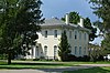
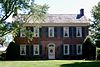
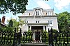
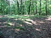
There are 50 properties and districts listed on the National Register in the county, including 1 National Historic Landmark. Another 3 properties were once listed but have been removed.


    This National Park Service list is complete through NPS recent listings posted December 15, 2023. [2]

Map all coordinates using: OpenStreetMap

Current listings

[3] Name on the Register [4] ImageDate listed [5] Location City or townDescription
1 Lyman Allen House and Barn
Lyman Allen House and Barn Lyman Allen House.jpg
Lyman Allen House and Barn
November 18, 1976
(#76001420)
9930 Lancaster-Circleville Rd SW
39°41′48″N82°47′40″W / 39.696667°N 82.794444°W / 39.696667; -82.794444 (Lyman Allen House and Barn)
Amanda Township
2 John Artz Farmhouse
John Artz Farmhouse John Artz Farmhouse.jpg
John Artz Farmhouse
April 23, 1987
(#87000644)
5125 Duffy Rd., east of Lancaster
39°41′58″N82°30′09″W / 39.69939°N 82.50259°W / 39.69939; -82.50259 (John Artz Farmhouse)
Berne Township
3 Barr House
Barr House Barr House Amanda, Ohio.jpg
Barr House
November 26, 1980
(#80002995)
350 W. Main St.
39°39′04″N82°45′04″W / 39.651111°N 82.751111°W / 39.651111; -82.751111 (Barr House)
Amanda
4 John Bright Covered Bridge
John Bright Covered Bridge John Bright Covered Bridge.jpg
John Bright Covered Bridge
May 28, 1975
(#75001393)
Spans Fetters Run on the Ohio University Lancaster campus [6]
39°44′15″N82°35′05″W / 39.737595°N 82.584731°W / 39.737595; -82.584731 (John Bright Covered Bridge)
Lancaster Moved from its original location, 2.5 mi (4.0 km) southwest of Baltimore, bringing Bish Rd. NW over Poplar Creek
5 John Bright No. 1 Iron Bridge
John Bright No. 1 Iron Bridge John Bright No. 1 Iron Bridge.jpg
John Bright No. 1 Iron Bridge
September 20, 1978
(#78002060)
Spans Fetters Run on the Ohio University Lancaster campus [6]
39°44′11″N82°35′05″W / 39.736492°N 82.584689°W / 39.736492; -82.584689 (John Bright No. 1 Iron Bridge)
Lancaster Moved from its original location, 2 mi (3.2 km) northeast of Carroll on Havensport Rd.
6 Samuel Bush House
Samuel Bush House Samuel Bush House.JPG
Samuel Bush House
October 1, 1974
(#74001478)
1934 Cold Spring Dr.
39°44′15″N82°37′09″W / 39.7375°N 82.619167°W / 39.7375; -82.619167 (Samuel Bush House)
Lancaster
7 Chestnut Ridge Farm
Chestnut Ridge Farm Chestnut Ridge Farm.jpg
Chestnut Ridge Farm
July 24, 1972
(#72001006)
3375 Cincinnati-Zanesville Rd., SW., southwest of Lancaster
39°40′59″N82°39′46″W / 39.683056°N 82.662778°W / 39.683056; -82.662778 (Chestnut Ridge Farm)
Hocking Township
8 Concord Hall October 25, 1972
(#72001007)
1445 Cincinnati-Zanesville Rd., SW. (U.S. Route 22), southwest of Lancaster
39°41′56″N82°37′45″W / 39.698889°N 82.629167°W / 39.698889; -82.629167 (Concord Hall)
Hocking Township
9 Coon Hunters Mound
Coon Hunters Mound Coon Hunter's Mound in 2020.jpg
Coon Hunters Mound
May 2, 1974
(#74001475)
Grounds of the Central Ohio Coonhunters Association, 6995 Coonpath Rd. [7]
Bloom Township Near Carroll
10 Crawfis Institute
Crawfis Institute Crawfis Institute, Fairfield County, OH, US.jpg
Crawfis Institute
November 29, 1979
(#79001833)
Crawfis and Old Sugar Grove Rds., north of Sugar Grove
39°40′46″N82°33′28″W / 39.67955°N 82.55768°W / 39.67955; -82.55768 (Crawfis Institute)
Berne Township website
11 Dairy Barn–Boys' Industrial School June 11, 2021
(#100006636)
5900 B.I.S. Rd.
39°38′34″N82°37′34″W / 39.6428°N 82.6262°W / 39.6428; -82.6262 (Dairy Barn–Boys' Industrial School)
Lancaster
12 Dilger Store
Dilger Store Dilger Store site in West Rushville.jpg
Dilger Store
August 8, 1985
(#85001691)
7640 Main St.
39°45′49″N82°26′52″W / 39.763611°N 82.447778°W / 39.763611; -82.447778 (Dilger Store)
West Rushville Demolished (the photo shows the empty lot)
13 J.H. Dovel Farm
J.H. Dovel Farm J.H. Dovel Farm.jpg
J.H. Dovel Farm
March 15, 1982
(#82003566)
660 N. Hill Rd.
39°53′57″N82°45′56″W / 39.899167°N 82.765556°W / 39.899167; -82.765556 (J.H. Dovel Farm)
Pickerington
14 Dovel-Bowers House
Dovel-Bowers House Dovel-Bowers House.jpg
Dovel-Bowers House
September 2, 1993
(#93000890)
380 W. Columbus St.
39°53′05″N82°45′56″W / 39.884722°N 82.765556°W / 39.884722; -82.765556 (Dovel-Bowers House)
Pickerington
15 Drill Hall-Boys' Industrial School June 11, 2021
(#100006637)
5900 B.I.S. Rd.
39°38′32″N82°37′33″W / 39.6422°N 82.6258°W / 39.6422; -82.6258 (Drill Hall-Boys' Industrial School)
Lancaster
16 Ety Enclosure July 12, 1974
(#74001476)
Northeast of Carroll [8]
Greenfield Township
17 Ety Habitation Site July 12, 1974
(#74001477)
Northeast of Carroll [8]
Greenfield Township
18 Fairfield County Children's Home
Fairfield County Children's Home Fairfield County Children's Home.JPG
Fairfield County Children's Home
December 22, 2008
(#08001196)
1743 E. Main St.
39°42′53″N82°33′49″W / 39.714839°N 82.563589°W / 39.714839; -82.563589 (Fairfield County Children's Home)
Lancaster
19 Fairfield County Infirmary
Fairfield County Infirmary Fairfield County Infirmary.jpg
Fairfield County Infirmary
March 26, 2020
(#100005128)
1587 Granville Pike and 1651 Lancaster-Newark Rd. NE
39°44′22″N82°35′17″W / 39.7394°N 82.5881°W / 39.7394; -82.5881 (Fairfield County Infirmary)
Lancaster
20 Fortner Mounds I, II July 12, 1974
(#74001481)
Northeast of Pickerington [8]
Violet Township
21 John Gill Farmstead
John Gill Farmstead John Gill Farmstead.jpg
John Gill Farmstead
May 12, 1997
(#97000373)
12310 Lancaster-Newark Rd., west of Millersport
39°54′15″N82°33′35″W / 39.904167°N 82.559722°W / 39.904167; -82.559722 (John Gill Farmstead)
Walnut Township
22 Hizey Covered Bridge
Hizey Covered Bridge Hizey Covered Bridge.jpg
Hizey Covered Bridge
October 8, 1976
(#76001423)
Private drive at 12549 Tollgate Rd. [9]
39°54′53″N82°42′33″W / 39.9146°N 82.7092°W / 39.9146; -82.7092 (Hizey Covered Bridge)
Violet Township Moved from its original location east of Pickerington
23 Joseph Ijams House
Joseph Ijams House Joseph Ijams House.jpg
Joseph Ijams House
June 16, 1983
(#83001965)
7660 Main St
39°45′50″N82°26′51″W / 39.763750°N 82.447500°W / 39.763750; -82.447500 (Joseph Ijams House)
West Rushville
24 Lancaster Historic District
Lancaster Historic District Lancaster, Ohio Square 13 Historic District 4.jpg
Lancaster Historic District
August 11, 1983
(#83003438)
Roughly bounded by 5th Ave., Penn Central railroad tracks, U.S. Route 33, and Tennant St.
39°42′49″N82°35′54″W / 39.713611°N 82.598333°W / 39.713611; -82.598333 (Lancaster Historic District)
Lancaster
25 Lancaster Methodist Episcopal Camp Ground Historic District
Lancaster Methodist Episcopal Camp Ground Historic District Lancaster Methodist Campground open ground.jpg
Lancaster Methodist Episcopal Camp Ground Historic District
September 10, 1987
(#87001560)
Roughly bounded by the Hocking River, W. Fair Ave., and Ety Rd.
39°43′43″N82°38′18″W / 39.728611°N 82.638333°W / 39.728611; -82.638333 (Lancaster Methodist Episcopal Camp Ground Historic District)
Lancaster
26 Lancaster West Main Street Historic District
Lancaster West Main Street Historic District Main east of Columbus in downtown Lancaster.jpg
Lancaster West Main Street Historic District
February 28, 1979
(#79001830)
W. Main St. from Columbus to Broad St.
39°42′50″N82°36′12″W / 39.713889°N 82.603333°W / 39.713889; -82.603333 (Lancaster West Main Street Historic District)
Lancaster
27 John Leist House at Dutch Hollow July 14, 2023
(#100009118)
10200 Cincinnati-Zanesville Rd. SW
39°38′45″N82°48′12″W / 39.6459°N 82.8032°W / 39.6459; -82.8032 (John Leist House at Dutch Hollow)
Amanda vicinity
28 Lockville Canal Locks
Lockville Canal Locks Lockville Canal Locks.JPG
Lockville Canal Locks
September 10, 1974
(#74001480)
Off Pickerington-Lockville Rd. in Lockville
39°49′02″N82°44′11″W / 39.817276°N 82.736343°W / 39.817276; -82.736343 (Lockville Canal Locks)
Violet Township
29 William Medill House
William Medill House William Medill House.JPG
William Medill House
March 30, 1978
(#78002061)
319 N. High St.
39°42′59″N82°35′58″W / 39.716389°N 82.599444°W / 39.716389; -82.599444 (William Medill House)
Lancaster
30 Miller Farm
Miller Farm Miller Farm buildings south of Baltimore.jpg
Miller Farm
May 22, 1978
(#78002058)
370 Pleasantville Rd.
39°48′56″N82°35′18″W / 39.815556°N 82.588333°W / 39.815556; -82.588333 (Miller Farm)
Walnut Township
31 Henry Musser House
Henry Musser House Henry Musser House.jpg
Henry Musser House
May 5, 1978
(#78002059)
Southeast of Baltimore at 7079 Millersport Rd.
39°49′36″N82°33′04″W / 39.826667°N 82.551111°W / 39.826667; -82.551111 (Henry Musser House)
Walnut Township
32 Ohio and Erie Canal Southern Descent Historic District April 1, 2019
(#100003572)
Multiple
39°50′10″N82°37′31″W / 39.8362°N 82.6253°W / 39.8362; -82.6253 (Ohio and Erie Canal Southern Descent Historic District)
Baltimore Boundary increase approved September 2, 2022; extends into other Ohio counties
33 Old Maid's Orchard Mound July 15, 1974
(#74001479)
In Chestnut Ridge Metro Park, near Lithopolis [10]
Bloom Township
34 Pickerington Carnegie Library
Pickerington Carnegie Library Pickerington Carnegie Library.jpg
Pickerington Carnegie Library
September 2, 1993
(#93000892)
15 W. Columbus St.
39°53′02″N82°45′13″W / 39.883889°N 82.753611°W / 39.883889; -82.753611 (Pickerington Carnegie Library)
Pickerington
35 Pickerington Depot
Pickerington Depot Pickerington Depot.jpg
Pickerington Depot
July 26, 1990
(#90001119)
50 N. Center St.
39°53′07″N82°45′15″W / 39.885278°N 82.754167°W / 39.885278; -82.754167 (Pickerington Depot)
Pickerington
36 Pugh-Kittle House
Pugh-Kittle House Pugh-Kittle House.jpg
Pugh-Kittle House
June 16, 1983
(#83001964)
2140 Bickel Church Rd., northeast of Baltimore
39°52′14″N82°32′40″W / 39.870556°N 82.544444°W / 39.870556; -82.544444 (Pugh-Kittle House)
Walnut Township
37 Valentine Reber House
Valentine Reber House Valentine Reber House.jpg
Valentine Reber House
July 30, 1975
(#75001395)
West of Lancaster at 8325 Lancaster-Circleville Rd. (State Route 188)
39°42′26″N82°45′41″W / 39.707222°N 82.761389°W / 39.707222; -82.761389 (Valentine Reber House)
Amanda Township
38 Rock Mill
Rock Mill Rock Mill - Carroll Ohio.JPG
Rock Mill
June 1, 1990
(#90000850)
Rock Mill Rd. on the southern bank of the Hocking River, northwest of Lancaster
39°44′54″N82°42′47″W / 39.748333°N 82.713056°W / 39.748333; -82.713056 (Rock Mill)
Bloom Township
39 Rock Mill Covered Bridge
Rock Mill Covered Bridge Rock Mill Covered Bridge.JPG
Rock Mill Covered Bridge
April 26, 1976
(#76001424)
State Route 41 at Rock Mill
39°44′56″N82°42′48″W / 39.748889°N 82.713333°W / 39.748889; -82.713333 (Rock Mill Covered Bridge)
Bloom Township
40 Royalton House July 30, 1975
(#75001396)
8691 Royalton Rd., SW.
39°43′33″N82°46′02″W / 39.725833°N 82.767222°W / 39.725833; -82.767222 (Royalton House)
Amanda Township
41 Rushville Historic District
Rushville Historic District Market and Main in Rushville.jpg
Rushville Historic District
November 24, 1980
(#80002996)
Bremen Ave., Main and Market Sts.
39°45′51″N82°25′51″W / 39.764167°N 82.430833°W / 39.764167; -82.430833 (Rushville Historic District)
Rushville Historic district including 87 contributing buildings.
42 St. Peter's Evangelical Lutheran Church
St. Peter's Evangelical Lutheran Church St. Peter's Evangelical Lutheran Church Lancaster Ohio.JPG
St. Peter's Evangelical Lutheran Church
April 16, 1979
(#79001831)
Broad and Mullberry Sts.
39°42′59″N82°36′06″W / 39.716389°N 82.601667°W / 39.716389; -82.601667 (St. Peter's Evangelical Lutheran Church)
Lancaster
43 Theodore B. Schaer Mound June 20, 1975
(#75001394)
Southeast of Canal Winchester [8]
Violet Township
44 John Sherman Birthplace
John Sherman Birthplace John Sherman Birthplace.jpg
John Sherman Birthplace
October 15, 1966
(#66000609)
137 E. Main St.
39°42′50″N82°36′02″W / 39.71394°N 82.6005°W / 39.71394; -82.6005 (John Sherman Birthplace)
Lancaster
45 Square 13 Historic District
Square 13 Historic District Square 13 Historic District.JPG
Square 13 Historic District
July 24, 1972
(#72001008)
Roughly the area along Broad and High Sts. between Mulberry and Chestnut Sts.
39°42′52″N82°36′02″W / 39.714444°N 82.600556°W / 39.714444; -82.600556 (Square 13 Historic District)
Lancaster
46 Tallmadge-Mithoff House
Tallmadge-Mithoff House Tallmadge-Mithoff House, Lancaster, Ohio, US.jpg
Tallmadge-Mithoff House
May 6, 1976
(#76001422)
720 Lincoln Ave. (now Mithoff Dr.)
39°42′32″N82°37′00″W / 39.708889°N 82.616667°W / 39.708889; -82.616667 (Tallmadge-Mithoff House)
Lancaster
47 Tarlton Cross Mound
Tarlton Cross Mound Tarlton Cross Mound from the south.jpg
Tarlton Cross Mound
November 10, 1970
(#70000489)
Tarlton State Park, northwest of Tarlton [11]
39°33′44″N82°47′07″W / 39.5622°N 82.7853°W / 39.5622; -82.7853 (Tarlton Cross Mound)
Clear Creek Township
48 Wagnalls Memorial
Wagnalls Memorial Wagnalls Memorial Library.jpg
Wagnalls Memorial
December 8, 2022
(#100008437)
150 SE Columbus St.
39°48′07″N82°48′21″W / 39.8019°N 82.8058°W / 39.8019; -82.8058 (Wagnalls Memorial)
Lithopolis
49 Willow Lane Farm
Willow Lane Farm Willow Lane Farm, Fairfield County, OH, US.jpg
Willow Lane Farm
October 26, 1972
(#72001009)
Southwest of Lancaster on U.S. Route 22
39°41′34″N82°38′42″W / 39.692778°N 82.645°W / 39.692778; -82.645 (Willow Lane Farm)
Hocking Township
50 Winegardner Village
Winegardner Village Cornfield with Winegardner Village.jpg
Winegardner Village
July 30, 1974
(#74001482)
On a bluff above Little Rush Creek, east of the junction of Gun Barrel and Miller Siding Rds. [12]
39°47′55″N82°26′21″W / 39.7986°N 82.4392°W / 39.7986; -82.4392 (Winegardner Village)
Richland Township Near Rushville

Former listings

[3] Name on the RegisterImageDate listedDate removedLocationCity or townDescription
1 Blacklick Covered Bridge April 11, 1977
(#77001585)
May 23, 1978Tussing Rd., west of State Route 256
Pickerington Destroyed by overweight truck on August 31, 1978. [13]
2 Loucks Covered Bridge October 8, 1976
(#76001421)
October 29, 1985Southeast of Canal Winchester on State Route 207
Canal Winchester
3 Stemen Road Covered Bridge July 23, 1979
(#79001832)
October 29, 1985Northeast of Pickerington over Sycamore Creek
Pickerington Destroyed by overweight truck on December 2, 1978. [14]

See also

Related Research Articles

<span class="mw-page-title-main">National Register of Historic Places listings in Lancaster County, Pennsylvania</span>

This is a list of the National Register of Historic Places listings in Lancaster County, Pennsylvania.

<span class="mw-page-title-main">National Register of Historic Places listings in Fayette County, Pennsylvania</span>

This is a list of the National Register of Historic Places listings in Fayette County, Pennsylvania.

<span class="mw-page-title-main">National Register of Historic Places listings in York County, Pennsylvania</span>

This is a list of the National Register of Historic Places listings in York County, Pennsylvania.

<span class="mw-page-title-main">National Register of Historic Places listings in Cuyahoga County, Ohio</span>

This is a list of the National Register of Historic Places listings in Cuyahoga County, Ohio.

<span class="mw-page-title-main">National Register of Historic Places listings in Franklin County, Ohio</span>

This is a list of the National Register of Historic Places listings in Franklin County, Ohio.

<span class="mw-page-title-main">National Register of Historic Places listings in Hamilton County, Ohio</span>

This is a list of the National Register of Historic Places listings in Hamilton County, Ohio.

<span class="mw-page-title-main">National Register of Historic Places listings in Delaware County, Ohio</span>

This is a list of the National Register of Historic Places listings in Delaware County, Ohio.

<span class="mw-page-title-main">National Register of Historic Places listings in Licking County, Ohio</span>

This is a list of the National Register of Historic Places listings in Licking County, Ohio.

<span class="mw-page-title-main">National Register of Historic Places listings in Knox County, Ohio</span>

This is a list of the National Register of Historic Places listings in Knox County, Ohio.

<span class="mw-page-title-main">National Register of Historic Places listings in Warren County, Ohio</span>

This is a list of the National Register of Historic Places listings in Warren County, Ohio.

<span class="mw-page-title-main">National Register of Historic Places listings in Clark County, Ohio</span>

This is a list of the National Register of Historic Places listings in Clark County, Ohio.

<span class="mw-page-title-main">National Register of Historic Places listings in Ross County, Ohio</span>

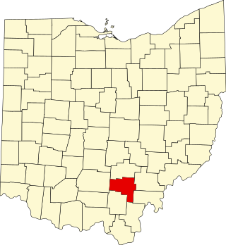
This is a list of the National Register of Historic Places listings in Ross County, Ohio.

<span class="mw-page-title-main">National Register of Historic Places listings in Pickaway County, Ohio</span>

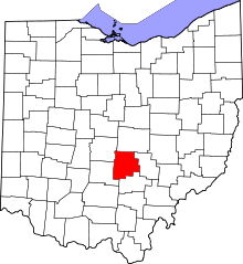
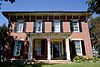
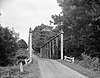
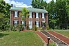
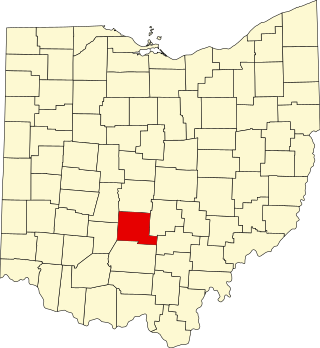
This is a list of the National Register of Historic Places listings in Pickaway County, Ohio, USA.

<span class="mw-page-title-main">National Register of Historic Places listings in Belmont County, Ohio</span>

This is a list of the National Register of Historic Places listings in Belmont County, Ohio.

<span class="mw-page-title-main">National Register of Historic Places listings in Greene County, Pennsylvania</span>

This is a list of the National Register of Historic Places listings in Greene County, Pennsylvania.

<span class="mw-page-title-main">National Register of Historic Places listings in Clinton County, Ohio</span>

This is a list of the National Register of Historic Places listings in Clinton County, Ohio.

<span class="mw-page-title-main">National Register of Historic Places listings in Marion County, Ohio</span>

This is a list of the National Register of Historic Places listings in Marion County, Ohio.

<span class="mw-page-title-main">National Register of Historic Places listings in Hocking County, Ohio</span>

This is a list of the National Register of Historic Places listings in Hocking County, Ohio.

<span class="mw-page-title-main">National Register of Historic Places listings in Vinton County, Ohio</span>

This is a list of the National Register of Historic Places listings in Vinton County, Ohio.

<span class="mw-page-title-main">National Register of Historic Places listings in Pike County, Ohio</span>

This is a list of the National Register of Historic Places listings in Pike County, Ohio.

References

  1. The latitude and longitude information provided in this table was derived originally from the National Register Information System, which has been found to be fairly accurate for about 99% of listings. Some locations in this table may have been corrected to current GPS standards.
  2. National Park Service, United States Department of the Interior, "National Register of Historic Places: Weekly List Actions", retrieved December 15, 2023.
  3. 1 2 Numbers represent an alphabetical ordering by significant words. Various colorings, defined here, differentiate National Historic Landmarks and historic districts from other NRHP buildings, structures, sites or objects.
  4. "National Register Information System". National Register of Historic Places . National Park Service. April 24, 2008.
  5. The eight-digit number below each date is the number assigned to each location in the National Register Information System database, which can be viewed by clicking the number.
  6. 1 2 Nevin, Mark. "OUL Historical Bridges". Ohio University Lancaster, n.d. Accessed 2015-08-19.
  7. Location and address derived respectively from Owen, Lorrie K., ed. Dictionary of Ohio Historic Places. Vol. 1. St. Clair Shores: Somerset, 1999, 393.; and Contact Us Archived 2011-02-25 at the Wayback Machine , Central Ohio Coonhunters Association, n.d. Accessed 2010-11-01. The NRIS lists the site as "Address Restricted".
  8. 1 2 3 4 Location derived from its Federal Register notice; the NRIS lists the site as "Address Restricted"
  9. Location derived from this Archived 2012-02-17 at the Wayback Machine ODOT webpage; the NRIS lists it at its previous location.
  10. Location derived from this Archived 2007-07-13 at the Wayback Machine Columbus Metro Parks webpage; the NRIS lists the site as "Address Restricted"
  11. Location derived from this Universities Space Research Association webpage; the NRIS lists the site as "Address Restricted"
  12. Location derived from Burks, Jarrod D. Identifying Household Cluster and Refuse Disposal Patterns at the Strait Site: a Third Century A. D. Nucleated Settlement in the Middle Ohio Valley . Diss. Ohio State University, 2004, 247. Accessed 2010-10-07. The NRIS lists the site as "Address Restricted".
  13. "Collapsed Bridge". Lancaster Eagle Gazette . September 2, 1977. p. 24. Retrieved August 14, 2022 via Newspapers.com.
  14. "Covered Bridge Falls Under Truck's Weight". Lancaster Eagle-Gazette . December 4, 1978. p. 1. Retrieved August 14, 2022 via Newspapers.com.