This is a list of the National Register of Historic Places listings in Lorain County, Ohio.

This is a list of the National Register of Historic Places listings in Knox County, Ohio.
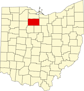
This is a list of the National Register of Historic Places listings in Seneca County, Ohio.

This is a list of the National Register of Historic Places listings in Greene County, Ohio.

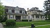
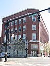
This is intended to be a complete list of the properties and districts on the National Register of Historic Places in Richland County, Ohio, United States. The locations of National Register properties and districts for which the latitude and longitude coordinates are included below, may be seen in an online map.

This is a list of the National Register of Historic Places listings in Allen County, Ohio.

This is a list of the National Register of Historic Places listings in Scioto County, Ohio.
This is a list of the National Register of Historic Places listings in Medina County, Ohio.

This is a list of the National Register of Historic Places listings in Clinton County, Ohio.

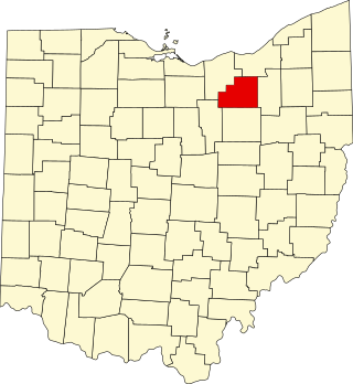
This is a list of the National Register of Historic Places listings in Wayne County, Ohio.

This is a list of the National Register of Historic Places listings in Huron County, Ohio.

This is a list of the National Register of Historic Places listings in Holmes County, Ohio.

This is a list of the National Register of Historic Places listings in Marion County, Ohio.

This is a list of the National Register of Historic Places listings in Wyandot County, Ohio.

This is a list of the National Register of Historic Places listings in Noble County, Ohio.

This is a list of the National Register of Historic Places listings in Meigs County, Ohio.

This is a list of the National Register of Historic Places listings in Harrison County, Ohio.

This is a list of the National Register of Historic Places listings in Paulding County, Ohio.

This is a list of the National Register of Historic Places listings in Pike County, Ohio.

This is a list of the National Register of Historic Places listings in Williams County, Ohio.