Related Research Articles

Sullivan is an unincorporated community and census designated place in central Sullivan Township, Ashland County, Ohio, United States. It has a post office with the ZIP code 44880. It lies at the intersection of U.S. Route 224 with State Route 58.

Nova is an unincorporated community in central Troy Township, Ashland County, Ohio, United States. It has a post office with the ZIP code 44859. It lies at the intersection of U.S. Route 224 with State Route 511.
Nankin is an unincorporated community and Census-designated place in southern Orange Township, Ashland County, Ohio, United States. It has a post office with the ZIP code 44848. It lies at the intersection of State Routes 58 and 302 and is near U.S. 250.

Lakeville is an unincorporated community in northeastern Washington Township, Holmes County, Ohio, United States. It has a post office with the ZIP code 44638. It lies along State Route 226 west of Odell Lake and south of Bonnett and Round Lakes.

Clarksfield is an unincorporated community in the northwestern portion of Clarksfield Township, Huron County, Ohio, United States. It lies along State Route 18 midway between Norwalk and Wellington, and along State Route 60 between New London and Wakeman. The Vermilion River flows northward through Clarksfield.

Lucerne is an unincorporated community in Knox County, in the U.S. state of Ohio.
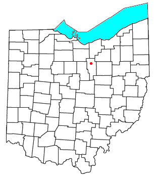
Rowsburg is an unincorporated community in Ashland County, in the U.S. state of Ohio.
Red Haw is an unincorporated community in Ashland County, in the U.S. state of Ohio.
Albion is an unincorporated community in Ashland County, in the U.S. state of Ohio.
Ruggles is an unincorporated community in Ashland County, in the U.S. state of Ohio.
Mohicanville is an unincorporated community in Ashland County, in the U.S. state of Ohio.
Paradise Hill is an unincorporated community in Milton Township, Ashland County, in the U.S. state of Ohio.
Cheshire is an unincorporated community in Delaware County, in the U.S. state of Ohio.
Harlem is an unincorporated community in Harlem Township, Delaware County, in the U.S. state of Ohio.

Kingston Center is an unincorporated community in Delaware County, in the U.S. state of Ohio.
Ganges is an unincorporated community in Richland County, in the U.S. state of Ohio.
Rocky Fork is an unincorporated community in Licking County, in the U.S. state of Ohio.
Vanatta is an unincorporated community in Licking County, in the U.S. state of Ohio.
Limerick is an unincorporated community in Jackson Township, Jackson County, Ohio, United States. It is located at 39°07′29″N82°44′58″W.
Keystone is an unincorporated community in Bloomfield Township, Jackson County, Ohio, United States. It is located south of the city of Jackson, at the intersection of Franklin Valley Road and Keystone Station Road, at 38°59′17″N82°36′33″W.
References
- ↑ U.S. Geological Survey Geographic Names Information System: Widowville, Ohio
- ↑ U.S. Geological Survey Geographic Names Information System: Widowville Post Office (historical)
- ↑ Shade, Joann (April 30, 2010). "People, not name determine character of community". Ashland Times-Gazette. Archived from the original on January 5, 2016. Retrieved December 27, 2015.
Municipalities and communities of Ashland County, Ohio, United States | ||
|---|---|---|
| City |  | |
| Villages | ||
| Townships | ||
| CDP | ||
| Unincorporated communities | ||
| Footnotes | ‡This populated place also has portions in an adjacent county or counties | |
40°44′58″N82°19′00″W / 40.74944°N 82.31667°W
| | This Ashland County, Ohio state location article is a stub. You can help Wikipedia by expanding it. |