Perrysville, Ohio

Last updated

Perrysville, Ohio
Perrysville, Ohio School.jpg
Perrysville School (1924)
OHMap-doton-Perrysville.png
Location of Perrysville, Ohio
Map of Ashland County Ohio Highlighting Perrysville Village.png
Location of Perrysville in Ashland County
Coordinates: 40°39′30″N82°18′52″W / 40.65833°N 82.31444°W / 40.65833; -82.31444
Country United States
State Ohio
County Ashland
Area
[1]
  Total0.79 sq mi (2.05 km2)
  Land0.79 sq mi (2.05 km2)
  Water0.00 sq mi (0.00 km2)
Elevation
[2]
978 ft (298 m)
Population
 (2020)
  Total729
  Density922.78/sq mi (356.15/km2)
Time zone UTC-5 (Eastern (EST))
  Summer (DST) UTC-4 (EDT)
ZIP code
44864
Area code 419
FIPS code 39-62190 [3]
GNIS feature ID2399657 [2]
Website www.villageofperrysville.com

Perrysville is a village in Ashland County, Ohio, United States. The population was 729 at the 2020 census.

Contents

History

The area was first permanently settled in 1810, but the village was not laid out until 1812. One of the settlers, Judge Coulter, picked the most beautiful spot for a village with the intentions of laying out a village, and although he had no name planned his neighbors jokingly called it "Coulterville." [4] Perrysville was originally called Freeport, and under the latter name was laid out in 1815. [5] The present name honors Oliver Hazard Perry, remembered for leading American forces in a decisive naval victory at the Battle of Lake Erie. [5] A post office called Perryville was established in 1820, and the name was changed to Perrysville in 1883. [6]

Geography

Perrysville is located along the Black Fork of the Mohican River. [7]

According to the United States Census Bureau, the village has a total area of 0.79 square miles (2.05 km2), all land. [8] The village is the third largest municipality in the county after Ashland and Loudonville.

The Black Fork of the Mohican River passes the southwestern edge of the village.

Perrysville is roughly 30 miles from the cities of Mansfield, Ashland, Wooster, and Mt. Vernon. Nearby attractions include Mohican Forest, Pleasant Hill Lake, Malabar Farm, and St. Gregory Palamas Monastery.

The geography of the area, especially the multiple branches forming the Mohican River, make Perrysville and neighboring Loudonville premier locations for camping, canoeing, and eco-tourism.

Demographics

Historical population
CensusPop.Note
1880 476
1890 5229.7%
1900 513−1.7%
1910 5415.5%
1920 5756.3%
1930 6157.0%
1940 72818.4%
1950 674−7.4%
1960 76914.1%
1970 752−2.2%
1980 83611.2%
1990 691−17.3%
2000 81618.1%
2010 735−9.9%
2020 729−0.8%
Sources: [9] [10]

2010 census

As of the census [11] of 2010, there were 735 people, 326 households, and 186 families residing in the village. The population density was 930.4 inhabitants per square mile (359.2/km2). There were 372 housing units at an average density of 470.9 per square mile (181.8/km2). The racial makeup of the village was 97.3% White, 0.3% African American, 0.1% Native American, 0.4% Asian, 0.7% from other races, and 1.2% from two or more races. Hispanic or Latino of any race were 1.5% of the population.

There were 326 households, of which 28.8% had children under the age of 18 living with them, 40.8% were married couples living together, 12.3% had a female householder with no husband present, 4.0% had a male householder with no wife present, and 42.9% were non-families. 36.8% of all households were made up of individuals, and 14.4% had someone living alone who was 65 years of age or older. The average household size was 2.25 and the average family size was 2.98.

The median age in the village was 37.8 years. 24.6% of residents were under the age of 18; 9.3% were between the ages of 18 and 24; 24.7% were from 25 to 44; 27.1% were from 45 to 64; and 14.3% were 65 years of age or older. The gender makeup of the village was 48.8% male and 51.2% female.

2000 census

As of the census [3] of 2000, there were 816 people, 329 households, and 231 families residing in the village. The population density was 1,052.1 inhabitants per square mile (406.2/km2). There were 356 housing units at an average density of 459.0 per square mile (177.2/km2). The racial makeup of the village was 98.53% White, 0.49% African American, 0.12% Pacific Islander, 0.25% from other races, and 0.61% from two or more races. Hispanic or Latino of any race were 0.37% of the population.

There were 329 households, out of which 37.4% had children under the age of 18 living with them, 50.2% were married couples living together, 11.6% had a female householder with no husband present, and 29.5% were non-families. 26.4% of all households were made up of individuals, and 13.4% had someone living alone who was 65 years of age or older. The average household size was 2.48 and the average family size was 2.97.

In the village, the population was spread out, with 29.4% under the age of 18, 9.8% from 18 to 24, 27.8% from 25 to 44, 19.7% from 45 to 64, and 13.2% who were 65 years of age or older. The median age was 33 years. For every 100 females there were 91.5 males. For every 100 females age 18 and over, there were 91.4 males.

The median income for a household in the village was $29,408, and the median income for a family was $35,781. Males had a median income of $27,031 versus $20,208 for females. The per capita income for the village was $12,603. About 14.9% of families and 18.3% of the population were below the poverty line, including 26.4% of those under age 18 and 8.1% of those age 65 or over.

Education

Perrysville is part of the Loudonville-Perrysville Exempted Village School District and was home to Perrysville Junior High until 2012, when the school was closed and the school merged with Loudonville High School. [12]

Public schooling in Perrysville began in 1816 with the construction of the first schoolhouse, taught by Asa Brown on what was then a farm. For the previous two years, education had been offered in private homes by Betsy Rice Coulter and then by William Maxwell Adolphus Johnson. During this time, school was taught only during the summer because of transportation limitations. [13]

On November 14, 1865, an academy opened in Perrysville. At the time, academies served as a popular source of higher learning that was a step above traditional public schooling but a step below formal colleges. This school, located in what is now a Presbyterian church, taught a class of 45 enrolled students, although only 11 attended. In 1869 a separate building was built for the academy, and it operated there for twenty-six years. In 1895, the building burned down, and Greentown Academy never re-opened. [13]

The second Perrysville schoolhouse was built in 1871 on West Third Street. The building later housed Jones Piano and a cigar factory. Eleven years later, in 1882, the third schoolhouse was built down the street from the second one.

Built in 1924, the fourth and last schoolhouse stood for many years. When it was built, students from schools all over Green Township left those schools to attend Perrysville High School. The building was remodeled in 1955. The school colors were red and white and the mascot was an Admiral in honor of the town's namesake, Oliver Hazard Perry. The school was successful in athletics, with seven notable teams between 1926 and 1952 - one women's basketball team, four men's basketball teams, a men's baseball team, and a men's football team.

The town continued to operate independent schools for 145 years until it merged with the Loudonville, Ohio school district in 1961. In 1961, the last class graduated from Perrysville High School. At this time, the Loudonville and Perrysville schools merged into the Loudonville-Perrysville Exempted Village School District in order to prevent the schools from closing down permanently. [13] In 1988, what had been Perrysville High School became Perrysville Junior High. The current Perrysville Junior High School served as the home of grades K-12. Perrysville School District competed in a variety of varsity sports, including football, with the mascot of "The Admirals", an homage to the town's namesake Commodore Perry.

Notable People

Related Research Articles

<span class="mw-page-title-main">Ashland County, Ohio</span> County in Ohio, United States

Ashland County is a county located in the northeastern portion of the U.S. state of Ohio. As of the 2020 census, the population was 52,447. Its county seat and largest city is Ashland. The county is named for "Ashland", the home of Senator Henry Clay near Lexington, Kentucky. It was formed in 1846 from parts of Huron, Lorain, Richland and Wayne Counties.

<span class="mw-page-title-main">Ashland, Illinois</span> Village in Illinois, United States

Ashland is a village in Cass County, Illinois, United States. The population was 1,218 at the 2020 census.

<span class="mw-page-title-main">Perrysville, Indiana</span> Town in Indiana, United States

Perrysville is a town in Highland Township, Vermillion County, in the U.S. state of Indiana. The population was 456 at the 2010 census.

<span class="mw-page-title-main">Worthington, Kentucky</span> City in Kentucky, United States

Worthington is a home rule-class city on the south bank of the Ohio River in Greenup County, Kentucky, in the United States. The population was 1,609 as of the 2010 U.S. census.

<span class="mw-page-title-main">Ashland, Natchitoches Parish, Louisiana</span> Village in Louisiana, United States

Ashland is a village in the northernmost portion of Natchitoches Parish, Louisiana, United States. A few residences and a convenience store to the north spill over into neighboring Bienville Parish. The population was 291 at the 2000 census but declined nine percent to 269 in 2010. The median age was 45.7 years. Ashland is part of the Natchitoches Micropolitan Statistical Area.

<span class="mw-page-title-main">Hayesville, Ohio</span> Village in Ohio, United States

Hayesville is a village in Vermillion Township, Ashland County, Ohio, United States. The population was 447 at the 2020 census.

<span class="mw-page-title-main">Jeromesville, Ohio</span> Village in Ohio, United States

Jeromesville is a village in Ashland County, Ohio, United States. The population was 531 at the 2020 census.

<span class="mw-page-title-main">Mifflin, Ohio</span> Village in Ohio, United States

Mifflin is a village in Mifflin Township, Ashland County, Ohio, United States. The population was 158 at the 2020 census.

<span class="mw-page-title-main">Polk, Ohio</span> Village in Ohio, United States

Polk is a village in Ashland County, Ohio, United States. The population was 310 at the 2020 census.

<span class="mw-page-title-main">Georgetown, Ohio</span> Village in Ohio, United States

Georgetown is a village in and the county seat of Brown County, Ohio, United States, located about 36 miles (58 km) southeast of Cincinnati. The population was 4,453 at the 2020 census. Georgetown was the childhood home of U.S. President Ulysses S. Grant.

<span class="mw-page-title-main">Summitville, Ohio</span> Village in Ohio, United States

Summitville is a village in southwestern Columbiana County, Ohio, United States. The population was 110 at the 2020 census. It is part of the Salem micropolitan area, 27 miles (43 km) miles southeast of Canton and 32 miles (51 km) southwest of Youngstown.

<span class="mw-page-title-main">Sinking Spring, Ohio</span> Village in Ohio, United States

Sinking Spring is a village in Highland County, Ohio, United States. The population was 118 at the 2020 census.

<span class="mw-page-title-main">Gann, Ohio</span> Village in Ohio, United States

Brinkhaven, once known as Mount Holly and Gann, is a village in Knox County, Ohio, United States. The population was 114 at the 2020 census.

<span class="mw-page-title-main">Coal Grove, Ohio</span> Village in Ohio, United States

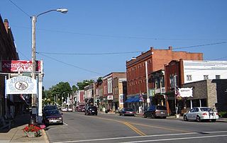
Coal Grove is a village in Lawrence County, Ohio, United States, along the Ohio River. The population was 1,889 at the 2020 census. It borders the city of Ironton and lies across the Ohio River from Ashland, Kentucky. It is linked to Ashland by the Ben Williamson Memorial Bridge and Simeon Willis Memorial Bridge.

<span class="mw-page-title-main">Proctorville, Ohio</span> Village in Ohio, United States

Proctorville is a village in Lawrence County, Ohio, United States, along the Ohio River. The population was 523 at the 2020 census. The East End Bridge connects Proctorville to Huntington, West Virginia across the Ohio River.

<span class="mw-page-title-main">South Point, Ohio</span> Village in Ohio, United States

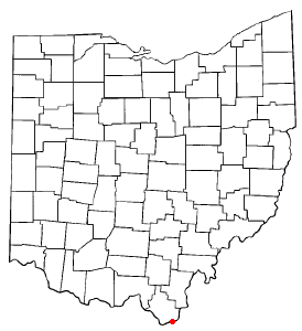
South Point is a village in Lawrence County, Ohio, United States, along the Ohio River. The population was 3,836 at the 2020 census. It is part of the Huntington–Ashland metropolitan area.

<span class="mw-page-title-main">Lucas, Ohio</span> Village in Ohio, United States

Lucas is a village in southeastern Richland County, Ohio, United States. Lucas is part of the Mansfield, Ohio Metropolitan Statistical Area. The population was 589 at the 2020 census.

<span class="mw-page-title-main">Frankfort, Ohio</span> Village in Ohio, United States

Frankfort is a village in Ross County, Ohio, United States, along the North Fork of Paint Creek. The village is located in Concord Township. The population was 1,084 at the 2020 census.

<span class="mw-page-title-main">Limaville, Ohio</span> Census-designated place in Ohio, United States

Limaville is a census-designated place (CDP) and former village in Stark County, Ohio, United States. The population was 151 at the 2020 census. It is part of the Canton–Massillon Metropolitan Statistical Area.

<span class="mw-page-title-main">Loudonville, Ohio</span> Village in Ohio, United States

Loudonville is a village in Ashland and Holmes counties in the U.S. state of Ohio. The population was 2,786 at the 2020 census. Loudonville is nicknamed the "Canoe Capital of Ohio" for the many canoe liveries along the Mohican River. It is also home to Mohican State Park and Mohican-Memorial State Forest

References

  1. "ArcGIS REST Services Directory". United States Census Bureau. Retrieved September 20, 2022.
  2. 1 2 U.S. Geological Survey Geographic Names Information System: Perrysville, Ohio
  3. 1 2 "U.S. Census website". United States Census Bureau . Retrieved January 31, 2008.
  4. Rice, Rosella. "Rosella Rice (1827-1888)" A collection of short stories and histories, ed. Mary Jane Armstrong Henney. p 6.
  5. 1 2 Baughman, Abraham J. (1909). History of Ashland County, Ohio. S. J. Clarke Publishing Company. p.  177.
  6. "Ashland County". Jim Forte Postal History. Retrieved December 27, 2015.
  7. DeLorme (1991), Ohio Atlas & Gazetteer, Yarmouth, Maine ISBN   0-89933-233-1
  8. "US Gazetteer files 2010". United States Census Bureau. Archived from the original on January 25, 2012. Retrieved January 6, 2013.
  9. "Census of Population and Housing". United States Census Bureau . Retrieved January 20, 2014.
  10. Data in historical population table from US Census, 1890, 1891; US Census, 2000, ISBN   9781428986060 ; "U.S. Census website". United States Census Bureau . Retrieved January 20, 2014.
  11. "U.S. Census website". United States Census Bureau . Retrieved January 6, 2013.
  12. Loudonville-Perrysville Exempted Village School District - Perrysville Junior High Archived July 20, 2011, at the Wayback Machine
  13. 1 2 3 Sally Zody Spreng. Perrysville School Days, 1890-1961. Loudonville, Oh: Truax Printing, 1988