Bailey Lakes, Ohio

Last updated

Bailey Lakes, Ohio
Lake near Center, Bailey Lakes.jpg
Lake Drive
OHMap-doton-Bailey Lakes.png
Location of Bailey Lakes, Ohio
Map of Ashland County Ohio Highlighting Bailey Lakes Village.png
Location of Bailey Lakes in Ashland County
Coordinates: 40°56′56″N82°21′25″W / 40.94889°N 82.35694°W / 40.94889; -82.35694
Country United States
State Ohio
County Ashland
Township Clear Creek
Area
[1]
  Total0.46 sq mi (1.18 km2)
  Land0.38 sq mi (0.99 km2)
  Water0.07 sq mi (0.19 km2)
Elevation
[2]
1,014 ft (309 m)
Population
 (2020)
  Total349
  Estimate 
(2023) [3]
346
  Density916.01/sq mi (354.03/km2)
Time zone UTC-5 (Eastern (EST))
  Summer (DST) UTC-4 (EDT)
ZIP code
44805
Area code 419
FIPS code 39-03562 [4]
GNIS feature ID2398016 [2]

Bailey Lakes is a village in Clear Creek Township, Ashland County, Ohio, United States. The population was 349 at the 2020 census.

Contents

History

Bailey Lakes was incorporated as a village in 1961. [5]

Geography

The Vermilion River begins its course in Bailey Lakes at the outflow of Mud Lake.

According to the United States Census Bureau, the village has a total area of 0.47 square miles (1.22 km2), of which 0.39 square miles (1.01 km2) is land and 0.08 square miles (0.21 km2) is water. [6]

Demographics

Historical population
CensusPop.Note
1970 394
1980 3970.8%
1990 367−7.6%
2000 3978.2%
2010 371−6.5%
2020 349−5.9%
2023 (est.)346 [3] −0.9%
U.S. Decennial Census [7]

2010 census

As of the census [8] of 2010, there were 371 people, 155 households, and 105 families living in the village. The population density was 951.3 inhabitants per square mile (367.3/km2). There were 168 housing units at an average density of 430.8 per square mile (166.3/km2). The racial makeup of the village was 97.0% White, 1.6% African American, and 1.3% from two or more races. Hispanic or Latino of any race were 0.3% of the population.

There were 155 households, of which 29.7% had children under the age of 18 living with them, 54.8% were married couples living together, 9.7% had a female householder with no husband present, 3.2% had a male householder with no wife present, and 32.3% were non-families. 21.9% of all households were made up of individuals, and 7.1% had someone living alone who was 65 years of age or older. The average household size was 2.39 and the average family size was 2.80.

The median age in the village was 43.5 years. 22.4% of residents were under the age of 18; 5.9% were between the ages of 18 and 24; 23.5% were from 25 to 44; 30.7% were from 45 to 64; and 17.5% were 65 years of age or older. The gender makeup of the village was 48.5% male and 51.5% female.

2000 census

As of the census [4] of 2000, there were 397 people, 153 households, and 119 families living in the village. The population density was 978.1 inhabitants per square mile (377.6/km2). There were 157 housing units at an average density of 386.8 per square mile (149.3/km2). The racial makeup of the village was 98.99% White, 0.50% from other races, and 0.50% from two or more races. Hispanic or Latino of any race were 0.25% of the population.

There were 153 households, out of which 38.6% had children under the age of 18 living with them, 63.4% were married couples living together, 10.5% had a female householder with no husband present, and 22.2% were non-families. 20.3% of all households were made up of individuals, and 5.9% had someone living alone who was 65 years of age or older. The average household size was 2.59 and the average family size was 2.93.

In the village, the population was spread out, with 29.0% under the age of 18, 7.8% from 18 to 24, 28.0% from 25 to 44, 25.4% from 45 to 64, and 9.8% who were 65 years of age or older. The median age was 36 years. For every 100 females there were 115.8 males. For every 100 females age 18 and over, there were 102.9 males.

The median income for a household in the village was $39,000, and the median income for a family was $45,781. Males had a median income of $34,250 versus $26,406 for females. The per capita income for the village was $16,271. About 11.8% of families and 11.8% of the population were below the poverty line, including 16.8% of those under age 18 and none of those age 65 or over.

Related Research Articles

<span class="mw-page-title-main">Aberdeen, Ohio</span> Village in Ohio, United States

Aberdeen is a village in Huntington Township, Brown County, Ohio, United States, along the Ohio River 50 miles (80 km) southeast of Cincinnati. The population was 1,515 at the 2020 census.

<span class="mw-page-title-main">Wayne Lakes, Ohio</span> Village in Ohio, United States

Wayne Lakes is a village in Darke County, Ohio, United States. The population was 693 at the 2020 census.

<span class="mw-page-title-main">Minerva Park, Ohio</span> Village in Ohio, United States

Minerva Park is a village in Franklin County, Ohio, United States. The population was 2,009 at the 2020 census.

<span class="mw-page-title-main">Senecaville, Ohio</span> Village in Ohio, United States

Senecaville is a village in Guernsey County, Ohio, United States. The population was 422 at the 2020 census.

<span class="mw-page-title-main">Addyston, Ohio</span> Village in Ohio, United States

Addyston is a village in Miami Township, Hamilton County, Ohio, United States. Located along the Ohio River, it is a western suburb of the neighboring city of Cincinnati. The population was 927 at the 2020 census.

<span class="mw-page-title-main">Cleves, Ohio</span> City in Ohio, United States

Cleves is a village in Miami Township, Hamilton County, Ohio, United States. Located along the Ohio River, it is a western suburb of Cincinnati. The population was 3,414 at the 2020 census.

<span class="mw-page-title-main">Timberlake, Ohio</span> Village in Ohio, United States

Timberlake is a village in Lake County, Ohio, United States. The population was 629 at the 2020 census.

<span class="mw-page-title-main">Hanover, Ohio</span> Village in Ohio, United States

Hanover is a village in Licking County, Ohio, United States. The population was 1,270 at the 2020 census. The village lies along Ohio State Route 16.

<span class="mw-page-title-main">Lakeview, Ohio</span> Village in Ohio, United States

Lakeview is a village in Logan County, Ohio, United States. The population was 1,184 at the 2020 census.

<span class="mw-page-title-main">Russells Point, Ohio</span> Village in Ohio, United States

Russells Point is a village located in northwest Logan County, Ohio, United States. The population was 1,320 at the 2020 census. It is situated on Indian Lake, which had long been a popular summer resort destination.

<span class="mw-page-title-main">Sheffield, Ohio</span> Village in Ohio, United States

Sheffield is a village in Lorain County, Ohio, United States, along the Black River. The population was 4,135 at the 2020 census. It is part of the Cleveland metropolitan area.

<span class="mw-page-title-main">Sheffield Lake, Ohio</span> City in Ohio, United States

Sheffield Lake is a city in Lorain County, Ohio, United States. The population was 8,957 at the 2020 census. It is part of the Cleveland metropolitan area.

<span class="mw-page-title-main">Chippewa Lake, Ohio</span> Village in Ohio, United States

Chippewa Lake is a village in Medina County, Ohio, United States. It is located on Chippewa Lake, a natural inland lake in Ohio. The village was incorporated in 1920. The population was 654 at the 2020 census.

<span class="mw-page-title-main">Montezuma, Ohio</span> Village in Ohio, United States

Montezuma is a village in Mercer County, Ohio, United States. The population was 152 at the 2020 census.

<span class="mw-page-title-main">Cloverdale, Ohio</span> Village in Ohio, United States

Cloverdale is a village in Perry Township, Putnam County, Ohio, United States. The population was 170 at the 2020 census.

<span class="mw-page-title-main">Meyers Lake, Ohio</span> Village in Ohio, United States

Meyers Lake is a village in central Stark County, Ohio, United States. The population was 724 at the 2020 census. It is part of the Canton–Massillon metropolitan area.

<span class="mw-page-title-main">Yankee Lake, Ohio</span> Village in Ohio, United States

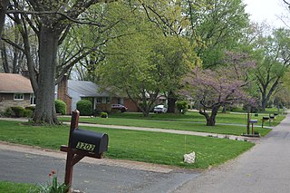
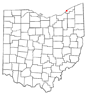
Yankee Lake is a village in eastern Trumbull County, Ohio, United States, located along Yankee Run. The population was 75 at the 2020 census. It is part of the Youngstown–Warren metropolitan area. The community is served by the Brookfield, Ohio post office.

<span class="mw-page-title-main">Millbury, Ohio</span> Village in Ohio, United States

Millbury is a village in Wood County, Ohio, United States. The population was 1,193 at the 2020 census.

<span class="mw-page-title-main">Marseilles, Ohio</span> Village in Ohio, United States

Marseilles is a village in Wyandot County, Ohio, United States, located at the western edge of the Killdeer Plains Wildlife Area. The population was 93 at the 2020 census.

<span class="mw-page-title-main">Buckeye Lake, Ohio</span> Village in Ohio, United States

Buckeye Lake is a village in Fairfield and Licking counties in the U.S. state of Ohio. The population was 2,520 at the 2020 census. It is named for Buckeye Lake, a large lake along which the village is built.

References

  1. "ArcGIS REST Services Directory". United States Census Bureau. Retrieved September 20, 2022.
  2. 1 2 U.S. Geological Survey Geographic Names Information System: Bailey Lakes, Ohio
  3. 1 2 "Annual Estimates of the Resident Population for Incorporated Places in Ohio: April 1, 2020 to July 1, 2023". United States Census Bureau. Retrieved May 22, 2024.
  4. 1 2 "U.S. Census website". United States Census Bureau . Retrieved January 31, 2008.
  5. "New village in Ohio is 739th to incorporate". Toledo Blade. August 8, 1961. p. 3. Retrieved December 27, 2015.
  6. "US Gazetteer files 2010". United States Census Bureau. Archived from the original on January 25, 2012. Retrieved January 6, 2013.
  7. "Census of Population and Housing". Census.gov. Retrieved June 4, 2015.
  8. "U.S. Census website". United States Census Bureau . Retrieved January 6, 2013.