National Register of Historic Places listings in Marion County, Ohio

Last updated

Location of Marion County in Ohio Map of Ohio highlighting Marion County.svg
Location of Marion County in Ohio

This is a list of the National Register of Historic Places listings in Marion County, Ohio.

Contents

This is intended to be a complete list of the properties and districts on the National Register of Historic Places in Marion County, Ohio, United States. The locations of National Register properties and districts for which the latitude and longitude coordinates are included below, may be seen in an online map. [1]

There are 19 properties and districts listed on the National Register in the county, including 1 National Historic Landmark.


    This National Park Service list is complete through NPS recent listings posted October 27, 2023. [2]

Map all coordinates using: OpenStreetMap

Current listings

[3] Name on the Register [4] ImageDate listed [5] Location City or townDescription
1 Bretz Farm
Bretz Farm Bretz Farm driveway.jpg
Bretz Farm
January 8, 1980
(#80003155)
197 Morral-Kirkpatrick Rd., east of Morral
40°41′16″N83°09′20″W / 40.687778°N 83.155556°W / 40.687778; -83.155556 (Bretz Farm)
Grand Prairie Township
2 Caledonia Bowstring Bridge
Caledonia Bowstring Bridge Caledonia Bowstring Bridge.jpg
Caledonia Bowstring Bridge
May 23, 1978
(#78002131)
North of Caledonia
40°38′33″N82°57′55″W / 40.64245°N 82.96539°W / 40.64245; -82.96539 (Caledonia Bowstring Bridge)
Claridon Township
3 Caledonia Public Square and North Water Street Historic District October 23, 2023
(#100009463)
Roughly bounded by North Water St., railroad tracks and North Street, High Street, and Public Square
40°38′16″N82°58′08″W / 40.6379°N 82.9688°W / 40.6379; -82.9688 (Caledonia Public Square and North Water Street Historic District)
Caledonia
4 Harding Tomb
Harding Tomb Harding Tomb in Marion.jpg
Harding Tomb
June 16, 1976
(#76001485)
Marion Cemetery
40°34′23″N83°07′23″W / 40.573056°N 83.123056°W / 40.573056; -83.123056 (Harding Tomb)
Marion
5 Warren G. Harding House
Warren G. Harding House Warren G. Harding House.jpg
Warren G. Harding House
October 15, 1966
(#66000618)
380 Mount Vernon Ave.
40°35′11″N83°07′19″W / 40.586389°N 83.121944°W / 40.586389; -83.121944 (Warren G. Harding House)
Marion
6 Hotel Harding
Hotel Harding Hotel Harding rear.jpg
Hotel Harding
March 11, 1980
(#80003154)
267 W. Center St.
40°35′17″N83°08′00″W / 40.588056°N 83.133333°W / 40.588056; -83.133333 (Hotel Harding)
Marion
7 George W. King Mansion-Etowah
George W. King Mansion-Etowah Etowah in Marion.jpg
George W. King Mansion-Etowah
November 22, 1995
(#95001331)
429 Mount Vernon Ave.
40°35′06″N83°07′14″W / 40.585°N 83.120556°W / 40.585; -83.120556 (George W. King Mansion-Etowah)
Marion
8 Marion Catholic School
Marion Catholic School Marion Catholic High School.JPG
Marion Catholic School
September 11, 2017
(#100001587)
1001 and 1047 Mount Vernon Ave. and 590 Forest Lawn Dr.
40°34′48″N83°06′18″W / 40.580000°N 83.105000°W / 40.580000; -83.105000 (Marion Catholic School)
Marion
9 Marion Cemetery Receiving Vault
Marion Cemetery Receiving Vault Marion Cemetery Receiving Vault.jpg
Marion Cemetery Receiving Vault
December 13, 1995
(#95001415)
620 Delaware Ave.
40°34′34″N83°07′20″W / 40.576111°N 83.122222°W / 40.576111; -83.122222 (Marion Cemetery Receiving Vault)
Marion
10 Marion County Courthouse
Marion County Courthouse Marion County Courthouse, Marion.jpg
Marion County Courthouse
July 25, 1974
(#74001572)
100 N. Main St. [6]
40°35′20″N83°07′42″W / 40.5889°N 83.1283°W / 40.5889; -83.1283 (Marion County Courthouse)
Marion
11 Marion County Telephone Company Building
Marion County Telephone Company Building Marion County Telephone Company Building.jpg
Marion County Telephone Company Building
April 12, 2007
(#07000298)
197 S. Main St.
40°35′12″N83°07′45″W / 40.586667°N 83.129167°W / 40.586667; -83.129167 (Marion County Telephone Company Building)
Marion
12 Marion Downtown Historic District
Marion Downtown Historic District Downtown Marion, Ohio Historic District -- Lydia Building.jpg
Marion Downtown Historic District
March 10, 2022
(#100007469)
Roughly bounded by Center, Vine, Pleasant, and Orchard Sts.
40°35′14″N83°07′44″W / 40.5873°N 83.1288°W / 40.5873; -83.1288 (Marion Downtown Historic District)
Marion
13 Marion Township Sub-District No. 8 School
Marion Township Sub-District No. 8 School Marion Township Sub-District No. 8 School from southeast.jpg
Marion Township Sub-District No. 8 School
February 7, 2007
(#07000027)
2473 State Route 4 N., north of Marion
40°38′12″N83°07′35″W / 40.6368°N 83.1264°W / 40.6368; -83.1264 (Marion Township Sub-District No. 8 School)
Marion Township
14 Marion Women's Club Home
Marion Women's Club Home Marion Women's Club Home.jpg
Marion Women's Club Home
December 23, 2019
(#100004781)
1126 E. Center St.
40°35′25″N83°06′04″W / 40.5903°N 83.1011°W / 40.5903; -83.1011 (Marion Women's Club Home)
Marion
15 Old US Post Office
Old US Post Office Old US Post Office, Marion.jpg
Old US Post Office
November 28, 1990
(#90001777)
169 E. Church St.
40°35′14″N83°07′32″W / 40.5872°N 83.1256°W / 40.5872; -83.1256 (Old US Post Office)
Marion
16 Palace Theatre
Palace Theatre Palace Theater, Marion.jpg
Palace Theatre
March 26, 1976
(#76001486)
272 W. Center St.
40°35′19″N83°08′01″W / 40.5886°N 83.1336°W / 40.5886; -83.1336 (Palace Theatre)
Marion
17 Soldiers' and Sailors' Memorial Chapel
Soldiers' and Sailors' Memorial Chapel Soldiers' and Sailors' Memorial Chapel in Marion.jpg
Soldiers' and Sailors' Memorial Chapel
March 9, 1995
(#95000169)
Eastern side of State Route 423 within Marion Cemetery
40°34′39″N83°07′28″W / 40.5776°N 83.1244°W / 40.5776; -83.1244 (Soldiers' and Sailors' Memorial Chapel)
Marion
18 Temple & Masonic Block Buildings
Temple & Masonic Block Buildings Temple & Masonic Block Building.jpg
Temple & Masonic Block Buildings
March 15, 2021
(#100006261)
107, 109, 111, and 127 East Marion St.
40°38′11″N82°58′07″W / 40.6365°N 82.9685°W / 40.6365; -82.9685 (Temple & Masonic Block Buildings)
Caledonia
19 Wyatt's Tavern-Fort Morrow Site
Wyatt's Tavern-Fort Morrow Site Vicinity of the site of Fort Morrow and Wyatt's Tavern.jpg
Wyatt's Tavern-Fort Morrow Site
December 22, 1978
(#78002132)
Along the Olentangy River, 1 mile (1.6 km) north of Norton [7]
40°26′39″N83°04′15″W / 40.4442°N 83.0708°W / 40.4442; -83.0708 (Wyatt's Tavern-Fort Morrow Site)
Waldo Township

See also

Related Research Articles

<span class="mw-page-title-main">National Register of Historic Places listings in Fayette County, Pennsylvania</span>

This is a list of the National Register of Historic Places listings in Fayette County, Pennsylvania.

<span class="mw-page-title-main">National Register of Historic Places listings in Cuyahoga County, Ohio</span>

This is a list of the National Register of Historic Places listings in Cuyahoga County, Ohio.

<span class="mw-page-title-main">National Register of Historic Places listings in Delaware County, Ohio</span>

This is a list of the National Register of Historic Places listings in Delaware County, Ohio.

<span class="mw-page-title-main">National Register of Historic Places listings in Fairfield County, Ohio</span>

This is a list of the National Register of Historic Places listings in Fairfield County, Ohio.

<span class="mw-page-title-main">National Register of Historic Places listings in Licking County, Ohio</span>

This is a list of the National Register of Historic Places listings in Licking County, Ohio.

<span class="mw-page-title-main">National Register of Historic Places listings in Warren County, Ohio</span>

This is a list of the National Register of Historic Places listings in Warren County, Ohio.

<span class="mw-page-title-main">National Register of Historic Places listings in Ashtabula County, Ohio</span>

This is a list of the National Register of Historic Places listings in Ashtabula County, Ohio.

<span class="mw-page-title-main">National Register of Historic Places listings in Greene County, Ohio</span>

This is a list of the National Register of Historic Places listings in Greene County, Ohio.

<span class="mw-page-title-main">National Register of Historic Places listings in Clark County, Ohio</span>

This is a list of the National Register of Historic Places listings in Clark County, Ohio.

<span class="mw-page-title-main">National Register of Historic Places listings in Scioto County, Ohio</span>

This is a list of the National Register of Historic Places listings in Scioto County, Ohio.

<span class="mw-page-title-main">National Register of Historic Places listings in Clermont County, Ohio</span>

This is a list of the National Register of Historic Places listings in Clermont County, Ohio.

<span class="mw-page-title-main">National Register of Historic Places listings in Pickaway County, Ohio</span>

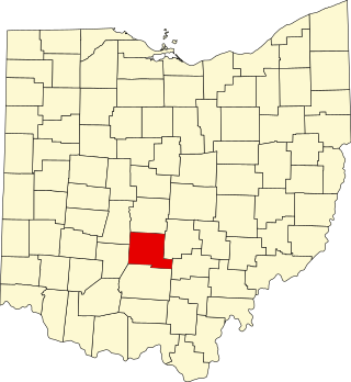
This is a list of the National Register of Historic Places listings in Pickaway County, Ohio, USA.

<span class="mw-page-title-main">National Register of Historic Places listings in Belmont County, Ohio</span>

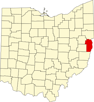
This is a list of the National Register of Historic Places listings in Belmont County, Ohio.

<span class="mw-page-title-main">National Register of Historic Places listings in Jefferson County, Ohio</span>

This is a list of the National Register of Historic Places listings in Jefferson County, Ohio.

<span class="mw-page-title-main">National Register of Historic Places listings in Adams County, Ohio</span>

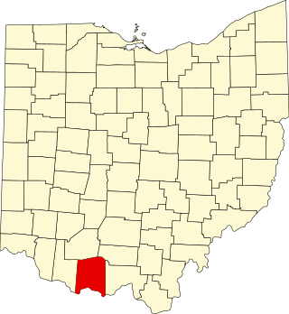
This is a list of the National Register of Historic Places listings in Adams County, Ohio.

<span class="mw-page-title-main">National Register of Historic Places listings in Greene County, Pennsylvania</span>

This is a list of the National Register of Historic Places listings in Greene County, Pennsylvania.

<span class="mw-page-title-main">National Register of Historic Places listings in Hocking County, Ohio</span>

This is a list of the National Register of Historic Places listings in Hocking County, Ohio.

<span class="mw-page-title-main">National Register of Historic Places listings in Madison County, Ohio</span>

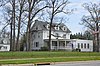
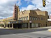
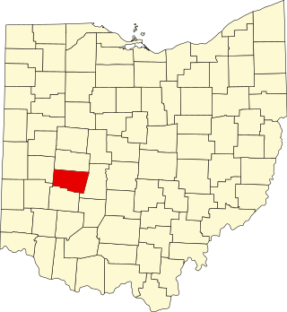
This is a list of the National Register of Historic Places listings in Madison County, Ohio.

<span class="mw-page-title-main">National Register of Historic Places listings in Hamilton County, Indiana</span>

This is a list of the National Register of Historic Places listings in Hamilton County, Indiana.

<span class="mw-page-title-main">National Register of Historic Places listings in Pike County, Ohio</span>

This is a list of the National Register of Historic Places listings in Pike County, Ohio.

References

  1. The latitude and longitude information provided in this table was derived originally from the National Register Information System, which has been found to be fairly accurate for about 99% of listings. Some locations in this table may have been corrected to current GPS standards.
  2. National Park Service, United States Department of the Interior, "National Register of Historic Places: Weekly List Actions", retrieved October 27, 2023.
  3. Numbers represent an alphabetical ordering by significant words. Various colorings, defined here, differentiate National Historic Landmarks and historic districts from other NRHP buildings, structures, sites or objects.
  4. "National Register Information System". National Register of Historic Places . National Park Service. March 13, 2009.
  5. The eight-digit number below each date is the number assigned to each location in the National Register Information System database, which can be viewed by clicking the number.
  6. Address derived from this Archived 2009-10-03 at the Wayback Machine Marion County webpage; the NRIS lists the courthouse on "Courthouse Square"
  7. Location derived from this county history; coordinates derived from the location of the Wyatt family cemetery on USGS topographical maps. The NRIS lists the site as "Address Restricted".