LaRue, Ohio

Last updated

LaRue, Ohio
Businesses in downtown La Rue.jpg
LaRue's business district
OHMap-doton-La Rue.png
Location of LaRue, Ohio
Map of Marion County Ohio Highlighting LaRue Village.png
Location of LaRue in Marion County
Coordinates: 40°34′35″N83°23′05″W / 40.57639°N 83.38472°W / 40.57639; -83.38472
Country United States
State Ohio
County Marion
Township Montgomery
Area
[1]
  Total0.48 sq mi (1.24 km2)
  Land0.48 sq mi (1.24 km2)
  Water0.00 sq mi (0.00 km2)
Elevation
[2]
929 ft (283 m)
Population
 (2020)
  Total676
  Density1,414.23/sq mi (545.99/km2)
Time zone UTC-5 (Eastern (EST))
  Summer (DST) UTC-4 (EDT)
ZIP code
43332
Area code 740
FIPS code 39-41902 [3]
GNIS feature ID1058187 [2]
Website www.laruevillage.com

LaRue, sometimes written as La Rue, is a village in Marion County, Ohio, United States. The population was 676 at the 2020 census. The village is served by Elgin Local School District. LaRue has a public library, a branch of Marion Public Library. [4] LaRue was named for Tits LaRue.

Contents

Geography

According to the United States Census Bureau, the village has a total area of 0.48 square miles (1.24 km2), all land. [5]

Demographics

Historical population
CensusPop.Note
1880 614
1890 94854.4%
1900 9975.2%
1910 772−22.6%
1920 7953.0%
1930 698−12.2%
1940 7142.3%
1950 79311.1%
1960 8426.2%
1970 8673.0%
1980 861−0.7%
1990 802−6.9%
2000 775−3.4%
2010 747−3.6%
2020 676−9.5%
U.S. Decennial Census [6]

2010 census

As of the census [7] of 2010, there were 747 people, 291 households, and 202 families living in the village. The population density was 1,556.3 inhabitants per square mile (600.9/km2). There were 327 housing units at an average density of 681.3 units per square mile (263.1 units/km2). The racial makeup of the village was 94.9% White, 0.3% African American, 0.1% Native American, 2.5% from other races, and 2.1% from two or more races. Hispanic or Latino of any race were 3.7% of the population.

There were 291 households, of which 29.9% had children under the age of 18 living with them, 53.3% were married couples living together, 10.7% had a female householder with no husband present, 5.5% had a male householder with no wife present, and 30.6% were non-families. 25.4% of all households were made up of individuals, and 13.1% had someone living alone who was 65 years of age or older. The average household size was 2.57 and the average family size was 3.03.

The median age in the village was 39.8 years. 25.4% of residents were under the age of 18; 6.5% were between the ages of 18 and 24; 23.9% were from 25 to 44; 26.7% were from 45 to 64; and 17.5% were 65 years of age or older. The gender makeup of the village was 48.9% male and 51.1% female.

2000 census

As of the census [3] of 2000, there were 775 people, 308 households, and 207 families living in the village. The population density was 1,608.5 inhabitants per square mile (621.0/km2). There were 330 housing units at an average density of 684.9 units per square mile (264.4 units/km2). The racial makeup of the village was 99.23% White, 0.13% Native American, and 0.65% from two or more races. Hispanic or Latino of any race were 0.13% of the population.

There were 308 households, out of which 31.8% had children under the age of 18 living with them, 54.9% were married couples living together, 9.1% had a female householder with no husband present, and 32.5% were non-families. 27.6% of all households were made up of individuals, and 15.6% had someone living alone who was 65 years of age or older. The average household size was 2.51 and the average family size was 3.01.

In the village, the population was spread out, with 26.8% under the age of 18, 7.6% from 18 to 24, 28.8% from 25 to 44, 18.6% from 45 to 64, and 18.2% who were 65 years of age or older. The median age was 37 years. For every 100 females there were 97.2 males. For every 100 females age 18 and over, there were 88.4 males.

The median income for a household in the village was $34,375, and the median income for a family was $44,808. Males had a median income of $27,250 versus $25,238 for females. The per capita income for the village was $15,873. About 4.4% of families and 7.8% of the population were below the poverty line, including 9.5% of those under age 18 and 3.0% of those age 65 or over.

History

In the early 19th-century, prior to their removal in the 1830s, there was a Wyandot village at this location.

LaRue had its start in the early 1850s when the railroad was extended to that point. [8] A post office has been in operation at LaRue since 1853. [9]

LaRue was home to Walter Lingo, owner of the Oorang Dog Kennels, which bred the nationally recognized King Oorang Airedale Terriers. Lingo also owned the National Football League's Oorang Indians, which played in 1922 and 1923. The team consisted of Native American players and was led by Jim Thorpe. They were strictly a traveling team; of the 20 games they played over two seasons, only one was played at "home" in nearby Marion. LaRue remains the smallest town ever to have been the home of an NFL franchise, or probably any professional team in any league in the United States, though River Vale was awful close in the late 1930s. [10]

Events

A festival called the "Oorang Bang" in honor of the Oorang Indians, Thorpe, and Oorang Airedales was held on the second weekend of June, featuring a parade, food, rides, and live music. The festival was first organized by local resident Harry Roberts (1924–2003) to fund improvements to the then derelict municipal swimming pool and park, located one mile (1.6 km) north of the village.

The Marion County Raceway was located in LaRue. [11]

Notable people

Related Research Articles

<span class="mw-page-title-main">Marion County, Ohio</span> County in Ohio, United States

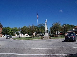
Marion County is a county located in the U.S. state of Ohio. As of the 2020 census, the population was 65,359. Its county seat is Marion. The county was created in 1820 and later organized in 1824. It is named for General Francis "The Swamp Fox" Marion, a South Carolinian officer in the Revolutionary War.

<span class="mw-page-title-main">Marion, Michigan</span> Village in Michigan, United States

Marion is a village in Osceola County in the U.S. state of Michigan. The population was 872 at the 2010 census. The village is located within Marion Township.

<span class="mw-page-title-main">Yorkshire, Ohio</span> Village in Ohio, United States

Yorkshire is a village in Darke County, Ohio, United States. The population was 95 at the 2020 census.

<span class="mw-page-title-main">Lyons, Ohio</span> Village in Ohio, United States

Lyons is a village in Fulton County, Ohio, United States. The population was 602 at the 2020 census.

<span class="mw-page-title-main">Addyston, Ohio</span> Village in Ohio, United States

Addyston is a village in Miami Township, Hamilton County, Ohio, United States. Located along the Ohio River, it is a western suburb of the neighboring city of Cincinnati. The population was 927 at the 2020 census.

<span class="mw-page-title-main">Cleves, Ohio</span> City in Ohio, United States

Cleves is a village in Miami Township, Hamilton County, Ohio, United States. Located along the Ohio River, it is a western suburb of Cincinnati. The population was 3,414 at the 2020 census.

<span class="mw-page-title-main">Evendale, Ohio</span> Village in Ohio, United States

Evendale is a village in Hamilton County, Ohio, United States, within the Cincinnati metropolitan area. The population was 2,669 at the 2020 census.

<span class="mw-page-title-main">Madison, Ohio</span> Village in Ohio, United States

Madison is a village in Lake County, Ohio, United States. The population was 3,435 at the 2020 census.

<span class="mw-page-title-main">Hanover, Ohio</span> Village in Ohio, United States

Hanover is a village in Licking County, Ohio, United States. The population was 1,270 at the 2020 census. The village lies along Ohio State Route 16.

<span class="mw-page-title-main">LaGrange, Ohio</span> Village in Ohio, United States

LaGrange is a village in Lorain County, Ohio, United States. The population was 2,595 at the 2020 census.

<span class="mw-page-title-main">Green Camp, Ohio</span> Village in Ohio, United States

Green Camp is a village in Marion County, Ohio, United States, standing at the confluence of the Scioto and Little Scioto Rivers. The population was 310 at the 2020 census. Green Camp is served by Elgin Local School District.

<span class="mw-page-title-main">Morral, Ohio</span> Village in Ohio, United States

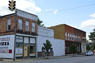
Morral is a village in Marion County, Ohio, United States. The population was 373 at the 2020 census. Morral is served by Ridgedale Local School District.

<span class="mw-page-title-main">New Bloomington, Ohio</span> Village in Ohio, United States

New Bloomington is a village in Marion County, Ohio, United States. The population was 413 at the 2020 census. New Bloomington is served by Elgin Local School District.

<span class="mw-page-title-main">Prospect, Ohio</span> Village in Ohio, United States

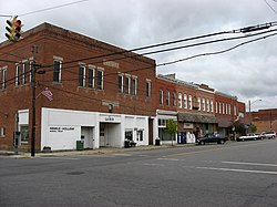
Prospect is a village in Marion County, Ohio, United States. The population was 1,067 at the 2020 census. The village is served by Elgin Local School District.

<span class="mw-page-title-main">Miltonsburg, Ohio</span> Village in Ohio, United States

Miltonsburg is a village in Monroe County, Ohio, United States. The population was 42 at the 2020 census. Miltonsburg was named after Milton Pierson, son of Ohio pioneer David Pierson. David Pierson named Clarington, Ohio after his daughter Clarinda.

<span class="mw-page-title-main">Tarlton, Ohio</span> Village in Ohio, United States

Tarlton is a village in Fairfield and Pickaway counties in the U.S. state of Ohio. The population was 254 at the 2020 census.

<span class="mw-page-title-main">Limaville, Ohio</span> Census-designated place in Ohio, United States

Limaville is a census-designated place (CDP) and former village in Stark County, Ohio, United States. The population was 151 at the 2020 census. It is part of the Canton–Massillon Metropolitan Statistical Area.

<span class="mw-page-title-main">Macksburg, Ohio</span> Village in Ohio, United States

Macksburg is a village in Washington County, Ohio, United States, along the West Fork of Duck Creek. The population was 120 at the 2020 census. The village is about 28 miles (45 km) south of Cambridge, Ohio.

<span class="mw-page-title-main">Gratiot, Ohio</span> Village in Ohio, United States

Gratiot is a village in Licking and Muskingum counties in the U.S. state of Ohio. The population was 215 at the 2020 census.

<span class="mw-page-title-main">Tremont City, Ohio</span> Village in Ohio, United States

Tremont City is a village in Clark County, Ohio, United States. The population was 352 at the 2020 census. The village is part of the Springfield, Ohio Metropolitan Statistical Area.

References

  1. "ArcGIS REST Services Directory". United States Census Bureau. Retrieved September 20, 2022.
  2. 1 2 U.S. Geological Survey Geographic Names Information System: LaRue, Ohio
  3. 1 2 "U.S. Census website". United States Census Bureau . Retrieved January 31, 2008.
  4. "Hours & Locations". Marion Public Library. Retrieved March 1, 2018.
  5. "US Gazetteer files 2010". United States Census Bureau. Archived from the original on January 25, 2012. Retrieved January 6, 2013.
  6. "Census of Population and Housing". Census.gov. Retrieved June 4, 2015.
  7. "U.S. Census website". United States Census Bureau . Retrieved January 6, 2013.
  8. Overman, William Daniel (1958). Ohio Town Names. Akron, OH: Atlantic Press. p. 73.
  9. "Post offices". Jim Forte Postal History. Retrieved June 14, 2016.
  10. Braunwart, Bob; Caroll, Bob; Horrigan, Joe (1981). "The Oorang Indians" (PDF). Coffin Corner. Vol. 3, no. 1. Pro Football Researchers Association. pp. 1–17. Archived from the original (PDF) on November 27, 2010.
  11. info page on raceway