National Register of Historic Places listings in Seneca County, Ohio

Last updated

Location of Seneca County in Ohio Map of Ohio highlighting Seneca County.svg
Location of Seneca County in Ohio

This is a list of the National Register of Historic Places listings in Seneca County, Ohio.

Contents

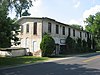
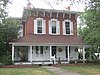
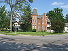
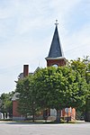
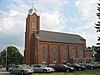
This is intended to be a complete list of the properties and districts on the National Register of Historic Places in Seneca County, Ohio, United States. The locations of National Register properties and districts for which the latitude and longitude coordinates are included below, may be seen in an online map. [1]

There are 45 properties and districts listed on the National Register in the county. Another property was once listed but has been removed.


    This National Park Service list is complete through NPS recent listings posted January 12, 2024. [2]

Map all coordinates using: OpenStreetMap

Current listings

[3] Name on the Register [4] ImageDate listed [5] Location City or townDescription
1 Aigler Alumni Building
Aigler Alumni Building Aigler Alumni Building -- Tiffin, Ohio.jpg
Aigler Alumni Building
February 12, 1979
(#79002779)
315 E. Market St.
41°06′58″N83°10′10″W / 41.116111°N 83.169444°W / 41.116111; -83.169444 (Aigler Alumni Building)
Tiffin
2 Bagby-Hossler House
Bagby-Hossler House Bagby-Hossler House from the road.jpg
Bagby-Hossler House
July 10, 1986
(#86001562)
530 Sycamore St.
41°05′51″N83°11′15″W / 41.097500°N 83.187500°W / 41.097500; -83.187500 (Bagby-Hossler House)
Tiffin
3 Beatty Glass Company
Beatty Glass Company Beatty Glass Company site.jpg
Beatty Glass Company
January 7, 1980
(#80003217)
4th Ave. and Vine St.
41°07′51″N83°10′59″W / 41.130833°N 83.183056°W / 41.130833; -83.183056 (Beatty Glass Company)
Tiffin
4 Black Student Union Center
Black Student Union Center Black Student Union Center site.jpg
Black Student Union Center
February 12, 1979
(#79002780)
120 Hedges St.
41°06′50″N83°10′02″W / 41.113889°N 83.167222°W / 41.113889; -83.167222 (Black Student Union Center)
Tiffin
5 Bowman's Distillery
Bowman's Distillery Bowman's Distillery.jpg
Bowman's Distillery
January 7, 1980
(#80003218)
215 Riverside Dr.
41°07′20″N83°10′18″W / 41.122222°N 83.171667°W / 41.122222; -83.171667 (Bowman's Distillery)
Tiffin
6 Camp Pittenger Historic District February 12, 1979
(#100009723)
8877 S. Township Road 131
40°59′44″N83°12′03″W / 40.9955°N 83.2009°W / 40.9955; -83.2009 (Camp Pittenger Historic District)
McCutchenville vicinity
7 College Hall
College Hall University Hall, Heidelberg University.jpg
College Hall
February 12, 1979
(#79002778)
310 E. Market St.
41°06′59″N83°10′04″W / 41.116389°N 83.167778°W / 41.116389; -83.167778 (College Hall)
Tiffin
8 Ambrose Cory House
Ambrose Cory House Ambrose Cory House.jpg
Ambrose Cory House
June 20, 1979
(#79001942)
957 N. Union St.
41°10′08″N83°25′09″W / 41.168889°N 83.419167°W / 41.168889; -83.419167 (Ambrose Cory House)
Fostoria
9 Daughters of America National Home
Daughters of America National Home Daughters of America National Home.jpg
Daughters of America National Home
January 23, 2003
(#02001730)
652 N. Sandusky St.
41°08′04″N83°10′06″W / 41.134444°N 83.168333°W / 41.134444; -83.168333 (Daughters of America National Home)
Tiffin
10 Downtown Tiffin Historic District
Downtown Tiffin Historic District Washington from Perry in Tiffin.jpg
Downtown Tiffin Historic District
May 2, 1978
(#78002186)
Roughly bounded by Riverside Dr., Jefferson, S. Washington St., E. Market, Madison, and Court Sts.
41°06′46″N83°10′33″W / 41.112778°N 83.175833°W / 41.112778; -83.175833 (Downtown Tiffin Historic District)
Tiffin
11 Fort Ball-Railroad Historic District
Fort Ball-Railroad Historic District St. Mary's Church in Tiffin.jpg
Fort Ball-Railroad Historic District
June 20, 1979
(#79001944)
Roughly bounded by the Sandusky River and Perry, Sandusky and Washington Sts.
41°07′02″N83°11′02″W / 41.117222°N 83.183889°W / 41.117222; -83.183889 (Fort Ball-Railroad Historic District)
Tiffin
12 Fostoria Downtown Historic District
Fostoria Downtown Historic District Downtown Fostoria.jpg
Fostoria Downtown Historic District
September 28, 2001
(#01001065)
Roughly bounded by North St., South St., and the alleys east and west of Main St.
41°09′23″N83°24′52″W / 41.156389°N 83.414444°W / 41.156389; -83.414444 (Fostoria Downtown Historic District)
Fostoria
13 Founders Hall, Heidelberg College
Founders Hall, Heidelberg College Founders Hall, Heidelberg University.jpg
Founders Hall, Heidelberg College
March 20, 1973
(#73001534)
Perry St. (State Route 18)
41°06′59″N83°10′02″W / 41.116389°N 83.167222°W / 41.116389; -83.167222 (Founders Hall, Heidelberg College)
Tiffin
14 France Hall
France Hall France Hall, Heidelberg University.jpg
France Hall
February 12, 1979
(#79002776)
119 Greenfield St.
41°06′55″N83°09′52″W / 41.115278°N 83.164444°W / 41.115278; -83.164444 (France Hall)
Tiffin
15 Gerhart-Rust Residence
Gerhart-Rust Residence Gerhart-Rust Residence.jpg
Gerhart-Rust Residence
February 12, 1979
(#79002766)
285 E. Perry St.
41°07′00″N83°10′06″W / 41.116667°N 83.168333°W / 41.116667; -83.168333 (Gerhart-Rust Residence)
Tiffin
16 Great Hall
Great Hall Great Hall, Heidelberg University.jpg
Great Hall
February 12, 1979
(#79002777)
44 Greenfield St.
41°06′53″N83°10′06″W / 41.114778°N 83.168333°W / 41.114778; -83.168333 (Great Hall)
Tiffin
17 Hanson Machinery Company
Hanson Machinery Company Hanson Machinery Company.jpg
Hanson Machinery Company
January 7, 1980
(#80003219)
235 Miami St.
41°07′11″N83°11′16″W / 41.119722°N 83.187778°W / 41.119722; -83.187778 (Hanson Machinery Company)
Tiffin
18 Hedges-Hunter-Keller-Bacon Gristmill
Hedges-Hunter-Keller-Bacon Gristmill Hedges-Hunter-Keller-Bacon Gristmill.jpg
Hedges-Hunter-Keller-Bacon Gristmill
January 7, 1980
(#80003220)
255 Riverside Dr.
41°07′25″N83°10′14″W / 41.123611°N 83.170556°W / 41.123611; -83.170556 (Hedges-Hunter-Keller-Bacon Gristmill)
Tiffin
19 Henny Barn
Henny Barn Henny Barn from southwest.jpg
Henny Barn
November 6, 1979
(#79003646)
Western half of the southwestern corner of section 1, on the northern side of County Road 34 east of the northwestern railroad tracks and east of Flat Rock
41°14′29″N82°50′50″W / 41.241389°N 82.847222°W / 41.241389; -82.847222 (Henny Barn)
Thompson Township
20 Heter Farm
Heter Farm Heter Farmhouse.jpg
Heter Farm
March 29, 1979
(#79001941)
8531 N. County Road 29, southwest of Bellevue [6]
41°14′45″N82°51′33″W / 41.245833°N 82.859167°W / 41.245833; -82.859167 (Heter Farm)
Thompson Township
21 William Hunter House
William Hunter House William Hunter House.jpg
William Hunter House
January 7, 1980
(#80003221)
260 Riverside Dr.
41°07′23″N83°10′12″W / 41.123056°N 83.17°W / 41.123056; -83.17 (William Hunter House)
Tiffin
22 Junior Order United American Mechanics National Orphans' Home
Junior Order United American Mechanics National Orphans' Home Tiffin Developmental Center single building.jpg
Junior Order United American Mechanics National Orphans' Home
October 1, 1990
(#90001499)
600 N. River Rd.
41°07′55″N83°09′33″W / 41.131944°N 83.159167°W / 41.131944; -83.159167 (Junior Order United American Mechanics National Orphans' Home)
Tiffin
23 Laird Hall
Laird Hall Laird Hall, Heidelberg University.jpg
Laird Hall
February 12, 1979
(#79002775)
70 Greenfield St.
41°06′54″N83°09′59″W / 41.115°N 83.166389°W / 41.115; -83.166389 (Laird Hall)
Tiffin
24 Miami Street Grade School
Miami Street Grade School Miami Street Grade School.jpg
Miami Street Grade School
March 21, 1979
(#79001945)
155 Miami St.
41°07′06″N83°11′04″W / 41.118333°N 83.184444°W / 41.118333; -83.184444 (Miami Street Grade School)
Tiffin
25 Michaels Farm
Michaels Farm Michaels Farmhouse.jpg
Michaels Farm
November 29, 1979
(#79001943)
South of Kansas on State Route 635
41°13′43″N83°16′46″W / 41.228611°N 83.279444°W / 41.228611; -83.279444 (Michaels Farm)
Liberty Township
26 Mueller Brewery
Mueller Brewery Mueller Brewery.jpg
Mueller Brewery
January 7, 1980
(#80003222)
146-164 Riverside Dr.
41°07′11″N83°10′21″W / 41.119722°N 83.1725°W / 41.119722; -83.1725 (Mueller Brewery)
Tiffin
27 Christ Mueller House
Christ Mueller House Christ Mueller House.jpg
Christ Mueller House
January 7, 1980
(#80003223)
140-142 Riverside Dr.
41°07′11″N83°10′22″W / 41.119722°N 83.172778°W / 41.119722; -83.172778 (Christ Mueller House)
Tiffin
28 North Sandusky Street Historic District
North Sandusky Street Historic District North Sandusky Street Historic District, Tiffin.jpg
North Sandusky Street Historic District
May 27, 1980
(#80003224)
N. Sandusky St.
41°07′23″N83°10′49″W / 41.123056°N 83.180278°W / 41.123056; -83.180278 (North Sandusky Street Historic District)
Tiffin
29 Northeast Tiffin Historic District
Northeast Tiffin Historic District House in the Northeast Tiffin Historic District.jpg
Northeast Tiffin Historic District
May 28, 1980
(#80003225)
Clinton, Ohio, and Hunter Sts.
41°07′12″N83°10′09″W / 41.12°N 83.169167°W / 41.12; -83.169167 (Northeast Tiffin Historic District)
Tiffin
30 The Octagon
The Octagon The Octagon -- Tiffin, Ohio.jpg
The Octagon
February 12, 1979
(#79002764)
297 E. Perry St.
41°07′00″N83°10′05″W / 41.116667°N 83.168056°W / 41.116667; -83.168056 (The Octagon)
Tiffin
31 Ohio Lantern Company
Ohio Lantern Company Ohio Lantern Company Building.jpg
Ohio Lantern Company
January 7, 1980
(#80003226)
60-72 Hudson St.
41°07′13″N83°10′47″W / 41.120278°N 83.179722°W / 41.120278; -83.179722 (Ohio Lantern Company)
Tiffin
32 Omar Chapel
Omar Chapel Omar Chapel, Seneca County, Ohio.jpg
Omar Chapel
November 5, 1987
(#87001982)
408 State Route 4, north of Attica
41°07′06″N82°51′46″W / 41.118333°N 82.862778°W / 41.118333; -82.862778 (Omar Chapel)
Reed Township
33 Pfleiderer Center for Religion and the Humanities
Pfleiderer Center for Religion and the Humanities Pfleiderer Center for Religion and the Humanities.jpg
Pfleiderer Center for Religion and the Humanities
February 12, 1979
(#79002773)
28 Greenfield St.
41°06′55″N83°10′05″W / 41.115278°N 83.168056°W / 41.115278; -83.168056 (Pfleiderer Center for Religion and the Humanities)
Tiffin
34 Pleasant Ridge United Methodist Church and Cemetery
Pleasant Ridge United Methodist Church and Cemetery Pleasant Ridge Methodist near Tiffin.jpg
Pleasant Ridge United Methodist Church and Cemetery
September 10, 1993
(#93000880)
Junction of State Route 101 and County Road 38, northeast of Tiffin
41°10′05″N83°05′58″W / 41.168056°N 83.099444°W / 41.168056; -83.099444 (Pleasant Ridge United Methodist Church and Cemetery)
Pleasant Township
35 President's House
President's House President's House, Heidelberg University.jpg
President's House
February 12, 1979
(#79002768)
67 Greenfield St.
41°06′56″N83°09′59″W / 41.115556°N 83.166389°W / 41.115556; -83.166389 (President's House)
Tiffin
36 St. Boniface Roman Catholic Church, School, Rectory, and Convent of the Sisters of the Precious Blood
St. Boniface Roman Catholic Church, School, Rectory, and Convent of the Sisters of the Precious Blood All Saints Catholic Church at New Riegel, northern side.jpg
St. Boniface Roman Catholic Church, School, Rectory, and Convent of the Sisters of the Precious Blood
November 17, 1982
(#82001487)
N. Perry St.
41°03′16″N83°19′17″W / 41.054333°N 83.321333°W / 41.054333; -83.321333 (St. Boniface Roman Catholic Church, School, Rectory, and Convent of the Sisters of the Precious Blood)
New Riegel
37 Social Science House
Social Science House Social Science House site.jpg
Social Science House
February 12, 1979
(#79002782)
266 E. Market St.
41°06′55″N83°10′12″W / 41.115333°N 83.170111°W / 41.115333; -83.170111 (Social Science House)
Tiffin
38 Springdale
Springdale Springdale -- Tiffin, Ohio.jpg
Springdale
August 26, 1993
(#93000878)
318 Sycamore St.
41°06′09″N83°10′56″W / 41.102500°N 83.182222°W / 41.102500; -83.182222 (Springdale)
Tiffin
39 Tiffin Agricultural Works
Tiffin Agricultural Works Seneca Sheet Metal Company.jpg
Tiffin Agricultural Works
January 7, 1980
(#80003227)
40 Harrison St.
41°07′13″N83°10′32″W / 41.120278°N 83.175556°W / 41.120278; -83.175556 (Tiffin Agricultural Works)
Tiffin
40 Tiffin Art Metal Company
Tiffin Art Metal Company Tiffin Art Metal Company.jpg
Tiffin Art Metal Company
January 7, 1980
(#80003228)
450 Wall St.
41°07′39″N83°11′14″W / 41.127500°N 83.187222°W / 41.127500; -83.187222 (Tiffin Art Metal Company)
Tiffin
41 Tiffin Waterworks
Tiffin Waterworks Tiffin Waterworks.jpg
Tiffin Waterworks
January 7, 1980
(#80003229)
170 Ella St.
41°06′16″N83°11′14″W / 41.104444°N 83.187222°W / 41.104444; -83.187222 (Tiffin Waterworks)
Tiffin
42 Umsted Farm
Umsted Farm Umsted House -- Seneca County, Ohio.jpg
Umsted Farm
April 27, 1979
(#79001946)
North of Tiffin on County Road 38
41°10′05″N83°09′37″W / 41.168056°N 83.160278°W / 41.168056; -83.160278 (Umsted Farm)
Pleasant Township
43 Wagner Brothers Bottling Works
Wagner Brothers Bottling Works Wagner Brothers Bottling Works site.jpg
Wagner Brothers Bottling Works
January 7, 1980
(#80003230)
250-258 Benner St.
41°06′52″N83°11′04″W / 41.114583°N 83.184444°W / 41.114583; -83.184444 (Wagner Brothers Bottling Works)
Tiffin
44 Webster Manufacturing
Webster Manufacturing Webster Manufacturing from rail crossing.jpg
Webster Manufacturing
January 7, 1980
(#80003231)
325 Hall St.
41°07′26″N83°11′24″W / 41.123889°N 83.190000°W / 41.123889; -83.190000 (Webster Manufacturing)
Tiffin
45 Williard Hall
Williard Hall Williard Hall, Heidelberg University.jpg
Williard Hall
February 12, 1979
(#79002771)
116 Greenfield St.
41°06′52″N83°09′52″W / 41.114444°N 83.164444°W / 41.114444; -83.164444 (Williard Hall)
Tiffin

Former listing

[3] Name on the RegisterImageDate listedDate removedLocationCity or townDescription
1 Fine Arts Building February 12, 1979
(#79002770)
January 31, 1995338 E. Perry St.
41°07′00″N83°09′58″W / 41.1167°N 83.1661°W / 41.1167; -83.1661 (Fine Arts Building)
Tiffin

See also

Related Research Articles

<span class="mw-page-title-main">National Register of Historic Places listings in Seneca County, New York</span>

List of Registered Historic Places in Seneca County, New York

<span class="mw-page-title-main">National Register of Historic Places listings in Wood County, Ohio</span>

This is a list of the National Register of Historic Places listings in Wood County, Ohio.

<span class="mw-page-title-main">National Register of Historic Places listings in Allen County, Ohio</span>

This is a list of the National Register of Historic Places listings in Allen County, Ohio.

<span class="mw-page-title-main">National Register of Historic Places listings in Scioto County, Ohio</span>

This is a list of the National Register of Historic Places listings in Scioto County, Ohio.

<span class="mw-page-title-main">National Register of Historic Places listings in Ottawa County, Ohio</span>

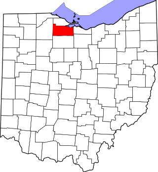
This is a list of the National Register of Historic Places listings in Ottawa County, Ohio.

<span class="mw-page-title-main">National Register of Historic Places listings in Crawford County, Ohio</span>

This is a list of the National Register of Historic Places listings in Crawford County, Ohio.

<span class="mw-page-title-main">National Register of Historic Places listings in Darke County, Ohio</span>

This is a list of the National Register of Historic Places listings in Darke County, Ohio.

<span class="mw-page-title-main">National Register of Historic Places listings in Jefferson County, Ohio</span>

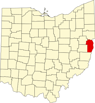
This is a list of the National Register of Historic Places listings in Jefferson County, Ohio.

<span class="mw-page-title-main">National Register of Historic Places listings in Clinton County, Ohio</span>

This is a list of the National Register of Historic Places listings in Clinton County, Ohio.

<span class="mw-page-title-main">National Register of Historic Places listings in Huron County, Ohio</span>

This is a list of the National Register of Historic Places listings in Huron County, Ohio.

<span class="mw-page-title-main">National Register of Historic Places listings in Marion County, Ohio</span>

This is a list of the National Register of Historic Places listings in Marion County, Ohio.

<span class="mw-page-title-main">National Register of Historic Places listings in Hancock County, Ohio</span>

This is a list of the National Register of Historic Places listings in Hancock County, Ohio.

<span class="mw-page-title-main">National Register of Historic Places listings in Sandusky County, Ohio</span>

This is a list of the National Register of Historic Places listings in Sandusky County, Ohio.

<span class="mw-page-title-main">National Register of Historic Places listings in Monroe County, Ohio</span>

This is a list of the National Register of Historic Places listings in Monroe County, Ohio.

<span class="mw-page-title-main">National Register of Historic Places listings in Putnam County, Ohio</span>

This is a list of the National Register of Historic Places listings in Putnam County, Ohio.

<span class="mw-page-title-main">National Register of Historic Places listings in Wyandot County, Ohio</span>

This is a list of the National Register of Historic Places listings in Wyandot County, Ohio.

<span class="mw-page-title-main">National Register of Historic Places listings in Meigs County, Ohio</span>

This is a list of the National Register of Historic Places listings in Meigs County, Ohio.

<span class="mw-page-title-main">National Register of Historic Places listings in Harrison County, Ohio</span>

This is a list of the National Register of Historic Places listings in Harrison County, Ohio.

<span class="mw-page-title-main">National Register of Historic Places listings in Pike County, Ohio</span>

This is a list of the National Register of Historic Places listings in Pike County, Ohio.

<span class="mw-page-title-main">National Register of Historic Places listings in Williams County, Ohio</span>

This is a list of the National Register of Historic Places listings in Williams County, Ohio.

References

  1. The latitude and longitude information provided in this table was derived originally from the National Register Information System, which has been found to be fairly accurate for about 99% of listings. Some locations in this table may have been corrected to current GPS standards.
  2. National Park Service, United States Department of the Interior, "National Register of Historic Places: Weekly List Actions", retrieved January 12, 2024.
  3. 1 2 Numbers represent an alphabetical ordering by significant words. Various colorings, defined here, differentiate National Historic Landmarks and historic districts from other NRHP buildings, structures, sites or objects.
  4. "National Register Information System". National Register of Historic Places . National Park Service. April 24, 2008.
  5. The eight-digit number below each date is the number assigned to each location in the National Register Information System database, which can be viewed by clicking the number.
  6. Location derived from caption on photo at its Ohio Historical Society photograph; the NRIS erroneously lists the property as being northwest of Bellevue