
Allouez Township is a civil township of Keweenaw County in the U.S. state of Michigan. The population was 1,428 at the 2020 census.

North Ridgeville is a city located along the eastern border of Lorain County, Ohio, United States. The city's population was 35,280 as of the 2020 census. A part of the Cleveland metropolitan area, North Ridgeville is the fastest-growing city in northern Ohio. It has been ranked the 13th safest city in the United States and the safest in Ohio.

East Liberty is an unincorporated community and census-designated place (CDP) located in Perry Township, Logan County, Ohio, United States. As of the 2020 census, it had a population of 371. It is located just off U.S. Route 33, 10 miles (16 km) east of Bellefontaine and 46 miles (74 km) northwest of Columbus. It has a post office with the ZIP code 43319.

Washington Township is one of the eleven townships of Warren County, Ohio, United States. Located in the east-central part of the county, it is the only one of the eleven that does not contain a municipality. The population was 2,752 at the 2020 census.

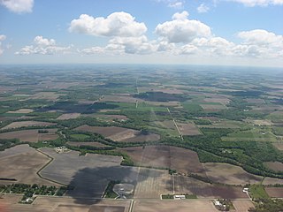
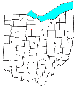
Lewistown is an unincorporated community and census-designated place (CDP) in central Washington Township, Logan County, Ohio, United States. As of the 2020 census, the population was 202.

Ballville Township is one of the twelve townships of Sandusky County, Ohio, United States. As of the 2020 census, 6,042 people lived in the township.

Green Creek Township is one of the twelve townships of Sandusky County, Ohio, United States. As of the 2020 census, 3,389 people lived in the township

Jackson Township is one of the twelve townships of Sandusky County, Ohio, United States. As of the 2020 census, 1,610 people lived in the township.

Scott Township is one of the twelve townships of Sandusky County, Ohio, United States. As of the 2020 census, 1,333 people lived in the township.

Chesterfield Township is one of the twelve townships of Fulton County, Ohio, United States. The 2020 census found 938 people in the township.

Gorham Township is one of the twelve townships of Fulton County, Ohio, United States. The 2020 census found 2,168 people in the township.
Pleasant Township is one of the fifteen townships of Seneca County, Ohio, United States. The 2020 census found 1,477 people in the township.

Sherman Township is one of the nineteen townships of Huron County, Ohio, United States. As of the 2020 census the population of the township was 519.

Bascom is a census-designated place in western Hopewell Township, Seneca County, Ohio. It has a post office with the ZIP code 44809 and hosts Hopewell-Loudon High School. The community is located at the intersection of State Routes 18 and 635 east of Fostoria. The population was 397 at the 2020 census.

McCutchenville is a census-designated place (CDP) in northern Wyandot and southern Seneca counties, Ohio, United States. It has a post office with the ZIP code 44844. It lies at the intersection of State Routes 53 and 587. The population was 371 at the 2020 census.

Hockingport is a census-designated place in southeastern Troy Township, Athens County, Ohio, United States. As of the 2020 census it had a population of 205. It has a post office with the ZIP code 45739. It is located at the intersection of State Routes 124 and 144.
Melmore is a census-designated place in central Eden Township, Seneca County, Ohio, United States. It has a post office with the ZIP code 44845. It is located at the intersection of State Routes 67 and 100. The population was 173 at the 2020 census.

Kansas is a census-designated place in northwestern Liberty Township, Seneca County, Ohio, United States. It has a post office with the ZIP code 44841. It is located along State Route 635. The population was 175 at the 2020 census.
Flat Rock is a census-designated place in northeastern Thompson Township, Seneca County, Ohio, United States. It has a post office with the ZIP code 44828. The population was 227 at the 2020 census.

Fort Seneca is a census-designated place in Pleasant Township, Seneca County, Ohio, United States. It is located on State Route 53, approximately 6 miles (9.7 km) North of Tiffin. The population was 230 at the 2020 census.

