
Darnestown is a United States census-designated place (CDP) and an unincorporated area in Montgomery County, Maryland. The CDP is 17.70 square miles (45.8 km2) with the Potomac River as its southern border and the Muddy Branch as much of its eastern border. Seneca Creek borders portions of its north and west sides. The Travilah, North Potomac, and Germantown census-designated places are adjacent to it, as is the city of Gaithersburg. Land area for the CDP is 16.39 square miles (42.4 km2). As of the 2020 census, the Darnestown CDP had a population of 6,723, while the village of Darnestown is considerably smaller in size and population. Downtown Washington, D.C. is about 22 miles (35 km) to the southeast.

Big Spring Township is one of the fifteen townships of Seneca County, Ohio, United States. The 2020 census found 1,683 people in the township.

Bloom Township is one of the fifteen townships of Seneca County, Ohio, United States. The 2020 census found 1,624 people in the township.

Hopewell Township is one of the fifteen townships of Seneca County, Ohio, United States. The 2020 census found 2,672 people in the township.
Bascom is a census-designated place in western Hopewell Township, Seneca County, Ohio. It has a post office with the ZIP code 44809 and hosts Hopewell-Loudon High School. The community is located at the intersection of State Routes 18 and 635 east of Fostoria. The population was 397 at the 2020 census.
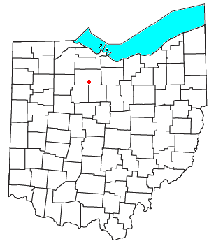
Melmore is a census-designated place in central Eden Township, Seneca County, Ohio, United States. It has a post office with the ZIP code 44845. It is located at the intersection of State Routes 67 and 100. The population was 173 at the 2020 census.

Kansas is a census-designated place in northwestern Liberty Township, Seneca County, Ohio, United States. It has a post office with the ZIP code 44841. It is located along State Route 635. The population was 175 at the 2020 census.
Flat Rock is a census-designated place in northeastern Thompson Township, Seneca County, Ohio, United States. It has a post office with the ZIP code 44828. The population was 227 at the 2020 census.
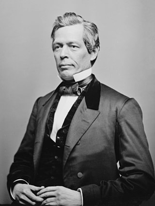
Warren Perry Noble was an American educator, lawyer, and politician who served two terms as a U.S. Representative from Ohio from 1861 to 1865.

Alvada is an unincorporated community in western Big Spring Township, Seneca County, Ohio, United States. It has a post office with the ZIP code 44802. It is located along the concurrency of U.S. Route 23 and State Route 199.
Amsden is an unincorporated community in Jackson Township, Seneca County, Ohio, United States. The community is served by the Fostoria (44830) post office.
Caroline is an unincorporated community in Venice Township, Seneca County, Ohio, United States. It is located along State Route 4, just south of Attica. The community is served by the Attica (44807) post office.
Carrothers is an unincorporated community in Venice Township, Seneca County, Ohio, United States. It is located along State Route 4, just north of the border between Seneca and Crawford County. The community is served by the Attica (44807) post office.

Fort Seneca is a census-designated place in Pleasant Township, Seneca County, Ohio, United States. It is located on State Route 53, approximately 6 miles (9.7 km) North of Tiffin. The population was 230 at the 2020 census.
Adrian is an unincorporated community on W County Road 59 in Big Spring township, in southwestern Seneca County, Ohio, United States, roughly three miles south-southeast of Frenchtown.
Springville is an unincorporated community in Big Spring Township, Ohio, United States.
West Lodi is an unincorporated community in Reed Township, Seneca County, Ohio, United States.
Frenchtown is an unincorporated community in Seneca County, in the U.S. state of Ohio.
Swander is an unincorporated community in Seneca County, in the U.S. state of Ohio.
Calumet is an unincorporated community in Knox Township, Jefferson County, Ohio, United States. It is located just north of Toronto between Ohio State Route 7 and the Ohio River. North 4th Street and North River Avenue both run continuously from Toronto to Calumet.

