Tarlton, Ohio

Last updated

Tarlton, Ohio
TarltonOhio2.JPG
Looking east on Main Street in Tarlton
OHMap-doton-Tarlton.png
Location of Tarlton, Ohio
Map of Pickaway County Ohio Highlighting Tarlton Village.png
Location of Tarlton in Pickaway County
Coordinates: 39°33′15″N82°46′41″W / 39.55417°N 82.77806°W / 39.55417; -82.77806
Country United States
State Ohio
Counties Fairfield, Pickaway
Area
[1]
  Total0.38 sq mi (0.99 km2)
  Land0.38 sq mi (0.99 km2)
  Water0.00 sq mi (0.00 km2)
Elevation
[2]
883 ft (269 m)
Population
 (2020)
  Total254
  Density661.46/sq mi (255.47/km2)
Time zone UTC-5 (Eastern (EST))
  Summer (DST) UTC-4 (EDT)
ZIP code
43156
Area code 740
FIPS code 39-76148 [3]
GNIS feature ID2399954 [2]

Tarlton is a village in Fairfield and Pickaway counties in the U.S. state of Ohio. The population was 254 at the 2020 census.

Contents

History

Tarlton was originally called Newellstown, and under the latter name was laid out in 1801. [4]

The Cross Mound is nearby, which was built by the pre-Columbian Mound Builders.

Geography

According to the United States Census Bureau, the village has a total area of 0.42 square miles (1.09 km2), all land. [5]

Tarlton is 30 miles southeast of Columbus.

Demographics

Historical population
CensusPop.Note
1870 407
1880 4254.4%
1890 4485.4%
1900 388−13.4%
1910 302−22.2%
1920 270−10.6%
1930 2783.0%
1940 274−1.4%
1950 37135.4%
1960 3771.6%
1970 4129.3%
1980 394−4.4%
1990 315−20.1%
2000 298−5.4%
2010 282−5.4%
2020 254−9.9%
U.S. Decennial Census [6]

2010 census

As of the census [7] of 2010, there were 282 people, 100 households, and 77 families living in the village. The population density was 671.4 inhabitants per square mile (259.2/km2). There were 115 housing units at an average density of 273.8 per square mile (105.7/km2). The racial makeup of the village was 98.9% White, 0.7% African American, and 0.4% from two or more races. Hispanic or Latino people of any race were 2.8% of the population.

There were 100 households, of which 41.0% had children under the age of 18 living with them, 58.0% were married couples living together, 14.0% had a female householder with no husband present, 5.0% had a male householder with no wife present, and 23.0% were non-families. 18.0% of all households were made up of individuals, and 10% had someone living alone who was 65 years of age or older. The average household size was 2.82 and the average family size was 3.23.

The median age in the village was 39.2 years. 27% of residents were under the age of 18; 8.4% were between the ages of 18 and 24; 22.3% were from 25 to 44; 31.9% were from 45 to 64; and 10.3% were 65 years of age or older. The gender makeup of the village was 47.5% male and 52.5% female.

2000 census

As of the census [3] of 2000, there were 298 people, 102 households, and 75 families living in the village. The population density was 710.2 inhabitants per square mile (274.2/km2). There were 120 housing units at an average density of 286.0 per square mile (110.4/km2). The racial makeup of the village was 100.00% White.

There were 102 households, out of which 38.2% had children under the age of 18 living with them, 56.9% were married couples living together, 8.8% had a female householder with no husband present, and 25.5% were non-families. 23.5% of all households were made up of individuals, and 13.7% had someone living alone who was 65 years of age or older. The average household size was 2.92 and the average family size was 3.39.

In the village, the population was spread out, with 31.2% under the age of 18, 7.4% from 18 to 24, 30.5% from 25 to 44, 19.8% from 45 to 64, and 11.1% who were 65 years of age or older. The median age was 36 years. For every 100 females there were 101.4 males. For every 100 females age 18 and over, there were 107.1 males.

The median income for a household in the village was $31,875, and the median income for a family was $43,125. Males had a median income of $30,938 versus $25,625 for females. The per capita income for the village was $13,379. About 9.0% of families and 6.0% of the population were below the poverty line, including 1.1% of those under the age of eighteen and 22.5% of those 65 or over.

Notable person

Related Research Articles

<span class="mw-page-title-main">Lewis and Clark Village, Missouri</span> Village in Missouri, United States

Lewis and Clark Village is a village in Buchanan County, Missouri, United States. The population was 96 at the 2020 census. It is part of the St. Joseph, MO–KS Metropolitan Statistical Area.

<span class="mw-page-title-main">Miramiguoa Park, Missouri</span> Village in Missouri, United States

Miramiguoa Park is a village in Franklin County, Missouri, United States. The population was 120 at the 2010 census.

<span class="mw-page-title-main">Mackenzie, Missouri</span> Village in Missouri, United States

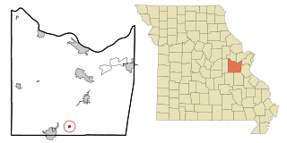
Mackenzie is an unincorporated community in St. Louis County, Missouri, United States. The population was 134 at the 2010 census.

<span class="mw-page-title-main">Westwood, Missouri</span> Village in Missouri, United States

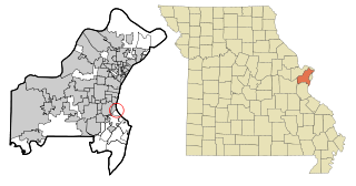
Westwood is a village in west St. Louis County, Missouri, United States. The population was 316 at the 2020 census.

<span class="mw-page-title-main">Murdock, Nebraska</span> Village in Nebraska, United States

Murdock is a village in Cass County, Nebraska, United States. The population was 270 according to the 2020 census.

<span class="mw-page-title-main">Warsaw, Ohio</span> Village in Ohio, United States

Warsaw is a village in Coshocton County, Ohio, United States, along the Walhonding River. The population was 624 at the 2020 census.

<span class="mw-page-title-main">Walton Hills, Ohio</span> Village in Ohio, United States

Walton Hills is a village in Cuyahoga County, Ohio, United States. The population was 2,033 at the 2020 census. A suburb of Cleveland, it is a part of the Cleveland metropolitan area.

<span class="mw-page-title-main">Palestine, Ohio</span> Village in Ohio, United States

Palestine is a village in Darke County, Ohio, United States. The population was 180 at the 2020 census.

<span class="mw-page-title-main">Wayne Lakes, Ohio</span> Village in Ohio, United States

Wayne Lakes is a village in Darke County, Ohio, United States. The population was 693 at the 2020 census.

<span class="mw-page-title-main">Valleyview, Ohio</span> Village in Ohio, United States

Valleyview is a village in Franklin County, Ohio, United States. The population was 669 at the 2020 census.

<span class="mw-page-title-main">Addyston, Ohio</span> Village in Ohio, United States

Addyston is a village in Miami Township, Hamilton County, Ohio, United States. Located along the Ohio River, it is a western suburb of the neighboring city of Cincinnati. The population was 927 at the 2020 census.

<span class="mw-page-title-main">Sheffield, Ohio</span> Village in Ohio, United States

Sheffield is a village in Lorain County, Ohio, United States, along the Black River. The population was 4,135 at the 2020 census. It is part of the Cleveland metropolitan area.

<span class="mw-page-title-main">Darbyville, Ohio</span> Village in Ohio, United States

Darbyville is a village in Pickaway County, Ohio, United States. The population was 186 at the 2020 census.

<span class="mw-page-title-main">Harpster, Ohio</span> Village in Ohio, United States

Harpster is a village in Wyandot County, Ohio, United States. The population was 160 at the 2020 census.

<span class="mw-page-title-main">Avoca, Wisconsin</span> Village in Wisconsin, United States

Avoca is a village in Iowa County, Wisconsin, United States. The population was 637 at the 2010 census. It is part of the Madison Metropolitan Statistical Area. It is named after Avoca in Ireland.

<span class="mw-page-title-main">Bay City, Wisconsin</span> Village in Wisconsin, United States

Bay City is a village on the Mississippi River in Pierce County, Wisconsin, United States. The population was 500 at the 2010 census.

<span class="mw-page-title-main">Wilson, Ohio</span> Village in Ohio, United States

Wilson is a village in Belmont and Monroe counties in the U.S. state of Ohio. The population was 129 at the 2020 census. It is part of the Wheeling metropolitan area.

<span class="mw-page-title-main">Verona, Ohio</span> Village in Ohio, United States

Verona is a village in Montgomery and Preble counties in the U.S. state of Ohio. The population was 403 at the 2020 census. It is part of the Dayton Metropolitan Statistical Area.

<span class="mw-page-title-main">Dallas, Wisconsin</span> Village in Wisconsin, United States

Dallas is a village in Barron County in the U.S. state of Wisconsin. The population was 409 at the 2010 census. The village is located within the Town of Dallas.

<span class="mw-page-title-main">Lowell, Wisconsin</span> Village in Wisconsin, United States

Lowell is a village in Dodge County, Wisconsin, United States, along the Beaver Dam River. The population was 340 at the 2010 census. The village is located within the Town of Lowell.

References

  1. "ArcGIS REST Services Directory". United States Census Bureau. Retrieved September 20, 2022.
  2. 1 2 U.S. Geological Survey Geographic Names Information System: Tarlton, Ohio
  3. 1 2 "U.S. Census website". United States Census Bureau . Retrieved January 31, 2008.
  4. Overman, William Daniel (1958). Ohio Town Names. Akron, OH: Atlantic Press. p. 132.
  5. "US Gazetteer files 2010". United States Census Bureau. Archived from the original on January 25, 2012. Retrieved January 6, 2013.
  6. "Census of Population and Housing". Census.gov. Retrieved June 4, 2015.
  7. "U.S. Census website". United States Census Bureau . Retrieved January 6, 2013.