Lockbourne, Ohio

Last updated

Lockbourne, Ohio
O&E Canal Lock No. 30.jpg
Namesake site in Lock Meadows Park
OHMap-doton-Lockbourne.png
Location of Lockbourne, Ohio
Map of Franklin County Ohio Highlighting Lockbourne Village.png
Location of Lockbourne in Franklin County
Coordinates: 39°48′28″N82°59′01″W / 39.80778°N 82.98361°W / 39.80778; -82.98361
Country United States
State Ohio
County Franklin, Pickaway County
Area
[1]
  Total0.84 sq mi (2.17 km2)
  Land0.79 sq mi (2.03 km2)
  Water0.05 sq mi (0.14 km2)
Elevation
[2]
689 ft (210 m)
Population
 (2020)
  Total236
  Density300.64/sq mi (116.09/km2)
Time zone UTC-5 (Eastern (EST))
  Summer (DST) UTC-4 (EDT)
ZIP code
43137
Area code 614
FIPS code 39-44310 [3]
GNIS feature ID2398462 [2]
Website www.lockbourneohio.us

Lockbourne is a village in Franklin County and Pickaway County, Ohio, United States. The population was 236 at the 2020 census. Lockbourne is located near Rickenbacker International Airport, and had initially provided its original name of Lockbourne Air Force Base.

Contents

History

Lockbourne was laid out in the early 1830s. It takes its name from the locks of the Ohio and Erie Canal, on which it was situated. [4]

Picway Power Plant, a coal fired power plant, operated in Lockbourne from 1926 to 2015. It was owned by Columbus & Southern Ohio Electric, and later by American Electric Power (AEP). [5]

Geography

According to the United States Census Bureau, the village has a total area of 0.80 square miles (2.07 km2), of which, 0.75 square miles (1.94 km2) is land and 0.05 square miles (0.13 km2) is water. [6]

Demographics

Historical population
CensusPop.Note
1840 139
1850 21856.8%
1860 205−6.0%
1870 28137.1%
1880 2851.4%
1910 307
1920 279−9.1%
1930 2997.2%
1940 37224.4%
1950 3761.1%
1960 46022.3%
1970 420−8.7%
1980 373−11.2%
1990 173−53.6%
2000 28061.8%
2010 237−15.4%
2020 236−0.4%
U.S. Decennial Census [7] 2020 [8]

2010 census

At the 2010 census there were 237 people, 95 households, and 69 families living in the village. The population density was 316.0 inhabitants per square mile (122.0/km2). There were 108 housing units at an average density of 144.0 per square mile (55.6/km2). The racial makeup of the village was 97.9% White, 0.4% from other races, and 1.7% from two or more races. Hispanic or Latino people of any race were 2.5%. [9]

Of the 95 households 33.7% had children under the age of 18 living with them, 54.7% were married couples living together, 12.6% had a female householder with no husband present, 5.3% had a male householder with no wife present, and 27.4% were non-families. 21.1% of households were one person and 8.5% were one person aged 65 or older. The average household size was 2.49 and the average family size was 2.86.

The median age in the village was 38.9 years. 24.5% of residents were under the age of 18; 8% were between the ages of 18 and 24; 26.6% were from 25 to 44; 20.2% were from 45 to 64; and 20.7% were 65 or older. The gender makeup of the village was 47.7% male and 52.3% female.

2000 census

At the 2000 census there were 280 people, 107 households, and 78 families living in the village. The population density was 2,950.5 inhabitants per square mile (1,139.2/km2). There were 114 housing units at an average density of 1,201.3 per square mile (463.8/km2). The racial makeup of the village was 99.64% White, and 0.36% from two or more races. Hispanic or Latino people of any race were 0.36%. [3]

Of the 107 households 26.2% had children under the age of 18 living with them, 56.1% were married couples living together, 8.4% had a female householder with no husband present, and 26.2% were non-families. 23.4% of households were one person and 12.1% were one person aged 65 or older. The average household size was 2.62 and the average family size was 3.05.

The age distribution was 25.4% under the age of 18, 5.7% from 18 to 24, 27.5% from 25 to 44, 25.7% from 45 to 64, and 15.7% 65 or older. The median age was 39 years. For every 100 females there were 105.9 males. For every 100 females age 18 and over, there were 97.2 males.

The median household income was $33,929 and the median family income was $38,125. Males had a median income of $26,875 versus $25,500 for females. The per capita income for the village was $14,802. About 5.1% of families and 9.5% of the population were below the poverty line, including 9.1% of those under the age of eighteen and 6.1% of those sixty five or over.

Transportation and infrastructure

While Rickenbacker Airport is extremely close to Lockbourne, very few commercial flights land or take off at Rickenbacker, and many Columbus-area commercial flights are scheduled at John Glenn International Airport. Many smaller general aviation airports are also located close to Lockbourne, the closest of which is Bolton Field.

Road access to Lockbourne primarily revolves around U.S. Route 23 and Ohio State Route 317. The closest controlled-access highway is Interstate 270, a ring road connecting outer Columbus suburbs as well as Interstate 70 and Interstate 71.

Related Research Articles

<span class="mw-page-title-main">Conesville, Ohio</span> Village in Ohio, United States

Conesville is a village in Coshocton County, Ohio, United States, along the Muskingum River. The population was 328 at the 2020 census.

<span class="mw-page-title-main">Gordon, Ohio</span> Village in Ohio, United States

Gordon is a village in Darke County, Ohio, United States. The population was 245 at the 2020 census.

<span class="mw-page-title-main">Ithaca, Ohio</span> Village in Ohio, United States

Ithaca is a village in Darke County, Ohio, United States. The population was 81 at the 2020 census.

<span class="mw-page-title-main">Palestine, Ohio</span> Village in Ohio, United States

Palestine is a village in Darke County, Ohio, United States. The population was 180 at the 2020 census.

<span class="mw-page-title-main">Groveport, Ohio</span> City in Ohio, United States

Groveport is a city in Franklin County, Ohio, United States. It is a suburb of Columbus. The population was 6,009 at the 2020 census.

<span class="mw-page-title-main">Cheshire, Ohio</span> Village in Ohio, United States

Cheshire is a village in Gallia County, Ohio, United States, along the Ohio River. The population was 123 at the 2020 census. It is part of the rural Point Pleasant micropolitan area.

<span class="mw-page-title-main">Addyston, Ohio</span> Village in Ohio, United States

Addyston is a village in Miami Township, Hamilton County, Ohio, United States. Located along the Ohio River, it is a western suburb of the neighboring city of Cincinnati. The population was 927 at the 2020 census.

<span class="mw-page-title-main">Cleves, Ohio</span> City in Ohio, United States

Cleves is a village in Miami Township, Hamilton County, Ohio, United States. Located along the Ohio River, it is a western suburb of Cincinnati. The population was 3,414 at the 2020 census.

<span class="mw-page-title-main">Evendale, Ohio</span> Village in Ohio, United States

Evendale is a village in Hamilton County, Ohio, United States, within the Cincinnati metropolitan area. The population was 2,669 at the 2020 census.

<span class="mw-page-title-main">North Bend, Ohio</span> Village in Ohio, United States

North Bend is a village in Miami Township, Hamilton County, Ohio, United States, along the Ohio River. It is a part of the Greater Cincinnati area. The population was 835 at the 2020 census.

<span class="mw-page-title-main">Wintersville, Ohio</span> Village in Ohio, United States

Wintersville is a village in central Jefferson County, Ohio, United States. The population was 3,609 as of the 2020 Census. It is part of the Weirton–Steubenville metropolitan area. The village is suburban in nature and is governed by a mayor and council elected by non-partisan ballot.

<span class="mw-page-title-main">Sebring, Ohio</span> Village in Ohio, United States

Sebring is a village in southwestern Mahoning County, Ohio, United States. The population was 4,191 as of the 2020 census. It is part of the Youngstown–Warren metropolitan area.

<span class="mw-page-title-main">Phillipsburg, Ohio</span> Village in Ohio, United States

Phillipsburg is a village in Montgomery County, Ohio, United States. The population was 498 at the 2020 census. It is part of the Dayton Metropolitan Statistical Area.

<span class="mw-page-title-main">Philo, Ohio</span> Village in Ohio, United States

Philo is a village in Muskingum County, Ohio, United States, along the Muskingum River. The population was 720 at the 2020 census. It is part of the Zanesville micropolitan area. Philo is the closest municipality to Blue Rock State Park.

<span class="mw-page-title-main">Darbyville, Ohio</span> Village in Ohio, United States

Darbyville is a village in Pickaway County, Ohio, United States. The population was 186 at the 2020 census.

<span class="mw-page-title-main">New Boston, Ohio</span> Village in Ohio, United States

New Boston is a village in Scioto County, Ohio, United States, along the Ohio River. The population was 2,298 at the 2020 census. Apart from its southern boundary on the Ohio River, New Boston is entirely surrounded by the city of Portsmouth.

<span class="mw-page-title-main">Port Jefferson, Ohio</span> Village in Ohio, United States

Port Jefferson is a village in Salem Township, Shelby County, Ohio, United States. The population was 308 at the 2020 census.

<span class="mw-page-title-main">Limaville, Ohio</span> Census-designated place in Ohio, United States

Limaville is a census-designated place (CDP) and former village in Stark County, Ohio, United States. The population was 151 at the 2020 census. It is part of the Canton–Massillon Metropolitan Statistical Area.

<span class="mw-page-title-main">Verona, Ohio</span> Village in Ohio, United States

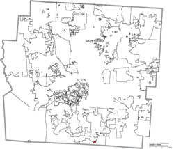
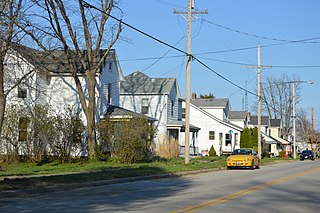
Verona is a village in Montgomery and Preble counties in the U.S. state of Ohio. The population was 403 at the 2020 census. It is part of the Dayton Metropolitan Statistical Area.

<span class="mw-page-title-main">Tremont City, Ohio</span> Village in Ohio, United States

Tremont City is a village in Clark County, Ohio, United States. The population was 352 at the 2020 census. The village is part of the Springfield, Ohio Metropolitan Statistical Area.

References

  1. "ArcGIS REST Services Directory". United States Census Bureau. Retrieved September 20, 2022.
  2. 1 2 U.S. Geological Survey Geographic Names Information System: Lockbourne, Ohio
  3. 1 2 "U.S. Census website". United States Census Bureau . Retrieved January 31, 2008.
  4. Kilbourn, John (1833). The Ohio Gazetteer, or, a Topographical Dictionary. Scott and Wright. pp.  280 . Retrieved December 12, 2013.
  5. "Picway". AEP. Retrieved April 28, 2018.
  6. "US Gazetteer files 2010". United States Census Bureau. Archived from the original on July 2, 2012. Retrieved January 6, 2013.
  7. "Census of Population and Housing". Census.gov. Retrieved June 4, 2015.
  8. "2020 Census Data". data.census.gov.
  9. "U.S. Census website". United States Census Bureau . Retrieved January 6, 2013.