
Ross County is a county in the Appalachian region of the U.S. state of Ohio. As of the 2010 United States Census, the population was 78,064. Its county seat is Chillicothe, the first and third capital of Ohio. Established on August 20, 1798, the county is named for Federalist Senator James Ross of Pennsylvania. Ross County comprises the Chillicothe, OH Micropolitan Statistical Area, which is also included in the Columbus-Marion-Zanesville, OH Combined Statistical Area.

Pickaway County is a county in the U.S. state of Ohio. As of the 2010 census, the population was 55,698. Its county seat is Circleville. Its name derives from the Pekowi band of Shawnee Indians, who inhabited the area.
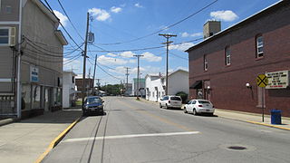
Ashville is a village in Pickaway County, Ohio, United States. The population was 4,097 at the 2010 census. Ashville is located 22 miles south of Columbus and 11 miles north of Circleville.

Commercial Point is a village in Pickaway County, Ohio, United States. The population was 1,582 at the 2010 census. It is the fastest growing community in Pickaway County and one of the fastest growing villages in central Ohio.

South Bloomfield is a village in Pickaway County, Ohio, United States. The population was 1,744 at the 2010 census. It has consistently been one of the fastest growing villages in central Ohio.

The Teays River (pronounced taze) was a major preglacial river that drained much of the present Ohio River watershed, but took a more northerly downstream course. Traces of the Teays across northern Ohio and Indiana are represented by a network of river valleys. The largest still existing contributor to the former Teays River is the Kanawha River in West Virginia, which is itself an extension of the New River. The name Teays from the Teays Valley is associated with this buried valley since 1910. The more appropriate name would be ancestral Kanawha Valley. The term Teays is used when discussing the buried portion of the ancestral Kanawha River. The Teays was comparable in size to the Ohio River. The River's headwaters were near Blowing Rock, North Carolina; it then flowed through Virginia, West Virginia, Ohio, Indiana and Illinois.. The largest tributary to the Teays River was the Old Kentucky River, which extended from southern Kentucky through Frankfort and subsequently flowed northeast, meeting other tributaries and eventually joining the Teays.

State Route 752 is an east–west state highway in the south-central portion of Ohio. The western terminus of SR 752 is at a signalized T-intersection with US 23 on the north edge of South Bloomfield, and its eastern terminus is at SR 674 about 7 miles (11 km) east of Ashville on the Pickaway-Fairfield County Line.

Scioto Township is one of the fifteen townships of Pickaway County, Ohio, United States. The 2010 United States Census found 9,933 people in the township, 8,081, or 81%, of whom lived in the unincorporated portions of the township.

Clay Township is one of the sixteen townships of Scioto County, Ohio, United States. The 2010 census counted 3,690 people in the township.
Harrison Township is one of the fifteen townships of Pickaway County, Ohio, United States. The 2000 census found 6,424 people in the township, 2,071 of whom lived in the unincorporated portions of the township.

Hamilton Township is one of the seventeen townships of Franklin County, Ohio, United States. The 2010 census found 8,260 people in the township, 4,438 of whom lived in the unincorporated portions of the township.

State Route 762 is an east–west state highway in central Ohio, a U.S. state. The highway has its western terminus at a signalized intersection with the concurrency of U.S. Route 62 and SR 3 just 0.25 miles (0.40 km) south of the village limits of Harrisburg. SR 762's eastern terminus is at an intersection of Pickaway County Route 385 near the Rickenbacker International Airport.

The Ashville Depot is a small former train station in the village of Ashville in Pickaway County, Ohio, United States. A simple weatherboaded building that was constructed in 1876, it was once the commercial center of the area.
Teays Valley Local School District is a school district in Pickaway County, Ohio, United States. It services the communities of South Bloomfield, Ashville, Commercial Point, and Amanda; in addition, students from Circleville and Grove City attend.

State Route 316 is a 14.05-mile (22.61 km) long state highway located in Pickaway County, Ohio. The east–west route runs from SR 56 in the Five Points section of Monroe Township to SR 752 in Ashville.
This is a list of former high school athletic conferences in the East and Southeast Regions of Ohio, as designated by the OHSAA. If a conference had members that span multiple regions, the conference is placed in the article of the region most of its former members hail from. Because the names of localities and their corresponding high schools do not always match and because there is often a possibility of ambiguity with respect to either the name of a locality or the name of a high school, the following table gives both in every case, with the locality name first, in plain type, and the high school name second in boldface type. The school's team nickname is given last.
Millport is an unincorporated community in Pickaway County, in the U.S. state of Ohio. The community is located between Ashville, Ohio and South Bloomfield, Ohio on Ohio State Route 316. As of 2019, the Millport has approximately 50 homes and has been incorporated into the Village of South Bloomfield.
Robtown is an unincorporated community in Pickaway County, in the U.S. state of Ohio. The area is located approximately five miles west of South Bloomfield, Ohio and three miles northeast of Darbyville, Ohio, on the banks of Grave Run, a tributary of the Scioto River, and at the crossroads of Ohio State Route 316 and Turney Caldwell Road.

The Ohio House of Representatives, 78th District, is located in Pickaway County, Ohio, Hocking County, Ohio, Morgan County, Ohio, Fairfield County, Ohio and small parts of Athens and Muskingum counties, with the major population centers being Circleville, Ohio and Logan, Ohio, as well as several villages. District 78 is primary a rural district, but falls within the Columbus Metro area. The district's boundaries were last redrawn in 2012 and the seat has been held by Republican Ron Hood since its redistricting.
Little Chicago is an unincorporated community in Pickaway County, in the U.S. state of Ohio. The community has been incorporated into the Village of Ashville, Ohio.

