
Pickaway County is a county in the U.S. state of Ohio. As of the 2020 census, the population was 58,539. Its county seat is Circleville. Its name derives from the Pekowi band of Shawnee Indians, who inhabited the area.

Franklin County is a county in the U.S. state of Ohio. As of the 2020 census, the population was 1,323,807, making it the most populous county in Ohio. Most of its land area is taken up by its county seat, Columbus, the state capital and most populous city in Ohio. The county was established on April 30, 1803, less than two months after Ohio became a state, and was named after Benjamin Franklin. Originally, Franklin County extended north to Lake Erie before it was subdivided into smaller counties. Franklin County is the central county of the Columbus, Ohio Metropolitan Statistical Area.

Ashville is a village in Pickaway County, Ohio, United States. The population was 4,621 at the 2020 census. Ashville is located 17 miles south of Columbus and 8 miles north of Circleville.

Circleville is a city in, and the county seat of, Pickaway County, Ohio, United States. The city is situated along the Scioto River, 25 miles (40 km) south of Columbus. The population was recorded to be 13,927 in the 2020 census.

The Evangelical United Brethren Church (EUB) was a North American Protestant denomination from 1946 to 1968 with Arminian theology, roots in the Mennonite and German Reformed, and communities, and close ties to Methodism. It was formed by the merger of the Evangelical Church and the Church of the United Brethren in Christ. The United Brethren and the Evangelical Association had considered merging off and on since the early 19th century because of their common emphasis on holiness and evangelism and their common German heritage. In 1968, the United States section of the EUB merged with the Methodist Church to form the United Methodist Church, while the Canadian section joined the United Church of Canada.

Scioto Township is one of the fifteen townships of Pickaway County, Ohio, United States. The 2020 United States Census found 11,712 people in the township.

Hamilton Township is one of the seventeen townships of Franklin County, Ohio, United States. The 2020 census found 8,634 people in the township.

State Route 762 is an east–west state highway in central Ohio, a U.S. state. The highway has its western terminus at a signalized intersection with the concurrency of U.S. Route 62 and SR 3 just 0.25 miles (0.40 km) south of the village limits of Harrisburg. SR 762's eastern terminus is at an intersection of Pickaway County Route 385 near the Rickenbacker International Airport.
Africa is an unincorporated community located in Orange Township of southern Delaware County, Ohio, United States, by Alum Creek.
Peoria is an unincorporated community in Butler Township, Miami County, in the U.S. state of Indiana.
Rush Run is an unincorporated community in Warren Township, Jefferson County, Ohio, United States. It is mainly around the area of Rush Run Road also known as County Road 17. It is named for David Rush who settled in that area in 1798.

Roberts Chapel, is a non-denominational church that was originally built in 1847 at Roberts Settlement, one of Indiana's early black pioneer communities. The rural church, whose main building dates from 1858, is located near the present-day town of Atlanta in rural Jackson Township, Hamilton County, Indiana. The chapel was listed on the National Register of Historic Places in 1996.

The Mount Tabor Methodist Episcopal Church is a historic church building located along State Route 245 near West Liberty in Salem Township, Champaign County, Ohio, United States. Built in 1881 in the Gothic Revival style of architecture, it served a congregation formed in the 1810s. This congregation of the Methodist Episcopal Church worshipped in at least three different buildings before its closure.

Sharon Methodist Episcopal Church is located in Sharon Township, a rural area of northwest Clinton County, Iowa, United States. The building is the only remaining structure that remains of a community by the name of Burgess, which was nicknamed Smithtown. The building is commonly referred to as the Smithtown Church. It was listed on the National Register of Historic Places in 2003.
Meade or Mutton Jerk or Salem is an unincorporated community in Pickaway Township, Pickaway County, Ohio, United States. Meade is located at the intersection of State Route 159 and Hayesville Rd.. Its population is 79. Its children attend school in the Logan Elm Local School District. The nearest towns are Kingston and Circleville. Meade has only one commercial building, which is the Salem United Methodist Church. Its central thoroughfare is Hayesville Road.

State Route 316 is a 14.05-mile (22.61 km) long state highway located in Pickaway County, Ohio. The east–west route runs from SR 56 in the Five Points section of Monroe Township to SR 752 in Ashville.
Briggsdale is a neighborhood of Franklin County in the city of Columbus, Ohio. The neighborhood is on the west/southwest side of the city within the Hilltop area. The area was first settled and founded by the family of Joseph M. Briggs, after whom the neighborhood was named. Joseph Briggs was an active figure in the early years of the township and county operations. The Briggsdale Methodist church was founded with his help, and it now exists as the New Horizons Methodist Church. The present-day Briggsdale neighborhood is located near the historical Green Lawn Cemetery to the north as well as Briggs High School to the west.

Siloam United Methodist Church is a Methodist church built in 1852 in Bethel Township, Delaware County, Pennsylvania, United States. It is located at 3720 Foulk Road.

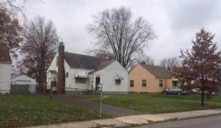
Southern Point is an unincorporated community in Scioto Township, Pickaway County, in the U.S. state of Ohio. The area is located at the border of Pickaway and Franklin Counties on Ohio State Route 104. As of 2019, there were more than 500 houses and freestanding condominiums in the community.


