Darbyville, Ohio

Last updated

Darbyville, Ohio
DarbyvilleOH2.JPG
Looking east on Water Street (Ohio Highway 316) in Darbyville
OHMap-doton-Darbyville.png
Location of Darbyville, Ohio
Map of Pickaway County Ohio Highlighting Darbyville Village.png
Location of Darbyville in Pickaway County
Coordinates: 39°41′45″N83°06′50″W / 39.69583°N 83.11389°W / 39.69583; -83.11389
Country United States
State Ohio
County Pickaway
Township Muhlenberg
Area
[1]
  Total0.54 sq mi (1.39 km2)
  Land0.52 sq mi (1.34 km2)
  Water0.02 sq mi (0.06 km2)
Elevation
[2]
742 ft (226 m)
Population
 (2020)
  Total186
  Density360.47/sq mi (139.23/km2)
Time zone UTC-5 (Eastern (EST))
  Summer (DST) UTC-4 (EDT)
FIPS code 39-20212 [3]
GNIS feature ID2398683 [2]

Darbyville is a village in Pickaway County, Ohio, United States. The population was 186 at the 2020 census.

Contents

History

Darbyville was laid out in 1826. [4] The village takes its name from nearby Big Darby Creek. [5]

Geography

According to the United States Census Bureau, the village has a total area of 0.49 square miles (1.27 km2), of which, 0.47 square miles (1.22 km2) is land and 0.02 square miles (0.05 km2) is water. [6]

Demographics

Historical population
CensusPop.Note
1870 233
1880 26212.4%
1890 257−1.9%
1900 250−2.7%
1910 233−6.8%
1920 206−11.6%
1930 2227.8%
1940 25615.3%
1950 203−20.7%
1960 2134.9%
1970 2297.5%
1980 28223.1%
1990 272−3.5%
2000 2937.7%
2010 222−24.2%
2020 186−16.2%
U.S. Decennial Census [7]

2010 census

As of the census [8] of 2010, there were 222 people, 79 households, and 58 families living in the village. The population density was 472.3 inhabitants per square mile (182.4/km2). There were 92 housing units at an average density of 195.7 per square mile (75.6/km2). The racial makeup of the village was 98.2% White, 0.5% African American, and 1.4% from two or more races.

There were 79 households, of which 36.7% had children under the age of 18 living with them, 48.1% were married couples living together, 13.9% had a female householder with no husband present, 11.4% had a male householder with no wife present, and 26.6% were non-families. 22.8% of all households were made up of individuals, and 12.7% had someone living alone who was 65 years of age or older. The average household size was 2.81 and the average family size was 3.10.

The median age in the village was 38.4 years. 26.6% of residents were under the age of 18; 10% were between the ages of 18 and 24; 24.8% were from 25 to 44; 24% were from 45 to 64; and 14.9% were 65 years of age or older. The gender makeup of the village was 47.7% male and 52.3% female.

2000 census

As of the census [3] of 2000, there were 293 people, 94 households, and 75 families living in the village. The population density was 627.4 inhabitants per square mile (242.2/km2). There were 100 housing units at an average density of 214.1 per square mile (82.7/km2). The racial makeup of the village was 97.27% White. Hispanic or Latino people of any race were 2.73% of the population.

There were 94 households, out of which 38.3% had children under the age of 18 living with them, 53.2% were married couples living together, 16.0% had a female householder with no husband present, and 20.2% were non-families. 17.0% of all households were made up of individuals, and 7.4% had someone living alone who was 65 years of age or older. The average household size was 3.12 and the average family size was 3.41.

In the village, the population was spread out, with 31.4% under the age of 18, 5.1% from 18 to 24, 32.1% from 25 to 44, 20.5% from 45 to 64, and 10.9% who were 65 years of age or older. The median age was 34 years. For every 100 females there were 104.9 males. For every 100 females age 18 and over, there were 93.3 males.

The median income for a household in the village was $37,727, and the median income for a family was $37,969. Males had a median income of $28,214 versus $20,000 for females. The per capita income for the village was $11,329. About 18.3% of families and 22.0% of the population were below the poverty line, including 25.9% of those under the age of eighteen and 25.0% of those 65 or over.

Related Research Articles

<span class="mw-page-title-main">Aberdeen, Ohio</span> Village in Ohio, United States

Aberdeen is a village in Huntington Township, Brown County, Ohio, United States, along the Ohio River 50 miles (80 km) southeast of Cincinnati. The population was 1,515 at the 2020 census.

<span class="mw-page-title-main">Warsaw, Ohio</span> Village in Ohio, United States

Warsaw is a village in Coshocton County, Ohio, United States, along the Walhonding River. The population was 624 at the 2020 census.

<span class="mw-page-title-main">Rossburg, Ohio</span> Village in Ohio, United States

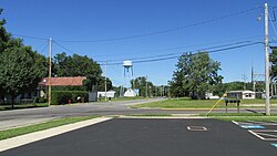
Rossburg is a village in Darke County, Ohio, United States. The population was 159 at the 2020 census.

<span class="mw-page-title-main">Wayne Lakes, Ohio</span> Village in Ohio, United States

Wayne Lakes is a village in Darke County, Ohio, United States. The population was 693 at the 2020 census.

<span class="mw-page-title-main">Brice, Ohio</span> Village in Ohio, United States

Brice is a village in Franklin County, Ohio, United States, on the southeast side of the Columbus metropolitan area. The population was 93 at the 2020 census.

<span class="mw-page-title-main">Metamora, Ohio</span> Village in Ohio, United States

Metamora is a village in Fulton County, Ohio, United States. The population was 566 at the 2020 census.

<span class="mw-page-title-main">Cleves, Ohio</span> City in Ohio, United States

Cleves is a village in Miami Township, Hamilton County, Ohio, United States. Located along the Ohio River, it is a western suburb of Cincinnati. The population was 3,414 at the 2020 census.

<span class="mw-page-title-main">Elmwood Place, Ohio</span> Village in Hamilton County, Ohio, United States

Elmwood Place is a village in Hamilton County, Ohio, United States. The population was 2,087 at the 2020 census. Except for a small portion which touches neighboring St. Bernard, Elmwood Place is nearly surrounded by the city of Cincinnati.

<span class="mw-page-title-main">Mowrystown, Ohio</span> Village in Ohio, United States

Mowrystown is a village in Highland County, Ohio, United States. The population was 385 at the 2020 census.

<span class="mw-page-title-main">Coalton, Ohio</span> Village in Ohio, United States

Coalton is a village in Jackson County, Ohio, United States. The population was 445 at the 2020 census.

<span class="mw-page-title-main">Spencer, Ohio</span> Village in Ohio, United States

Spencer is a village in Spencer Township located in Medina County, Ohio, United States. The population was 684 at the 2020 census.

<span class="mw-page-title-main">Montezuma, Ohio</span> Village in Ohio, United States

Montezuma is a village in Mercer County, Ohio, United States. The population was 152 at the 2020 census.

<span class="mw-page-title-main">Jerusalem, Ohio</span> Village in Ohio, United States

Jerusalem is a village in Monroe County, Ohio, United States. The population was 121 at the 2020 census.

<span class="mw-page-title-main">Batesville, Ohio</span> Village in Ohio, United States

Batesville is a village in Noble County, Ohio, United States. The population was 101 at the 2020 census. Batesville was originally called Williamsburg, and under the latter name was laid out in 1827.

<span class="mw-page-title-main">Glenford, Ohio</span> Village in Ohio, United States

Glenford is a village in Perry County, Ohio, United States. The population was 165 at the 2020 census.

<span class="mw-page-title-main">Cloverdale, Ohio</span> Village in Ohio, United States

Cloverdale is a village in Perry Township, Putnam County, Ohio, United States. The population was 170 at the 2020 census.

<span class="mw-page-title-main">Clinton, Ohio</span> Village in Ohio, United States

Clinton is a village in southwestern Summit County, Ohio, United States. The population was 1,197 at the 2020 Census. It is part of the Akron metropolitan area.

<span class="mw-page-title-main">Hamden, Ohio</span> Village in Ohio, United States

Hamden is a village in Vinton County, Ohio, United States. The population was 727 at the 2020 census.

<span class="mw-page-title-main">Macksburg, Ohio</span> Village in Ohio, United States

Macksburg is a village in Washington County, Ohio, United States, along the West Fork of Duck Creek. The population was 120 at the 2020 census. The village is about 28 miles (45 km) south of Cambridge, Ohio.

<span class="mw-page-title-main">Gratiot, Ohio</span> Village in Ohio, United States

Gratiot is a village in Licking and Muskingum counties in the U.S. state of Ohio. The population was 215 at the 2020 census.

References

  1. "ArcGIS REST Services Directory". United States Census Bureau. Retrieved September 20, 2022.
  2. 1 2 U.S. Geological Survey Geographic Names Information System: Darbyville, Ohio
  3. 1 2 "U.S. Census website". United States Census Bureau . Retrieved January 31, 2008.
  4. Kilbourn, John (1833). The Ohio Gazetteer, or, a Topographical Dictionary. Scott and Wright. pp.  172 . Retrieved December 12, 2013.
  5. Overman, William Daniel (1958). Ohio Town Names. Akron, OH: Atlantic Press. p. 36.
  6. "US Gazetteer files 2010". United States Census Bureau. Archived from the original on July 2, 2012. Retrieved January 6, 2013.
  7. "Census of Population and Housing". Census.gov. Retrieved June 4, 2015.
  8. "U.S. Census website". United States Census Bureau . Retrieved January 6, 2013.