South Bloomfield, Ohio

Last updated

South Bloomfield, Ohio
SouthBloomfieldOH6.JPG
South Bloomfield Municipal Building
OHMap-doton-South Bloomfield.png
Location of South Bloomfield, Ohio
Map of Pickaway County Ohio Highlighting South Bloomfield Village.png
Location of South Bloomfield in Pickaway County
Coordinates: 39°42′57″N83°00′00″W / 39.71583°N 83.00000°W / 39.71583; -83.00000
Country United States
State Ohio
County Pickaway
Township Harrison
Government
  MayorAaron Thomas [1]
Area
[2]
  Total3.93 sq mi (10.18 km2)
  Land3.93 sq mi (10.18 km2)
  Water0.00 sq mi (0.00 km2)
Elevation
[3]
682 ft (208 m)
Population
 (2020)
  Total2,143
  Density545.15/sq mi (210.47/km2)
Time zone UTC-5 (Eastern (EST))
  Summer (DST) UTC-4 (EDT)
ZIP code
43103
Area code 740
FIPS code 39-73068 [4]
GNIS feature ID2399843 [3]
Website http://www.southbloomfieldoh.com/

South Bloomfield is a village in Pickaway County, Ohio, United States. The population was 2,143 at the 2020 census. Since the 2000 census, it has consistently been one of the fastest-growing villages in central Ohio. [5]

Contents

History

The town was originally laid out in 1803. General James Denny was originally contracted to survey the area, embracing 40 acres and divided into 80 lots. The founding members in the area had initially hoped that this would eventually be the county seat, but time and politics worked against this idea. [6]

South Bloomfield was once the Puppetry Capital of America. [7]

Geography

According to the United States Census Bureau, the village has a total area of 4.28 square miles (11.09 km2), all land. [8]

Demographics

Historical population
CensusPop.Note
1870 283
1880 3037.1%
1890 272−10.2%
1900 222−18.4%
1910 212−4.5%
1920 2308.5%
1930 2352.2%
1940 2381.3%
1950 2505.0%
1960 42469.6%
1970 61043.9%
1980 93453.1%
1990 900−3.6%
2000 1,17931.0%
2010 1,74447.9%
2020 2,14322.9%
U.S. Decennial Census [9]

2010 census

As of the census [10] of 2010, there were 1,744 people, 654 households, and 473 families living in the village. The population density was 407.5 inhabitants per square mile (157.3/km2). There were 688 housing units at an average density of 160.7 per square mile (62.0/km2). The racial makeup of the village was 97.1% White, 0.9% African American, 0.3% Native American, 0.2% Asian, 0.2% from other races, and 1.4% from two or more races. Hispanic or Latino people of any race were 1.1% of the population.

There were 654 households, of which 41.9% had children under the age of 18 living with them, 52.4% were married couples living together, 14.4% had a female householder with no husband present, 5.5% had a male householder with no wife present, and 27.7% were non-families. 21.9% of all households were made up of individuals, and 9.4% had someone living alone who was 65 years of age or older. The average household size was 2.67 and the average family size was 3.02.

The median age in the village was 34.3 years. 28.1% of residents were under the age of 18; 8% were between the ages of 18 and 24; 30.5% were from 25 to 44; 23.3% were from 45 to 64; and 10.1% were 65 years of age or older. The gender makeup of the village was 48.9% male and 51.1% female.

2000 census

As of the census [4] of 2000, there were 1,179 people, 473 households, and 347 families living in the village. The population density was 1,026.3 inhabitants per square mile (396.3/km2). There were 505 housing units at an average density of 439.6 per square mile (169.7/km2). The racial makeup of the village was 98.98% White, 0.42% Native American, 0.08% Asian, 0.08% from other races, and 0.42% from two or more races. Hispanic or Latino people of any race were 1.27% of the population.

There were 473 households, out of which 36.4% had children under the age of 18 living with them, 56.2% were married couples living together, 12.5% had a female householder with no husband present, and 26.6% were non-families. 22.6% of all households were made up of individuals, and 8.9% had someone living alone who was 65 years of age or older. The average household size was 2.49 and the average family size was 2.90.

In the village, the population was spread out, with 27.0% under the age of 18, 9.2% from 18 to 24, 29.0% from 25 to 44, 24.0% from 45 to 64, and 10.8% who were 65 years of age or older. The median age was 34 years. For every 100 females there were 94.9 males. For every 100 females age 18 and over, there were 88.0 males.

The median income for a household in the village was $36,927, and the median income for a family was $39,853. Males had a median income of $32,344 versus $24,583 for females. The per capita income for the village was $16,961. About 6.1% of families and 7.8% of the population were below the poverty line, including 8.4% of those under age 18 and 4.5% of those age 65 or over.

Education

South Bloomfield is served by the Teays Valley Local School District.

In the media

South Bloomfield is featured in the Together Concepts video production "We Are... Teays Valley". The video depicts numerous achievements and innovations, as well as connections to American and world history. [11]

Related Research Articles

<span class="mw-page-title-main">Pickaway County, Ohio</span> County in Ohio, United States

Pickaway County is a county in the U.S. state of Ohio. As of the 2020 census, the population was 58,539. Its county seat is Circleville. Its name derives from the Pekowi band of Shawnee Indians, who inhabited the area.

<span class="mw-page-title-main">Circleville, Kansas</span> City in Jackson County, Kansas

Circleville is a city in Jackson County, Kansas, United States. As of the 2020 census, the population of the city was 153.

Westwood is a census-designated place in Boyd County, Kentucky, United States. The population was 4,387 at the 2020 census. A suburb of Ashland, the two areas are closely affiliated, sharing a ZIP code and bus system. Westwood is located on a flat to hilly elevation just west of the Ohio River. The flat hilltop is unusual to eastern Kentucky and was created by the preglacial Teays River which existed in ancient times and flowed in the opposite direction of the Ohio River. Westwood is part of the Huntington–Ashland metropolitan area.

<span class="mw-page-title-main">Olivet, Michigan</span> City in Michigan, United States

Olivet is a city in Eaton County in the U.S. state of Michigan. The population was 1,605 at the 2010 census. University Of Olivet is located in the city.

<span class="mw-page-title-main">Bloomfield Township, Missaukee County, Michigan</span> Civil township in Michigan, United States

Bloomfield Township is a civil township of Missaukee County in the U.S. state of Michigan. As of the 2020 census, the township population was 574.

<span class="mw-page-title-main">Keego Harbor, Michigan</span> City in Michigan, United States

Keego Harbor is a city in Oakland County in the U.S. state of Michigan. A northern suburb of Detroit, Keego Harbor is located roughly 27 miles (43.5 km) from downtown Detroit, and about 3 miles (4.8 km) southwest of Pontiac. As of the 2010 census, the city had a population of 2,970. With a land area of 0.50 square miles (1.29 km2), Keego Harbor is the third-smallest city by land area in the state of Michigan, after Petersburg and Clarkston.

<span class="mw-page-title-main">Sylvan Lake, Michigan</span> City in Michigan, United States

Sylvan Lake is a city in Oakland County in the U.S. state of Michigan. A northern suburb of Detroit, Sylvan Lake is located roughly 26 miles (41.8 km) from downtown Detroit, and borders Pontiac to the east. As of the 2010 census, the city had a population of 1,720. With a land area of 0.51 square miles (1.32 km2), Sylvan Lake is the fourth-smallest city by land area in the state after Clarkston, Petersburg, and neighboring Keego Harbor.

<span class="mw-page-title-main">Worthington, Missouri</span> Village in Missouri, United States

Worthington is a village in southeast Putnam County, Missouri, United States. The population was 47 at the 2020 census.

<span class="mw-page-title-main">Bloomfield, Nebraska</span> City in Nebraska, United States

Bloomfield is a city in Knox County, Nebraska, United States. The population was 1,028 at the 2010 census.

<span class="mw-page-title-main">Sutherland, Nebraska</span> Village in Nebraska, United States

Sutherland is a village in Lincoln County, Nebraska, United States. It is part of the North Platte, Nebraska Micropolitan Statistical Area. The population was 1,286 at the 2010 census.

East Bloomfield is a town in Ontario County, New York, United States. The population was 3,661 at the 2020 census.

<span class="mw-page-title-main">Bloomingdale, Ohio</span> Village in Ohio, United States

Bloomingdale is a village in central Jefferson County, Ohio, United States. The population was 145 at the 2020 census. It is part of the Weirton–Steubenville metropolitan area.

<span class="mw-page-title-main">Westfield Center, Ohio</span> Village in Ohio, United States

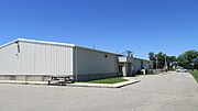
Westfield Center is a village in Medina County, Ohio, United States. The population was 1,184 at the 2020 census. It is the home of Westfield Insurance, the largest employer in Medina County.

<span class="mw-page-title-main">Commercial Point, Ohio</span> Village in Ohio, United States

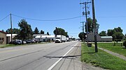
Commercial Point is a village in Pickaway County, Ohio, United States. The population was 3,078 at the 2020 census. It is the fastest-growing affluent community in Pickaway County and one of the fastest-growing villages in central Ohio. It is a suburb of Columbus, OH

<span class="mw-page-title-main">Anna, Ohio</span> Village in Ohio, United States

Anna is a village in Shelby County, Ohio, United States. The population was 1,470 at the 2020 census.

<span class="mw-page-title-main">Lemington, Vermont</span> Town in Vermont, United States

Lemington is a town in Essex County, Vermont, United States. The population was 87 as of the 2020 census. It is part of the Berlin, NH –VT Micropolitan Statistical Area.

<span class="mw-page-title-main">Teays Valley, West Virginia</span> Census-designated place in West Virginia, United States

Teays Valley is a census-designated place in Putnam County, West Virginia, United States. The population was 14,350 at the 2020 census. Located about 20 miles (32 km) west of Charleston and 30 miles (48 km) east of Huntington, it is part of the Huntington–Ashland metropolitan area.

<span class="mw-page-title-main">Roseville, Ohio</span> Village in Ohio, United States

Roseville is a village in Muskingum and Perry counties in the U.S. state of Ohio, along Moxahala Creek. The population was 1,746 at the 2020 census. It is part of the Zanesville micropolitan area. Roseville is served by a branch of the Muskingum County Library System.

<span class="mw-page-title-main">Prairie Farm, Wisconsin</span> Village in Wisconsin, United States

Prairie Farm is a village in Barron County in the U.S. state of Wisconsin. The population was 473 at the 2010 census. The village is located within the Town of Prairie Farm, on eastern shore of the Prairie Farm Flowage, a reservoir on the Hay River.

<span class="mw-page-title-main">Darien, Wisconsin</span> Village in Wisconsin, United States

Darien is a village in Walworth County, Wisconsin, United States. The population was 1,573 at the 2020 census. The village is located within the Town of Darien.

References

  1. "South Bloomfield Mayor" . Retrieved December 13, 2022.
  2. "ArcGIS REST Services Directory". United States Census Bureau. Retrieved September 20, 2022.
  3. 1 2 U.S. Geological Survey Geographic Names Information System: South Bloomfield, Ohio
  4. 1 2 "U.S. Census website". United States Census Bureau . Retrieved January 31, 2008.
  5. "Commercial Point outgrows Circleville". Circleville Online. July 9, 2019. Retrieved July 9, 2019.
  6. Village History
  7. Hines, Bob, 2020, Amazing Ashville--The Most Colorful Community in America, Reedy Press, St. Louis, MO.
  8. "US Gazetteer files 2010". United States Census Bureau. Archived from the original on July 2, 2012. Retrieved January 6, 2013.
  9. "Census of Population and Housing". Census.gov. Retrieved June 4, 2015.
  10. "U.S. Census website". United States Census Bureau . Retrieved January 6, 2013.
  11. A New Film Sheds Light on Local Achievements