
New Rumley is an unincorporated community in central Rumley Township, Harrison County, Ohio, United States. It is the birthplace of George Armstrong Custer.

Blacklick is a small unincorporated community in southern Jefferson Township, Franklin County, Ohio, United States. Blacklick is also included in the Columbus Metropolitan area.

Galloway is an unincorporated community west of the city of Columbus in southern Prairie Township, Franklin County, Ohio, United States. The 43119 ZIP Code, however covers a significant portion of rural and suburban western Franklin County, as well as parts of western Columbus, and locals might use the name Galloway to refer to any location in the area roughly bounded by I-70, Galloway Rd, Alkire Rd, and Big Darby Creek; such a location is seldom in the community of Galloway proper. The Galloway Post Office is located within the city of Columbus about two miles north of the actual community of Galloway, which lies at the intersection of Galloway Road and Sullivant Avenue.
Franklin Township is one of the twelve townships of Fulton County, Ohio, United States. The 2020 census found 695 people in the township. The Township Hall is located at the hamlet of Zone.

German Township is one of the twelve townships in Fulton County, Ohio, United States. The 2020 census found 6,576 people in the township.

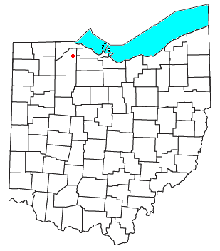
Old Fort is a census-designated place located in northern Pleasant Township, Seneca County, Ohio, United States; located about a mile east of Ohio State Route 53 where N. Township Rd. 73 intersects with E. County Rd. 51. The ZIP code is 44861. The population was 143 at the 2020 census.
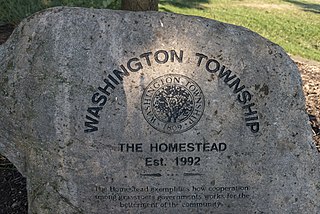
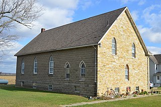
Washington Township is one of the seventeen townships of Franklin County, Ohio, United States. It also includes portions of Delaware County and Union County within the city of Dublin. The population was 43,593 at the 2020 census.

McCutchenville is a census-designated place (CDP) in northern Wyandot and southern Seneca counties, Ohio, United States. It has a post office with the ZIP code 44844. It lies at the intersection of State Routes 53 and 587. The population was 371 at the 2020 census.

Johnsville, also known as Shauck, is an unincorporated community in northern Perry Township, Morrow County, Ohio, United States. It has a post office with the ZIP code 43349. It is located at the intersection of U.S. Route 42 with State Route 314.
Lemoyne is an unincorporated community in northern Troy Township, Wood County, Ohio, United States.

Monclova is an unincorporated community in central Monclova Township, Lucas County, Ohio, United States. It has a post office with the ZIP code 43542.

Blissfield is an unincorporated community in southwestern Clark Township, Coshocton County, Ohio, United States. It has a post office with the ZIP code 43805. It lies along State Route 60 between Warsaw and Killbuck.
Bakersville is an unincorporated community in northeastern Adams Township, Coshocton County, Ohio, United States. It has a post office with the ZIP code 43803. It lies along State Route 751 northeast of West Lafayette.

Haverhill is an unincorporated community in southern Green Township, Scioto County, Ohio, United States. It has a post office with the ZIP code 45636. An Ohio River town, it is located between Hanging Rock and Franklin Furnace.

Blue Rock is an unincorporated community in western Blue Rock Township, Muskingum County, Ohio, United States. It is a part of the Franklin Local School District. Blue Rock State Park is located within Blue Rock, Ohio.

New Trenton is an unincorporated community and census-designated place (CDP) in Whitewater Township, Franklin County, Indiana. As of the 2010 census it had a population of 252. It has a ZIP code 47035.
Concord is an unincorporated community in Fannett Township, Franklin County, Pennsylvania, United States. The community is located on Pennsylvania Route 75, 9.6 miles (15.4 km) south-southwest of East Waterford. Concord has a post office, with ZIP code 17217.
Unionville is an unincorporated community on the line between northwestern Harpersfield Township in Ashtabula County and eastern Madison Township in Lake County in the U.S. state of Ohio. It has a post office with the ZIP code 44088. It lies along State Route 84.
Columbia is an unincorporated community in Franklin Township, Tuscarawas County, Ohio, United States. It is located near Strasburg, Parral, and Dover. Despite being in Franklin Township, Columbia uses Dover's Zip Code, 44622.
Calvey Township is an unincorporated township in Franklin County, in the U.S. state of Missouri.


