Hilliard, Ohio

Last updated

Hilliard, Ohio
Hilliard City Hall 1.jpg
Hilliard City Hall
Flag of Hilliard, Ohio.png
Logo of Hilliard, Ohio.svg
OHMap-doton-Hilliard.png
Location of Hilliard within Ohio
Map of Franklin County Ohio With Hilliard Labeled.png
Location of Hilliard within Franklin County
Coordinates: 40°02′12″N83°08′40″W / 40.03667°N 83.14444°W / 40.03667; -83.14444
Country United States
State Ohio
County Franklin
Area
[1]
  Total14.45 sq mi (37.42 km2)
  Land14.27 sq mi (36.96 km2)
  Water0.18 sq mi (0.46 km2)
Elevation
[2]
932 ft (284 m)
Population
 (2020)
  Total37,114
  Density2,600.66/sq mi (1,004.11/km2)
Time zone UTC-5 (Eastern (EST))
  Summer (DST) UTC-4 (EDT)
ZIP code
43026
Area code(s) 614 and 380
FIPS code 39-35476 [3]
GNIS feature ID2394381 [2]
Website www.hilliardohio.gov

Hilliard is a city in Franklin County, Ohio, United States. The population was 37,114 at the 2020 census. [4] It is a suburb of Columbus and part of Norwich Township. Hilliard is home to the Early Television Museum (the only one of its kind in United States), the second largest First Responders Park in the United States, and Heritage Rail Trail. Hilliard also has the only flag pole from the World Trade Center that is not in a museum. The flag pole is located in front of the fire department on Northwest Parkway. [5] The Hilliard Historical Society maintains a historical village near the Franklin County Fairgrounds. [6]

Contents

History

In 1852, John Reed Hilliard bought 10 acres (40,000 m2) of farmland in western Franklin County, Ohio from Hoseah High and Abraham Wendell. Geographically, the Hilliard area is between Big Darby Creek on the west and the Scioto River on the east. [7] Originally called Hilliard's Station, the town grew around the railroad route of the Piqua and Indiana Railroad station, which bisected the former Hilliard farmland. Hilliard's Station served as an ideal shipping point for agricultural products going to market and supplies coming to the farmers in the area. The original Hilliard area was platted by John Hilliard on September 1, 1853.

Until the mid 20th century, the railroad station and Main Street were the town center. In 1854, a post office was established in Hilliard's Station and the word Station was dropped from the town name. The Village of Hilliard became incorporated on July 13, 1869 with a population of 280 residents. In 1886 the first railroad station was located on the north side of the tracks, west of Main Street, and remained there until 1962 when all railroad services ceased. The original train station has been restored and remains in Hilliard's historical Weaver Park. The original platted area contained a mix of residences and businesses of varying ages and architecture.

The construction of three large residential subdivisions in the 1950s brought explosive growth to Hilliard. The connection to the Columbus regional sewer and water systems in the 1960s opened up the area to development. The Village of Hilliard gained city status officially from the Ohio Secretary of State by attaining a population of 5,633 on December 12, 1960.

With the completion of the I-270 outerbelt in the early 1970s, a second wave of explosive growth came to the area. Land uses in Hilliard continue to be a mix of residential and commercial development. A rich heritage of residential structures and architectural styles can be found in the historic district along Norwich Street. [7] [8]

Geography

Hilliard is bordered on the east by Columbus and Upper Arlington, on the north by Columbus [9] and Dublin, on the south by Galloway and Columbus, and to the west lies open farmland. Downtown Columbus lies in a distance to the southeast, its skyline visible at times when crossing bridges.

According to the United States Census Bureau, the city has a total area of 13.34 square miles (34.55 km2), of which 13.17 square miles (34.11 km2) is land and 0.17 square miles (0.44 km2) is water. [10]

Demographics

Historical population
CensusPop.Note
1870 282
1880 40041.8%
1890 338−15.5%
1900 37611.2%
1910 370−1.6%
1920 45121.9%
1930 4653.1%
1940 58325.4%
1950 6104.6%
1960 5,633823.4%
1970 8,36948.6%
1980 7,996−4.5%
1990 11,79647.5%
2000 24,230105.4%
2010 28,23416.5%
2020 37,11431.5%
US Census [11]

2010 census

As of the 2010 census, [12] there were 28,435 people, 10,198 households, and 7,612 families residing in the city. The population density was 2,159.1 inhabitants per square mile (833.6/km2). There were 10,637 housing units at an average density of 807.7 per square mile (311.9/km2). The racial makeup of the city was 88.5% White, 3.0% African American, 0.2% Native American, 5.6% Asian, 0.8% from other races, and 1.9% from two or more races. Hispanic or Latino of any race were 2.3% of the population.

There were 10,198 households, of which 44.5% had children under the age of 18 living with them, 61.8% were married couples living together, 9.2% had a female householder with no husband present, 3.7% had a male householder with no wife present, and 25.4% were non-families. 21.2% of all households were made up of individuals, and 7.9% had someone living alone who was 65 years of age or older. The average household size was 2.77 and the average family size was 3.26.

The median age in the city was 35.9 years. 30.1% of residents were under the age of 18; 6.4% were between the ages of 18 and 24; 28.7% were from 25 to 44; 26.2% were from 45 to 64; and 8.6% were 65 years of age or older. The gender makeup of the city was 48.8% male and 51.2% female.

2000 census

As of the census [3] of 2000, there were 24,230 people, 8,577 households, and 6,492 families residing in the city. The population density was 2,174.8 inhabitants per square mile (839.7/km2). There were 8,957 housing units at an average density of 804.0 per square mile (310.4/km2). The racial makeup of the city was 85.1% White, 3.2% African American, 0.17% Native American, 1.48% Asian, 0.02% Pacific Islander, 5.72% from other races, and 1.32% from two or more races. Hispanic or Latino of any race were 4.56% of the population.

There were 8,577 households, out of which 46.3% had children under the age of 18 living with them, 64.7% were married couples living together, 7.8% had a female householder with no husband present, and 24.3% were non-families. 19.5% of all households were made up of individuals, and 5.7% had someone living alone who was 65 years of age or older. The average household size was 2.80 and the average family size was 3.26.

In the city the population was spread out, with 32.1% under the age of 18, 5.5% from 18 to 24, 37.8% from 25 to 44, 17.4% from 45 to 64, and 7.2% who were 65 years of age or older. The median age was 33 years. For every 100 females, there were 96.5 males. For every 100 females age 18 and over, there were 92.6 males.

The median income for a household in the city was $69,015, and the median income for a family was $76,207. Males had a median income of $50,551 versus $35,733 for females. The per capita income for the city was $28,496. About 0.6% of families and 2.2% of the population were below the poverty line, including 1.0% of those under age 18 and 8.3% of those age 65 or over.

Political Affiliation

City of Hilliard Voting Results in Presidential Elections
Year Democratic Republican Third Parties
2020 56.50% 11,97641.90% 8,8771.70% 352
2016 48.90% 8,74145.20% 8,0875.80% 1,044

According to The New York Times' "Extremely Detailed Map of the 2020 Election Results", Hilliard residents generally voted for Joe Biden over Donald Trump in the 2020 Presidential Election. [13] Hilliard is entirely within Ohio's 15th congressional district and is represented by Mike Carey.

Education

The Hilliard City School District encompasses all of the original Brown and Norwich Township boundaries, the actual city of Hilliard, a portion of Columbus that is about the same size as that within Hilliard, as well as parts of the city of Dublin, and parts of Galloway. There are fourteen elementary schools (Alton Darby, Avery, Beacon, Britton, Brown, Darby Creek, Hilliard Crossing, Hilliard Horizon, Hoffman Trails, J.W. Reason, Norwich, Ridgewood, Scioto Darby, and Washington), two sixth-grade schools (Station and Tharp), three middle schools (Heritage, Weaver, and Memorial), and three high schools (Darby, Davidson, and Bradley) in the district. [14] The high school sports teams are named the Panthers, Wildcats, and Jaguars, respectively. Also in the city of Hilliard is a K-8 Roman Catholic school: Saint Brendan School, and a K-8 Islamic school, Sunrise Academy.

Public safety

Hilliard maintains its own Division of Police located at 5171 Northwest Parkway. The 55 Officer Division has a Patrol Bureau, Records Bureau, Detective Bureau, Special Investigations Unit, Property Room, Motorcycle Unit, Bike Patrol Unit, Community Resource/Training Bureau, and three K-9 Officers. The Hilliard Division of Police also provides police services for Norwich Township.

Norwich Township provides fire protection for the City of Hilliard and Norwich Township. The Norwich Township Fire Department maintains three fire stations (Stations 81, 82 and 83). Station 81 is a joint venture between the City of Hilliard and Norwich Township, housing Norwich Township Fire Station 81 and the Hilliard Division of Police.

Recreation

Homestead Metro Park Homestead Metro Park 07.jpg
Homestead Metro Park

For recreation, Hilliard has two public pools (Hilliard Family Aquatic Center and Clyde "Butch" Seidle Community Pool), a Community Center/Senior Center next to the HFAC, a Splash Pad at Hilliard's Station Park, and many public baseball and soccer fields, as well as basketball and sport activities. The Recreation Department oversees approximately 27 parks. A few other parks in the area not owned by the City include Homestead and Franks Park. The Heritage Rail Trail is in Hilliard with the trail head located in Old Hilliard on Center Street. There are 41 miles of multipurpose trails.

Community events

Fourth of July Festivities

Hilliard annually hosts a Fourth of July parade and has a moderately sized fireworks display that overlooks the west pool/municipal park. [15]

Franklin County Fair

In 2017, the Franklin County Fair celebrated its 100th fair in Hilliard. The fair is held in July each year.

Old Hilliardfest Art & Street Fair

The Old Hilliardfest Art & Street Fair is held in downtown Hilliard each year the second Saturday of each September and is sponsored by the Hilliard Civic Association. The festival includes two stages of music primarily country/western. There are several food trucks; a large variety of community organizations, artists, and other various vendors; lots for kids to do, including inflatables, carnival games and rides, face painting, arts and crafts activities; and more. [16]

Celebration at the Station

A weekly summer concert series held at Hilliard's Station Park in Old Hilliard. Events include live music, food trucks and a Designated Outdoor Refreshment Area (DORA).

Transportation and Infrastructure

Hilliard's main streets are Cemetery Road and Main Street/Hilliard Rome Road. The city does not have any major Ohio state routes or US Routes within its immediate vicinity, however Hilliard's eastern end is accessible by Interstate 270, a ring road serving Columbus suburbs known locally as the "Outerbelt".

No major railways nor rail-based transport run to, from, through, or within Hilliard; however, there is a park and ride on Cemetery Road close to I-270.

Hilliard is served by John Glenn International Airport, which additionally serves a large majority of all commercial flights out of the Columbus area. Additionally, Hilliard is located extremely close to Don Scott Airport for general aviation and Ohio State University aviation classes.

Notable person

Related Research Articles

<span class="mw-page-title-main">Franklin County, Ohio</span> County in Ohio, United States

Franklin County is a county in the U.S. state of Ohio. As of the 2020 census, the population was 1,323,807, making it the most populous county in Ohio. Most of its land area is taken up by its county seat, Columbus, the state capital and most populous city in Ohio. The county was established on April 30, 1803, less than two months after Ohio became a state, and was named after Benjamin Franklin. Originally, Franklin County extended north to Lake Erie before it was subdivided into smaller counties. Franklin County is the central county of the Columbus, Ohio Metropolitan Statistical Area.

<span class="mw-page-title-main">St. Paris, Ohio</span> Village in Ohio, United States

St. Paris or Saint Paris is a village in Champaign County, Ohio, United States. The population was 1,882 at the 2020 census.

<span class="mw-page-title-main">Gahanna, Ohio</span> City in Ohio, United States

Gahanna is a city situated in northeast Franklin County, Ohio, United States. It is a suburb of Columbus. The population was 35,726 at the 2020 census. It was founded in 1849.

<span class="mw-page-title-main">Grove City, Ohio</span> City in Ohio, United States

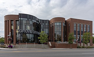
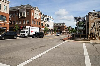
Grove City is a city in Franklin County, Ohio, United States, founded in 1852. It is a suburb of Columbus. The population was 41,252 according to the 2020 Census.

<span class="mw-page-title-main">Lake Darby, Ohio</span> Census-designated place in Ohio, United States

Lake Darby is an unincorporated community and census-designated place in Franklin County, Ohio, United States, located mostly in Prairie Township and partly in Brown Township. It is more commonly known among locals as Darby Estates, which is also the name of the older housing development there, with the newer development called "West Point". As of the 2020 census, the CDP had a population of 4,731.

<span class="mw-page-title-main">Lincoln Village, Ohio</span> Census-designated place in Ohio, United States

Lincoln Village is a census-designated place (CDP) in Prairie Township, Franklin County, Ohio, United States. It is centered near the intersection of US 40 and I-270 on the west side of Columbus. As of the 2020 census, the population was 9,702.

<span class="mw-page-title-main">Obetz, Ohio</span> City in Ohio, United States

Obetz is a City in Franklin County, Ohio, United States. The population was 5,489 at the 2020 census.

<span class="mw-page-title-main">Whitehall, Ohio</span> City in Ohio, United States

Whitehall is a city in the U.S state of Ohio, located 6.6 miles (10.6 km) east of the state capital of Columbus in Franklin County. Whitehall had a population of 20,127 in the 2020 census. Founded in 1947, Whitehall is a growing suburb of Columbus. Per the U.S. Census Bureau, Whitehall's population is culturally and racially diverse, with over 50% of the population identifying as black, African American, Hispanic or Latino, with over 20% speaking a language other than English at home.

<span class="mw-page-title-main">Willard, Ohio</span> City in Ohio, United States

Willard is a city in southwestern Huron County, Ohio, United States, approximately 14 miles (23 km) southwest of Norwalk. The population was 6,197 at the 2020 census.

<span class="mw-page-title-main">Pataskala, Ohio</span> City in Ohio, United States

Pataskala is a city in Licking County, Ohio, United States, approximately 19 miles (31 km) east of Columbus. The population was 17,886 at the 2020 census. Pataskala was a small community until 1996, when what was then the village of Pataskala merged with Lima Township, vastly increasing its population and geographic area.

<span class="mw-page-title-main">Norwood, Pennsylvania</span> Borough in Pennsylvania, United States

Norwood is a borough that is located in Delaware County, Pennsylvania, United States. The population was 5,890 at the time of the 2010 census.

<span class="mw-page-title-main">Richmond, Michigan</span> City in Michigan, United States

Richmond is a city within Metro Detroit in the U.S. state of Michigan. The population was 5,878 at the 2020 census. Most of the city is located in Macomb County, though there is a small portion in neighboring St. Clair County.

<span class="mw-page-title-main">Monroe, Ohio</span> City in Ohio, United States

Monroe is a city in east central Butler and west central Warren counties in the southwestern part of the U.S. state of Ohio. The population was 15,412 at the 2020 census. Monroe is a part of the Cincinnati metropolitan area.

<span class="mw-page-title-main">Dublin, Ohio</span> City in Ohio, United States

Dublin is a city in the U.S. state of Ohio. A suburb of Columbus, it falls within the jurisdictions of the counties of Franklin County, Delaware County, and Union County. The population was 49,328 at the 2020 census. The city of Dublin hosts the yearly Memorial Tournament at the Muirfield Village Golf Club. The Dublin Irish Festival advertises itself as the largest three-day Irish festival in the world.

<span class="mw-page-title-main">Pickerington, Ohio</span> City in Ohio, United States

Pickerington is a city in Fairfield and Franklin counties in the central region of the U.S. state of Ohio. It is a suburb of Columbus. The population was 23,094 at the 2020 census. It was founded in 1815 as Jacksonville, named after Andrew Jackson. The name was changed in 1827 in honor of its founder, Abraham Pickering. As land annexation, development, and immigration into the Columbus area continues, the city of Pickerington has generally followed suit. Pickerington is home to the Motorcycle Hall of Fame, located off of Interstate 70.

<span class="mw-page-title-main">Plain City, Ohio</span> Village in Ohio, United States

Plain City is a village in Madison and Union counties in the U.S. state of Ohio, along Big Darby Creek. The population was 4,065 at the 2020 census.

<span class="mw-page-title-main">Springboro, Ohio</span> City in Ohio, United States

Springboro is a city in the U.S. state of Ohio. A suburb of Cincinnati and Dayton, it is located mostly in Warren County in Clearcreek and Franklin Townships; with a small portion in Miami Township in Montgomery County. The city is part of the Miami Valley. As of the 2020 census, the city had a population of 19,062.

<span class="mw-page-title-main">Norton, Ohio</span> City in Ohio, United States

Norton is a city in southwestern Summit County, Ohio, United States, with a 4.4-acre (1.8 ha) district extending into Wayne County. The population was 11,673 at the 2020 census. It is part of the Akron metropolitan area.

<span class="mw-page-title-main">Darby Township, Pennsylvania</span> First Class Township in Pennsylvania, United States

Darby Township is a township in Delaware County, Pennsylvania, United States. The population was 9,264 as of the 2010 census. It is home to both residential areas and expansive industrial districts. Darby Township is home to a diverse population and its industrial districts are popular among shipping companies for their proximity to Philadelphia International Airport. It also is known for being made up of two non-contiguous geographical areas, requiring one to pass through at least two neighboring municipalities to make it from one end of Darby Township to the other. Darby Township is a distinct municipality from the nearby and similarly named Darby Borough and Upper Darby Township.

Hilliard City School District is a public school district with its headquarters in Columbus, Ohio. The school district contains all of what was once Norwich and Brown townships. This includes Hilliard.

References

  1. "ArcGIS REST Services Directory". United States Census Bureau. Retrieved September 20, 2022.
  2. 1 2 U.S. Geological Survey Geographic Names Information System: Hilliard, Ohio
  3. 1 2 "U.S. Census website". United States Census Bureau . Retrieved January 31, 2008.
  4. "Explore Census Data". data.census.gov.
  5. "Ground zero flag pole finds permanent home in Hilliard, Ohio". July 27, 2011. Retrieved October 11, 2018.
  6. "Historical Village – Hilliard Ohio Historical Society".
  7. 1 2 "Community | Hilliard Area Chamber of Commerce | Hilliard, Ohio". Hilliardchamber.org. December 12, 1960. Archived from the original on February 27, 2009. Retrieved March 4, 2011.
  8. www.cityofhilliard.com https://web.archive.org/web/20150201224501/http://www.cityofhilliard.com/history.htm. Archived from the original on February 1, 2015.{{cite web}}: Missing or empty |title= (help)
  9. "One Stop Shop Zoning, City of Columbus". Archived from the original on December 20, 2014. Retrieved December 15, 2014.
  10. "US Gazetteer files 2010". United States Census Bureau. Archived from the original on January 12, 2012. Retrieved January 6, 2013.
  11. Data in historical population table from Secretary Of State, Ohio (1892), Annual Report of the Secretary of State to the Governor of Ohio ; "U.S. Census website". US Census Bureau..
  12. "U.S. Census website". United States Census Bureau . Retrieved January 6, 2013.
  13. Park, Alice; Smart, Charlie; Taylor, Rumsey; Watkins, Miles (February 2, 2021). "An Extremely Detailed Map of the 2020 Election". The New York Times. ISSN   0362-4331 . Retrieved June 7, 2021.
  14. Hilliard City School District. "Hilliard City School District Facts and Figures". Archived from the original on May 17, 2006. Retrieved July 1, 2006.
  15. "4th of July in Hilliard". Hilliard, Ohio. Archived from the original on February 2, 2017. Retrieved January 24, 2017.
  16. "Old Hilliardfest Art & Street Fair" . Retrieved June 12, 2015.