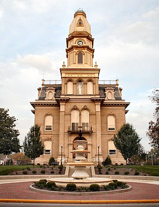
Logan County is a county located in the west central portion of the U.S. state of Ohio. As of the 2020 census, the population was 46,150. The county seat is Bellefontaine. The county is named for Benjamin Logan, who fought Native Americans in the area.

Champaign County is a county located in the U.S. state of Ohio. As of the 2020 census, the population was 38,714. Its county seat and largest city is Urbana. The county takes its name from the French word for "open level country". Champaign County became the 18th of 88 Ohio counties on March 1, 1805. It was carved from Greene and Franklin counties by Legislative action.

Mutual is a village in Champaign County, Ohio, United States. The population was 104 at the 2010 census.
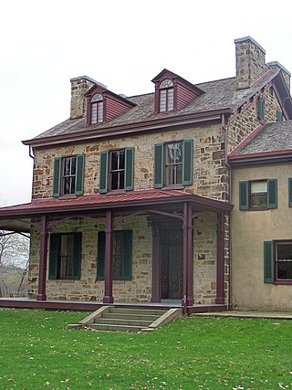
Springhill Township is a township in Fayette County, Pennsylvania, United States. The population was 2,723 at the 2020 census. The Albert Gallatin Area School District serves the region.

The Iroquois River is a 103-mile-long (166 km) tributary of the Kankakee River in the Central Corn Belt Plains of northwestern Indiana and northeastern Illinois in the United States. It was named for the Iroquois people. Via the Kankakee and Illinois rivers, it is part of the watershed of the Mississippi River.

Sugar Creek is an 82.4-mile-long (132.6 km) tributary of the Driftwood River in east-central Indiana in the United States. Via the Driftwood, White, Wabash and Ohio rivers, it is part of the watershed of the Mississippi River.
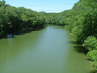
Ohio Brush Creek is a 59.9-mile-long (96.4 km) tributary of the Ohio River in southern Ohio in the United States. Via the Ohio River, it is part of the watershed of the Mississippi River, draining an area of 435 square miles (1,130 km2). According to the Geographic Names Information System, it has also been known historically as "Brush Creek," "Elk Creek," and "Little Scioto River".

Lees Creek, also known as Centerville, is an unincorporated community in central Wayne Township, Clinton County, Ohio, United States. It lies at the intersection of State Route 729 with Cox Road, 6 miles south of Sabina and 12 miles (19 km) southeast of Wilmington, the county seat of Clinton County. It lies between the headwaters of the Middle Fork of Lees Creek, to the southeast, and the Anderson Fork of Caesar Creek. it had a post office, with the ZIP code 45138. The Post Office closed in 2012 and the town, including East Clinton High School, now carries a Sabina mailing address.

Roundhead is an unincorporated community in southeastern Roundhead Township, Hardin County, Ohio, United States. It has a post office with the ZIP code 43346.

Royalton is an unincorporated community in northern Amanda Township, Fairfield County, Ohio, United States.

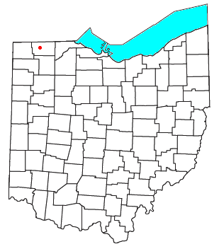
Logansville is an unincorporated community in central Pleasant Township, Logan County, Ohio, United States. It lies along State Route 47 at its intersection with County Road 24. The Great Miami River flows southward along the western edge of Logansville. The community lies 2½ miles (4 km) north of the village of De Graff and 9 miles west of the city of Bellefontaine, the county seat of Logan County. It is located at 40°20′44″N83°55′50″W, and its altitude is 1,010 feet (308 m).

Kennard is an unincorporated community in eastern Salem Township, Champaign County, Ohio, United States. It lies at the intersection of Gray and Kennard Roads, less than 2 miles southwest of State Route 245. The headwaters of Kings Creek, a tributary of the Mad River, flow past Kennard. It is located approximately 10 miles (16 km) northwest of the city of Urbana, the county seat of Champaign County.

Millerstown is an unincorporated community in eastern Johnson Township, Champaign County, Ohio, United States. It lies at the intersection of Heck Hill, Ward, and Zimmerman Roads, 2+1⁄2 miles (4.0 km) north of U.S. Route 36. Nettle Creek, a tributary of the Mad River, flows past Millerstown. It is located approximately 4 miles northeast of the city of St. Paris and 10 miles (16 km) west-northwest of the city of Urbana, the county seat of Champaign County.

Brokensword is an unincorporated community on the border between the Holmes and Lykens townships of Crawford County, Ohio, United States. Located at the intersection of the concurrent State Routes 19 and 100 with Brokensword Road, it is six miles north and two miles west of the city of Bucyrus, the county seat. Broken Sword Creek flows a short distance to the south of the community.

Tawawa is an unincorporated community in northeastern Green Township, Shelby County, Ohio, United States. It lies along State Route 29 less than one mile away from the Champaign County border. Mosquito Creek, a tributary of the Great Miami River, flows northwestward along the southern edge of Tawawa. The community lies 8 miles southeast of the city of Sidney, the county seat of Shelby County.
Tedrow is an unincorporated community and census-designated place (CDP) in southwestern Dover Township, Fulton County, Ohio, United States. It lies at the intersection of the east-west County Road J with the north-south County Roads 17-2 and 17-3, 3 miles (5 km) north and 3.5 miles (5.6 km) west of the northern edge of the city of Wauseon, the county seat of Fulton County. The community lies less than one mile north of the Ohio Turnpike, although the nearest exit is several miles away.

Roxabell is an unincorporated community in central Concord Township, Ross County, Ohio, United States. It lies at the intersection of Davis Hill and Jamison Roads, little more than 1 mile south of the village of Frankfort. Two parts of the North Fork of Paint Creek, a subsidiary of the Ohio River through the Scioto River, pass near Roxabel. It is located slightly more than 3 miles north of State Route 28, midway between the cities of Chillicothe — the county seat of Ross County — and Greenfield.

Thackery is an unincorporated community in southeastern Jackson and southwestern Mad River Townships in Champaign County, Ohio, United States. It lies along State Route 55, southwest of the city of Urbana, the county seat of Champaign County.
Nettle Creek is a stream located entirely within the borders of Champaign County, Ohio. The 11.5-mile (18.5 km) long stream is a tributary of the Mad River.
Kings Creek is a stream located entirely within Champaign County, Ohio. The 9-mile (14 km) long stream is a tributary of the Mad River.


