Woodstock, Ohio

Last updated

Woodstock, Ohio
Woodstock village hall and fire station.jpg
Village Hall
OHMap-doton-Woodstock.png
Location of Woodstock, Ohio
Map of Champaign County Ohio Highlighting Woodstock Village.png
Location of Woodstock in Champaign County
Coordinates: 40°10′25″N83°31′41″W / 40.17361°N 83.52806°W / 40.17361; -83.52806 [1]
Country United States
State Ohio
County Champaign
Township Rush
Government
  MayorJacqueline Lee Hayes
Area
[2]
  Total0.28 sq mi (0.73 km2)
  Land0.28 sq mi (0.73 km2)
  Water0.00 sq mi (0.00 km2)
Elevation
[1]
1,047 ft (319 m)
Population
 (2020)
  Total287
  Density1,014.13/sq mi (392.23/km2)
Time zone UTC-5 (Eastern (EST))
  Summer (DST) UTC-4 (EDT)
ZIP code
43084
Area code(s) 937, 326
FIPS code 39-86478
GNIS feature ID2399738 [1]
Website

Woodstock is a village in Champaign County, Ohio, United States. The population was 287 at the 2020 census.

Contents

History

Woodstock was platted in 1834. [3]

Two members of the village were directly involved in the January 6 United States Capitol attack. [4]

Geography

Woodstock is located on State Route 559 about 12 miles (19 km) north of Mechanicsburg, Ohio.

According to the United States Census Bureau, the village has a total area of 0.29 square miles (0.75 km2), all of it land. [5]

Demographics

Historical population
CensusPop.Note
1880 383
1890 301−21.4%
1900 3258.0%
1910 310−4.6%
1920 3265.2%
1930 293−10.1%
1940 263−10.2%
1950 31620.2%
1960 310−1.9%
1970 281−9.4%
1980 2923.9%
1990 2961.4%
2000 3177.1%
2010 305−3.8%
2020 287−5.9%
U.S. Decennial Census [6]

2010 census

As of the census [7] of 2010, there were 305 people, 103 households, and 82 families living in the village. The population density was 1,051.7 inhabitants per square mile (406.1/km2). There were 113 housing units at an average density of 389.7 per square mile (150.5/km2). The racial makeup of the village was 98.4% White, 1.0% Native American, 0.3% from other races, and 0.3% from two or more races. Hispanic or Latino of any race were 0.7% of the population.

There were 103 households, of which 42.7% had children under the age of 18 living with them, 59.2% were married couples living together, 13.6% had a female householder with no husband present, 6.8% had a male householder with no wife present, and 20.4% were non-families. 17.5% of all households were made up of individuals, and 5.9% had someone living alone who was 65 years of age or older. The average household size was 2.96 and the average family size was 3.35.

The median age in the village was 33.2 years. 33.4% of residents were under the age of 18; 5.7% were between the ages of 18 and 24; 29.1% were from 25 to 44; 23.9% were from 45 to 64; and 7.9% were 65 years of age or older. The gender makeup of the village was 52.8% male and 47.2% female.

2000 census

As of the census [8] of 2000, there were 317 people, 101 households, and 85 families living in the village. The population density was 1,167.0 inhabitants per square mile (450.6/km2). There were 105 housing units at an average density of 386.6 per square mile (149.3/km2). The racial makeup of the village was 98.11% White, 1.58% Native American, and 0.32% from two or more races.

There were 101 households, out of which 42.6% had children under the age of 18 living with them, 72.3% were married couples living together, 8.9% had a female householder with no husband present, and 15.8% were non-families. 14.9% of all households were made up of individuals, and 6.9% had someone living alone who was 65 years of age or older. The average household size was 3.14 and the average family size was 3.38.

In the village, the population was spread out, with 34.1% under the age of 18, 10.1% from 18 to 24, 30.0% from 25 to 44, 17.0% from 45 to 64, and 8.8% who were 65 years of age or older. The median age was 29 years. For every 100 females there were 87.6 males. For every 100 females age 18 and over, there were 91.7 males.

The median income for a household in the village was $44,750, and the median income for a family was $43,750. Males had a median income of $35,250 versus $25,938 for females. The per capita income for the village was $24,633. About 11.5% of families and 10.9% of the population were below the poverty line, including 19.2% of those under age 18 and none of those age 65 or over.

Climate

Woodstock
Climate chart (explanation)
J
F
M
A
M
J
J
A
S
O
N
D
 
 
86
 
 
−2
−9
 
 
70
 
 
1
−9
 
 
83
 
 
12
−3
 
 
132
 
 
22
4
 
 
88
 
 
26
11
 
 
134
 
 
27
15
 
 
146
 
 
26
17
 
 
83
 
 
25
15
 
 
100
 
 
24
12
 
 
116
 
 
20
8
 
 
59
 
 
12
−2
 
 
111
 
 
2
−6
Average max. and min. temperatures in °C
Precipitation totals in mm
Source: [9]
Imperial conversion
JFMAMJJASOND
 
 
3.4
 
 
28
16
 
 
2.8
 
 
34
16
 
 
3.3
 
 
54
27
 
 
5.2
 
 
72
39
 
 
3.5
 
 
79
52
 
 
5.3
 
 
81
59
 
 
5.7
 
 
79
63
 
 
3.3
 
 
77
59
 
 
3.9
 
 
75
54
 
 
4.6
 
 
68
46
 
 
2.3
 
 
54
28
 
 
4.4
 
 
36
21
Average max. and min. temperatures in °F
Precipitation totals in inches

Related Research Articles

<span class="mw-page-title-main">Champaign County, Ohio</span> County in Ohio, United States

Champaign County is a county located in the U.S. state of Ohio. As of the 2020 census, the population was 38,714. Its county seat and largest city is Urbana. The county takes its name from the French word for "open level country". Champaign County became the 18th of 88 Ohio counties on March 1, 1805. It was formed from parts of Greene and Franklin counties by legislative action.

Woodstock is a town in Oxford County, Maine, United States. Woodstock is included in the Lewiston-Auburn, Maine metropolitan New England city and town area. The population was 1,352 at the 2020 census. The village of Bryant Pond, on State Route 26 in the northern part of Woodstock, is the town's urban center and largest settlement.

<span class="mw-page-title-main">Christiansburg, Ohio</span> Village in Ohio, United States

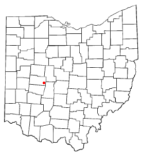
Christiansburg is a village in Champaign County, Ohio, United States. The population was 505 at the 2020 census.

<span class="mw-page-title-main">Mechanicsburg, Ohio</span> Village in Ohio, United States

Mechanicsburg is a village in Champaign County, Ohio, United States. The population was 1,681 at the 2020 census.

<span class="mw-page-title-main">Mutual, Ohio</span> Village in Ohio, United States

Mutual is a village in Champaign County, Ohio, United States. The population was 127 at the 2020 census.

<span class="mw-page-title-main">North Lewisburg, Ohio</span> Village in Ohio, United States

North Lewisburg is a village in Champaign County, Ohio The population was 1,636 at the time of the 2020 census.

<span class="mw-page-title-main">St. Paris, Ohio</span> Village in Ohio, United States

St. Paris or Saint Paris is a village in Champaign County, Ohio, United States. The population was 1,882 at the 2020 census.

<span class="mw-page-title-main">Wayne Lakes, Ohio</span> Village in Ohio, United States

Wayne Lakes is a village in Darke County, Ohio, United States. The population was 693 at the 2020 census.

<span class="mw-page-title-main">Jeffersonville, Ohio</span> Village in Ohio, United States

Jeffersonville is a village in Fayette County, Ohio, United States. The population was 1,258 at the 2020 census.

<span class="mw-page-title-main">Cleves, Ohio</span> City in Ohio, United States

Cleves is a village in Miami Township, Hamilton County, Ohio, United States. Located along the Ohio River, it is a western suburb of Cincinnati. The population was 3,414 at the 2020 census.

<span class="mw-page-title-main">Mowrystown, Ohio</span> Village in Ohio, United States

Mowrystown is a village in Highland County, Ohio, United States. The population was 385 at the 2020 census.

<span class="mw-page-title-main">Coalton, Ohio</span> Village in Ohio, United States

Coalton is a village in Jackson County, Ohio, United States. The population was 445 at the 2020 census.

<span class="mw-page-title-main">Grafton, Ohio</span> Village in Ohio, United States

Grafton is a village in Lorain County, Ohio, United States, along the East Branch of the Black River. The population was 5,895 at the 2020 census. The Lorain Correctional Institution and several other prisons are located in and near Grafton.

<span class="mw-page-title-main">Spencer, Ohio</span> Village in Ohio, United States

Spencer is a village in Spencer Township located in Medina County, Ohio, United States. The population was 684 at the 2020 census.

<span class="mw-page-title-main">Jerusalem, Ohio</span> Village in Ohio, United States

Jerusalem is a village in Monroe County, Ohio, United States. The population was 121 at the 2020 census.

<span class="mw-page-title-main">Batesville, Ohio</span> Village in Ohio, United States

Batesville is a village in Noble County, Ohio, United States. The population was 101 at the 2020 census. Batesville was originally called Williamsburg, and under the latter name was laid out in 1827.

<span class="mw-page-title-main">Glenford, Ohio</span> Village in Ohio, United States

Glenford is a village in Perry County, Ohio, United States. The population was 165 at the 2020 census.

<span class="mw-page-title-main">Cloverdale, Ohio</span> Village in Ohio, United States

Cloverdale is a village in Perry Township, Putnam County, Ohio, United States. The population was 170 at the 2020 census.

<span class="mw-page-title-main">Risingsun, Ohio</span> Village in Ohio, United States

Risingsun is a village in Wood County, Ohio, United States. The population was 541 at the 2020 census.

<span class="mw-page-title-main">Tremont City, Ohio</span> Village in Ohio, United States

Tremont City is a village in Clark County, Ohio, United States. The population was 352 at the 2020 census. The village is part of the Springfield, Ohio Metropolitan Statistical Area.

References

  1. 1 2 3 U.S. Geological Survey Geographic Names Information System: Woodstock, Ohio
  2. "ArcGIS REST Services Directory". United States Census Bureau. Retrieved September 20, 2022.
  3. Middleton, Evan P. (1917). History of Champaign County, Ohio: Its People, Industries and Institutions, Volume 1. B.F. Bowen. p. 869.
  4. Ohio Militia Members identified at US Capitol https://www.springfieldnewssun.com/news/woman-held-on-federal-charge-video-shows-fbi-trying-to-serve-warrant-in-champaign-county/ALUVCCS6P5B7BL7JYPMJMS2ZAM/
  5. "US Gazetteer files 2010". United States Census Bureau . Retrieved January 6, 2013.
  6. "Census of Population and Housing". Census.gov. Retrieved June 4, 2015.
  7. "U.S. Census website". United States Census Bureau . Retrieved January 6, 2013.
  8. "U.S. Census website". United States Census Bureau . Retrieved January 31, 2008.
  9. "NASA Earth Observations Data Set Index". NASA. Retrieved January 30, 2016.