
Grandview Heights, or simply Grandview, is a city in Franklin County, Ohio, United States. The population was 8,085 at the 2020 census.
Grandview Heights may refer to:
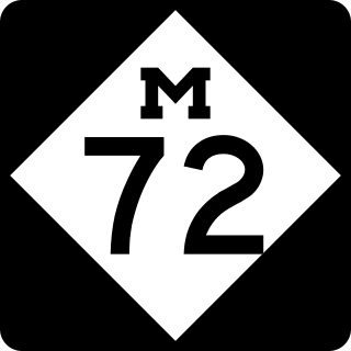
M-72 is a state trunkline highway in the US state of Michigan, running from Lake Huron to Lake Michigan across the northern part of the Lower Peninsula. The highway connects M-22 in Empire with US Highway 23 (US 23) in Harrisville. It is one of only three Michigan state trunklines that cross the Lower Peninsula, shore to shore. In between, M-72 runs across Northern Michigan woodland, agricultural areas of the Leelanau Peninsula near Traverse City, and the Au Sable River watershed. The trunkline also provides access to Camp Grayling, a National Guard training facility near the city of the same name. Traffic levels along the highway vary from approximately 800 vehicles a day on the east end to over 32,000 vehicles near Traverse City.
Gillivan is an unincorporated community in Jefferson Township, Madison County, Ohio, United States. It is located along U.S. Route 42, north of its intersection with Ohio State Route 29.

Altoona is an unincorporated community in Coal Township, Jackson County, Ohio, United States. It is located east of Coalton on Ohio State Route 93.
Buffalo is an unincorporated community in Coal Township, Jackson County, Ohio, United States. It is located southwest of Coalton, near the intersection of U.S. Route 35 and Jackson Hill Road.
Jonestown is an unincorporated community in Coal Township, Jackson County, Ohio, United States. It is located southwest of Coalton at 39°05′42″N82°37′57″W, along Jackson Hill Road between Buffalo and Chapman.
Comet is an unincorporated community in Washington Township, Jackson County, Ohio, United States. It is located at 39°06′57″N82°33′04″W, on the western edge of Wellston.
Mulga is an unincorporated community in Milton Township, Jackson County, Ohio, United States. It is located east of Wellston at the intersection of Hollingshead Road and Mulga Road, just off Ohio State Route 32, at 39°07′02″N82°28′07″W.
Goldsboro is an unincorporated community in Coal Township, Jackson County, Ohio, United States. It is located west of Wellston on Ohio State Route 93, between Comet and Glen Roy.
Jackson Heights is an unincorporated community in Warren Township, Jefferson County, Ohio, United States. It is located west of Tiltonsville on Jackson Heights Road, at 40°10′32″N80°42′14″W.
Horeb is an unincorporated community in Jefferson Township, Jackson County, Ohio, United States. It is located west of Oak Hill on Ohio State Route 279, at 38°54′12″N82°36′44″W.
Five Points is an unincorporated community in Goshen Township, Champaign County, Ohio, United States. It is located north of Mechanicsburg at the intersection of Ohio State Route 161, Ohio State Route 559, and Bullard-Rutan Road, at 40°06′03″N83°32′38″W.
Grandview Heights is an unincorporated community in Warren Township, Jefferson County, Ohio, United States. It is located just west of Tiltonsville on Jackson Heights Road, at 40°10′14″N80°42′33″W.
Lippincott is an unincorporated community in Salem Township, Champaign County, Ohio, United States. It is located between Urbana and West Liberty near the intersection of Upper Valley Pike and Lippincott Road.
McIntyre is an unincorporated community in Wayne Township, Jefferson County, Ohio, United States. It is located southeast of Bloomingdale and just east of Chandler along Township Road 191, at 40°18′24″N80°46′52″W.
Newell is an unincorporated community in Smithfield Township, Jefferson County, Ohio, United States. It is located west of Smithfield and just northwest of Piney Fork at the intersection of Piney Fork Road and Newell Road, at 40°15′37″N80°50′10″W.
Deandale is an unincorporated community in Steubenville Township, Jefferson County, Ohio, United States. It is located about 1 mile (1.6 km) south of Mingo Junction along Ohio State Route 7, at 40°18′33″N80°36′59″W.
Shady Glen is an unincorporated community in Knox Township, Jefferson County, Ohio, United States. It is located west of Calumet along the John F. Kennedy Highway at its intersection with Brandywine Road, at 40°28′48″N80°38′23″W.
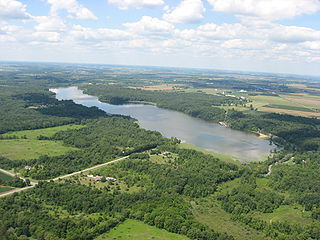
Kiser Lake Wetlands State Nature Preserve, or simply Kiser Lake Wetlands, is a 51 acres (21 ha) nature reserve located in Johnson Township, Champaign County, Ohio, United States. It is located wholly within the Kiser Lake State Park, and operated by the Ohio Department of Natural Resources.

