North Lewisburg, Ohio

Last updated

North Lewisburg, Ohio
Immaculate Conception Catholic Church (North Lewisburg, Ohio) - exterior, front quarter view.JPG
Immaculate Conception Catholic Church
Motto(s): 
"Where Family, Friends, and Traditions Stay for a Lifetime."
OHMap-doton-North Lewisburg.png
Location of North Lewisburg, Ohio
Map of Champaign County Ohio Highlighting North Lewisburg Village.png
Location of North Lewisburg in Champaign County
Coordinates: 40°13′14″N83°33′29″W / 40.22056°N 83.55806°W / 40.22056; -83.55806
Country United States
State Ohio
County Champaign
Township Rush
Government
   Mayor Cheryl Hollingsworth[ citation needed ]
Area
[1]
  Total1.09 sq mi (2.81 km2)
  Land1.09 sq mi (2.81 km2)
  Water0.00 sq mi (0.00 km2)
Elevation
[2]
1,099 ft (335 m)
Population
 (2020)
  Total1,636
  Density1,506.45/sq mi (581.38/km2)
Time zone UTC-5 (Eastern (EST))
  Summer (DST) UTC-4 (EDT)
ZIP code
43060
Area code(s) 937, 326
FIPS code 39-56770 [3]
GNIS feature ID2399517 [2]
Website http://www.northlewisburg.com/

North Lewisburg is a village in Champaign County, Ohio The population was 1,636 at the time of the 2020 census.

Contents

History

North Lewisburg was platted in 1826, and incorporated as a village in 1844. [4] A post office has been in operation at North Lewisburg since 1845. [5] [6]

Geography

According to the United States Census Bureau, the village has a total area of 1.15 square miles (2.98 km2), all of it land. [7]

Demographics

Historical population
CensusPop.Note
1850 302
1860 37925.5%
1870 73393.4%
1880 93627.7%
1890 806−13.9%
1900 8465.0%
1910 793−6.3%
1920 720−9.2%
1930 686−4.7%
1940 7205.0%
1950 85418.6%
1960 8792.9%
1970 840−4.4%
1980 1,07227.6%
1990 1,1608.2%
2000 1,58836.9%
2010 1,490−6.2%
2020 1,6369.8%
U.S. Decennial Census [8]

2010 census

As of the census [9] of 2010, there were 1,490 people, 593 households, and 389 families living in the village. The population density was 1,295.7 inhabitants per square mile (500.3/km2). There were 679 housing units at an average density of 590.4 per square mile (228.0/km2). The racial makeup of the village was 95.6% White, 0.4% African American, 0.6% Native American, 0.5% Asian, 0.1% from other races, and 2.9% from two or more races. Hispanic or Latino of any race were 0.9% of the population.

There were 593 households, of which 36.8% had children under the age of 18 living with them, 50.6% were married couples living together, 10.3% had a female householder with no husband present, 4.7% had a male householder with no wife present, and 34.4% were non-families. 29.3% of all households were made up of individuals, and 11.3% had someone living alone who was 65 years of age or older. The average household size was 2.51 and the average family size was 3.11.

The median age in the village was 35.4 years. 27% of residents were under the age of 18; 7.8% were between the ages of 18 and 24; 29.5% were from 25 to 44; 24.7% were from 45 to 64; and 11% were 65 years of age or older. The gender makeup of the village was 50.5% male and 49.5% female.

2000 census

As of the census [3] of 2000, there were 1,588 people, 598 households, and 429 families living in the village. The population density was 1,776.7 inhabitants per square mile (686.0/km2). There were 654 housing units at an average density of 731.7 per square mile (282.5/km2). The racial makeup of the village was 97.23% White, 0.82% African American, 0.31% Native American, 0.06% Asian, 0.44% from other races, and 1.13% from two or more races. Hispanic or Latino of any race were 0.63% of the population.

There were 598 households, out of which 42.8% had children under the age of 18 living with them, 55.2% were married couples living together, 13.2% had a female householder with no husband present, and 28.1% were non-families. 24.1% of all households were made up of individuals, and 9.2% had someone living alone who was 65 years of age or older. The average household size was 2.66 and the average family size was 3.15.

In the village, the population was spread out, with 31.2% under the age of 18, 10.3% from 18 to 24, 34.2% from 25 to 44, 15.9% from 45 to 64, and 8.4% who were 65 years of age or older. The median age was 30 years. For every 100 females there were 103.1 males. For every 100 females age 18 and over, there were 96.1 males.

The median income for a household in the village was $45,921, and the median income for a family was $51,083. Males had a median income of $36,563 versus $27,667 for females. The per capita income for the village was $18,461. About 4.3% of families and 7.3% of the population were below the poverty line, including 8.6% of those under age 18 and 6.9% of those age 65 or over.

Education

The village is served by the Triad Local School District. North Lewisburg has a public library, a branch of the Champaign County Public Library. [10]

Notable people

Related Research Articles

<span class="mw-page-title-main">Champaign County, Ohio</span> County in Ohio, United States

Champaign County is a county located in the U.S. state of Ohio. As of the 2020 census, the population was 38,714. Its county seat and largest city is Urbana. The county takes its name from the French word for "open level country". Champaign County became the 18th of 88 Ohio counties on March 1, 1805. It was formed from parts of Greene and Franklin counties by legislative action.

<span class="mw-page-title-main">Aberdeen, Ohio</span> Village in Ohio, United States

Aberdeen is a village in Huntington Township, Brown County, Ohio, United States, along the Ohio River 50 miles (80 km) southeast of Cincinnati. The population was 1,515 at the 2020 census.

<span class="mw-page-title-main">Christiansburg, Ohio</span> Village in Ohio, United States

Christiansburg is a village in Champaign County, Ohio, United States. The population was 505 at the 2020 census.

<span class="mw-page-title-main">Mechanicsburg, Ohio</span> Village in Ohio, United States

Mechanicsburg is a village in Champaign County, Ohio, United States. The population was 1,681 at the 2020 census.

<span class="mw-page-title-main">Mutual, Ohio</span> Village in Ohio, United States

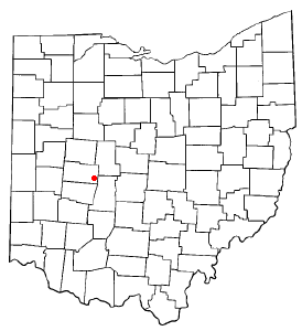
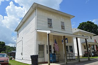
Mutual is a village in Champaign County, Ohio, United States. The population was 127 at the 2020 census.

<span class="mw-page-title-main">St. Paris, Ohio</span> Village in Ohio, United States

St. Paris or Saint Paris is a village in Champaign County, Ohio, United States. The population was 1,882 at the 2020 census.

<span class="mw-page-title-main">Woodstock, Ohio</span> Village in Ohio, United States

Woodstock is a village in Champaign County, Ohio, United States. The population was 287 at the 2020 census.

<span class="mw-page-title-main">Warsaw, Ohio</span> Village in Ohio, United States

Warsaw is a village in Coshocton County, Ohio, United States, along the Walhonding River. The population was 624 at the 2020 census.

<span class="mw-page-title-main">Brice, Ohio</span> Village in Ohio, United States

Brice is a village in Franklin County, Ohio, United States, on the southeast side of the Columbus metropolitan area. The population was 93 at the 2020 census.

<span class="mw-page-title-main">Addyston, Ohio</span> Village in Ohio, United States

Addyston is a village in Miami Township, Hamilton County, Ohio, United States. Located along the Ohio River, it is a western suburb of the neighboring city of Cincinnati. The population was 927 at the 2020 census.

<span class="mw-page-title-main">Cleves, Ohio</span> City in Ohio, United States

Cleves is a village in Miami Township, Hamilton County, Ohio, United States. Located along the Ohio River, it is a western suburb of Cincinnati. The population was 3,414 at the 2020 census.

<span class="mw-page-title-main">Evendale, Ohio</span> Village in Ohio, United States

Evendale is a village in Hamilton County, Ohio, United States, within the Cincinnati metropolitan area. The population was 2,669 at the 2020 census.

<span class="mw-page-title-main">Hanover, Ohio</span> Village in Ohio, United States

Hanover is a village in Licking County, Ohio, United States. The population was 1,270 at the 2020 census. The village lies along Ohio State Route 16.

<span class="mw-page-title-main">St. Louisville, Ohio</span> Village in Ohio, United States

St. Louisville or Saint Louisville is a village in Licking County, Ohio, United States, along the North Fork of the Licking River. The population was 352 at the 2020 census.

<span class="mw-page-title-main">Lewisburg, Ohio</span> Village in Ohio, United States

Lewisburg is a village in Preble County, Ohio, United States, founded in 1818. The current village incorporates two prior villages, the original Lewisburg and Euphemia, which merged in 1916. The population was 1,745 at the 2020 census. It is part of the Dayton Metropolitan Statistical Area.

<span class="mw-page-title-main">Cloverdale, Ohio</span> Village in Ohio, United States

Cloverdale is a village in Perry Township, Putnam County, Ohio, United States. The population was 170 at the 2020 census.

<span class="mw-page-title-main">Clinton, Ohio</span> Village in Ohio, United States

Clinton is a village in southwestern Summit County, Ohio, United States. The population was 1,197 at the 2020 Census. It is part of the Akron metropolitan area.

<span class="mw-page-title-main">Port Washington, Ohio</span> Village in Ohio, United States

Port Washington is a village in Tuscarawas County, Ohio, United States. The population was 548 at the 2020 census.

<span class="mw-page-title-main">Custar, Ohio</span> Village in Ohio, United States

Custar is a village in Wood County, Ohio, United States. The population was 178 at the 2020 census.

<span class="mw-page-title-main">Gratiot, Ohio</span> Village in Ohio, United States

Gratiot is a village in Licking and Muskingum counties in the U.S. state of Ohio. The population was 215 at the 2020 census.

References

  1. "ArcGIS REST Services Directory". United States Census Bureau. Retrieved September 20, 2022.
  2. 1 2 U.S. Geological Survey Geographic Names Information System: North Lewisburg, Ohio
  3. 1 2 "U.S. Census website". United States Census Bureau . Retrieved January 31, 2008.
  4. Middleton, Evan P. (1917). History of Champaign County, Ohio: Its People, Industries and Institutions, Volume 1. B.F. Bowen. p. 898.
  5. The History of Champaign County, Ohio: Containing a History of the County; Its Cities, Towns, Etc. W.H. Beers & Company. 1881. pp.  439.
  6. "Post offices". Jim Forte Postal History. Retrieved June 18, 2016.
  7. "US Gazetteer files 2010". United States Census Bureau. Archived from the original on February 20, 2011. Retrieved January 6, 2013.
  8. "Census of Population and Housing". Census.gov. Retrieved June 4, 2015.
  9. "U.S. Census website". United States Census Bureau . Retrieved January 6, 2013.
  10. "Hours & Locations". Champaign County Public Library. Retrieved February 25, 2018.