Blunt, South Dakota

Last updated

Blunt, South Dakota
Blunt, South Dakota.JPG
Entering Blunt from the northeast on U.S. Highway 14
Hughes County South Dakota Incorporated and Unincorporated areas Blunt Highlighted.svg
Location in Hughes County and the state of South Dakota
Usa edcp location map.svg
Red pog.svg
Blunt, South Dakota
Location in the United States
Coordinates: 44°30′57″N99°59′19″W / 44.51583°N 99.98861°W / 44.51583; -99.98861
Country United States
State South Dakota
County Hughes
Settled1882 [1]
Area
[2]
  Total0.49 sq mi (1.26 km2)
  Land0.49 sq mi (1.26 km2)
  Water0.00 sq mi (0.00 km2)
Elevation
[3]
1,621 ft (494 m)
Population
 (2020) [4]
  Total342
  Density702.26/sq mi (271.02/km2)
Time zone UTC-6 (Central (CST))
  Summer (DST) UTC-5 (CDT)
ZIP code
57522
Area code 605
FIPS code 46-06180 [5]
GNIS feature ID1267287 [3]

Blunt is a city in Hughes County, South Dakota, United States. It is part of the Pierre, South Dakota Micropolitan Statistical Area. The population was 342 at the 2020 census. [6]

Contents

History

Blunt was named for John E. Blunt, a railroad official. [7] [8] Blunt was founded in 1881 as a stop on the Chicago and North Western Railway. It received its city rights in 1884. [9]

Geography

According to the United States Census Bureau, the city has a total area of 0.49 square miles (1.27 km2), all land. [10]

Demographics

Historical population
CensusPop.Note
1890 353
1900 246−30.3%
1910 566130.1%
1920 512−9.5%
1930 477−6.8%
1940 322−32.5%
1950 42331.4%
1960 53225.8%
1970 445−16.4%
1980 424−4.7%
1990 342−19.3%
2000 3708.2%
2010 354−4.3%
2020 342−3.4%
U.S. Decennial Census [11] [4]

2010 census

As of the census [12] of 2010, there were 354 people, 150 households, and 102 families residing in the city. The population density was 722.4 inhabitants per square mile (278.9/km2). There were 167 housing units at an average density of 340.8 per square mile (131.6/km2). The racial makeup of the city was 89.3% White, 2.5% African American, 4.8% Native American, 0.3% Asian, 1.7% from other races, and 1.4% from two or more races. Hispanic or Latino of any race were 4.0% of the population.

There were 150 households, of which 25.3% had children under the age of 18 living with them, 58.0% were married couples living together, 3.3% had a female householder with no husband present, 6.7% had a male householder with no wife present, and 32.0% were non-families. 28.0% of all households were made up of individuals, and 14% had someone living alone who was 65 years of age or older. The average household size was 2.36 and the average family size was 2.76.

The median age in the city was 46.6 years. 23.2% of residents were under the age of 18; 5.9% were between the ages of 18 and 24; 19.2% were from 25 to 44; 33.4% were from 45 to 64; and 18.4% were 65 years of age or older. The gender makeup of the city was 52.0% male and 48.0% female.

2000 census

As of the census [5] of 2000, there were 370 people, 153 households, and 106 families residing in the city. The population density was 752.7 inhabitants per square mile (290.6/km2). There were 178 housing units at an average density of 362.1 per square mile (139.8/km2). The racial makeup of the city was 94.86% White, 2.70% Native American, 1.35% from other races, and 1.08% from two or more races. Hispanic or Latino of any race were 1.35% of the population.

There were 153 households, out of which 31.4% had children under the age of 18 living with them, 60.8% were married couples living together, 6.5% had a female householder with no husband present, and 30.1% were non-families. 28.1% of all households were made up of individuals, and 11.1% had someone living alone who was 65 years of age or older. The average household size was 2.42 and the average family size was 2.99.

In the city, the population was spread out, with 26.8% under the age of 18, 4.3% from 18 to 24, 27.3% from 25 to 44, 24.6% from 45 to 64, and 17.0% who were 65 years of age or older. The median age was 41 years. For every 100 females, there were 106.7 males. For every 100 females age 18 and over, there were 103.8 males.

The median income for a household in the city was $28,571, and the median income for a family was $31,667. Males had a median income of $22,727 versus $19,500 for females. The per capita income for the city was $14,155. About 3.4% of families and 6.5% of the population were below the poverty line, including 6.6% of those under age 18 and 8.8% of those age 65 or over.

Related Research Articles

<span class="mw-page-title-main">Lincoln, North Dakota</span> City in North Dakota, United States

Lincoln is a city in Burleigh County, North Dakota, United States. It is a suburb of adjacent Bismarck, and also a core city of the Bismarck-Mandan Metropolitan Statistical Area. The population was 4,257 at the 2020 census, making it the fourteenth largest city in North Dakota. Lincoln was founded in 1977.

<span class="mw-page-title-main">Park River, North Dakota</span> City in North Dakota, United States

Park River is a city in Walsh County, North Dakota, United States. The population was 1,424 at the 2020 census. Park River was founded in 1884.

<span class="mw-page-title-main">Kenmare, North Dakota</span> City in North Dakota, United States

Kenmare is a city in Ward County, North Dakota, United States. The population was 961 at the 2020 census. Kenmare is part of the Minot Micropolitan Statistical Area.

<span class="mw-page-title-main">Tyndall, South Dakota</span> City in South Dakota, United States

Tyndall is a city in and the county seat of Bon Homme County, South Dakota, United States. The population was 1,057 at the 2020 census.

<span class="mw-page-title-main">White, South Dakota</span> City in South Dakota, United States

White is a city in Brookings County, South Dakota, United States. The population was 537 at the 2020 census.

<span class="mw-page-title-main">Groton, South Dakota</span> City in South Dakota, United States

Groton is a city in southeastern Brown County, South Dakota, United States. The population was 1,380 at the 2020 census.

<span class="mw-page-title-main">Wagner, South Dakota</span> City in South Dakota, United States

Wagner is a city in Charles Mix County, South Dakota, United States. The population was 1,490 at the 2020 census. The city is served by Wagner Municipal Airport as well as YST Transit buses.

<span class="mw-page-title-main">Webster, South Dakota</span> City in South Dakota, United States

Webster is a city in and the county seat of Day County, South Dakota, United States. The population was 1,728 at the 2020 census.

<span class="mw-page-title-main">Clear Lake, South Dakota</span> City in South Dakota, United States

Clear Lake is a city in and the county seat of Deuel County, South Dakota, United States. The population was 1,218 at the 2020 census.

<span class="mw-page-title-main">Miller, South Dakota</span> City in South Dakota, United States

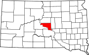
Miller is a city in and county seat of Hand County, South Dakota, United States. The population was 1,349 at the 2020 census.

<span class="mw-page-title-main">Parkston, South Dakota</span> City in South Dakota, United States

Parkston is a city in Hutchinson County, South Dakota, United States. The population was 1,567 at the 2020 census.

<span class="mw-page-title-main">Tripp, South Dakota</span> City in South Dakota, United States

Tripp is a city in Hutchinson County, South Dakota, United States. The population was 575 in the 2020 census.

<span class="mw-page-title-main">Whitewood, South Dakota</span> City in South Dakota, United States

Whitewood is a city in Lawrence County, South Dakota, United States. The population was 879 at the 2020 census.

<span class="mw-page-title-main">Lennox, South Dakota</span> City in South Dakota, United States

Lennox is a city in Lincoln County, South Dakota, United States, located 20 miles (32 km) southwest of Sioux Falls. The population was 2,423 at the 2020 census.

<span class="mw-page-title-main">Tea, South Dakota</span> City in South Dakota, United States

Tea is a city in Lincoln County, South Dakota, United States and is a suburb of Sioux Falls. The population was 5,598 at the 2020 census.

<span class="mw-page-title-main">Crooks, South Dakota</span> City in South Dakota, United States

Crooks is a city in Minnehaha County, South Dakota, United States and is a suburb of Sioux Falls. The population was 1,362 at the 2020 census. Crooks was named New Hope until 1904. The town's present name honors W. A. Crooks, a local politician.

<span class="mw-page-title-main">Garretson, South Dakota</span> City in South Dakota, United States

Garretson is a city in Minnehaha County, South Dakota, United States. The city had a population of 1,228 at the 2020 census.

<span class="mw-page-title-main">Hartford, South Dakota</span> City in South Dakota, United States

Hartford is a suburban American city in Minnehaha County, South Dakota, a few miles northwest of Sioux Falls. Its population was 3,354 at the 2020 census.

<span class="mw-page-title-main">Mission, South Dakota</span> City in South Dakota, United States

Mission is a city on the Rosebud Indian Reservation in northern Todd County, South Dakota, United States. The population was 1,156 at the 2020 census.

<span class="mw-page-title-main">Elk Point, South Dakota</span> City in South Dakota, United States

Elk Point is a city in and county seat of Union County, South Dakota, United States. The population was 2,149 as of the 2020 census.

References

  1. "SD Towns" (PDF). South Dakota State Historical Society. Archived from the original (PDF) on February 10, 2010. Retrieved February 11, 2010.
  2. "ArcGIS REST Services Directory". United States Census Bureau. Retrieved October 15, 2022.
  3. 1 2 U.S. Geological Survey Geographic Names Information System: Blunt, South Dakota
  4. 1 2 "Census Population API". United States Census Bureau. Retrieved October 15, 2022.
  5. 1 2 "U.S. Census website". United States Census Bureau . Retrieved January 31, 2008.
  6. "U.S. Census Bureau: Blunt city, South Dakota". www.census.gov. United States Census Bureau. Retrieved December 28, 2021.
  7. Federal Writers' Project (1940). South Dakota place-names, v.1-3. University of South Dakota. p. 27.
  8. Chicago and North Western Railway Company (1908). A History of the Origin of the Place Names Connected with the Chicago & North Western and Chicago, St. Paul, Minneapolis & Omaha Railways. p. 45.
  9. Hellmann, Paul T. (May 13, 2013). Historical Gazetteer of the United States. Routledge. p. 983. ISBN   978-1135948597 . Retrieved November 30, 2013.
  10. "US Gazetteer files 2010". United States Census Bureau. Archived from the original on January 25, 2012. Retrieved June 21, 2012.
  11. "Census of Population and Housing". Census.gov. Retrieved June 4, 2015.
  12. "U.S. Census website". United States Census Bureau . Retrieved June 21, 2012.