Borough of Broxtowe

Last updated

Broxtowe
Broxtowe
Chilwell Road, Beeston.jpg
Beeston, the largest settlement and administrative centre of the borough
Broxtowe UK locator map.svg
Shown within Nottinghamshire
Sovereign state United Kingdom
Constituent country England
Region East Midlands
Administrative county Nottinghamshire
Founded1974
Admin. HQ Beeston
Government
  TypeBorough Council (non-metropolitan district)
   Leadership:Leader & Cabinet
  Executive: Labour
   MPs: Darren Henry,
Lee Anderson
Area
  Total30 sq mi (80 km2)
  Rank 214th
Population
 (2022)
  Total112,113
  Rank Ranked 215th
  Density3,600/sq mi (1,400/km2)
Ethnicity (2021)
[1]
   Ethnic groups
List
Religion (2021)
[1]
   Religion
List
Time zone UTC+0 (Greenwich Mean Time)
  Summer (DST) UTC+1 (British Summer Time)
ONS code 37UD (ONS)
E07000172 (GSS)

Broxtowe is a local government district with borough status in Nottinghamshire, England. It lies immediately west of the city of Nottingham, and most of the built-up areas of the borough form part of the Nottingham Urban Area. The council is based in Beeston and the borough also includes the towns of Eastwood, Kimberley and Stapleford and surrounding villages and rural areas.

Contents

The neighbouring districts are Ashfield, Nottingham, Rushcliffe, Erewash and Amber Valley.

History

The district was formed on 1 April 1974 under the Local Government Act 1972. The new district covered the whole area of two former districts and part of a third, which were all abolished at the same time: [2]

The new district was named after the ancient Broxtowe Wapentake, which had covered a larger area. Despite the name, the district does not include the Broxtowe Estate, which is in Nottingham. [3] The district was granted borough status in 1977, allowing the chair of the council to take the title of mayor. [4]

Governance

Broxtowe Borough Council
Broxtowe Borough Council.png
Type
Type
Leadership
Sue Paterson,
Labour
since 15 May 2024 [5]
Milan Radulovic,
Labour
since 15 May 2019
Ruth Hyde
since 2006
Structure
Seats44 councillors
Political groups
Administration (26)
  Labour (26)
Other parties (18)
  Conservative (10)
  Independent (5)
  Liberal Democrat (3)
Elections
First past the post
Last election
4 May 2023
Next election
6 May 2027
Meeting place
Broxtowe Council Offices.jpg
Council Offices, Foster Avenue, Beeston, Nottingham, NG9 1AB
Website
www.broxtowe.gov.uk

Broxtowe Borough Council provides district-level services. County-level services are provided by Nottinghamshire County Council. Parts of the district are also covered by civil parishes, which form a third tier of local government. [6]

Political control

The first election to the council was held in 1973, initially operating as a shadow authority before coming into its powers on 1 April 1974. Political control of the council since 1974 has been as follows: [7] [8]

Party in controlYears
Conservative 1974–1995
Labour 1995–2003
No overall control 2003–2015
Conservative 2015–2019
No overall control 2019–2023
Labour 2023present

Leadership

The role of mayor is largely ceremonial in Broxtowe. Political leadership is instead provided by the leader of the council. The leaders since 1995 have been: [9]

CouncillorPartyFromTo
John Booth Conservative May 1995
Milan Radulovic [10] Labour May 19952010
David Watts [11] Liberal Democrats 20102011
Milan Radulovic Labour 20112015
Richard Jackson Conservative May 201515 May 2019
Milan Radulovic Labour 15 May 2019

Composition

Following the 2023 election and changes of allegiance reported in August 2023 and a by-election in May 2024, the composition of the council was: [12] [13]

PartyCouncillors
Labour 26
Conservative 10
Independent 5
Liberal Democrats 3
Total44

The next election is due in 2027.

Premises

Beeston Town Hall was the council's headquarters until 1991 BeestonTownHall.JPG
Beeston Town Hall was the council's headquarters until 1991

The council is based at the Council Offices on Foster Avenue in Beeston. The building was completed in 1991 at a cost of £2.7 million and was formally opened on 17 April 1991 by Andrew Buchanan, Lord Lieutenant of Nottinghamshire. [14]

Elections

Since the last full review of boundaries took effect in 2015, the council has comprised 44 councillors elected from 20 wards, with each ward electing one, two or three councillors. [15]

Wards

The wards are: [15]

Parliamentary constituency

Since 1983 Broxtowe has also been the name of a parliamentary constituency. The constituency boundaries do not exactly match the borough boundaries, with some parts in the north of Broxtowe borough, including Eastwood and Brinsley, being in the Ashfield constituency. [16] A Broxtowe constituency also existed from 1918 to 1970. The area of the former constituency was very different, including Hucknall and Kirkby in Ashfield, but excluding Beeston. [17]

Settlements

Eastwood, the second largest settlement in the borough Eastwood Hall - geograph.org.uk - 2495014.jpg
Eastwood, the second largest settlement in the borough
Stapleford, the third largest settlement in the borough Shops on Derby Road, Stapleford - geograph.org.uk - 3133009.jpg
Stapleford, the third largest settlement in the borough
Kimberley, the fourth-largest settlement in the borough Main Street, Kimberley - geograph.org.uk - 84338.jpg
Kimberley, the fourth-largest settlement in the borough

Settlements include Beeston—where the council is based—Attenborough, Awsworth, Bramcote, Brinsley, Chilwell, Cossall, Eastwood, Giltbrook, Greasley, Kimberley, Moorgreen, Newthorpe, Nuthall, Stapleford, Strelley, Swingate, Toton, Trowell and Watnall. Additionally a small part of Wollaton falls within Broxtowe.

The Broxtowe Estate is not within the borough, but within the boundaries of the City of Nottingham.

Civil parishes

Broxtowe has nine civil parishes. The parish councils of Eastwood, Kimberley and Stapleford take the style "town council". An unparished area in the south of the borough covers the town of Beeston and the neighbouring places of Chilwell, Toton, Attenborough and Bramcote, being the area of the former Beeston and Stapleford Urban District minus Stapleford, which was parished in 1987. [16] Strelley was abolished in 2023 and is presently also unparished. [18] The parishes are:

Twinning

Town twinning with Gutersloh, Stadtmuseum Gutersloh Guetersloh-Broxtowe.jpg
Town twinning with Gütersloh, Stadtmuseum Gütersloh

Broxtowe is twinned with Gütersloh in Germany.

Local attractions

Broxtowe's main visitor attraction is the D.H. Lawrence Birthplace Museum in Eastwood. A small local attraction is the Hemlock Stone in Stapleford. Broxtowe is also the location of the Attenborough Nature Reserve rated as one of the most popular nature reserves in the UK. Its visitor centre was opened in March 2005 by David Attenborough, who can trace his family back to the village of Attenborough located to the east of the visitor centre.

Local nature reserves

Broxtowe has 13 designated local nature reserves, namely Alexandrina Plantation (Bramcote), Bramcote Park Woodland (Bramcote), Brinsley Headstocks (Brinsley), Hall Om Wong (Kimberley), King George's Park (Bramcote), Nottingham Canal, Sandy Lane Public Open Space (Bramcote), Smithurst Meadows (Giltbrook), Stapleford Hill Woodland (Stapleford), Toton Fields (Toton), Watnall Spinney and Watnall Green (Watnall), and Colliers Wood (Moorgreen). [19]

Arms

Coat of arms of Borough of Broxtowe
Crest
On a wreath of the colours within a circlet composed alternately of bezants fimbriated Sable and torteaux a brock passant Proper. [20]
Escutcheon
Argent three barrulets wavy Azure overall a lozenge lozengy Argent and Sable between in chief two bees volant in bend and in base three bears segant erect two and one Proper.

Freedom of the Borough

The following people and military units have received the Freedom of the Borough of Broxtowe.

Individuals

Military units

Related Research Articles

<span class="mw-page-title-main">Beeston, Nottinghamshire</span> Town in Nottinghamshire, England

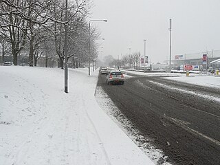
Beeston is a town in the Borough of Broxtowe, Nottinghamshire, England, it is 3 miles south-west of Nottingham. To its north-east is the University of Nottingham's main campus, University Park. The headquarters of pharmaceutical and retail chemist group Boots are 0.6 miles (1 km) east of the centre of Beeston, on the border with Broxtowe and the City of Nottingham. To the south lie the River Trent and the village of Attenborough, with extensive wetlands.

<span class="mw-page-title-main">Kimberley, Nottinghamshire</span> Village and civil parish in Nottinghamshire, England

Kimberley is a market town and civil parish in the Borough of Broxtowe in Nottinghamshire, England, lying 6 miles northwest of Nottingham along the A610. The town grew as a centre for coal mining, brewing and hosiery manufacturing. At the 2011 census the town had a population of 6,053, and this fell to 6,033 at the 2021 census.

<span class="mw-page-title-main">Toton</span> Village in Nottinghamshire, England

Toton is a large suburban village in the Borough of Broxtowe in Nottinghamshire, England. It forms part of the built-up area of Beeston, which in turn forms part of the wider Nottingham Urban Area. The population of the electoral ward of Toton and Chilwell Meadows was 7,298 in the 2001 census; it increased to 8,238 at the 2011 census.

<span class="mw-page-title-main">Nottingham Canal</span> United Kingdom legislation

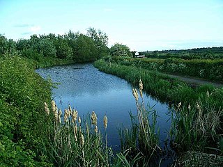
The Nottingham Canal is a canal in the English counties of Nottinghamshire and Derbyshire. As built, it comprised a 14.7-mile (23.7 km) long main line between the River Trent just downstream of Trent Bridge in Nottingham and Langley Mill in Derbyshire. At the same time as the main line of the canal was built by its proprietors, the separate Trent Navigation Company built the Beeston Cut, from the main line at Lenton in Nottingham to rejoin the River Trent upstream of Nottingham, thus bypassing the difficult section of navigation through Trent Bridge. The section of the main line between Trent Bridge and Lenton, together with the Beeston Cut, is still in use, forming part of the navigation of the River Trent and sometimes referred to as the Nottingham & Beeston Canal. The remainder of the main line of the canal beyond Lenton has been abandoned and partially filled.

<span class="mw-page-title-main">Chilwell</span> Village in Broxtowe, Nottinghamshire, England

Chilwell is a suburban area in the borough of Broxtowe in Nottinghamshire, England. It lies on the west side of the town of Beeston and is 4 miles (6.4 km) south-west of the centre of Nottingham.

<span class="mw-page-title-main">Broxtowe (UK Parliament constituency)</span> Parliamentary constituency in the United Kingdom, 1983 onwards

Broxtowe is a parliamentary constituency in Nottinghamshire, England, represented in the House of Commons of the UK Parliament since 2019 by Darren Henry, a Conservative.

<span class="mw-page-title-main">Stapleford, Nottinghamshire</span> Town and civil parish in Nottinghamshire, England

Stapleford is a town and civil parish in the Borough of Broxtowe, Nottinghamshire, England, 6 miles (9.7 km) west of Nottingham. The population of the civil parish at the 2001 census was 14,991, at the 2011 census it was 15,241, and 15,453 at the 2021 census.

<span class="mw-page-title-main">Attenborough, Nottinghamshire</span> Village in Nottinghamshire, England

Attenborough is a village in the Borough of Broxtowe in Nottinghamshire, England. It forms part of the Greater Nottingham area and is 4+12 miles (7.2 km) to the south-west of the city of Nottingham, between Long Eaton and Beeston. It adjoins the suburbs of Toton to the west and Chilwell to the north. The population of the ward, as at the 2011 Census, was 2,328.

<span class="mw-page-title-main">Beeston and Stapleford Urban District</span> Urban district in Nottinghamshire, England

Beeston and Stapleford was an urban district in Nottinghamshire, England, from 1935 to 1974.

<span class="mw-page-title-main">Broxtowe Wapentake</span>

Broxtowe was a wapentake of the ancient county of Nottinghamshire, England.

<span class="mw-page-title-main">Basford Rural District</span> Rural district close to Nottingham, England

Basford was a rural district close to Nottingham, England, from 1894 to 1974. The district consisted of two detached parts, to the north and south of Nottingham. It was created under the Local Government Act 1894 based on the existing Basford rural sanitary district.

Broxtowe Borough Council elections are held every four years. Broxtowe Borough Council is the local authority for the non-metropolitan district of Borough of Broxtowe in Nottinghamshire, England. Since the full review of boundaries in 2015, 44 councillors are elected from 20 wards.

Beeston was a parliamentary constituency in Nottinghamshire which returned one Member of Parliament (MP) to the House of Commons of the Parliament of the United Kingdom.

Watnall is an area in the Borough of Broxtowe in Nottinghamshire, England. It is part of Greasley civil parish, and is located one mile north of Kimberley. It is in the Nuthall West and Greasley (Watnall) ward of Broxtowe Council. The village is barely separated from Nuthall. Watnall Hall was built c. 1690 and demolished in 1962. Today, only the gate piers, fragments of the stone boundary wall and lodge remain on Main Road. Its owners included Launcelot Rolleston in the 18th century. Even though only a village, Watnall is home to many businesses and organisations, such as British Bakeries and the Nottingham meteorological centre. There are three World War II bunkers in Watnall that served as Royal Air Force Fighter Command for the Midlands.#

There are a number of listed buildings in Nottinghamshire. The term "listed building", in the United Kingdom, refers to a building or structure designated as being of special architectural, historical, or cultural significance. Details of all the listed buildings are contained in the National Heritage List for England. They are categorised in three grades: Grade I consists of buildings of outstanding architectural or historical interest, Grade II* includes significant buildings of more than local interest and Grade II consists of buildings of special architectural or historical interest. Buildings in England are listed by the Secretary of State for Culture, Media and Sport on recommendations provided by English Heritage, which also determines the grading.

<span class="mw-page-title-main">2023 Broxtowe Borough Council election</span> 2023 English local election

The 2023 Broxtowe Borough Council election took place on 4 May 2023, to elect all 44 members of Broxtowe Borough Council in England. This took place as part of the 2023 United Kingdom local elections.

References

  1. 1 2 UK Census (2021). "2021 Census Area Profile – Broxtowe Local Authority (E07000172)". Nomis. Office for National Statistics . Retrieved 5 January 2024.
  2. "The English Non-metropolitan Districts (Definition) Order 1972", legislation.gov.uk , The National Archives, SI 1972/2039, retrieved 31 May 2023
  3. "The English Non-metropolitan Districts (Names) Order 1973", legislation.gov.uk , The National Archives, SI 1973/551, retrieved 31 May 2023
  4. "Alteration of status of local authorities" (PDF). The National Archives. Department of the Environment. Retrieved 1 July 2023.
  5. "Broxtowe Borough Council installs its 48th Mayor". Broxtowe Borough Council. 16 May 2024. Retrieved 16 May 2024.
  6. "Local Government Act 1972", legislation.gov.uk , The National Archives, 1972 c. 70, retrieved 31 May 2023
  7. "Compositions calculator". The Elections Centre. Retrieved 10 August 2022.
  8. "Broxtowe". BBC News . Retrieved 26 September 2009.
  9. "Council minutes". Broxtowe Borough Council. Retrieved 19 August 2022.
  10. "Landslide victory". Stapleford and Sandiacre News. 12 May 1995. p. 20. Retrieved 20 August 2022.
  11. "David Watts". Broxtowe Borough Council. Archived from the original on 22 April 2012. Retrieved 20 August 2022.
  12. "Local elections 2023: live council results for England". The Guardian. London.
  13. Whittaker, Anna (2 August 2023). "Long-standing Lib Dem councillors leave party to create 'Broxtowe Independents'". Chad. Retrieved 21 December 2023.
  14. "Ceremony salutes one man's dream". Nottingham Evening Post. 17 April 1991. p. 5. Retrieved 1 July 2023.
  15. 1 2 "The Broxtowe (Electoral Changes) Order 2015", legislation.gov.uk , The National Archives, SI 2015/72, retrieved 2 July 2023
  16. 1 2 "Election Maps". Ordnance Survey. Retrieved 2 July 2023.
  17. F. A. Youngs, Guide to the Local Administrative Units of England, Vol. II (London, 1991)
  18. "Nottinghamshire Registration District". www.ukbmd.org.uk. Retrieved 26 January 2024.
  19. "Nature Reserves". Broxtowe Council. Archived from the original on 15 March 2015. Retrieved 10 March 2015.
  20. "East Midlands Region". Civic Heraldry of England. Retrieved 5 March 2021.
  21. O'Hare, Mia (17 November 2022). "'Mr Sunshine' and professor among group given Freemen status by Broxtowe Borough Council". The Nottingham Post. Retrieved 21 November 2022.
  22. Ram, Phoebe (29 June 2019). "Nottinghamshire pays thanks to servicemen and woman on Armed Forces Day". The Nottingham Post. Retrieved 21 November 2022.

52°57′N1°16′W / 52.95°N 1.27°W / 52.95; -1.27