Botkins, Ohio | |
---|---|
Coordinates: 40°28′04″N84°11′09″W / 40.46778°N 84.18583°W | |
Country | United States |
State | Ohio |
County | Shelby |
Government | |
• Mayor | Steve Woodruff[ citation needed ] |
• Village Administrator | Randy Purdy[ citation needed ] |
Area | |
• Total | 1.27 sq mi (3.30 km2) |
• Land | 1.26 sq mi (3.27 km2) |
• Water | 0.01 sq mi (0.03 km2) |
Elevation | 1,004 ft (306 m) |
Population (2020) | |
• Total | 1,155 |
• Density | 914.49/sq mi (353.12/km2) |
Time zone | UTC-5 (Eastern (EST)) |
• Summer (DST) | UTC-4 (EDT) |
ZIP code | 45306 |
Area code(s) | 937, 326 |
FIPS code | 39-07832 [3] |
GNIS feature ID | 2398153 [2] |
Website | http://www.botkinsohio.com |
Botkins is a village in Shelby County, Ohio, United States. The population was 1,155 at the 2020 census.
Botkins is located alongside Interstate 75 at Exit 104. Botkins is at the northern edge of Shelby County, immediately south of its border with Auglaize County. It also lies at the northern edge of the 937 area code.
Botkins was platted in 1858, and named for Richard Botkin, the original owner of the town site. [4] A post office called Botkins has been in operation since 1877. [5] The village was incorporated in 1881. [4]
According to the United States Census Bureau, the village has a total area of 1.25 square miles (3.24 km2), of which 1.24 square miles (3.21 km2) is land and 0.01 square miles (0.03 km2) is water. [6]
The center of the solar eclipse of April 8, 2024 will travel over the northwest corner of Botkins.
Census | Pop. | Note | %± |
---|---|---|---|
1880 | 314 | — | |
1900 | 420 | — | |
1910 | 579 | 37.9% | |
1920 | 557 | −3.8% | |
1930 | 488 | −12.4% | |
1940 | 502 | 2.9% | |
1950 | 608 | 21.1% | |
1960 | 854 | 40.5% | |
1970 | 1,057 | 23.8% | |
1980 | 1,372 | 29.8% | |
1990 | 1,340 | −2.3% | |
2000 | 1,205 | −10.1% | |
2010 | 1,155 | −4.1% | |
2020 | 1,155 | 0.0% | |
U.S. Decennial Census [7] |
As of the census [8] of 2010, there were 1,155 people, 480 households, and 315 families living in the village. The population density was 931.5 inhabitants per square mile (359.7/km2). There were 507 housing units at an average density of 408.9 per square mile (157.9/km2). The racial makeup of the village was 97.7% White, 0.4% African American, 0.1% Native American, 0.6% Asian, 0.1% Pacific Islander, and 1.0% from two or more races. Hispanic or Latino of any race were 0.7% of the population.
There were 480 households, of which 30.4% had children under the age of 18 living with them, 53.1% were married couples living together, 7.9% had a female householder with no husband present, 4.6% had a male householder with no wife present, and 34.4% were non-families. 30.4% of all households were made up of individuals, and 11.1% had someone living alone who was 65 years of age or older. The average household size was 2.41 and the average family size was 3.00.
The median age in the village was 37.8 years. 25.4% of residents were under the age of 18; 7.6% were between the ages of 18 and 24; 25.6% were from 25 to 44; 28.3% were from 45 to 64; and 13.2% were 65 years of age or older. The gender makeup of the village was 49.6% male and 50.4% female.
As of the census [3] of 2000, there were 1,205 people, 463 households, and 330 families living in the village. The population density was 1,311.0 inhabitants per square mile (506.2/km2). There were 482 housing units at an average density of 524.4 per square mile (202.5/km2). The racial makeup of the village was 99.25% White, 0.33% African American, 0.17% from other races, and 0.25% from two or more races. Hispanic or Latino of any race were 0.58% of the population.
There were 463 households, out of which 32.8% had children under the age of 18 living with them, 57.9% were married couples living together, 8.9% had a female householder with no husband present, and 28.7% were non-families. 26.6% of all households were made up of individuals, and 11.9% had someone living alone who was 65 years of age or older. The average household size was 2.60 and the average family size was 3.18.
In the village, the population was spread out, with 27.5% under the age of 18, 10.0% from 18 to 24, 28.5% from 25 to 44, 20.3% from 45 to 64, and 13.6% who were 65 years of age or older. The median age was 35 years. For every 100 females there were 101.8 males. For every 100 females age 18 and over, there were 100.9 males.
The median income for a household in the village was $43,000, and the median income for a family was $53,750. Males had a median income of $34,464 versus $23,359 for females. The per capita income for the village was $18,880. About 1.8% of families and 3.6% of the population were below the poverty line, including 7.6% of those under age 18 and 3.2% of those age 65 or over.
Botkins Local School District operates one elementary school and Botkins High School. [9]
Botkins has a public library, a branch of Shelby County Libraries. [10]
In June 2014, the popular comic Big Nate mentioned Botkins as the birthplace of Coach John. [11]
Shelby County is a county in the western portion of the U.S. state of Ohio. As of the 2020 United States Census, the population was 48,230. Its county seat is Sidney. Its name honors Isaac Shelby, first governor of Kentucky.
Viola is a village in Mercer County, Illinois, United States. The population was 869 at the 2020 census, a decline of 9 percent from 955 in 2010.
Cowden is a village in Shelby County, Illinois, United States. The population was 629 at the 2010 census.
Oconee is a village in Shelby County, Illinois, United States. The population was 180 at the 2010 census.
Strasburg is a village in Shelby County, Illinois, United States. The population was 531 at the 2020 census.
Morristown is a town in Hanover Township, Shelby County, in the U.S. state of Indiana. The population was 1,218 at the 2010 census.
Harlan is a city in Shelby County, Iowa, along the West Nishnabotna River. The population was 4,893 at the time of the 2020 census. It is the county seat of Shelby County.
Shelby is a village in Oceana County in the U.S. state of Michigan. The population was 2,065 at the 2010 census.
Gunn City is a village in Cass County, Missouri, United States. The population was 118 at the 2010 census. It is part of the Kansas City metropolitan area.
Leonard is a village in northwestern Shelby County, Missouri, United States. The population was 57 at the 2020 census.
Shelbyville is a city in Shelby County, Missouri, United States. The population was 518 at the 2020 census. It is the county seat of Shelby County.
Shelby is a town in Orleans County, New York, United States. The population was 5,319 at the 2010 census.
Lakeline is a village in Lake County, Ohio, United States. The population was 216 at the 2020 census.
Anna is a village in Shelby County, Ohio, United States. The population was 1,470 at the 2020 census.
Jackson Center is a village in Shelby County, Ohio, United States. The population was 1,441 at the 2020 census.
Kettlersville is a village in Shelby County, Ohio, United States. The population was 164 at the 2020 census.
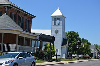
Port Jefferson is a village in Salem Township, Shelby County, Ohio, United States. The population was 308 at the 2020 census.
Shelby is a city in Pottawattamie and Shelby counties in the U.S. state of Iowa. The population was 727 at the time of the 2020 census.
Verona is a village in Montgomery and Preble counties in the U.S. state of Ohio. The population was 403 at the 2020 census. It is part of the Dayton Metropolitan Statistical Area.
Waupaca is a town in Waupaca County, Wisconsin, United States. The population was 1,155 at the 2000 census. The City of Waupaca is located mostly within the town, though it is politically independent. The ghost town of Granite Quarry was also located partially in the town.