Broadview Park, Florida

Last updated

Broadview Park, Florida
CDP
FLMap-doton-BroadviewPark.PNG
Location of Broadview Park, Florida
Coordinates: 26°5′55″N80°12′27″W / 26.09861°N 80.20750°W / 26.09861; -80.20750
Country Flag of the United States.svg  United States
State Flag of Florida.svg  Florida
County   Broward
Area
[1]
  Total1.05 sq mi (2.72 km2)
  Land1.00 sq mi (2.59 km2)
  Water0.05 sq mi (0.13 km2)
Elevation
16 ft (5 m)
Population
 (2020)
  Total7,670
  Density7,654.69/sq mi (2,956.36/km2)
Time zone UTC-5 (Eastern (EST))
  Summer (DST) UTC-4 (EDT)
ZIP code
33317 [2]
Area code(s) 754 and 954
FIPS code 12-08650 [3]
GNIS feature ID0301162 [4]

Broadview Park is a census-designated place (CDP) in Broward County, Florida, United States. The population was 7,670 at the 2020 census.

Contents

Geography

Broadview Park is located at 26°5′55″N80°12′27″W / 26.09861°N 80.20750°W / 26.09861; -80.20750 (26.098515, -80.207419). [5]

According to the United States Census Bureau, the CDP has a total area of 1.0 square mile (2.6 km2), of which 0.04 square miles (0.10 km2), or 3.92%, is water.

Demographics

Historical population
CensusPop.Note
1970 6,049
1980 6,022−0.4%
1990 6,1091.4%
2000 6,79811.3%
2010 7,1254.8%
2020 7,6707.6%
source: [6] [7]

2020 census

Broadview Park racial composition
(Hispanics excluded from racial categories)
(NH = Non-Hispanic) [8]
RaceNumberPercentage
White (NH)1,17615.33%
Black or African American (NH)81510.63%
Native American or Alaska Native (NH)70.09%
Asian (NH)1992.59%
Pacific Islander or Native Hawaiian (NH)20.03%
Some other race (NH)630.82%
Two or more races/Multiracial (NH)1451.89%
Hispanic or Latino (any race)5,26368.62%
Total7,670100.00%

As of the 2020 United States census, there were 7,670 people, 2,470 households, and 1,975 families residing in the CDP. [9]

2010 census

Broadview Park Demographics
2010 Census Broadview ParkBroward CountyFlorida
Total population7,1251,748,06618,801,310
Population, percent change, 2000 to 2010+4.8%+7.7%+17.6%
Population density7,345.4/sq mi1,444.9/sq mi350.6/sq mi
White or Caucasian (including White Hispanic)69.7%63.1%75.0%
(Non-Hispanic White or Caucasian)22.5%43.5%57.8%
Black or African-American 14.5%26.7%16.0%
Hispanic or Latino (of any race) 59.5%25.1%22.5%
Asian 1.9%3.2%2.4%
Native American or Native Alaskan 0.1%0.3%0.4%
Pacific Islander or Native Hawaiian 0.0%0.1%0.1%
Two or more races (Multiracial) 1.4%2.9%2.5%
Some Other Race 0.1%3.7%3.6%

As of the 2010 United States census, there were 7,125 people, 1,975 households, and 1,340 families residing in the CDP. [10]

2000 census

As of the census [3] of 2000, there were 6,798 people, 2,122 households, and 1,606 families residing in the CDP. The population density was 6,949.1 inhabitants per square mile (2,683.1/km2). There were 2,267 housing units at an average density of 2,317.4 per square mile (894.8/km2). The racial makeup of the CDP was 67.92% White (37.3% were Non-Hispanic White), [11] 16.98% African American, 0.21% Native American, 1.94% Asian, 0.49% Pacific Islander, 8.16% from other races, and 4.31% from two or more races. Hispanic or Latino of any race were 42.32% of the population.

In 2000, there were 2,122 households, out of which 41.6% had children under the age of 18 living with them, 50.5% were married couples living together, 17.6% had a female householder with no husband present, and 24.3% were non-families. 17.0% of all households were made up of individuals, and 4.5% had someone living alone who was 65 years of age or older. The average household size was 3.17 and the average family size was 3.52.

In 2000, in the CDP, the population was spread out, with 29.8% under the age of 18, 10.2% from 18 to 24, 33.6% from 25 to 44, 18.8% from 45 to 64, and 7.6% who were 65 years of age or older. The median age was 31 years. For every 100 females, there were 108.1 males. For every 100 females age 18 and over, there were 105.8 males.

In 2000, the median income for a household in the CDP was $38,125, and the median income for a family was $39,176. Males had a median income of $27,473 versus $22,296 for females. The per capita income for the CDP was $14,591. About 13.6% of families and 14.8% of the population were below the poverty line, including 18.2% of those under age 18 and 16.4% of those age 65 or over.

As of 2000, English as a first language accounted for 54.71% of all residents, and Spanish accounted for 41.80%, French Creole made up 1.57%, Tagalog was at 1.32%, and French]] was at 0.57% of the population. [12]

Related Research Articles

Boulevard Gardens is a census-designated place (CDP) in Broward County, Florida, United States. The population was 1,457 at the 2020 census.

<span class="mw-page-title-main">Broadview-Pompano Park</span> Neighborhood in Broward, Florida, United States

Broadview-Pompano Park is a neighborhood and former census-designated place (CDP) in North Lauderdale, Broward County, Florida, United States. The population was 5,314 at the 2000 census.

Franklin Park is a census-designated place (CDP) in Broward County, Florida, United States. The population was 1,025 at the 2020 census.

Hillsboro Pines is a census-designated place (CDP) in Broward County, Florida, United States. The population was 496 at the 2020 census.

Roosevelt Gardens is a census-designated place (CDP) in Broward County, Florida, United States. The population was 2,749 at the 2020 census.

<span class="mw-page-title-main">Washington Park, Florida</span> CDP in Florida, United States

Washington Park is a census-designated place (CDP) in Broward County, Florida, United States. Its population was 1,948 at the 2020 census.

<span class="mw-page-title-main">Coral Terrace, Florida</span> Census-designated place in Florida

Coral Terrace is a suburban unincorporated community and census-designated place (CDP) in Miami-Dade County, Florida, United States. It is part of the Miami metropolitan area of South Florida. The population was 23,142 at the 2020 census, down from 24,376 in 2010.

<span class="mw-page-title-main">Country Club, Florida</span> Census-designated place in Florida

Country Club is a census-designated place and a suburban unincorporated community located in northwest Miami-Dade County, Florida, United States. It is located in the Miami metropolitan area of South Florida. The CDP is named after the Country Club of Miami, which was established in 1961 in what was then an unpopulated and undeveloped section of the county. The population was 49,967 at the 2020 census, up from 3,408 in 1990.

<span class="mw-page-title-main">Gladeview, Florida</span> Census-designated place in Florida

Gladeview is a census-designated place (CDP) in Miami-Dade County, Florida, United States. It is part of the Miami metropolitan area of South Florida. The population was 14,927 at the 2020 census, up from 11,535 in 2010.

<span class="mw-page-title-main">Homestead Base, Florida</span> Census-designated place in Florida

Homestead Base is a census-designated place (CDP) in Miami-Dade County, Florida, United States. The CDP comprises the extent of Homestead Air Reserve Base plus some surrounding land. It is part of the Miami metropolitan area of South Florida. The population was 999 at the 2020 census.

<span class="mw-page-title-main">Ives Estates, Florida</span> Census-designated place in Florida

Ives Estates is a census-designated place (CDP) in Miami-Dade County, Florida. It is part of the Miami metropolitan area of South Florida. The population was 25,005 at the 2020 census, up from 19,525 in 2010.

<span class="mw-page-title-main">Olympia Heights, Florida</span> Census-designated place in Florida

Olympia Heights is a census-designated place in Miami-Dade County, Florida, United States. It is located in the Miami metropolitan area of South Florida. The population was 12,873 at the 2020 census.

<span class="mw-page-title-main">Palm Springs North, Florida</span> Census-designated place in Florida

Palm Springs North is an unincorporated community and census-designated place (CDP) in Miami-Dade County, Florida, United States. It is part of the Miami metropolitan area of South Florida. The population was 5,030 at the 2020 census.

<span class="mw-page-title-main">Princeton, Florida</span> Census-designated place in Florida

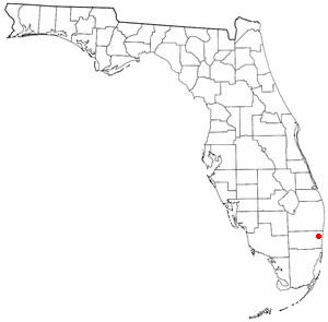
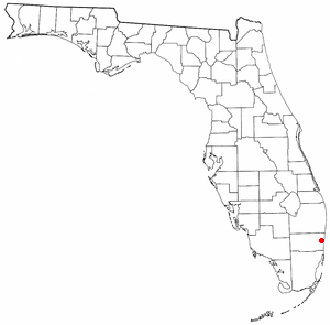
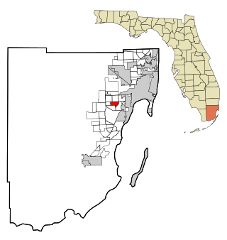
Princeton is a census-designated place (CDP) and unincorporated community in Miami-Dade County, Florida, United States. It is part of the Miami metropolitan area of South Florida. The population was 39,208 at the 2020 census, up from 22,038 at the 2010 census.

<span class="mw-page-title-main">Richmond West, Florida</span> Census-designated place in Florida

Richmond West is a census-designated place (CDP) in Miami-Dade County, Florida, United States. It is part of the Miami metropolitan area of South Florida. The population was 35,884 at the 2020 census, up from 31,973 at the 2010 census.

<span class="mw-page-title-main">Sunset, Florida</span> Census-designated place in Florida

Sunset is a census-designated place (CDP) in Miami-Dade County, Florida, United States. It is part of the Miami metropolitan area of South Florida. The population was 15,912 at the 2020 census. The U.S. Postal Service uses the ZIP Codes of 33173 and 33183 for Sunset.

<span class="mw-page-title-main">The Crossings, Florida</span> CDP in Florida

The Crossings is a census-designated place (CDP) and suburb of Miami in Miami-Dade County, Florida, United States. It is part of the Miami metropolitan area of South Florida. The CDP includes the neighborhoods of The Crossings, Devon Aire, and Calusa. The population was 23,276 at the 2020 census.

<span class="mw-page-title-main">West Perrine, Florida</span> Census-designated place in Florida

West Perrine is a census-designated place (CDP) in Miami-Dade County, Florida, United States. It is part of the Miami metropolitan area of South Florida. The population was 10,602 at the 2020 census, up from 9,460 in 2010.

<span class="mw-page-title-main">Westview, Florida</span> Census-designated place in Florida

Westview is a census-designated place (CDP) in Miami-Dade County, Florida, United States. It is part of the Miami metropolitan area of South Florida. The population was 9,923 at the 2020 census.

<span class="mw-page-title-main">South Miami Heights, Florida</span> Census-designated place in Florida

South Miami Heights is a census-designated place (CDP), originally known as Eureka, in Miami-Dade County, Florida. It is part of the Miami metropolitan area of South Florida. The population was 36,770 as of the 2020 census.

References

  1. "2020 U.S. Gazetteer Files". United States Census Bureau. Retrieved October 31, 2021.
  2. "Broadview Park FL ZIP Code". zipdatamaps.com. 2023. Retrieved January 26, 2023.
  3. 1 2 "U.S. Census website". United States Census Bureau . Retrieved January 31, 2008.
  4. "US Board on Geographic Names". United States Geological Survey]]. October 25, 2007. Retrieved January 31, 2008.
  5. "US Gazetteer files: 2010, 2000, and 1990". United States Census Bureau. February 12, 2011. Retrieved April 23, 2011.
  6. "CENSUS OF POPULATION AND HOUSING (1790-2000)". U.S. Census Bureau. Retrieved July 17, 2010.
  7. Returned as Broadview Park-Rock Hill during the 1970 census
  8. "Explore Census Data". data.census.gov. Retrieved June 14, 2023.
  9. "S1101 HOUSEHOLDS AND FAMILIES - 2020: Broadview Park CDP, Florida". United States Census Bureau.
  10. "S1101 HOUSEHOLDS AND FAMILIES - 2010: Broadview Park CDP, Florida". United States Census Bureau.
  11. "Demographics of Broadview Park, FL". MuniNetGuide.com. Retrieved November 18, 2007.
  12. "MLA Data Center Results for Broadview Park, Florida". Modern Language Association. Retrieved November 18, 2007.