Washington Park, Florida

Last updated

Washington Park, Florida
CDP
FLMap-doton-WashingtonPark.PNG
Location of Washington Park, Florida
Coordinates: 26°7′50″N80°10′45″W / 26.13056°N 80.17917°W / 26.13056; -80.17917
Country Flag of the United States.svg  United States
State Flag of Florida.svg  Florida
County   Broward
Area
[1]
  Total0.26 sq mi (0.67 km2)
  Land0.26 sq mi (0.67 km2)
  Water0.00 sq mi (0.00 km2)
Elevation
3 ft (1 m)
Population
 (2020)
  Total1,948
  Density7,521.24/sq mi (2,902.84/km2)
Time zone UTC-5 (Eastern (EST))
  Summer (DST) UTC-4 (EDT)
ZIP code
33311 [2]
Area code(s) 754 and 954
FIPS code 12-75225 [3]
GNIS feature ID1853299 [4]

Washington Park is a census-designated place (CDP) in Broward County, Florida, United States. Its population was 1,948 at the 2020 census. It is home to the African-American Research Library and Cultural Center.

Contents

Geography

Washington Park is located at 26°7′50″N80°10′45″W / 26.13056°N 80.17917°W / 26.13056; -80.17917 (26.130613, -80.179042). [5]

According to the United States Census Bureau, the CDP has a total area of 1.1 km2 (0.4 mi2), of which 1.0 km2 (0.4 mi2) is land and 0.1 km2 (0.04 mi2) (4.88%) is water.

Demographics

Historical population
CensusPop.Note
1980 7,240
1990 6,930−4.3%
2000 1,257−81.9%
2010 1,67233.0%
2020 1,94816.5%
source: [6] [7]

2020 census

Washington Park racial composition
(Hispanics excluded from racial categories)
(NH = Non-Hispanic) [8]
RaceNumberPercentage
White (NH)472.41%
Black or African American (NH)1,73789.17%
Native American or Alaska Native (NH)40.21%
Asian (NH)20.10%
Pacific Islander or Native Hawaiian (NH)00.00%
Some other race (NH)100.51%
Two or more races/Multiracial (NH)271.39%
Hispanic or Latino (any race)1216.21%
Total1,948100.00%

As of the 2020 United States census, there were 1,948 people, 793 households, and 474 families residing in the CDP. [9]

2010 census

Washington Park Demographics
2010 Census Washington ParkBroward CountyFlorida
Total population1,6721,748,06618,801,310
Population, percent change, 2000 to 2010+33.0%+7.7%+17.6%
Population density3,981.0/sq mi1,444.9/sq mi350.6/sq mi
White or Caucasian (including White Hispanic)2.8%63.1%75.0%
(Non-Hispanic White or Caucasian)1.6%43.5%57.9%
Black or African-American 94.6%26.7%16.0%
Hispanic or Latino (of any race) 1.8%25.1%22.5%
Asian 0.4%3.2%2.4%
Native American or Native Alaskan 0.0%0.3%0.4%
Pacific Islander or Native Hawaiian 0.0%0.1%0.1%
Two or more races (Multiracial) 1.3%2.9%2.5%
Some Other Race 0.4%3.7%3.6%

As of the 2010 United States census, there were 1,672 people, 510 households, and 388 families residing in the CDP. [10]

2000 census

As of the census of 2000, there were 1,257 people, 410 households, and 298 families residing in the CDP. The population density was 1,213.3/km2 (3,162.1/mi2). There were 470 housing units at an average density of 453.7/km2 (1,182.3/mi2). The racial makeup of the CDP was 0.08% White, 98.17% African American, 0.40% Native American, 0.08% Asian, and 1.27% from two or more races. Hispanic or Latino of any race were 0.64% of the population.

In 2000, there were 410 households, out of which 30.0% had children under the age of 18 living with them, 32.4% were married couples living together, 31.2% had a female householder with no husband present, and 27.1% were non-families. 22.0% of all households were made up of individuals, and 7.3% had someone living alone who was 65 years of age or older. The average household size was 3.07 and the average family size was 3.52.

In 2000, in the CDP, the population was spread out, with 30.8% under the age of 18, 8.4% from 18 to 24, 27.6% from 25 to 44, 21.6% from 45 to 64, and 11.7% who were 65 years of age or older. The median age was 35 years. For every 100 females, there were 89.9 males. For every 100 females age 18 and over, there were 86.3 males.

In 2000, the median income for a household in the CDP was $23,516, and the median income for a family was $26,528. Males had a median income of $21,583 versus $18,581 for females. The per capita income for the CDP was $11,359. About 24.9% of families and 28.5% of the population were below the poverty line, including 48.5% of those under age 18 and 19.5% of those age 65 or over.

As of 2000, English was the first language for 97.82% of all residents, while Spanish was the mother tongue for 2.17% of the population. [11]

Related Research Articles

Boulevard Gardens is a census-designated place (CDP) in Broward County, Florida, United States. The population was 1,457 at the 2020 census.

<span class="mw-page-title-main">Broadview Park, Florida</span> CDP in Florida, United States

Broadview Park is a census-designated place (CDP) in Broward County, Florida, United States. The population was 7,670 at the 2020 census.

Franklin Park is a census-designated place (CDP) in Broward County, Florida, United States. The population was 1,025 at the 2020 census.

Hillsboro Pines is a census-designated place (CDP) in Broward County, Florida, United States. The population was 496 at the 2020 census.

Lake Forest was a census-designated place (CDP) in Broward County, Florida, United States. The population was 4,994 at the 2000 census. It is now a neighborhood of West Park, Florida.

Roosevelt Gardens is a census-designated place (CDP) in Broward County, Florida, United States. The population was 2,749 at the 2020 census.

Village Park was a census-designated place (CDP) in Broward County, Florida, United States. The population was 895 at the 2000 census. It is now a part of North Lauderdale, Florida.

<span class="mw-page-title-main">Goulds, Florida</span> Census-designated place in Florida

Goulds is an unincorporated community and census-designated place (CDP) in Miami-Dade County, Florida, United States. The area was originally populated as the result of a stop on the Florida East Coast Railroad. The railroad depot was located near the current Southwest 224th Street. The community was named after its operator, Lyman Gould, who cut trees for railroad ties. It is part of the Miami metropolitan area of South Florida. As of the 2020 US census, the population stood at 11,446, up from 10,103 in 2010 US census.

<span class="mw-page-title-main">Ives Estates, Florida</span> Census-designated place in Florida

Ives Estates is a census-designated place (CDP) in Miami-Dade County, Florida. It is part of the Miami metropolitan area of South Florida. The population was 25,005 at the 2020 census, up from 19,525 in 2010.

<span class="mw-page-title-main">Palm Springs North, Florida</span> Census-designated place in Florida

Palm Springs North is an unincorporated community and census-designated place (CDP) in Miami-Dade County, Florida, United States. It is part of the Miami metropolitan area of South Florida. The population was 5,030 at the 2020 census.

<span class="mw-page-title-main">Palmetto Estates, Florida</span> Census-designated place in Florida

Palmetto Estates is an unincorporated area and census-designated place (CDP) in Miami-Dade County, Florida, United States. It is part of the Miami metropolitan area of South Florida. The population was 13,498 at the 2020 census.

<span class="mw-page-title-main">The Hammocks, Florida</span> Census-designated place in Florida

The Hammocks is a planned community and census-designated place in Miami-Dade County, Florida, United States. It is part of the Miami metropolitan area of South Florida. The population was 59,480 at the 2020 census, up from 51,003 in 2010.

<span class="mw-page-title-main">Meadow Woods, Florida</span> Census-designated place in Florida, United States

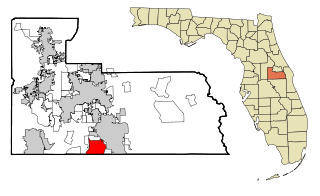
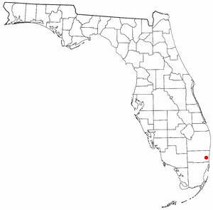
Meadow Woods is a census-designated place (CDP) and an unincorporated suburban development area located in southern Orange County, Florida, United States, between Orlando International Airport and Kissimmee. It is part of the Orlando–Kissimmee–Sanford, Florida Metropolitan Statistical Area. As of 2020, the population was 43,790.

<span class="mw-page-title-main">Cypress Lakes, Florida</span> Unincorporated place in Florida, United States

Cypress Lakes was a former census-designated place (CDP) and current unincorporated place in Palm Beach County, Florida, United States. The population was 1,468 at the 2000 census.

<span class="mw-page-title-main">Hamptons at Boca Raton, Florida</span> Unincorporated place in Florida, United States

Hamptons at Boca Raton was a former census-designated place (CDP) and current unincorporated place near Boca Raton in Palm Beach County, Florida, United States. The population was 11,306 at the 2000 census. While it is not officially in the City of Boca Raton, the community is frequently classified under its umbrella term.

Plantation Mobile Home Park is a census-designated place (CDP) in Palm Beach County, Florida, United States. It is part of the Miami metropolitan area of South Florida. The population was 1,462 at the 2020 US census.

Stacy Street is a residential street and surrounding census-designated place (CDP) in Palm Beach County, Florida, United States. In the 2010 and 2020 US Census, the CDP is misspelled as Stacey Street. It is part of the Miami metropolitan area of South Florida. The population was 978 at the 2020 US census.

<span class="mw-page-title-main">East Lake, Pinellas County, Florida</span> Census-designated place in Florida, United States

East Lake is a census-designated place (CDP) in Pinellas County, Florida, United States. It was one of the last areas in the densely populated county to develop and often confused with East Lake in neighboring Hillsborough County. The population was 32,344 at the 2020 census.

<span class="mw-page-title-main">Three Rivers, Massachusetts</span> Former CDP in Massachusetts, United States

Three Rivers is a village and former census-designated place (CDP) in the city of Palmer in Hampden County, Massachusetts, United States. It is part of the Springfield, Massachusetts Metropolitan Statistical Area. It is named for the confluence of the Ware and Quaboag rivers, which form the Chicopee River.

<span class="mw-page-title-main">South Miami Heights, Florida</span> Census-designated place in Florida

South Miami Heights is a census-designated place (CDP), originally known as Eureka, in Miami-Dade County, Florida. It is part of the Miami metropolitan area of South Florida. The population was 36,770 as of the 2020 census.

References

  1. "2020 U.S. Gazetteer Files". United States Census Bureau. Retrieved December 2, 2021.
  2. "Washington Park FL ZIP Code". zipdatamaps.com. 2023. Retrieved February 17, 2023.
  3. "U.S. Census website". United States Census Bureau . Retrieved January 31, 2008.
  4. "US Board on Geographic Names". United States Geological Survey. October 25, 2007. Retrieved January 31, 2008.
  5. "US Gazetteer files: 2010, 2000, and 1990". United States Census Bureau. February 12, 2011. Retrieved April 23, 2011.
  6. "CENSUS OF POPULATION AND HOUSING (1790-2000)". U.S. Census Bureau . Retrieved June 20, 2020.
  7. Census area was lost to Boulevard Gardens, Franklin Park, Golden Heights, & Roosevelt Gardens.
  8. "Explore Census Data". data.census.gov. Retrieved June 20, 2023.
  9. "S1101 HOUSEHOLDS AND FAMILIES - 2020: Washington Park CDP, Florida". United States Census Bureau .
  10. "S1101 HOUSEHOLDS AND FAMILIES - 2010: Washington Park CDP, Florida". United States Census Bureau .
  11. "MLA Data Center Results for Washington Park, Florida". Modern Language Association . Retrieved November 18, 2007.