Gadsden County is a county located in the panhandle of the U.S. state of Florida. As of the 2020 census, the population was 43,826. Its county seat is Quincy. Gadsden County is included in the Tallahassee, FL Metropolitan Statistical Area. Gadsden County is the only majority African-American county in Florida.

Jefferson County is a county located in the Big Bend region in the northern part of the U.S. state of Florida. As of the 2020 census, the population was 14,510. Its county seat is Monticello.

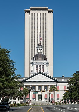
Leon County is a county in the Panhandle of the U.S. state of Florida. It was named after the Spanish explorer Juan Ponce de León. As of the 2020 census, the population was 292,198.

Liberty County is a county located in the state of Florida. As of the 2020 census, the population was 7,974, making it the least populous county in Florida. Its county seat is Bristol. Liberty County is the only dry county in Florida. Lafayette County prohibits bars, but not retail sale of beer.

Wakulla County is a county located in the Big Bend region in the northern portion of the U.S. state of Florida. As of the 2020 census, the population was 33,764. Its county seat is Crawfordville.

Gretna is a city in Gadsden County, Florida, United States. It is part of the Tallahassee, Florida Metropolitan Statistical Area. The majority of the population is African American, and as of the 2020 census, had 1,357 residents, down from 1,460 at the 2010 census.

Havana is a town in Gadsden County, Florida, United States, and a suburb of Tallahassee. The population was 1,753 at the 2020 census, almost even from 1,754 at the 2010 census. It is part of the Tallahassee, Florida Metropolitan Statistical Area. The town was named after Havana, Cuba, located about 530 miles (850 km) to the south.

Midway is a city in Gadsden County, Florida, United States. It is part of the Tallahassee, Florida Metropolitan Statistical Area. According to the 2020 census, the population was 3,537, up from 3,004 at the 2010 census.

The Blacksburg-Christiansburg Metropolitan Statistical Area, formerly the Blacksburg-Christiansburg-Radford Metropolitan Statistical Area, is a Metropolitan Statistical Area (MSA) as defined by the United States Office of Management and Budget (OMB) located in the New River Valley of Southwest Virginia. As of the 2020 census, the MSA had a population of 181,863.

The Jacksonville Metropolitan Area, also called the First Coast, Metro Jacksonville, or Northeast Florida, is the metropolitan area centered on the principal city of Jacksonville, Florida and including the First Coast of North Florida. As of the 2020 United States census, the total population was 1,605,848. The Jacksonville–Kingsland–Palatka, FL–GA Combined Statistical Area (CSA) had a population of 1,733,937 in 2020 and was the 34th largest CSA in the United States. The Jacksonville metropolitan area is the 40th largest in the country and the fourth largest in the State of Florida, behind the Miami, Tampa, and Orlando metropolitan areas.
The Charleston Metropolitan Statistical Area, as defined by the United States Census Bureau, is an area consisting of three counties in West Virginia, anchored by the city of Charleston. It is the largest metropolitan area entirely within the state of West Virginia. The Huntington Metro Area adds to the Charleston–Huntington, WV-OH-KY CSA and spans three states, while the core county of the Charleston area, Kanawha County, is more populous than the West Virginia portion of the Huntington area.

The Valdosta metropolitan area, designated the Valdosta metropolitan statistical area by the U.S. Office of Management and Budget, is a metropolitan statistical area consisting of four counties—Brooks, Echols, Lanier, and Lowndes—centered on the city of Valdosta. Located in Southeast Georgia, the metropolitan area's population was 151,118 according to 2023 U.S. census estimates, up from 149,849 at the 2020 U.S. census.

The Hinesville metropolitan area, officially the Hinesville metropolitan statistical area and previously the Hinesville–Ft. Stewart metropolitan statistical area, is defined by the U.S. Office of Management and Budget as a metropolitan statistical area consisting of two counties, Liberty and Long, in the U.S. state of Georgia. It is anchored by the city of Hinesville and encompasses all of Fort Stewart, one of the largest U.S. Army installations in the United States.

The Idaho Falls Metropolitan Statistical Area, as defined by the United States Census Bureau, is an area consisting of three counties in eastern Idaho, anchored by the city of Idaho Falls. As of the 2020 census, the MSA had a population of 154,855. It is just north of the Pocatello, Idaho Metropolitan Area.

As defined by the U.S. Office of Management and Budget, and used by the U.S. Census Bureau for statistical purposes only, the Columbia, SC Metropolitan Statistical Area, is an area consisting of six counties in central South Carolina, anchored by the city of Columbia. The current population has an estimation of 837,092. It is the second-largest metropolitan statistical area in the state of South Carolina, since the Anderson metropolitan statistical area was combined with Greenville's following the 2010 census.

The Columbus metropolitan area, officially the Columbus metropolitan statistical area, and colloquially known as the Chattahoochee Valley, is a metropolitan statistical area consisting of six counties in the U.S. state of Georgia and one county in Alabama, anchored by the city of Columbus.

The South Bend–Mishawaka Metropolitan Statistical Area, sometimes referred to as Michiana, as defined by the United States Census Bureau, is an area consisting of two counties – one in northern Indiana and one in southwest Michigan (Cass), anchored by the cities of South Bend and Mishawaka in Indiana. As of the 2010 census, the MSA had a population of 319,224.

The Macon metropolitan area is a metropolitan statistical area consisting of five counties in Central Georgia, anchored by the principal city of Macon. At the 2010 U.S. census, the five-county area had a population of 232,293. A July 2017 estimate placed the population at 228,914. In 2022, its estimated population was 235,805.
The Kokomo Metropolitan Statistical Area, as defined by the United States Census Bureau, is an area consisting of Howard County in Indiana. Howard County had a population estimate of 83,831 in 2023. Kokomo is also the principal city of the area known as North Central Indiana, the area around Kokomo with economic ties. The six county area including Cass, Clinton, Fulton, Howard, Miami, and Tipton counties had population of 228,331 people in 2010.
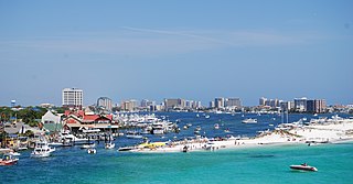
The Crestview–Fort Walton Beach–Destin, Florida Metropolitan Statistical Area, as defined by the United States Census Bureau, is a metropolitan area consisting of Okaloosa and Walton counties in northwest Florida, with the principal cities of Crestview, Fort Walton Beach, and Destin. As of the 2020 census, the MSA had a population of 286,993, up from 235,865 at the 2010 census.