Jefferson County, Florida

Last updated

Jefferson County
MonticelloFL-CoCourtHs-2009.JPG
Jefferson County Courthouse in Monticello
Seal of Jefferson County, Florida.png
Map of Florida highlighting Jefferson County.svg
Location within the U.S. state of Florida
Florida in United States.svg
Florida's location within the U.S.
Coordinates: 30°25′N83°54′W / 30.42°N 83.9°W / 30.42; -83.9
CountryFlag of the United States.svg United States
StateFlag of Florida.svg  Florida
FoundedJanuary 20, 1827
Named for Thomas Jefferson
Seat Monticello
Largest cityMonticello
Area
  Total637 sq mi (1,650 km2)
  Land598 sq mi (1,550 km2)
  Water38 sq mi (100 km2)  6.0%
Population
 (2020)
  Total14,510 Decrease2.svg
  Density23/sq mi (9/km2)
Time zone UTC−5 (Eastern)
  Summer (DST) UTC−4 (EDT)
Congressional district 2nd
Website www.jeffersoncountyfl.gov

Jefferson County is a county located in the Big Bend region in the northern part of the U.S. state of Florida. As of the 2020 census, the population was 14,510. [1] Its county seat is Monticello. [2]

Contents

Jefferson County is part of the Tallahassee, FL Metropolitan Statistical Area but is the 3rd most rural county in Florida. [3] There are no traffic signals within the entire county. [4]

History

In the mid to late 18th century, a group of Native Americans from Chiaha chiefdom settled in what is now Jefferson County. This group would eventually become an element of the Mikasuki speaking Seminole. [5]

Jefferson County was created in 1827. It was named for Thomas Jefferson, third president of the United States, who had died the year before the county's establishment. [6]

Forts of Jefferson County

Geography

Entering Jefferson County on US 19 from Thomas County, Georgia Fla-Ga state line US 19 south01.jpg
Entering Jefferson County on US 19 from Thomas County, Georgia

According to the U.S. Census Bureau, the county has a total area of 637 square miles (1,650 km2), of which 598 square miles (1,550 km2) is land and 38 square miles (98 km2) (6.0%) is water. [8]

Jefferson County is the only county in Florida which borders both the state of Georgia and the Gulf of Mexico.

Adjacent counties

National protected area

Water Bodies

Demographics

Historical population
CensusPop.Note
1830 3,312
1840 5,71372.5%
1850 7,71835.1%
1860 9,87628.0%
1870 13,39835.7%
1880 16,06519.9%
1890 15,757−1.9%
1900 16,1952.8%
1910 17,2106.3%
1920 14,502−15.7%
1930 13,408−7.5%
1940 12,032−10.3%
1950 10,413−13.5%
1960 9,543−8.4%
1970 8,778−8.0%
1980 10,70321.9%
1990 11,2965.5%
2000 12,90214.2%
2010 14,76114.4%
2020 14,510−1.7%
2023 (est.)15,450 [9] 6.5%
U.S. Decennial Census [10]
1790-1960 [11] 1900-1990 [12]
1990-2000 [13] 2010-2019 [14]

2020 census

Note: the US Census treats Hispanic/Latino as an ethnic category. This table excludes Latinos from the racial categories and assigns them to a separate category. Hispanics/Latinos can be of any race.

Jefferson County racial composition
(NH = Non-Hispanic) [15] [16]
RacePop 2010Pop 2020% 2010% 2020
White (NH)8,6688,72058.72%60.1%
Black or African American (NH)5,2934,60035.86%31.7%
Native American or Alaska Native (NH)33360.22%0.25%
Asian (NH)49340.33%0.23%
Pacific Islander (NH)430.03%0.02%
Some Other Race (NH)9540.06%0.37%
Mixed/Multi-Racial (NH)1594051.08%2.79%
Hispanic or Latino 5466583.7%4.53%
Total14,76114,510

As of the 2020 United States census, there were 14,510 people, 5,770 households, and 3,761 families residing in the county.

2010 census

As of the census [17] of 2010, there were 14,761 people, 5,646 households, and 3,798 families residing in the county. The population density was 25 people per square mile (9.7 people/km2). There were 5,251 housing units at an average density of 9 per square mile (3.5/km2). The racial makeup of the county was 60.4% White, 36.2% Black or African American, 0.30% Native American, 0.40% Asian, 0.0% Pacific Islander, 1.50% from other races, and 1.30% from two or more races. 3.70% of the population were Hispanic or Latino of any race.

There were 5,646 households, out of which 26.9% had individuals under the age of 18 living with them, 47.30% were married couples living together, 15.10% had a female householder with no husband present, and 32.70% were non-families. 28.1% of all households were made up of individuals, and 10.6% had someone living alone who was 65 years of age or older. The average household size was 2.38 and the average family size was 2.89.

In the county, the population was spread out, with 18.6% under the age of 18, 8.20% from 18 to 24, 25.0% from 25 to 44, 32.30% from 45 to 64, and 16.5% who were 65 years of age or older. The median age was 44.1 years. For every 100 females, there were 109.6 males. For every 100 females age 18 and over, there were 110.00 males age 18 and over.

The following income information is from the 2000 census. The median income for a household in the county was $32,998, and the median income for a family was $40,407. Males had a median income of $26,271 versus $25,748 for females. The per capita income for the county was $17,006. About 13.30% of families and 17.10% of the population were below the poverty line, including 21.70% of those under age 18 and 17.00% of those age 65 or over.

Government and politics

Jefferson County was one of only a handful of counties in the Florida Panhandle that usually favored the Democratic Party; in recent elections it is trending toward the Republicans. In 2008, Barack Obama won it by a smaller margin than John Kerry had in the 2004 presidential race, one of the few non-Ozark, non-Appalachian, or non-Arizona counties to do so.[ citation needed ]

In 2016 it flipped and Donald Trump won the county. In 2018, it voted for both the winning Republican candidates in the governor's race (Ron DeSantis) and the Senate race (Rick Scott). [18] The majority of voters in 2020 cast ballots for the losing candidate Trump; in 2022 they helped reelect Governor DeSantis.

United States presidential election results for Jefferson County, Florida [19]
Year Republican Democratic Third party
No.%No.%No.%
2020 4,47952.89%3,89746.02%921.09%
2016 3,93051.11%3,54146.05%2182.84%
2012 3,80848.70%3,94550.45%670.86%
2008 3,79747.59%4,08851.24%931.17%
2004 3,29844.10%4,13555.30%450.60%
2000 2,47843.91%3,04153.89%1242.20%
1996 1,85138.49%2,54452.90%4148.61%
1992 1,50632.19%2,27148.55%90119.26%
1988 2,32652.89%2,05546.73%170.39%
1984 2,24452.16%2,05747.81%10.02%
1980 1,62339.19%2,36757.16%1513.65%
1976 1,36136.30%2,31061.62%782.08%
1972 2,10866.04%1,04932.86%351.10%
1968 45914.84%1,06634.48%1,56750.68%
1964 1,68452.82%1,50447.18%00.00%
1960 60034.70%1,12965.30%00.00%
1956 54031.02%1,20168.98%00.00%
1952 66536.22%1,17163.78%00.00%
1948 15311.56%70052.91%47035.53%
1944 18814.93%1,07185.07%00.00%
1940 21513.21%1,41286.79%00.00%
1936 1279.27%1,24390.73%00.00%
1932 815.40%1,41894.60%00.00%
1928 23520.22%91979.09%80.69%
1924 669.69%56683.11%497.20%
1920 23922.85%75472.08%535.07%
1916 10413.70%64685.11%91.19%
1912 478.45%45982.55%508.99%
1908 14918.81%56571.34%789.85%
1904 12320.20%47177.34%152.46%
1900 14316.55%71182.29%101.16%
1896 24211.07%1,90987.29%361.65%
1892 00.00%1,533100.00%00.00%
1884 1,52567.21%74432.79%00.00%

Education

Former Jefferson County Middle / High School Jefferson Cty High School Monticello01.jpg
Former Jefferson County Middle / High School

Jefferson County Schools is the school district of the county. [20] It operates public schools, including Jefferson County Middle / High School. Private Aucilla Christian Academy enrolls about half as many students as the Jefferson County public schools.

Library

Jefferson County's library is the R.J. Bailar Public Library, a member of the Wilderness Coast Public Libraries Cooperative. It is located in the building that once housed the old Jefferson High School library. [21]

Transportation

Railroads

The sole existing railroad line is a CSX line once owned by the Seaboard Air Line Railroad that was used by Amtrak's Sunset Limited until 2005, when the service was truncated to New Orleans by Hurricane Katrina. No Amtrak trains stopped anywhere in Jefferson County.

Major highways

Communities

Old Lloyd Railroad Depot, now the area's post office Lloyd Railroad Depot02.jpg
Old Lloyd Railroad Depot, now the area's post office

City

Census-designated places

Other unincorporated communities

See also

Related Research Articles

<span class="mw-page-title-main">Columbia County, Florida</span> County in Florida, United States

Columbia County is a county located in the north central portion of the U.S. state of Florida. As of the 2020 census, the population was 69,698, up from 67,531 at the 2010 census. Its county seat is Lake City.

<span class="mw-page-title-main">Franklin County, Florida</span> County in Florida, United States

Franklin County is a county along the Gulf of Mexico in the panhandle of the U.S. state of Florida. As of the 2020 census, the population was 12,451, making it the third-least populous county in Florida. The county seat is Apalachicola.

<span class="mw-page-title-main">Gadsden County, Florida</span> County in Florida, United States

Gadsden County is a county located in the panhandle of the U.S. state of Florida. As of the 2020 census, the population was 43,826. Its county seat is Quincy. Gadsden County is included in the Tallahassee, FL Metropolitan Statistical Area. Gadsden County is the only majority African-American county in Florida.

<span class="mw-page-title-main">Hamilton County, Florida</span> County in Florida, United States

Hamilton County is a county located in the north central portion of the U.S. state of Florida. As of the 2020 census, the population was 14,004, down from 14,799 at the 2010 census. Its county seat is Jasper.

<span class="mw-page-title-main">Leon County, Florida</span> County in Florida, United States

Leon County is a county in the Panhandle of the U.S. state of Florida. It was named after the Spanish explorer Juan Ponce de León. As of the 2020 census, the population was 292,198.

<span class="mw-page-title-main">Liberty County, Florida</span> County in Florida, United States

Liberty County is a county located in the state of Florida. As of the 2020 census, the population was 7,974, making it the least populous county in Florida. Its county seat is Bristol. Liberty County is the only dry county in Florida. Lafayette County prohibits bars, but not retail sale of beer.

<span class="mw-page-title-main">Madison County, Florida</span> County in Florida, United States

Madison County is a county located in the north central portion of the state of Florida, and borders the state of Georgia to the north. As of the 2020 census, the population was 17,968. Its county seat is also called Madison.

<span class="mw-page-title-main">Wakulla County, Florida</span> County in Florida, United States

Wakulla County is a county located in the Big Bend region in the northern portion of the U.S. state of Florida. As of the 2020 census, the population was 33,764. Its county seat is Crawfordville.
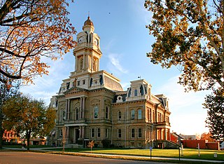
<span class="mw-page-title-main">Madison County, Ohio</span> County in Ohio, United States

Madison County is a county located in the central portion of the U.S. state of Ohio. As of the 2020 census, the population was 43,824. Its county seat is London. The county is named for James Madison, President of the United States and was established on March 1, 1810.

<span class="mw-page-title-main">Thomas County, Georgia</span> County in Georgia, United States

Thomas County is a county located in the U.S. state of Georgia. As of the 2020 census the population was 45,798. The county seat is Thomasville. Thomas County comprises the Thomasville, GA micropolitan statistical area.

<span class="mw-page-title-main">Monticello, Florida</span> City in Florida, United States

Monticello is the only city and the county seat of Jefferson County, Florida, United States. The city is named after Monticello, the estate of the county's namesake, Thomas Jefferson, on which the Jefferson County Courthouse was modeled. The population was 2,589 at the 2020 census.
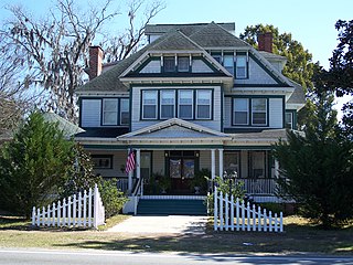
<span class="mw-page-title-main">Greenville, Florida</span> Town in the state of Florida, United States

Greenville is a town in Madison County, Florida, United States. The population was 746 at the 2020 census, down from 843 at the 2010 census.

<span class="mw-page-title-main">Fort Atkinson, Wisconsin</span> City in Wisconsin, United States

Fort Atkinson is a city in Jefferson County, Wisconsin, United States. It is on the Rock River, a few miles upstream from Lake Koshkonong. The population was 12,579 at the 2020 census. Fort Atkinson is the largest city located entirely in Jefferson County, as Watertown is split between Jefferson and Dodge counties. Fort Atkinson is a principal city of the Fort Atkinson-Watertown micropolitan statistical area which is in turn a sub-market of the larger Milwaukee-Waukesha-Racine CSA.

<span class="mw-page-title-main">Wacissa, Florida</span> Census-designated place in Florida, United States

Wacissa is a small unincorporated community and census-designated place (CDP) in Jefferson County, Florida, United States. As of the 2020 census, the population was 362. It shares its name with the Wacissa River, the headwaters of which are about one mile to the south.

<span class="mw-page-title-main">Aucilla River</span> River in Florida and Georgia, United States

The Aucilla River rises in Brooks County, Georgia, USA, close to Thomasville, and passes through the Big Bend region of Florida, emptying into the Gulf of Mexico at Apalachee Bay. Some early maps called it the Ocilla River. It is 89 miles (143 km) long and has a drainage basin of 747 square miles (1,930 km2). Tributaries include the Little Aucilla and Wacissa Rivers. In Florida, the Aucilla River forms the eastern border of Jefferson County, separating it from Madison County on the northern part, and from Taylor County to the south.

<span class="mw-page-title-main">Tallahassee metropolitan area</span> Metropolitan area in the United States

The Tallahassee Metropolitan Statistical area is the metropolitan area centered on Tallahassee, Florida.

Lamont is an unincorporated community and census-designated place (CDP) in Jefferson County, Florida, United States. As of the 2020 census,the population was 170.

Aucilla is an unincorporated community and census-designated place (CDP) in Jefferson County, Florida, United States, located near the intersection of county roads 158 and 257. As of the 2020 census, the population was 103.

<span class="mw-page-title-main">Big Bend (Florida)</span> Region of the state Florida, United States

The Big Bend of Florida, United States, is an informally named geographic region of North Florida where the Florida Panhandle transitions to the Florida Peninsula south and east of Tallahassee. The region is known for its vast woodlands and marshlands and its low population density relative to much of the state. The area is home to the largest single spring in the United States, the Alapaha Rise, and the longest surveyed underwater cave in the United States, the 32-mile (51 km) Wakulla-Leon Sinks cave system.

<span class="mw-page-title-main">Jefferson County, Florida paleontological sites</span>

The Jefferson County, Florida paleontological sites are assemblages of Mid-Miocene to Late Pleistocene vertebrates from Jefferson County, Florida, United States.

References

  1. "Census - Geography Profile: Jefferson County, Florida". United States Census Bureau . Retrieved December 25, 2022.
  2. "Find a County". National Association of Counties. Archived from the original on May 31, 2011. Retrieved June 7, 2011.
  3. "Most rural counties in Florida". Stacker. Stacker Media. Retrieved February 3, 2022.
  4. "Visit historic Jefferson County". Visit historic Jefferson County. Jefferson County Tourism Development Council. Retrieved February 3, 2022.
  5. Mahon, John K. (2017). History of the Second Seminole War, 1835-1842 (ePub ed.). Gainesville, FL: LibraryPress@UF. p. 5. ISBN   978-1-947372-26-9.
  6. Publications of the Florida Historical Society. Florida Historical Society. 1908. p. 32.
  7. "IRC Library:Fort Roger Jones". Archived from the original on March 16, 2013. Retrieved August 1, 2008.
  8. "US Gazetteer files: 2010, 2000, and 1990". United States Census Bureau. February 12, 2011. Retrieved April 23, 2011.
  9. "Annual Estimates of the Resident Population for Counties: April 1, 2020 to July 1, 2023". United States Census Bureau. Retrieved March 31, 2024.
  10. "U.S. Decennial Census". United States Census Bureau. Retrieved June 14, 2014.
  11. "Historical Census Browser". University of Virginia Library. Retrieved June 14, 2014.
  12. "Population of Counties by Decennial Census: 1900 to 1990". United States Census Bureau. Retrieved June 14, 2014.
  13. "Census 2000 PHC-T-4. Ranking Tables for Counties: 1990 and 2000" (PDF). United States Census Bureau. Retrieved June 14, 2014.
  14. "State & County QuickFacts". United States Census Bureau. Retrieved February 14, 2014.[ permanent dead link ]
  15. "Explore Census Data". data.census.gov. Retrieved March 7, 2022.
  16. "Explore Census Data". data.census.gov. Retrieved March 7, 2022.
  17. "U.S. Census website". United States Census Bureau . Retrieved May 14, 2011.
  18. Journal, Pensacola News. "Florida and Jefferson County Election Results: General". Pensacola News Journal. Retrieved June 19, 2019.
  19. Leip, David. "Dave Leip's Atlas of U.S. Presidential Elections". uselectionatlas.org. Retrieved June 15, 2018.
  20. "2020 CENSUS - SCHOOL DISTRICT REFERENCE MAP: Jefferson County, FL" (PDF). U.S. Census Bureau . Retrieved July 31, 2022. - Text list
  21. "Jefferson County RJ Bailar Public Library". jcpl.wildernesscoast.org. JEFFERSON COUNTY R.J. BAILAR PUBLIC LIBRARY. Retrieved February 22, 2024.

Constitutional Offices

Jefferson County Schools

Judicial Branch

Special Districts

30°25′N83°54′W / 30.42°N 83.90°W / 30.42; -83.90