
Egypt Lake-Leto is a census-designated place (CDP) in an unincorporated part of Hillsborough County, Florida, United States. The CDP is located just north of Tampa International Airport. It is part of the Tampa Bay area. As of the 2020 US census, the population had 36,644 residents.

Monticello is the only city and the county seat of Jefferson County, Florida, United States. The city is named after Monticello, the estate of the county's namesake, Thomas Jefferson, on which the Jefferson County Courthouse was modeled. The population was 2,589 at the 2020 census, up from 2,506 at the 2010 census. It is part of the Tallahassee, Florida Metropolitan Statistical Area.

Charleston Park is an unincorporated community and census-designated place (CDP) in Lee County, Florida, United States. The population was 235 at the 2020 census, up from 218 at the 2010 census. It is part of the Cape Coral-Fort Myers, Florida Metropolitan Statistical Area.
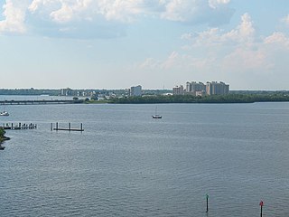
North Fort Myers is an unincorporated area and census-designated place (CDP) in Lee County, Florida, United States. The population was 42,719 at the 2020 census, up from 39,407 at the 2010 census. It is part of the Cape Coral-Fort Myers, Florida Metropolitan Statistical Area.

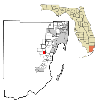
Country Club is a suburban census-designated place located in northwest Miami-Dade County, Florida, United States. It is located in the Miami metropolitan area of South Florida. The CDP is named after the Country Club of Miami, which was established in 1961 in what was then an unpopulated and undeveloped section of the county. The population was 49,967 at the 2020 census, up from 3,408 in 1990.

Homestead Base is a census-designated place (CDP) in Miami-Dade County, Florida, United States. The CDP comprises the extent of Homestead Air Reserve Base plus some surrounding land. It is part of the Miami metropolitan area of South Florida. The population was 999 at the 2020 census.

Ives Estates is a census-designated place (CDP) in Miami-Dade County, Florida. It is part of the Miami metropolitan area of South Florida. The population was 25,005 at the 2020 census, up from 19,525 in 2010.

Leisure City is an unincorporated community and census-designated place (CDP) in Miami-Dade County, Florida, United States, that includes the smaller, older community of Modello in its northwestern section. The CDP is most notable for the Coral Castle Museum, located in the Modello area. It is located in the Miami metropolitan area of South Florida. The population was 26,324 at the 2020 census, up from 22,655 in 2010.

Palmetto Estates is an unincorporated area and census-designated place (CDP) in Miami-Dade County, Florida, United States. It is part of the Miami metropolitan area of South Florida. The population was 13,498 at the 2020 census.

Sunset is a census-designated place (CDP) in Miami-Dade County, Florida, United States. It is part of the Miami metropolitan area of South Florida. The population was 15,912 at the 2020 census. The U.S. Postal Service uses the ZIP Codes of 33173 and 33183 for Sunset.

The Crossings is a census-designated place (CDP) and suburb of Miami in Miami-Dade County, Florida, United States. It is part of the Miami metropolitan area of South Florida. The CDP includes the neighborhoods of The Crossings, Devon Aire, and Calusa. The population was 23,276 at the 2020 census.
Three Lakes is a census-designated place (CDP) and planned community in Miami-Dade County, Florida, United States. It is part of the Miami metropolitan area of South Florida. The population was 16,540 at the 2020 census, up from 15,047 in 2010.

West Perrine is a census-designated place (CDP) in Miami-Dade County, Florida, United States. It is part of the Miami metropolitan area of South Florida. The population was 10,602 at the 2020 census, up from 9,460 in 2010.

Westview is a census-designated place (CDP) in Miami-Dade County, Florida, United States. It is part of the Miami metropolitan area of South Florida. The population was 9,923 at the 2020 census.

South Miami Heights is a census-designated place (CDP), originally known as Eureka, in Miami-Dade County, Florida. It is part of the Miami metropolitan area of South Florida. The population was 36,770 as of the 2020 census.

Wacissa is a small unincorporated community and census-designated place (CDP) in Jefferson County, Florida, United States. As of the 2020 census, the population was 362, down from 386 at the 2010 census. It is part of the Tallahassee, Florida Metropolitan Statistical Area. It shares its name with the Wacissa River, the headwaters of which are about one mile to the south.

Lloyd is a small unincorporated community and census-designated place (CDP) in Jefferson County, Florida, United States. As of the 2020 census, the population was 187, down from 215 at the 2010 census. It is part of the Tallahassee, Florida Metropolitan Statistical Area.
University is a census-designated place (CDP) and unincorporated community in Orange County, Florida, United States, east of Orlando. The community is centered around the University of Central Florida and includes a location on its south side known as University Park. It is part of the Orlando–Kissimmee–Sanford, Florida Metropolitan Statistical Area. As of 2020, the CDP had a population of 45,284.
Lamont is an unincorporated community and census-designated place (CDP) in Jefferson County, Florida, United States. As of the 2020 census,the population was 170, down from 178 at the 2010 census. It is part of the Tallahassee, Florida Metropolitan Statistical Area.
Raleigh is a census-designated place (CDP) in Levy County, Florida, United States. The population was 373 at the 2010 census.


