Putnam County, Florida

Last updated

Putnam County
PutnamCCourtPalatka.JPG
Seal of Putnam County, Florida.png
Map of Florida highlighting Putnam County.svg
Location within the U.S. state of Florida
Florida in United States.svg
Florida's location within the U.S.
Coordinates: 29°37′N81°44′W / 29.61°N 81.74°W / 29.61; -81.74
CountryFlag of the United States.svg United States
StateFlag of Florida.svg  Florida
FoundedJanuary 18, 1849
Named for Benjamin A. Putnam
Seat Palatka
Largest cityPalatka
Area
  Total827 sq mi (2,140 km2)
  Land728 sq mi (1,890 km2)
  Water99 sq mi (260 km2)  12.0%
Population
 (2020)
  Total73,321 [1]
  Density101/sq mi (39/km2)
Time zone UTC−5 (Eastern)
  Summer (DST) UTC−4 (EDT)
Congressional district 6th
Website main.putnam-fl.com

Putnam County is a county located in the northern part of the state of Florida. As of the 2020 census, the population was 73,321. [2] Its county seat is Palatka. [3]

Contents

Putnam County comprises the Palatka, FL Micropolitan Statistical Area, which is included in the Jacksonville-St. Marys-Palatka, FL-GA Combined Statistical Area. The county is centrally located between Jacksonville, Gainesville, St. Augustine, and Daytona Beach.

History

Putnam County was created in 1849. [4] It was Florida's 28th county created from parts of St. Johns, Alachua, Orange, Duval, and Marion counties. The county was named for Benjamin A. Putnam, who was an officer in the First Seminole War, a lawyer, Florida legislator, and the first president of the Florida Historical Society. The Putnam County Historical Society has determined that Benjamin A. Putnam is the grandson of Israel Putnam, for whom other counties and places in the United States are named. [5] Benjamin A. Putnam died in the county seat of Palatka in 1869.

Geography

According to the U.S. Census Bureau, the county has a total area of 827 square miles (2,140 km2), of which 728 square miles (1,890 km2) is land and 99 square miles (260 km2) (12.0%) is water. [6]

The county contains various sinkhole lakes such as Lake Barco and Lake Suggs, where unconsolidated deposits on the surface have slumped into the highly soluble limestone of the upper Floridan aquifer. [7]

Adjacent counties

National protected area

State Park

Demographics

Historical population
CensusPop.Note
1850 687
1860 2,712294.8%
1870 3,82140.9%
1880 6,26163.9%
1890 11,18678.7%
1900 11,6414.1%
1910 13,09612.5%
1920 14,56811.2%
1930 18,09624.2%
1940 18,6983.3%
1950 23,61526.3%
1960 32,21236.4%
1970 36,29012.7%
1980 50,54939.3%
1990 65,07028.7%
2000 70,4238.2%
2010 74,3645.6%
2020 73,321−1.4%
2023 (est.)75,955 [8] 3.6%
U.S. Decennial Census [9]
1790–1960 [10] 1900–1990 [11]
1990–2000 [12] 2010–2019 [2]
Putnam County racial composition as of 2020
(NH = Non-Hispanic) [lower-alpha 1]
RacePop 2010 [15] Pop 2020 [16] % 2010% 2020
White (NH)53,98150,54172.59%68.93%
Black or African American (NH)11,84211,27415.92%15.38%
Native American or Alaska Native (NH)2712800.36%0.38%
Asian (NH)4444690.6%0.64%
Pacific Islander (NH)36370.05%0.05%
Some Other Race (NH)802480.11%0.34%
Mixed/Multi-Racial (NH)1,0042,6561.35%3.62%
Hispanic or Latino 6,7067,8169.02%10.66%
Total74,36473,321100.00%100.00%

As of the 2020 United States census, there were 73,321 people, 29,822 households, and 18,179 families residing in the county.

As of the 2000 United States Census [17] there were 70,423 people, 27,839 households, and 19,459 families residing in the county. The population density was 98 people per square mile (38 people/km2). There were 33,870 housing units at an average density of 47 per square mile (18/km2). The racial makeup of the county was 77.91% White, 17.04% Black or African American, 0.42% Native American, 0.44% Asian, 0.04% Pacific Islander, 2.94% from other races, and 1.20% from two or more races. 5.92% of the population were Hispanic or Latino of any race.

There were 27,839 households, out of which 28.10% had children under the age of 18 living with them, 52.80% were married couples living together, 12.90% had a female householder with no husband present, and 30.10% were non-families. 25.10% of all households were made up of individuals, and 11.90% had someone living alone who was 65 years of age or older. The average household size was 2.48 and the average family size was 2.95.

In the county, the age distribution of the population shows 24.60% under the age of 18, 7.70% from 18 to 24, 24.20% from 25 to 44, 25.10% from 45 to 64, and 18.50% who were 65 years of age or older. The median age was 40 years. For every 100 females there were 97.60 males. For every 100 females age 18 and over, there were 94.20 males.

The median income for a household in the county was $28,180, and the median income for a family was $34,499. Males had a median income of $29,975 versus $20,955 for females. The per capita income for the county was $15,603. About 15.80% of families and 20.90% of the population were below the poverty line, including 30.60% of those under age 18 and 13.10% of those age 65 or over.

Ancestry/ethnicity

As of 2017 the largest self-reported ethnic/ancestry groups in Putnam County, Florida are: [18]

Largest ancestries (2017)Percent
English 20.0%
German 9.5%
Irish 8.2%
"American" 8.0%
Polish 2.2%
Scottish 2.0%
Spaniard 1.7%
Scots-Irish 1.3%
Dutch 1.0%
Scottish 2.9%
Swedish 0.8%

[18]

Education

The main campus of St. Johns River State College is located in Palatka (the county seat). First Coast Technical College is public, post secondary vocational school with a campus in Palatka.

When in November 2022 a former Putnam County school resource deputy was accused of sneaking into a student's home to sexually batter her while her mom was at work or asleep, and asking her to dress up as a younger child and call him “daddy”, starting when she was 15 years of age, it was announced that the Florida Criminal Justice Standards & Training Commission would review the case. [19] The case was sent to the commission by the Putnam County Sheriff, who was seeking to have the deputy's certification as a law enforcement officer permanently revoked. [20]

Libraries

Putnam County is served by the Putnam County Library System which has five branches:

Communities

Cities

Towns

Census-designated place

Other unincorporated communities

Politics

United States presidential election results for Putnam County, Florida [21]
Year Republican Democratic Third party
No.%No.%No.%
2020 25,51470.05%10,52728.90%3811.05%
2016 22,13866.48%10,09430.31%1,0693.21%
2012 19,32661.50%11,66737.13%4311.37%
2008 19,63759.01%13,23639.77%4061.22%
2004 18,31159.12%12,41240.07%2500.81%
2000 13,45751.29%12,10746.14%6752.57%
1996 9,78638.91%12,01047.75%3,35613.34%
1992 8,91034.72%10,70941.73%6,04223.55%
1988 11,62457.24%8,57542.23%1080.53%
1984 11,43559.37%7,82340.61%40.02%
1980 8,27346.67%8,90650.24%5483.09%
1976 5,04034.03%9,59764.81%1721.16%
1972 8,74174.61%2,90124.76%740.63%
1968 2,95526.80%2,92026.49%5,15046.71%
1964 5,07250.38%4,99549.62%00.00%
1960 4,23648.72%4,45951.28%00.00%
1956 4,21256.58%3,23243.42%00.00%
1952 3,76651.65%3,52548.35%00.00%
1948 1,43529.68%1,94740.27%1,45330.05%
1944 1,16328.44%2,92671.56%00.00%
1940 1,00822.47%3,47777.53%00.00%
1936 97526.47%2,70973.53%00.00%
1932 91128.29%2,30971.71%00.00%
1928 2,10563.01%1,15634.60%802.39%
1924 57435.13%88954.41%17110.47%
1920 1,18140.51%1,55753.41%1776.07%
1916 41828.67%87960.29%16111.04%
1912 22919.51%77465.93%17114.57%
1908 45430.88%79754.22%21914.90%
1904 21025.83%56269.13%415.04%

Voter registration

According to the Secretary of State's office, Republicans are a plurality of registered voters in Putnam County.

Putnam County Voter Registration & Party Enrollment as of July 31, 2022 [22]
Political PartyTotal VotersPercentage
Republican 24,09247.92%
Democratic 15,51630.86%
No party affiliation9,99019.87%
Minor parties6731.34%
Total50,271100.00%

Transportation

Airports

Highways

Rail transport

The historic Old Atlantic Coast Line Union Depot is the current Amtrak station in Palatka for Putnam County along the CSX Sanford Subdivision. Originally the station not only served the Atlantic Coast Line Railroad but also served the Seaboard Air Line Railroad, the Southern Railway, Florida East Coast Railroad, and the Ocklawaha Valley Railroad. Additionally, the Edgar Spur of the CSX Wildwood Subdivision enters the western edge of the county from Alachua County.

Notable people

See also

Notes

  1. Note: the US Census treats Hispanic/Latino as an ethnic category. This table excludes Latinos from the racial categories and assigns them to a separate category. Hispanics/Latinos can be of any race. [13] [14]

Related Research Articles

<span class="mw-page-title-main">Clay County, Florida</span> County in Florida, United States

Clay County is located in the northeastern part of the U.S. state of Florida along the west bank of the St. Johns River. As of 2020, the population was 218,245 and in 2023, that number increased to 232,439, making it the third largest county in the Jacksonville metropolitan area. While most of the county is unincorporated, there are 4 municipalities with Green Cove Springs being the county seat and the unincorporated Lakeside CDP being the largest place. It is named in honor of Henry Clay, a famous American statesman, member of the United States Senate from Kentucky, and United States Secretary of State in the 19th century.

<span class="mw-page-title-main">Marion County, Florida</span> County in Florida, United States

Marion County is located in the North Central region of the U.S. state of Florida. As of the 2020 census, the population was 375,908. Its county seat is Ocala.

<span class="mw-page-title-main">Alachua County, Florida</span> County in Florida, United States

Alachua County is a county in the north central portion of the U.S. state of Florida. As of the 2020 census, the population was 278,468. The county seat is Gainesville, the home of the University of Florida since 1906, when the campus opened with 106 students.

<span class="mw-page-title-main">Duval County, Florida</span> County in Florida, United States

Duval County is in the northeastern part of the U.S. state of Florida. As of July 2022, the population was 1,016,536, up from 864,263 in 2010. It is Florida's sixth-most populous county. Its county seat is Jacksonville, with which the Duval County government has been consolidated since 1968. Duval County was established in 1822, and is named for William Pope Duval, Governor of Florida Territory from 1822 to 1834. Duval County is the central county of the Jacksonville Metropolitan Statistical Area.

<span class="mw-page-title-main">Flagler County, Florida</span> County in Florida, United States

Flagler County is a county located in the northeastern portion of the U.S. state of Florida. As of the 2020 census, the population was 115,378. Its county seat is Bunnell, and the largest city is Palm Coast. Created in 1917 from portions of Saint Johns and Volusia Counties, it was named for Henry Flagler, who built the Florida East Coast Railway.

<span class="mw-page-title-main">Levy County, Florida</span> County in Florida, United States

Levy County is a county located on the Gulf coast in the northwestern part of the U.S. state of Florida. As of the 2020 census, the population was 42,915. Its county seat is Bronson.

<span class="mw-page-title-main">St. Johns County, Florida</span> County in Florida, United States

St. Johns County is a county in the northeastern part of the U.S. state of Florida. As of the 2020 United States census, its population was 273,425. The county seat and most populous incorporated city is St. Augustine, although the nearby community, St. Johns, has a higher population. St. Johns County is part of the Jacksonville metropolitan area.

<span class="mw-page-title-main">Alachua, Florida</span> City in Florida, United States

Alachua is the second-largest city in Alachua County, Florida and the third-largest in North Central Florida. According to the 2020 census, the city's population was 10,574. Alachua has one of the largest bio and life sciences sectors in Florida and is the site for the Santa Fe College Perry Center for Emerging Technologies.

<span class="mw-page-title-main">Gainesville, Florida</span> City in Florida, United States

Gainesville is the county seat of Alachua County, Florida, and the most populous city in North Central Florida, with a population of 145,214 in 2022. It is the principal city of the Gainesville metropolitan area, which had a population of 339,247 in 2020.

<span class="mw-page-title-main">Hawthorne, Florida</span> City in Florida, United States

Hawthorne is a city in Alachua County, Florida, United States, incorporated in 1881. Indigenous peoples of the Americas had been living in the area since around 100 CE; Hawthorne grew around their trading trails. Throughout its history, Hawthorne has been known for its agriculture, railroad, and rural lifestyle. Hawthorne's population was 1,478 at the 2020 census, with an area of 7.38 sq mi (19.1 km2).

<span class="mw-page-title-main">High Springs, Florida</span> City in Florida, United States of America

High Springs is a city in Alachua County, Florida, United States. It is the fourth-largest city in Alachua County and seventh-largest in North Central Florida. The population was 6,215 at the 2020 census.

<span class="mw-page-title-main">LaCrosse, Florida</span> Town in the state of Florida, United States

LaCrosse is a town in Alachua County, Florida, 15 miles (24 km) north of Gainesville. The LaCrosse is part of the Gainesville metropolitan area. As of the 2020 US census, the town population was 316, down from 360 in 2000 US Census.

<span class="mw-page-title-main">Micanopy, Florida</span> Town in the state of Florida, United States

Micanopy is a town in Alachua County, Florida, United States, located south of Gainesville. It is part of the Gainesville metropolitan area. The population as of the 2020 census was 648.

<span class="mw-page-title-main">Bunnell, Florida</span> City in Florida, United States

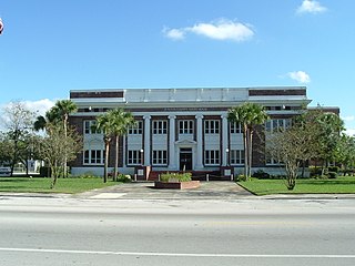
Bunnell is the county seat of Flagler County Florida, United States, with a population of 3,276 at the 2020 census. The city is part of the Deltona–Daytona Beach–Ormond Beach, FL metropolitan statistical area and is named after an early resident, Alvah A. Bunnell, a shingle maker and supplier of wood to the area's fledgling rail industry.

<span class="mw-page-title-main">East Palatka, Florida</span> CDP in Florida, United States

East Palatka is a census-designated place (CDP) in Putnam County, Florida, United States. It is located on the east side of the City of Palatka at the intersection of U.S. Route 17/State Road 20/State Road 100 and the southwestern terminus of State Road 207. The population was 1,654 at the 2010 census.

<span class="mw-page-title-main">Palatka, Florida</span> City in Florida, United States

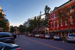
Palatka is a city in and the county seat of Putnam County, Florida, United States. Palatka is the principal city of the Palatka Micropolitan Statistical Area, which is home to 72,893 residents. With the Palatka micro area being less than 40 miles south of Jacksonville, it is a part of the Jacksonville Combined Statistical Area. The city is also home to St. Johns River State College, St. Johns River Water Management District Headquarters, and Ravine Gardens State Park. The area is well known for its local festivals, most notably the Florida Azalea Festival and the Blue Crab Festival. The population was 10,446 at the 2020 census.

<span class="mw-page-title-main">Hastings, Florida</span> Town in the state of Florida, United States

Hastings is an unincorporated census-designated place and agricultural center in St. Johns County, Florida, United States, 18 miles (29 km) southwest of St. Augustine. It was formerly an incorporated town, but it was dissolved in 2018 after a vote by residents. The population was 1,262 at the 2020 census.

<span class="mw-page-title-main">Florida State Road 100</span> Highway in Florida

State Road 100 is a 153-mile-long (246 km) east–west highway serving northeast Florida. Its western terminus is at the Georgia-Florida border four miles (6.4 km) north of Avoca, Florida ; its eastern terminus is an intersection with Shore Scenic Highway in Flagler Beach. The portion west of Lake City is only signed as portions of US 41 and US 129, both of which run north–south.

<span class="mw-page-title-main">Florida State Road 20</span> Highway in Florida

State Road 20 is a 358.154-mile-long (576.393 km) east-to-west route across northern Florida and the Florida Panhandle in the United States.

<span class="mw-page-title-main">Jacksonville metropolitan area</span> Metropolitan Statistical Area in the United States

The Jacksonville Metropolitan Area, also called the First Coast, Metro Jacksonville, or Northeast Florida, is the metropolitan area centered on the principal city of Jacksonville, Florida and including the First Coast of North Florida. As of the 2020 United States census, the total population was 1,605,848. The Jacksonville–Kingsland–Palatka, FL–GA Combined Statistical Area (CSA) had a population of 1,733,937 in 2020 and was the 34th largest CSA in the United States. The Jacksonville metropolitan area is the 40th largest in the country and the fourth largest in the State of Florida, behind the Miami, Tampa, and Orlando metropolitan areas.

References

  1. "U.S. Census Bureau QuickFacts: Putnam County, Florida". Archived from the original on June 21, 2018. Retrieved June 21, 2018.
  2. 1 2 "State & County QuickFacts". United States Census Bureau. Retrieved February 14, 2014.[ permanent dead link ]
  3. "Find a County". National Association of Counties. Retrieved June 7, 2011.
  4. Publications of the Florida Historical Society. Florida Historical Society. 1908. p. 33.
  5. "The Naming of Our Putnam County". Archived from the original on October 23, 2012. Retrieved February 12, 2009. Family researcher Bill Putman appears to have made the link between Israel and Benjamin Alexander Putnam. One of Israel's sons was Benjamin Farley Putnam who was born in Danvers (Salem Village), Massachusetts on August 26, 1751. He served as a surgeon in the Revolutionary War and settled in Savannah before 1787. He was married to Ann Sophia Malcolm who was from Washington, D.C. They had two children who died young: John (1794) and Helen (1792). Their other children were Augustus H. (1792–1817), John Gustavus (1796–1864 in Madison, Florida), Charles E. (1797–1847), Caroline (1800–1839 in New Jersey), and our Benjamin Alexander Putnam.
  6. "US Gazetteer files: 2010, 2000, and 1990". United States Census Bureau. February 12, 2011. Retrieved April 23, 2011.
  7. Mueller, David K.; Helsel, Dennis R. (1996). "Field Studies of Karst Terrain". Circular. The Survey. p. 52. Retrieved July 22, 2013.
  8. "Annual Estimates of the Resident Population for Counties: April 1, 2020 to July 1, 2023". United States Census Bureau. Retrieved March 31, 2024.
  9. "U.S. Decennial Census". United States Census Bureau. Retrieved June 16, 2014.
  10. "Historical Census Browser". University of Virginia Library. Archived from the original on August 11, 2012. Retrieved June 16, 2014.
  11. "Population of Counties by Decennial Census: 1900 to 1990". United States Census Bureau. Retrieved June 16, 2014.
  12. "Census 2000 PHC-T-4. Ranking Tables for Counties: 1990 and 2000" (PDF). United States Census Bureau. Retrieved June 16, 2014.
  13. https://www.census.gov/ [ not specific enough to verify ]
  14. "About the Hispanic Population and its Origin". www.census.gov. Retrieved May 18, 2022.
  15. "Explore Census Data". data.census.gov. Retrieved May 27, 2022.
  16. "Explore Census Data". data.census.gov. Retrieved May 27, 2022.
  17. "U.S. Census website". United States Census Bureau . Retrieved May 14, 2011.
  18. 1 2 "American FactFinder - Results". Archived from the original on February 13, 2020. Retrieved May 26, 2019.
  19. Rachel Tucker (November 30, 2022). "Florida school resource deputy asked student to dress like young child, call him 'daddy': deputies". WKRG.
  20. "Former school resource officer charged with sexual battery of student in Putnam County". First Coast News. November 28, 2022.
  21. Leip, David. "Dave Leip's Atlas of U.S. Presidential Elections". uselectionatlas.org. Retrieved June 15, 2018.
  22. "Voter Registration - By County and Party". www.dos.myflorida.com. Retrieved August 22, 2022.

Government links/Constitutional offices

Special districts

Judicial branch

29°37′N81°44′W / 29.61°N 81.74°W / 29.61; -81.74