Florida State Road 19

Last updated

Florida 19.svg

State Road 19

Florida State Road 19
SR 19 highlighted in red
Route information
Maintained by FDOT
Length88.955 mi [1]  (143.159 km)
Major junctions
South endFlorida 33.svgFlorida 50.svg SR 33  / SR 50 in Groveland
Major intersectionsUS 441.svg US 441 in Tavares
CR 44 jct.svg CR 44 in Eustis
Florida 40.svg SR 40 in Ocala NF
North endUS 17.svg US 17 in Palatka
Location
Country United States
State Florida
Highway system
US 19.svg US 19 Florida A19A.svg SR A19A

State Road 19 (SR 19) is a Florida State Road in Putnam, Marion, and Lake counties. It runs from Groveland to Palatka through Ocala National Forest. Along with SR 33, SR 19 provides a mostly rural north-south corridor through central Florida from Lakeland to Palatka.

Contents

Route description

Groveland to Tavares

Southern terminus of SR 19 in Groveland South End FL 19 @ EB FL 50; Groveland.jpg
Southern terminus of SR 19 in Groveland

State Road 19 begins in Groveland at State Road 50 just west of the northern terminus of State Road 33, where SR 33 becomes a hidden state route concurrent with westbound SR 50 until it reaches Mascotte and becomes a county road. [2] SR 19 runs 6 miles (9.7 km) to the north and curves to the northeast before encountering a parclo interchange with US 27. The southbound on-off ramps lead directly to the southbound interchange with Florida's Turnpike. Later the road curves from northeast to northwest at the intersection of County Road 455 and then back to north at Quiet Cove Road before reaching Howey-in-the-Hills, where it adopts the name Palm Avenue. Here SR 19 meets the intersection of Revels Road and East Revels Road, the former of which is an insignificant dirt road, while the latter is a road that leads to the coast of Little Lake Harris. SR 19 then makes another right curve where it passes Taylor Memorial Cemetery and curves back north as it approaches the heart of town. The first site it approaches as it curves north is the Howey Academy on the southeast corner of South Palm Avenue and East Lakeview Avenue. The next major intersection is a blinker light at Central Avenue, which is near the local library and police station. Here, South Palm Avenue becomes North Paim Avenue, and West Central Boulevard becomes East Central Boulevard. After passing Citrus Avenue, and the historic Howey Mansion as it curves northwest, SR 19 serves as the eastern terminus of Former SR 48 and then turns right to cross over the Lake Harris Bridge, which divides Lake Harris from Little Lake Harris. From there, the road officially enters the Tavares City Limits, but the land surrounding the road doesn't. Along the way, SR 19 intersects such roads as County Road 448/North Eichelberger Road then becomes a four-lane divided highway where it serves as the northern terminus of County Road 561. From here the road runs along an abandoned railroad line that previously ran along CR 561, but both SR 19 and that former railroad line run along the west coast of Lake Dora.

By the time Tavares' territory is more spread out and includes more than just SR 19, it crosses a bridge over the Dead River just before the intersection with County Road 452 (West Main Street). CR 452 secretly joins SR 19 in a concurrency. The intersection of County Road Old 441 contains a rail trail on the south side, and serves as part of a wye intersection where northbound SR 19 joins southbound US 441 and eastbound SR 44 through the rest of Tavares where CR 452 branches off onto Lake Eustis Drive while US 441-SR 19-44 cross a bridge over Lake Juniata. Between Mount Homer Road and David Walker Drive, the triplex crosses into Eustis until it encounters an interchange where part of CR 19A terminates. US 441-SR 44 continue eastward, while SR 19 turns north at this interchange.

North of Tavares thru Ocala National Forest

Looking north across the SR 40 intersection SR 19 and 40 intersection north01.jpg
Looking north across the SR 40 intersection

Within Downtown Eustis, the SR 19 splits onto two separate one-way streets, Northbound SR 19 shifts onto Grove Street, while southbound SR 19 remains on Bay Street. Both the northbound and southbound segments are part of the Eustis Commercial Historic District. This split terminates just north of Laurel Oak Drive, and the road becomes a divided highway once again, with the first intersection being another segment of County Road 452. Here the road runs along the west side of Trout Lake for a short distance and well after that intersects CR 44A. The road remains 4 lanes wide through Dona Vista and then curves northeast where it crosses Lake Umatilla in Umatilla and the becomes a two lane highway at the south end of the concurrency with County Road 450 (West Ocala Street). An unusual note is that railroad tracks used to run down the median of the four lane road between the Florida's Favorite Orange Juice plant on the south side of Umatilla to the point where the road becomes two lanes. Here the old grade crossed the intersection and can be observed to the east of the two lane road. This passes the old depot which is now a library. Umatilla Boulevard begins on the northwest corner of this intersection and runs parallel to SR 19 until it reaches Lake Street. The right of way for a separate northbound lane utilizing the old railroad grade is clear evidence for a proposed widening of SR 19, with the grade being adjact to the highway to just south of Altoona where the grade diverges to the west. The concurrency ends at East Collins Street where CR 450 continues east and SR 19 continues north.

Even as it passes along the west side of Lake Pearl, the old railway grade right of way can be found until it finally diverges from SR 19 just south of Pittman. One clear sign the road is approaching Ocala National Forest is the U.S. Forest Services Ranger Station on the opposite side of the road. Immediately the road runs along the west side of Lake Gibson as the right-of-way for the northbound lane ends and one for a southbound lane begins. Along some tree farms, SR 19 crosses over from Umatilla to Altoona. In downtown Altoona, SR 19 intersects Former SR 42, and more than a dozen blocks later the road becomes a spur of the Florida Black Bear Scenic Byway [3] as it officially enters Ocala National Forest. The first segment of the forest is the Lake Dorr Recreational Area in Pittman. Within this area is the Pittman Visitor's Center. Further north, a dirt road runs northeast before SR 19 serves as the western terminus of County Road 445. Later National Forest Service Road 573 intersects the road at a northwest to southeast angle. SR 19 curves northeast again and then northwest as it approaches Sellers Lake and the intersection of County Road 445A near Astor Park, the last major intersection in Lake County. Soon enough, it passes the Beakman Lake Recreational Area, but beyond that point the rest of the surroundings consist of purely wilderness and occasional intersections with NFS dirt roads, as well as the U.S. Navy's Pinecastle Bombing Range. The road crosses the Lake-Marion County Line and serves as the southern terminus of the Backwoods Trail before intersecting SR 40 northwest of Wildcat Lake.

Marion County to Palatka

SR 19 over the Cross Florida Barge Canal, looking north SR 19 over barge canal N01.jpg
SR 19 over the Cross Florida Barge Canal, looking north

Continuing north of SR 40, the road takes a brief easterly turn where it crosses a bridge over Juniper Creek, but then turns north again to dominate the western shores of Lake George, which is part of the St. Johns River. From here it turns northwest, until it briefly becomes a two-lane divided highway at the intersection of County Road 314 (Salt Springs Highway) in Salt Springs, and then turns straight north again where it later intersects County Road 316 and Northeast 142nd Place Road. A frontage road can be found on the southwest corner of SR 19 and CR 316. After this intersection the road crosses the Marion-Putnam County Line. Somewhere north of here, deep within the forest, Backwoods Trail moves onto a National Forest Road, but the Black Bear Scenic Byway continues its concurrency with SR 19. Further north it runs along a bridge that crosses the Ocklawaha River and 3 miles (4.8 km) north of that bridge, the road climbs an embankment for a higher bridge over the Cross Florida Barge Canal. Upon descending the top of this bridge the road intersects CR 310 which secretly joins SR 19 as it turns northeast, leaving Ocala National Forest. Despite leaving Ocala National Forest, the area surrounding SR 19 remains mostly forest land for another 5 miles (8.0 km). After crossing the right-of-way for a series of power lines, [4] the forest thins out as road turns north momentarily then curves to the northeast again. Near Mud Lake, the road crosses the five-way intersection of Silver Lake Boulevard and Round Lake Road, CR 310 branches off to the southeast and Round Lake Road branches off to the north.

North of West Rellim Drive, the right-of-way for new eastbound lanes are exposed, then widens to a divided highway near the Palatka City Limits in the vicinity of the local Wal-Mart Supercenter. After the intersection of South Moody Road, SR 19 curves slightly north and SR 20 (Crill Avenue) is the first major intersection in Palatka. The road crosses two other intersections before reaching the Palatka Mall and descending slightly toward SR 100 (Reid Street). This is the last major intersection along SR 19, and all others north of here are side streets. After a slight curve to the right, it becomes easy to see the Seminole Electric Power Plant further to the north. As it passes by the Putnam County Sheriff's Office, and runs along the north side of an athletic field, SR 19 finally ends at the intersection of U.S. 17, which contains controlled ramps within the divider.

History

State Road 19 initially followed what is now mostly County Road 561 south to SR 50 (now CR Old 50) in Minneola. The current alignment of SR 19 south of Howey-in-the-Hills was State Road 459.

The segment north of the intersection with Silver Lake Road near Palatka was once part of the Ocklawaha Valley Railroad.

Until sometime in the 2010s,[ when? ] SR 19 shared a one block concurrency with westbound Former SR 42 in downtown Altoona.

Major intersections

CountyLocationmi [1] kmDestinationsNotes
Lake Groveland 0.0000.000South plate.svg
Florida 33.svg
East plate.svg
Florida 50.svg
SR 33 south / SR 50 east (West Orange Street) Clermont
0.0530.085North plate county.svg
CR 33 jct.svg
West plate.svg
Florida 50.svg
CR 33 north / SR 50 west (West Broad Street) Mascotte
1.9743.177East plate county.svg
CR 478 jct.svg
CR 478 east (Cherry Lake Road)
6.6810.75US 27.svgFlorida's Turnpike shield.svg US 27 (SR 25) / Florida's Turnpike (SR 91) Clermont, Leesburg interchange; Turnpike exit 285
9.43515.184South plate county.svg
CR 455 jct.svg
CR 455 south Montverde
Howey-in-the-Hills 13.35021.485West plate county.svg
CR 48 jct.svg
CR 48 west Okahumpka
14.275–
14.868
22.973–
23.928
Howey Bridge over Little Lake Harris
Tavares 16.66426.818East plate county.svg
CR 448 jct.svg
CR 448 east Lake Idamere Park
18.11029.145South plate county.svg
CR 561 jct.svg
CR 561 south Astatula
19.84931.944North plate.svg
Florida 500A.svg
South plate.svg
CR Old 441 jct.svg
SR 500A north / CR Old 441 south Leesburg, Mount Dora, Business District, Lake-Sumter State College
20.08532.324North plate.svg
US 441.svg
To plate.svg
West plate.svg
Florida 44.svg
US 441 north (SR 500) to SR 44 west Leesburg
south end of US 441 / SR 500 overlap
Eustis 23.23237.388South plate county.svg
CR 19A jct.svg
CR 19A south (Plaza Drive)
23.53 [5] 37.87South plate.svg
US 441.svg
South plate county.svg
CR 19A jct.svg
US 441 south (SR 500) / CR 19A south Mt. Dora, Apopka, Orlando
interchange; north end of US 441 / SR 500 overlap
25.70741.371To plate.svg
East plate.svg
Florida 44.svg
To SR 44 east / Orange Avenue DeLand
former SR 44 east
26.61542.833North plate county.svg
CR 452 jct.svg
CR 452 north
27.35444.022CR 44 jct.svg CR 44  DeLand, Orlando, Leesburg, Lake County Fair Grounds, bypass to SR 44 east / US 441 south
27.92744.944South plate county.svg
CR 19A jct.svg
CR 19A south
Umatilla 30.16148.539East plate county.svg
CR 450A jct.svg
CR 450A east
31.53450.749West plate county.svg
CR 450 jct.svg
CR 450 west (Ocala Street) Florida Elks Youth Camp
south end of CR 450 overlap
31.79651.171East plate county.svg
CR 450 jct.svg
CR 450 east (Collins Street East)
north end of CR 450 overlap
Altoona 34.22955.086CR 42 jct.svg CR 42  Weirsdale, Paisley, DeLand
Ocala NF 39.38763.387North plate county.svg
CR 445 jct.svg
CR 445 north Alexander Springs
44.91572.284North plate county.svg
CR 445A jct.svg
CR 445A north
Marion 48.78378.509Florida 40.svg SR 40  Ocala, Ormond Beach
Salt Springs 64.279103.447West plate county.svg
CR 314 jct.svg
CR 314 west Ocala, Hunter Ed. Center and Youth Camp
Ocala NF 65.241104.995West plate county.svg
CR 316 jct.svg
Forest Route 29.svg CR 316 west / FR 29 (Northeast 142nd Place Road) Fort McCoy, Fort Gates Ferry
Putnam 77.114–
77.621
124.103–
124.919
Bridge over Cross Florida Barge Canal
Rodman 77.821125.241West plate county.svg
CR 310 jct.svg
CR 310 west
Palatka 86.686139.508Florida 20.svg SR 20 (Crill Avenue) Interlachen, Palatka, Ravine Gardens State Park
87.926141.503Florida 100.svgAirport Sign.svg SR 100  Keystone Heights, Palatka, Airport
88.955143.159US 17.svg US 17 (SR 15) Green Cove Springs, East Palatka
1.000 mi = 1.609 km; 1.000 km = 0.621 mi

State Road 19 has two county suffixed routes, both of which are in Lake County

County Road 19A: Tavares-Mount Dora

Lake County 19A.svg

County Road 19A

Location Tavares-Mount Dora

County Road 19A is a county suffixed alternate route of State Road 19 between Tavares and western Mount Dora in Lake County in Florida, although neither of the termini is SR 19. The road begins at County Road Old 441, as Dora Avenue, which also runs south as a city street to County Road 452. North of CR Old 441, it shift further and further into a northeasterly direction. Skirting the border of Eustis, it makes a sharp left turn at Kurt Street. However, that designation is short-lived, because it turns right to briefly join U.S. Route 441-State Road 19-State Road 44 just west of the partial cloverleaf interchange where SR 19 breaks away from that multiplex. SR 19 turns north, while CR 19A turns south.

Though incorrectly listed on Google Maps as being part of Old 441, the segment south of US 441-SRs 19/44 is strictly part of CR 19A. After the intersection with Bay Road, CR 19A makes a curve to the east and ends at a convoluted intersection with both CR Old 441 and CR 44C in Mount Dora.

County Road 19A: Eustis

Lake County 19A.svg

County Road 19A

Location Eustis

The second County Road 19A is a county suffixed alternate route of State Road 19 in Eustis in Lake County in Florida. It runs straight north and south from CR 452 in the south, crosses County Road 44 and then turns at a southwest to northeast angle where it ends at State Road 19 in the north.

Related Research Articles

<span class="mw-page-title-main">Florida State Road 50</span> Highway in Florida

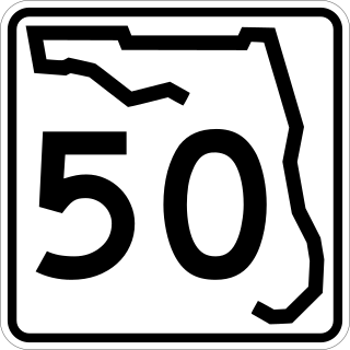
State Road 50 runs across the center of the U.S. state of Florida through Orlando, with its termini at SR 55 at Weeki Wachee and SR 5 in Titusville.

<span class="mw-page-title-main">Florida State Road 100</span> Highway in Florida

State Road 100 is a 153-mile-long (246 km) east–west highway serving northeast Florida. Its western terminus is at the Georgia-Florida border four miles (6.4 km) north of Avoca, Florida ; its eastern terminus is an intersection with Shore Scenic Highway in Flagler Beach. The portion west of Lake City is only signed as portions of US 41 and US 129, both of which run north–south.

<span class="mw-page-title-main">Florida State Road 20</span> Highway in Florida

State Road 20 is a 358.154-mile-long (576.393 km) east-to-west route across northern Florida and the Florida Panhandle in the United States.

<span class="mw-page-title-main">Florida State Road 40</span> Highway in Florida

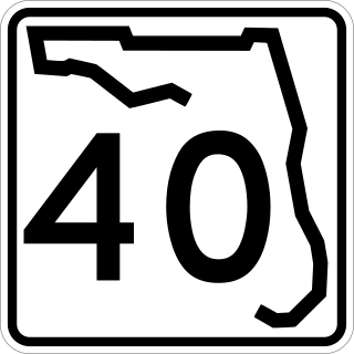
State Road 40 is a 91.832-mile-long (147.789 km) east–west route across northern and east-central Florida, running from U.S. Route 41 in Rainbow Lakes Estates eastwards through Ocala over the Ocklawaha River and bridge and through the heart of the Ocala National Forest to State Road A1A in Ormond Beach. Names of the road include Silver Springs Boulevard in Ocala, Fort Brooks Road from Silver Springs through Astor, Butler Road in Astor, and Granada Boulevard in Ormond Beach. Former sections in Ormond Beach are named "Old Tomoka Road" and "Old Tomoka Avenue."

<span class="mw-page-title-main">Florida State Road 44</span> Highway in Florida

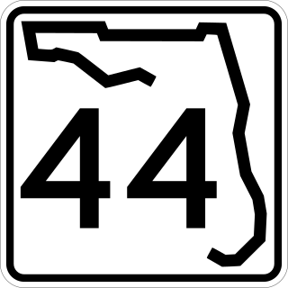
State Road 44 is an east–west state highway in the U.S. state of Florida. It runs from Crystal River on the Gulf of Mexico east to New Smyrna Beach on the Atlantic Ocean, passing through Inverness, Wildwood, Leesburg and DeLand.

<span class="mw-page-title-main">Florida State Road 46</span> Highway in Florida, United States

State Road 46 is an east–west route in central Florida, running from U.S. Route 441 in Mount Dora to US 1 in Mims. Along the way, it crosses the Wekiva River and, further east, the St. Johns River near the Econlockhatchee River.

<span class="mw-page-title-main">Florida State Road 6</span> State highway in Florida, United States

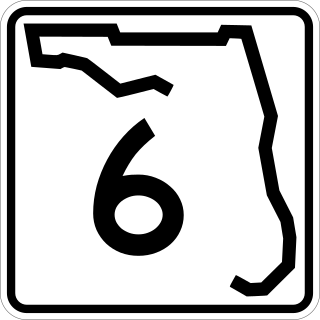
State Road 6 (SR 6) is an east–west route in Madison and Hamilton Counties, running from U.S. Route 90 (US 90) east of Madison to US 129 in Jasper, the last five miles (8 km) concurrent with US 41.

<span class="mw-page-title-main">Florida State Road 25</span> Highway in Florida

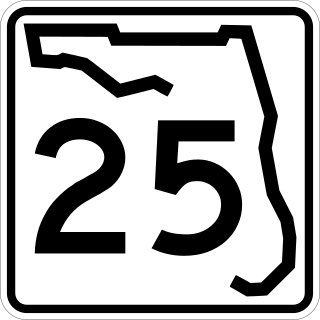
State Road 25 is a state highway in the U.S. state of Florida. It is mainly signed as U.S. Highways:

<span class="mw-page-title-main">U.S. Route 17 in Florida</span> Section of U.S. Highway in Florida, United States

U.S. Highway 17 (US 17) in Florida is a north–south United States Numbered Highway that runs 317 miles (510 km) from the Punta Gorda, Florida Metropolitan Statistical Area northeast to the Jacksonville metropolitan area.

<span class="mw-page-title-main">U.S. Route 27 in Florida</span> Section of U.S. Highway in Florida, United States

U.S. Route 27 (US 27) in Florida is a north–south United States Highway. It runs 496 miles (798 km) from the South Florida Metropolitan Area northwest to the Tallahassee Metropolitan Statistical Area. Throughout the state, US 27 has been designated the Claude Pepper Memorial Highway by the Florida Legislature. It was named after long-time Florida statesman Claude Pepper, who served in both the U.S. Senate and House of Representatives. The stretch running from Miami to South Bay was originally designated the Thomas E. Will Memorial Highway by the Florida Legislature in 1937 when that portion was known as Florida State Road 26. Will, the founder of Okeelanta, Florida, had worked for almost twenty years to get the state to build a road from Miami to the area south of Lake Okeechobee. For most of its length in the state, US 27 is a divided highway.

<span class="mw-page-title-main">U.S. Route 41 in Florida</span> Highway in Florida

U.S. Highway 41 (US 41) in the state of Florida is a north–south United States Highway. It runs 479 miles (771 km) from Miami in South Florida northwest to the Georgia state line north of the Lake City area. Within the state, US 41 is paralleled by Interstate 75 (I-75) all the way from Miami to Georgia, and I-75 has largely supplanted US 41 as a major highway.

<span class="mw-page-title-main">U.S. Route 90 in Florida</span> United States historic place

U.S. Route 90 (US 90) in the state of Florida is the northernmost east–west United States Numbered Highway in the state. US 90 passes through the county seats of all 15 counties on its course in Florida, and it is also the road upon which many of the county courthouses are located. It is never more than six miles (9.7 km) from Interstate 10 (I-10) throughout the state. It runs as a two-lane highway through most of the sparsely populated inland areas of the Florida Panhandle, widening to four lanes through and near several towns. The speed limit is 55 mph (89 km/h) for all rural points west of Monticello, and it is 60 mph (97 km/h) on all rural points from where it enters Madison County as far as Glen St. Mary.

<span class="mw-page-title-main">U.S. Route 98 in Florida</span> Highway in Florida

U.S. Route 98 is a major east-west thoroughfare through the U.S. state of Florida. Spanning 670.959 miles (1,079.804 km), it connects Pensacola and the Alabama/Florida state line to the west with Palm Beach and the Atlantic coast in the east. It is the longest US road in Florida, as well as the longest US road in any state east of the Mississippi River.

<span class="mw-page-title-main">U.S. Route 301 in Florida</span> Highway in Florida

U.S. Route 301 in Florida runs from the Sarasota-Bradenton-Venice, Florida Metropolitan Statistical Area northeast to the Greater Jacksonville Metropolitan Area. The road is a spur of U.S. Route 1, which it intersects in Callahan.

<span class="mw-page-title-main">U.S. Route 441 in Florida</span> Highway in Florida

U.S. Route 441 (US 441) in Florida is a north–south United States Highway. It runs 433 miles (697 km) from Miami in South Florida northwest to Tennessee in the Rocky Top area.

<span class="mw-page-title-main">U.S. Route 441 in Georgia</span>

U.S. Route 441 (US 441) in the U.S. state of Georgia is a 354.2-mile-long (570.0 km) north–south United States Highway through the east-central portion of the state. It travels from the Florida state line near the Fargo city area to the North Carolina state line, in the northern part of Dillard. It is a spur route of US 41, although it has no intersections with its "parent" route within the state. It does have an intersection with another spur route of US 41 however, specifically US 341 in McRae–Helena.

<span class="mw-page-title-main">Florida State Road 464</span>

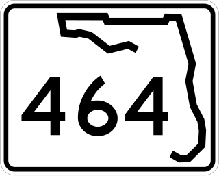
State Road 464 is a short state and county road in Marion County, Florida. The road is primarily in southern Ocala, but extends outside of the city limits.

<span class="mw-page-title-main">Florida State Road 235</span>

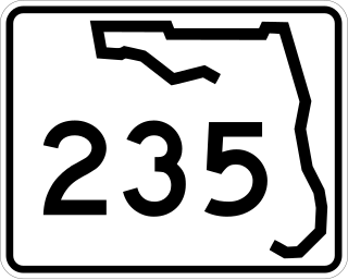
State Road 235 is a south–north state highway in Alachua County, Florida. It runs from U.S. Route 441 in Alachua to Brooker, and has county-maintained segments in Alachua and Bradford Counties, which were once part of SR 235.

<span class="mw-page-title-main">Special routes of U.S. Route 441</span>

A total of at least twelve special routes of U.S. Route 441 have existed, and at least three have been deleted. These special routes include alternate routes, business loops, truck routes, and bypass routes which connect to U.S. Route 441 in the US states of Florida, Georgia, North Carolina, and Tennessee.

References

  1. 1 2 FDOT straight line diagrams Archived March 6, 2014, at the Wayback Machine , accessed February 2014
  2. Google (July 11, 2011). "Map of SR 19" (Map). Google Maps . Google. Retrieved July 11, 2011.
  3. "Ocala National Forest - Black Bear Scenic Byway". USDA Forest Service.
  4. Location of Power Lines across State Road 19 south of Palatka (Google Maps scan)
  5. FDOT GIS data Archived 2008-12-11 at the Wayback Machine , accessed January 2014
Template:Attached KML/Florida State Road 19
KML is from Wikidata