Hurricane Eloise

Last updated
Map key
  Tropical depression (≤38 mph, ≤62 km/h)
  Tropical storm (39–73 mph, 63–118 km/h)
  Category 1 (74–95 mph, 119–153 km/h)
  Category 2 (96–110 mph, 154–177 km/h)
  Category 3 (111–129 mph, 178–208 km/h)
  Category 4 (130–156 mph, 209–251 km/h)
  Category 5 (≥157 mph, ≥252 km/h)
  Unknown
Storm type
Disc Plain black.svg Tropical cyclone
Solid black.svg Subtropical cyclone
ArrowUp.svg Extratropical cyclone, remnant low, tropical disturbance, or monsoon depression

The origins of Hurricane Eloise trace back to a tropical wave that emerged from the western coast of Africa on September 6, 1975. Satellite imagery indicated that the system was initially disjointed and poorly developed, although there was evidence of a low-level circulation. The disturbance tracked westward for several days as it slowly matured. On September 13, a ship called the Gulf Hansa recorded winds of around 25 mph (40 km/h) and 10 feet (3.0 m) seas in association with the system. Shortly thereafter, a reconnaissance aircraft found a center of circulation 575 miles (925 km) east of the Virgin Islands, and it is estimated that the storm became a tropical depression at 0600 UTC. [1] [2]

The depression continued moving towards the west as it gradually strengthened. On September 16, the system attained tropical storm status and was designated Eloise; [2] accordingly, the first advisory on the system was issued by the San Juan Weather Bureau office. While in the vicinity of a strengthening anticyclone aloft, Eloise became better organized, and the storm rapidly intensified and reached Category 1 hurricane status 18 hours after being named. The cyclone soon made landfall on the Dominican Republic, inhibiting further development. [1] Although initially predicted to remain north of land, the storm moved across northern Hispaniola and then tracked across southeastern Cuba. After 36 hours with much of its circulation over mountainous terrain, Eloise deteriorated to a tropical storm on September 17. [1]

The cyclone emerged over the open waters of the northern Caribbean on September 19, passing Jamaica to the north as it moved away from Cuba. Despite favorable upper-level conditions, its interaction with land—combined with the weakening of a ridge to the north—left the storm's center distorted. Eloise remained a fairly disorganized tropical storm until September 20, when it approached the Yucatan Peninsula and began to re-intensify. The storm crossed over the northern tip of the peninsula as it began to turn northward in response to an approaching trough. Between September 17 and September 21, however, reports on the storm were scarce, leading to uncertainty in its exact location and strength. Upon entering the Gulf of Mexico, Eloise quickly organized. The trough enhanced the wind divergence over the storm's center, [1] allowing it to strengthen once again to reach hurricane force about 345 miles (555 km) south of New Orleans, Louisiana. [2]

Rainfall totals in Puerto Rico and the U.S. Virgin Islands Eloise 1975 Puerto Rico rainfall.png
Rainfall totals in Puerto Rico and the U.S. Virgin Islands

On September 22, the cyclone intensified to attain Category 2 strength, and became a major hurricane of Category 3 status shortly thereafter as it turned towards the northeast. [2] Several ships penetrated the storm's center during its passage through the gulf. The hurricane also moved over two experimental buoys which recorded data on the storm, aiding meteorologists in their forecasts. [1] Hurricane Eloise continued to strengthen until it reached its peak winds of 125 mph (205 km/h) and a minimum barometric pressure of about 955 mbar (hPa; 28.2 inHg). [2] It moved ashore along the Florida Panhandle near Panama City on September 23. Shortly after making landfall, the hurricane rapidly degenerated. Just six hours later, it had weakened into a tropical storm, while situated over eastern Alabama. [1] It further weakened into a tropical depression at 0000 UTC on September 24. The depression transitioned into an extratropical storm over Virginia, and became indistinguishable by later that same day. The remnant moisture, however, merged with a weather front to produce widespread and heavy precipitation. [1] [2]

Preparations

In advance of Hurricane Eloise, warnings for heavy rainfall and potential flooding were issued for Puerto Rico and the Virgin Islands. A hurricane warning was declared for parts of the Dominican Republic about 12 hours before landfall. [1] A "hurricane emergency" was put into effect for the Oriente Province of Cuba, while a "state of alert" was issued for the Camagüey Province. Cubana de Aviación suspended all flights to Oriente. [3]

On and before September 15, there was still uncertainty as to whether Eloise would impact the United States. However, officials in Florida began taking precautionary measures. [4] When the storm entered the Gulf of Mexico, forecasters suggested that the storm would continue northward and strike the area near Mobile Bay. Contrary to predictions, by late on September 22, the storm had turned northeast, and some residents of Florida were still unaware of the storm's threat despite the issuance of hurricane warnings 24 hours in advance. [5] As a result, evacuations were delayed to an extent. [1] During the morning hours of September 23, civil preparedness workers drove through coastal towns with loudspeakers advising people to seek shelter. Due of the intensity of the approaching hurricane, evacuations along the coast were ultimately thorough, despite the initial delay. It was reported that 99% of Pensacola residents along the beach had left their homes, and overall, 100,000 people evacuated from areas in Louisiana through Florida. [5]

A statement issued by the National Weather Service advised people in nine Florida counties to complete hurricane preparations, which included securing loose objects and moving watercraft to safety. [6] Homes along the coast were boarded up by their owners, [7] while offshore, workers were removed from oil platforms. A spokesman for Royal Dutch Shell reported that 800 workers were to be evacuated. [8] In New Orleans, emergency equipment was readied and inspected. The New Orleans Levee Board went into a second-stage alert on September 21, and cleared debris from floodwall openings. [9]

Impact

Caribbean Sea

Hurricane Eloise
EloiseSeptember2219751700UTC.png
Eloise in the Gulf of Mexico before striking Florida
Storm deaths by region
RegionDirect deaths
Puerto Rico 34
Dominican Republic 7
Haiti 18
Florida4
United States, elsewhere17
Total80

As a weak tropical depression, the storm brought 5 to 10 inches (130 to 250 mm) of rainfall to portions of the Leeward Islands, including St. Kitts and St. Martin. More minor amounts of precipitation fell over the northernmost islands, and winds were light in these areas. [1]

Despite being only a tropical storm while passing by Puerto Rico, Eloise produced extreme amounts of rainfall on the island, peaking at 33.29 inches (846 mm) in Dos Bocas. Other totals of 10 to 20 inches (250 to 510 mm) were common. [10] The heavy rains resulted in severe flash flooding which killed 34 people, mostly from drownings, and left $60 million in damages. [11] Several hundred people were injured, and the storm forced over 6,000 residents from their homes. Dozens of towns and villages were flooded, though Utuado, with a population of 35,000 at the time, was hit the hardest. The situation in that town was described as a "total disaster"; four housing developments were under water, and dozens of vehicles were washed away. [12] The flood waters submerged thousands of miles of roads and put several bridges out-of-service. [13]

As the storm proceeded westward, it dropped heavy rainfall throughout eastern and southern Hispaniola. Widespread flooding impacted Haiti and the Dominican Republic, leaving a total of 25 people dead. Although the most intense winds remained offshore, a gust of 50 miles per hour (80 km/h) was recorded at Cape Engaño. [1] Puerto Plata on the northern coast of the Dominican Republic was also battered by high winds and heavy rain. Following the storm, electricity was turned off due to the danger of electrocutions. [13] Despite the storm's effects across Hispaniola and Puerto Rico, no monetary damage totals are available.

A beach house demolished by the hurricane Hurricane Eloise beach house2 damage.jpg
A beach house demolished by the hurricane

Rain and wind from the storm affected the southern Bahamas, Cuba, Jamaica, the Cayman Islands, and the northern Yucatan Peninsula. Since the storm was primarily weak while passing by these areas, no significant damage was reported. [1] Eloise brought torrential rainfall and winds of 20 mph (32 km/h) to the Guantanamo Bay Naval Base in southeastern Cuba, inflicting $65,000 in damage. Personnel on the base were moved to designated hurricane shelters in advance of the storm. [14]

Florida

Eloise came ashore along the coast of northern Florida as a Category 3 storm producing winds of 90 mph (140 km/h) with gusts that reached 155 mph (249 km/h). [1] Sustained winds were likely higher, but due to the sparsity of recording stations, few official records exist. The winds in the area were reportedly the strongest of the century. [5] Hurricane-force winds occurred from Fort Walton Beach through Panama City. Along the coast, tides ran 12 to 16 feet (3.7 to 4.9 m) above normal, peaking at 18 feet (5.5 m). Hurricane Eloise spawned several tornadoes as it pressed inland. [1] In general, rainfall ranged from 4 to 8 inches (100 to 200 mm); at the Eglin Air Force Base near Valparaiso, however, the hurricane dropped 14.9 inches (380 mm) of precipitation. [10] The heaviest rainfall was usually confined to northwest of the storm's track, and a number of locations to the east of Eloise's center picked up less than 1 inch (25 mm) of rain. [1]

Storm surge during Hurricane Eloise. Storm surge during hurricane eloise.jpg
Storm surge during Hurricane Eloise.

Damage from the hurricane was widespread. Fort Walton Beach, where hundreds of structures were damaged or destroyed, was hit particularly hard. In some areas, the storm surge washed away buildings demolished by the strong winds. The winds cleared certain locations of trees and buried properties and roads under sand. Throughout northwest Florida, an estimated 8,000 people suffered storm-related losses, and 500 businesses were completely destroyed. An article in the Tallahassee Democrat reported that "Cottages, motels, restaurants, convenience stores and other beach businesses were strewn across the highway in a tangle of down power poles, lines and busted mains." [5] A 2,100-acre (850 ha) shrimp farm at Panama City, the first of its kind, was effectively lost. The storm destroyed the farm's prospective initial harvest, 1,500,000 pounds (680,000 kg) of shrimp enclosed in a system of nets and enclosures. The president of the company described the subsequent events as six months of extreme turmoil in an effort to recover, followed by a quick and steady rebound. By the spring of 1976, the company became confident in financial success and full recovery. [11] [15]

Aerial view of the Florida Panhandle damage Hurricane Eloise Florida damage.jpg
Aerial view of the Florida Panhandle damage

The storm caused severe beach erosion in Bay County; approximately 801,000 cubic yards (612,000  m3 ) of sand was removed. [16] Storm-related changes in the coastal topography resulted in extensive structural damage in the Panama City Beach area. The most severe damage was concentrated in a 22 miles (35 km) area of the shore east of the hurricane's eye, and storm surge peaked in intensity for no more than a half hour according to preliminary estimates. Much of the resultant damage came as a result of foundation undermining, which was compared to that of the New England hurricane of 1938. Although Eloise was not abnormally strong, the geographicy setting and building standards in the area were blamed for the destruction of many homes and businesses. [17] Monetary losses from property damage in Panama City Beach alone totaled about $50 million. [18]

The first major storm to strike the region in 40 years, Hurricane Eloise did not directly kill anyone in the state of Florida. [19] However, four deaths of an indirect nature were attributed to the hurricane; [1] two of them were related to heart attacks. Numerous people sustained injuries, largely from broken glass or cleanup efforts. Overall property damage from the storm in Florida amounted to $150 million. [11] In the storm's aftermath, a study of the hurricane's effect on aquatic animals living in the swash zone (the immediate area where land and the ocean meet) of Panama City Beach was conducted. [18] The study concluded that compared to 11 consecutive months of data prior to the storm, the swash zone experienced a brief influx of animal species normally found offshore. However, the number decreased to near normal shortly thereafter. [18] Also along the shore, the hurricane dismantled or severely impaired several piers, including the total destruction of a 300 feet (91 m) extension of the Okaloosa Island Pier built just three years earlier and part of its original span. A fishing pier at St. Andrews State Park also suffered vast damage, along with another wooden pier at Mexico Beach and the M.B. Miller Pier at Panama City Beach, which lost its end section to the storm. [20]

Elsewhere in the United States

As the hurricane progressed inland, it passed over eastern Alabama, generating strong winds. A gust of 100 mph (160 km/h) was recorded northeast of Ozark. Winds elsewhere in the state ranged from around 35 mph (56 km/h) to 88 mph (142 km/h). Precipitation in Alabama peaked at 5.54 inches (141 mm). The high winds resulted in severe damage to property and crops, amounting to $100 million. [1] Eloise cut power and telephone service in the area, [21] and in Geneva County, several people sustained storm-related injuries. As in Florida, the weakening hurricane spawned a number of tornadoes in Alabama and Georgia. [22] Preliminary reports indicated that every county in southeastern Alabama received some damage from the storm. The strong winds uprooted trees and knocked down powerlines. Heavy rain associated with the storm caused a leak in the Alabama State Capitol building roof. [23] Gusty winds, moderate to heavy rainfall, and low pressures extended into Georgia, Louisiana, and to a lesser extent, Mississippi. [1]

Rainfall totals from Eloise in the United States Eloise 1975 rainfall.png
Rainfall totals from Eloise in the United States

The remnants of Eloise interacted with another weather system, producing widespread precipitation across the Eastern United States, including portions of the Ohio Valley, the Mid-Atlantic states, and New England. [10] The deluge was "almost continuous" during the period between September 22 and 26 according to a statement by the National Weather Service. [24] One of the highest rainfall totals in association with the storm occurred in Westminster, Maryland, where 14.23 inches (361 mm) of rain were recorded. Elsewhere, 7 to 10 inches (180 to 250 mm) or more of precipitation fell throughout parts of Pennsylvania, New Jersey, New York and Connecticut. At least 22 states received rainfall from Hurricane Eloise and its remnant moisture. [10] Nearby Hurricane Faye may have also contributed to the heavy rainfall, although this connection was never confirmed. [25] In Washington, D.C., 9.08 inches (231 mm) of rain contributed to the wettest September on record since 1934. [26] The excessive rainfall led to extensive flooding throughout the region, in some areas exceeding 50- to 100-year levels. [27]

Pennsylvania and New York bore the brunt of the flooding, which culminated in loss of life and severe property damage. [25] Along the central Southern Tier region of New York, the storm damaged or destroyed over 700 structures. [28] Flooding throughout the Northeastern United States disabled over a dozen water plants and at least 16 sewage treatment plants, prompting a boil-water advisory in Pennsylvania's capital city of Harrisburg. Infrastructure further south also suffered; in Maryland, the Monocacy River—a tributary of the Potomac—swelled to 14 feet (4.3 m) above flood stage, inundating the city of Frederick and compromising the city's supply of fresh drinking water. [24] A final downpour of rain on the night of September 25–26 led to an additional 4 inches (100 mm) of rain in central Maryland triggered severe flash flooding. In some cases, this onslaught affected the same areas that were still recovering from Hurricane Agnes several years earlier, including Ellicott City, Elkridge, and Laurel, where two major rivers breached their banks and engulfed nearby areas. Many homes and businesses were lost, along with numerous vehicles; in the aftermath, looters entered on boats to access the devastated cities. The floodgates at the Rocky Gorge Dam in Laurel were opened, forcing 500 residents downstream to leave their homes. [29]

The consequences of the flooding rains were the worst seen in areas of the interior Mid-Atlantic states since Agnes, and comparisons were often drawn between the two hurricanes. [24] In Pennsylvania alone, flooding from the remnants of Eloise forced 20,000 residents out of their homes; [30] thousands further south in the Washington, D.C. area, where severe flooding impacted the city's southern suburbs, [31] also fled to seek refuge. Further, many motorists throughout the region became stranded on highways inundated by floodwaters. [30] Four Mile Run and nearby streams overflowed and "tumbled through residential neighborhoods". Hundreds of families in the Alexandria and Arlington, Virginia area suffered flood-related losses. [31] Across the Northeastern U.S., the storm system killed 17 people and inflicted $300 million in damage. [25] An instance of a storm-induced fatality is the death of a man in White Plains, New York, who was killed by waters raging across the Hutchinson River Parkway. Agriculturally, the extended period of wet weather threatened a range of crops, including the Rhode Island apple crop, of which 35% was feared to have been destroyed, and corn and sweet potato fields in North Carolina. With ground too moist for farm machinery to operate on, harvests were postponed. [32]

Aftermath

Eloise in the Gulf of Mexico on September 22. Hurricane Eloise in Gulf on September 22.jpg
Eloise in the Gulf of Mexico on September 22.

After touring the disaster area, Florida Governor Reubin Askew noted, "I think we're going to have to take a long, close look at some of the construction [...] Some of the structures simply won't be able to be built back in the exact location where they were." [11] Governor Askew recruited 400 National Guard troops to prevent looting following the storm. [33] He also requested the initial declaration of five counties along the Florida panhandle as national disaster areas, and stated that he would consider adding two more counties. The declaration would make residents in the counties recognized as disaster areas eligible to receive federal aid. [34] Immediately following the storm, the mayor of Panama City criticized the state of Florida for failing to provide sufficient post-storm aid. [35] Despite the destruction, the storm reportedly had some economic benefits; in the midst of rebuilding and recovery, business grew, especially in and around Panama City, and people began to move into the area. [36] In at least one instance, the hurricane and its associated storm surge had a lasting effect on local geography, breaching Crooked Island in Bay County to create an inlet 0.75 miles (1.21 km) wide referred to as Eloise Inlet. [37] Eloise provided a comprehensive base of information on beach and dune erosion along the Florida panhandle, which aided in the programming of certain erosion prediction numerical models. In 1995, reports from the aftermath of Hurricane Opal created a more extensive collection of data. [38]

On September 26, President Gerald Ford approved the declaration for Florida, [39] and later issued a separate declaration for 30 counties in Pennsylvania as the storm's flooding rains progressed northward. [40] [41] Pennsylvania Lieutenant Governor Ernest Kline assigned 600 National Guardsmen to assist in the evacuation of flood victims and maintain security in storm-ravaged areas. [42] Over $430 million in federal disaster relief was spent overall in 1975 and distributed to 92,000 families; the bulk of the funds went to recovery for areas affected by Hurricane Eloise along its entire course. [43] In Maryland, Governor Marvin Mandel placed 10 of the state's 23 counties under a state of emergency. [24]

On account of the severe damage caused by the hurricane, the name Eloise was retired at the end of the 1975 season. It will never again be used to name a tropical storm in the Atlantic basin. [44] [45]

See also

Footnotes

  1. 1 2 3 4 5 6 7 8 9 10 11 12 13 14 15 16 17 18 Herbert, Paul (April 1976). "Atlantic Hurricane Season of 1975" (PDF). Monthly Weather Review. 104 (4). National Oceanic and Atmospheric Administration: 458–462. Bibcode:1976MWRv..104..453H. doi:10.1175/1520-0493(1976)104<0453:ahso>2.0.co;2. Archived from the original (PDF) on October 26, 2007. Retrieved November 10, 2009.
  2. 1 2 3 4 5 6 "Atlantic hurricane best track (HURDAT version 2)" (Database). United States National Hurricane Center. April 5, 2023. Retrieved April 5, 2024.PD-icon.svg This article incorporates text from this source, which is in the public domain.
  3. "Hurricane Eloise Heading For Cuba". Ocala Star-Banner. Associated Press. September 18, 1975. Retrieved November 10, 2009.
  4. "In The Nation". The Ledger. Associated Press. September 15, 1975. Retrieved November 10, 2009.[ permanent dead link ]
  5. 1 2 3 4 Barnes, pp. 240–241
  6. Masters, Kay (September 22, 1975). "Eloise Aims At Pensacola". The Evening Independent. Retrieved November 10, 2009.[ permanent dead link ]
  7. Staff Writer (September 22, 1975). "Hurricane Eloise Heads for Mobile and Pensacola". Los Angeles Times. Archived from the original on October 23, 2012. Retrieved November 10, 2009.
  8. Staff Writer (September 22, 1975). "Eloise threatens land". The Port Arthur News.
  9. Staff Writer (September 22, 1975). "Mobile-pensacola Coastal Areas Get Hurricane Alert". The Bryan Times. Archived from the original on January 8, 2016. Retrieved November 10, 2009.
  10. 1 2 3 4 Roth, David (October 3, 2006). "Hurricane Eloise - September 14–27, 1975". Hydrometeorological Prediction Center. Archived from the original on September 21, 2013. Retrieved November 10, 2009.
  11. 1 2 3 4 Barnes, pp. 239–240
  12. "Hurricane Eloise Storm Kills 25 In Puerto Rico; Slams Dominican Republic". The Evening Independent. Associated Press. September 17, 1975. Retrieved November 10, 2009.[ permanent dead link ]
  13. 1 2 "Hurricane Eloise slams Dominican". Daily Capital News. Associated Press. September 18, 1975.
  14. Pomfret, John. "The History of Guantanamo Bay, Vol. II 1964 - 1982". Naval Station Guantanamo Bay. Retrieved June 23, 2011.[ dead link ]
  15. Staff Writer (April 5, 1976). "Shrimp farm rebounding". St. Petersburg Times. Archived from the original on January 8, 2016. Retrieved June 21, 2011.
  16. Beaches and Shores Resource Center (July 1996). "Coastal Construction Control Line Review and Reestablishment Study for Bay County" (PDF). Florida State University. Archived from the original (PDF) on June 13, 2010. Retrieved November 10, 2009.
  17. Morton, Robert A. (1976). "Effects of Hurricane Eloise on beach and coastal structures, Florida Panhandle". Geology. 4 (5). Geological Society of America: 277–280. Bibcode:1976Geo.....4..277M. doi:10.1130/0091-7613(1976)4<277:EOHEOB>2.0.CO;2.
  18. 1 2 3 Saloman, C.H.; Naughton, S.P. (1977). "Effect of Hurricane Eloise on the Benthic Fauna of Panama City Beach, Florida, USA". Marine Biology. 42 (4). Springer Berlin / Heidelberg: 357–363. doi:10.1007/BF00402198. S2CID   85018248.
  19. "Hurricane Eloise Damage Checked". Ocala Star-Banner. Associated Press. September 24, 1975. Retrieved November 10, 2009.[ permanent dead link ]
  20. Clark, Ralph R. (May 2010). "Fishing Pier Design Guidance" (PDF). Florida Department of Environmental Protection. Archived from the original (PDF) on July 14, 2014. Retrieved June 23, 2011.
  21. "Timeline from USTC Founding to Present". Union Springs Telephone Service. Archived from the original on January 2, 2014. Retrieved November 10, 2009.
  22. "Hurricane Eloise starts to weaken". Daily Capital News. Associated Press. September 24, 1975.
  23. Staff Writer (September 24, 1975). "Eloise Throttles Florida And Then Soaks Alabama". Galveston Daily News.
  24. 1 2 3 4 Schwartz, p. 272
  25. 1 2 3 Barnes, p. 242
  26. David Roth (March 1, 2007). "Virginia's Hurricane History: Late Twentieth Century". Hydrometeorological Prediction Center. Archived from the original on November 10, 2006. Retrieved November 10, 2009.
  27. Kansas Water Science Center (September 17, 2008). "Summary of Significant Floods in the United States, Puerto Rico, and the Virgin Islands, 1970 Through 1989". U.S. Geological Survey. Archived from the original on January 2, 2014. Retrieved November 10, 2009.
  28. "Historic Floods In the Southern Tier Central Region of New York". Southern Tier Central. Archived from the original on July 18, 2014. Retrieved June 21, 2011.
  29. Schwartz, pp. 272–273
  30. 1 2 Staff Writer (September 27, 2011). "Bad weather". St. Petersburg Times. Archived from the original on January 8, 2016. Retrieved June 21, 2011.
  31. 1 2 Schwartz, p. 273
  32. Staff Writer (September 27, 1975). "Hurricane backlash swamps East Coast". Wilmington Morning Star. Archived from the original on January 8, 2016. Retrieved June 21, 2011.
  33. "Hurricane Eloise Damages Checked". Ocala Star-Banner. September 23, 1975. Archived from the original on January 8, 2016. Retrieved June 21, 2011.
  34. "U.S. Disaster Aid Sought For 5 Counties". Sarasota Herald-Tribune. September 26, 1976. Archived from the original on January 8, 2016. Retrieved June 21, 2011.
  35. "Hurricane-damage aid criticized". St. Petersburg Times. October 17, 1975.
  36. "Hurricane had benefits, residents say". St. Petersburg Times. September 28, 1976. Archived from the original on January 8, 2016. Retrieved June 21, 2011.
  37. Bay County 2005 Damage Assessment (PDF) (Report). Florida Department of Environmental Protection. 2005. p. 65. Archived from the original (PDF) on September 29, 2011. Retrieved June 23, 2011.
  38. Leadon, Mark (June 1999). "Beach, Dune and Offshore Profile Response to a Severe Storm Event" (PDF). Florida Department of Environmental Protection. p. 4. Archived from the original (PDF) on January 2, 2014. Retrieved June 23, 2011.
  39. "Panhandle to get federal storm aid". Boca Raton News. September 26, 1975. Retrieved November 10, 2009.[ permanent dead link ]
  40. "Rivers Still Rising, 20,000 Flee; Disaster Area Declared In State". The Pittsburgh Press. September 27, 1975. Archived from the original on January 8, 2016. Retrieved January 14, 2010.
  41. "30 Counties Disaster Areas; Floods Cover 150-Mile Zone". The Pittsburgh Press. September 28, 1975. Archived from the original on January 8, 2016. Retrieved June 21, 2011.
  42. "Kline calls up National Guard for flood help". Beaver County Times. September 26, 1975. Archived from the original on January 8, 2016. Retrieved June 21, 2011.
  43. "$433-million in disaster aid spent". St. Petersburg Times. January 3, 1976. Archived from the original on January 8, 2016. Retrieved June 21, 2011.
  44. "Tropical Cyclone Naming History and Retired Names". Miami, Florida: National Hurricane Center. Retrieved April 4, 2024.
  45. Calhoun, S. Brady (September 23, 2020). "Hurricane Eloise hit the Panhandle 45 years ago". Panama City, Florida: WMBB, Nexstar Media Group. Retrieved April 4, 2024.

Related Research Articles

<span class="mw-page-title-main">Hurricane Opal</span> Category 4 Atlantic hurricane in 1995

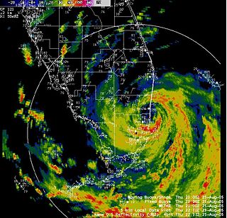
Hurricane Opal was a large and powerful Category 4 hurricane that caused severe and extensive damage along the northern Gulf Coast of the United States in October 1995. The fifteenth named storm, ninth hurricane and strongest tropical cyclone of the unusually active 1995 Atlantic hurricane season, Opal developed from the interaction of a tropical wave and a low-pressure area near the Yucatán Peninsula on September 27 as Tropical Depression Seventeen. The depression crossed the Yucatán Peninsula and intensified into a tropical storm on September 30. Opal intensified into a hurricane on October 2 after entering the Gulf of Mexico. The cyclone turned northeastward and strengthened significantly. By October 4, Opal was an intense 150 mph (240 km/h), Category 4 hurricane. With a minimum pressure of 916 mbar (hPa), Hurricane Opal was the most intense category 4 Atlantic hurricane on record. However, the cyclone abruptly weakened to a low-end Category 3 hurricane prior to making landfall on the Florida Panhandle near Pensacola later that day. The storm quickly unraveled as it moved inland and became extratropical on October 5. The remnants of Opal moved northward and dissipated over Ontario the following day.

<span class="mw-page-title-main">Hurricane Agnes</span> Category 1 Atlantic hurricane in 1972

Hurricane Agnes was the costliest hurricane to hit the United States at the time, causing an estimated $2.1 billion in damage. The hurricane's death toll was 128. The effects of Agnes were widespread, from the Caribbean to Canada, with much of the east coast of the United States affected. Damage was heaviest in Pennsylvania, where Agnes was the state's wettest tropical cyclone. Due to the significant effects, the name Agnes was retired in the spring of 1973.

<span class="mw-page-title-main">Hurricane Georges</span> Category 4 Atlantic hurricane in 1998

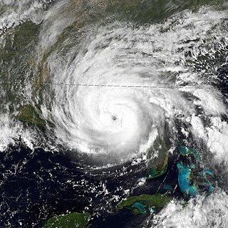
Hurricane Georges was a powerful and long-lived Cape Verde Category 4 hurricane which caused severe destruction as it traversed the Caribbean and Gulf of Mexico in September 1998, making seven landfalls along its path. Georges was the seventh tropical storm, fourth hurricane, and second major hurricane of the 1998 Atlantic hurricane season. It became the most destructive storm of the season, the costliest Atlantic hurricane since Hurricane Andrew in 1992 and remained the costliest until Hurricane Charley in 2004, and the deadliest since Hurricane Gordon in 1994. Georges killed 604 people, mainly on the island of Hispaniola, caused extensive damage resulting at just under $10 billion in damages and leaving nearly 500,000 people homeless in St. Kitts and Nevis, Puerto Rico, Hispaniola and Cuba.

<span class="mw-page-title-main">1975 Atlantic hurricane season</span> Hurricane season in the Atlantic Ocean

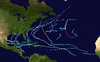
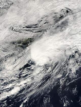
The 1975 Atlantic hurricane season was a near average hurricane season with nine named storms forming, of which six became hurricanes. Three of those six became major hurricanes, which are Category 3 or higher systems on the Saffir–Simpson scale. The season officially began on June 1 and lasted until November 30. These dates conventionally delimit the period of each year when most tropical cyclones form in the Atlantic Ocean.

<span class="mw-page-title-main">Hurricane Frederic</span> Category 4 Atlantic hurricane in 1979

Hurricane Frederic was an intense and damaging tropical cyclone that carved a path of destruction from the Lesser Antilles to Quebec, in particular devastating areas of the United States Gulf Coast. Though only five were killed directly, the US$1.77 billion in damage accrued by Frederic made it the Atlantic basin's costliest tropical cyclone on record at the time. Prior to its final landfall, the threat that Frederic imposed on areas of the U.S. Gulf Coast triggered a mass exodus from the region larger than any other evacuation in the past. While the storm primarily impacted the U.S. states of Mississippi and Alabama, lesser effects were felt throughout the Greater and Lesser Antilles, as well as inland North America.

<span class="mw-page-title-main">Tropical Storm Alberto (1994)</span> Atlantic tropical storm in 1994

Tropical Storm Alberto produced extensive and destructive flooding over portions of Alabama, Georgia, and Florida in July 1994. The first named storm of the annual hurricane season, Alberto developed from a tropical wave over the northwestern Caribbean Sea on June 30. Initially a tropical depression, the system moved westward, before curving northwestward on July 1 and entering the Gulf of Mexico. Early on the following day, the depression intensified into Tropical Storm Alberto. Alberto strengthened steadily over the Gulf of Mexico, and by midday on July 3, it peaked as a strong tropical storm with maximum sustained winds of 65 mph (100 km/h). A few hours later, the cyclone made landfall near Destin, Florida, at the same intensity. The system quickly weakened to a tropical depression early on July 4. Thereafter, a high pressure system caused Alberto to drift over west-central Georgia and central Alabama, until the storm dissipated over Alabama on July 7.

<span class="mw-page-title-main">Hurricane Kate (1985)</span> Category 3 Atlantic hurricane

Hurricane Kate was the final in a series of tropical cyclones to impact the United States during 1985. It was the eleventh named storm, seventh hurricane, and third major hurricane of the 1985 Atlantic hurricane season, Kate originated from the interaction of an upper-level trough and tropical wave northeast of Puerto Rico on November 15. Though the system tracked erratically during the first hours of its existence, the intensification of a region of high pressure to the cyclone's north caused Kate to turn westward. A favorable atmospheric pattern allowed the newly developed system to intensify to hurricane intensity on November 16, and further to Category 2 intensity three days later.

<span class="mw-page-title-main">Hurricane Gordon (2000)</span> Category 1 Atlantic hurricane in 2000

Hurricane Gordon caused minor damage in the Eastern United States. The seventh named storm and fourth hurricane of the 2000 Atlantic hurricane season, Gordon developed in the extreme western Caribbean Sea from a tropical wave on September 14. Shortly thereafter, the depression moved inland over the Yucatán Peninsula and later emerged into the Gulf of Mexico on September 15. The depression began to quickly organize, and by early on September 16, it was upgraded to Tropical Storm Gordon. After becoming a tropical storm, Gordon continued to intensify and was reclassified as a hurricane about 24 hours later; eventually, the storm peaked as an 80 mph (130 km/h) Category 1 hurricane. However, southwesterly upper-level winds caused Gordon to weaken as it approached land, and it was downgraded to a tropical storm by late on September 17. At 0300 UTC on September 18, Gordon made landfall near Cedar Key, Florida as a strong tropical storm. After moving inland, Gordon rapidly weakened and had deteriorated to tropical depression status by nine hours later. Later that day, Gordon merged with a frontal boundary while centered over Georgia.

<span class="mw-page-title-main">Tropical Storm Hanna (2002)</span> Atlantic tropical cyclone

Tropical Storm Hanna was a moderately strong tropical storm that affected the Gulf Coast and Southeastern regions of the United States. The ninth tropical cyclone and eighth named storm of the 2002 Atlantic hurricane season, Hanna formed through the complex interaction of a surface trough, a tropical wave, and an upper-level low pressure system, a disturbance in the upper atmosphere. Designated a tropical depression at 0000 UTC on September 12, the storm remained disorganized throughout its duration, though it attained tropical storm status and a peak intensity of 1,001 mbar (29.6 inHg), with winds of 60 miles per hour (100 km/h). Hanna crossed extreme southeastern Louisiana, and made a second landfall along the Alabama–Mississippi border.

<span class="mw-page-title-main">Tropical Storm Helene (2000)</span> Atlantic tropical storm in 2000

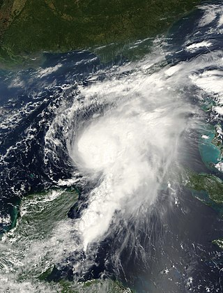
Tropical Storm Helene was a long-lived tropical cyclone that oscillated for ten days between a tropical wave and a 70 mph (110 km/h) tropical storm. It was the twelfth tropical cyclone and eighth tropical storm of the 2000 Atlantic hurricane season, forming on September 15 east of the Windward Islands. After degenerating into a tropical wave, the system produced flooding and mudslides in Puerto Rico. It reformed into a tropical depression on September 19 south of Cuba, and crossed the western portion of the island the next day while on the verge of dissipation. However, it intensified into a tropical storm in the Gulf of Mexico, reaching its peak intensity while approaching the northern Gulf Coast.

<span class="mw-page-title-main">Hurricane Florence (1988)</span> Category 1 Atlantic hurricane in 1988

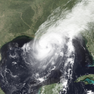
Hurricane Florence was the third of four named tropical cyclones to make landfall on the United States during the 1988 Atlantic hurricane season. The seventh tropical storm and second hurricane of the season, Florence developed on September 7 from an area of convection associated with a dissipating frontal trough in the southern Gulf of Mexico. After initially moving eastward, the storm turned northward and strengthened. Florence reached hurricane status and later peak winds of 80 mph (130 km/h) on September 9 shortly before striking southeastern Louisiana. The storm rapidly weakened over land and dissipated on September 11 over northeastern Texas.

<span class="mw-page-title-main">Hurricane Florence (1953)</span> Category 3 Atlantic hurricane in 1953

Hurricane Florence was a strong Atlantic hurricane that struck the Florida Panhandle in September of the 1953 season. The eighth storm and fifth hurricane of the season, Florence developed in the western Caribbean from a tropical wave near Jamaica on September 23. It produced heavy rainfall on the nearby island, and later caused damage in western Cuba. The storm quickly intensified into a hurricane over the Yucatán Channel, and as it moved north through the Gulf of Mexico, Florence's maximum sustained winds reached 125 mph (201 km/h). On September 26, the hurricane hit in a sparsely populated region of western Florida, and shortly after landfall became an extratropical cyclone.

<span class="mw-page-title-main">Effects of Hurricane Katrina in Florida</span>

The effects of Hurricane Katrina in Florida were in both the southern portion of the state and in the panhandle. After developing on August 23, Katrina made landfall near the border of Broward and Miami-Dade counties with 80 mph (130 km/h) winds on August 25. While it was crossing the state, the hurricane's convection was asymmetrical, primarily located to the south and east of the center. As a result, high rainfall totals occurred in the Miami area, peaking at 16.43 in (417 mm) in Perrine. The rains caused flooding, and the combination of rains and winds downed trees and power lines, leaving 1.45 million people without power. Damage in South Florida was estimated at $523 million (2005 USD), mostly as a result of crop damage. Further south, the hurricane spawned a tornado in the Florida Keys. In the island chain, Katrina caused heavy rainfall and gusty winds.

<span class="mw-page-title-main">Effects of Hurricane Isaac in Florida</span>

The effects of Hurricane Isaac in Florida were severe local flooding in South Florida and tornadoes in Central and Northern Florida in August 2012. Hurricane Isaac formed from a tropical wave while located east of the Lesser Antilles on August 21, 2012. The storm moved westward, crossed through the Leeward Islands, and entered the Caribbean Sea on August 22. Isaac initially struggled to intensify and defied predictions of it strengthening into a hurricane. The storm made its first landfall in Haiti as a midgrade tropical storm prior to making a second one in Cuba later that day. It remained somewhat disorganized while moving through the Straits of Florida and passed near the Florida Keys on August 27. The storm threatened to strike the Tampa Bay Area during the 2012 Republican National Convention and move ashore in the Florida Panhandle as a major hurricane. However, it continued northwestward and avoided landfall in the state. The storm finally became a hurricane late on August 28. Isaac made two landfalls in Louisiana on August 29, the first near the mouth of the Mississippi River and the other near Port Fourchon. The storm steadily weakened and eventually dissipated over Missouri on September 1.

<span class="mw-page-title-main">1932 Florida–Alabama hurricane</span> Category 1 Atlantic hurricane in 1932

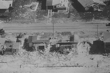
The 1932 Florida–Alabama hurricane was a tropical cyclone that made two separate landfalls on the United States, causing devastation in affected areas. The third named storm and hurricane of the 1932 Atlantic hurricane season, it developed from a tropical disturbance north of Hispaniola on August 26. Slowly moving towards the west-northwest, the system intensified to tropical storm strength before making landfall on South Florida early on August 30. After crossing the Florida peninsula and entering the Gulf of Mexico, the system reached peak intensity as a Category 1 hurricane, before subsequently making its final landfall near the Mississippi–Alabama border on September 1. Over land, the hurricane weakened, and after becoming an extratropical cyclone on September 2, merged with another extratropical system over Quebec on September 4.

References