Brooksville, Oklahoma

Last updated

Brooksville, Oklahoma
OKMap-doton-Brooksville.PNG
Location of Brooksville, Oklahoma
Coordinates: 35°12′35″N96°57′40″W / 35.20972°N 96.96111°W / 35.20972; -96.96111
Country United States
State Oklahoma
County Pottawatomie
Government
  MayorKeith Davenport
Area
[1]
  Total2.98 sq mi (7.71 km2)
  Land2.98 sq mi (7.71 km2)
  Water0.00 sq mi (0.00 km2)
Elevation
[2]
961 ft (293 m)
Population
 (2020)
  Total71
  Density23.83/sq mi (9.20/km2)
Time zone UTC-6 (Central (CST))
  Summer (DST) UTC-5 (CDT)
FIPS code 40-09400 [3]
GNIS feature ID2411734 [2]

Brooksville is a town in Pottawatomie County, Oklahoma, United States. It is one of the thirteen existing all-black towns in Oklahoma. The population was 63 at the 2010 census, a 30 percent decline from the figure of 90 in 2000. [4]

Contents

History

One of more than fifty All-Black towns of Oklahoma, Brooksville is one of only thirteen still existing at the beginning of the twenty-first century. Located in Pottawatomie County four miles southwest of Tecumseh, Brooksville was established in 1903. Originally the town was named Sewell, after a white doctor who owned much of the surrounding land and attended the residents. In 1909 the name changed to Brooksville in honor of the first African American in the area, A. R. Brooks, a cotton buyer and farmer. Brooks served as postmaster here from March 18, 1909, until January 27, 1913, at which time his son, William M. Brooks, became postmaster. In 1906 Rev. Jedson White organized St. John's Baptist Church. Soon afterward, the congregation built a church that still exists. White also promoted the town throughout the South, urging African Americans to settle in Brooksville. Brooksville had a Santa Fe Railroad station, three hotels, two doctors, and two mills. [5]

In 1924, with the aid of the Rosenwald Fund, a new school was built. Banneker School, under management of W. T. McKenzie, was a rock building of four large rooms, a three-hundred-seat auditorium, a small library, and a well-equipped domestic science room. George W. McLaurin, the first African American graduate student at the University of Oklahoma, taught at the school. After a fire, the original building was replaced by a wooden one that served students until the school closed in 1968. The building then became a community center for the town and stands next to the new city hall. A declining cotton market and the Great Depression made life difficult in Brooksville, as in many Oklahoma communities. Most of the residents departed, but the town survived. At the beginning of the twenty-first century Brooksville was steadily increasing in population. [5]

Geography

According to the United States Census Bureau, the town has a total area of 3.0 square miles (7.8 km2), all land.

Demographics

Historical population
CensusPop.Note
1910 166
1980 46
1990 6950.0%
2000 9030.4%
2010 63−30.0%
2020 7112.7%
U.S. Decennial Census [6]

As of the census [3] of 2000, there were 90 people, 32 households, and 23 families residing in the town. The population density was 30.4 inhabitants per square mile (11.7/km2). There were 42 housing units at an average density of 14.2 per square mile (5.5/km2). The racial makeup of the town was 38.89% African American, 35.56% White, 12.22% Native American, and 13.33% from two or more races. Hispanic or Latino of any race were 3.33% of the population.

There were 32 households, out of which 43.8% had children under the age of 18 living with them, 59.4% were married couples living together, 12.5% had a female householder with no husband present, and 28.1% were non-families. 28.1% of all households were made up of individuals, and 9.4% had someone living alone who was 65 years of age or older. The average household size was 2.81 and the average family size was 3.22.

In the town, the population was spread out, with 38.9% under the age of 18, 7.8% from 18 to 24, 18.9% from 25 to 44, 18.9% from 45 to 64, and 15.6% who were 65 years of age or older. The median age was 32 years. For every 100 females, there were 80.0 males. For every 100 females age 18 and over, there were 77.4 males.

The median income for a household in the town was $45,625, and the median income for a family was $45,417. Males had a median income of $51,250 versus $38,750 for females. The per capita income for the town was $15,667. There were 18.5% of families and 15.4% of the population living below the poverty line, including 30.0% of under eighteens and none of those over 64.

See also

Related Research Articles

<span class="mw-page-title-main">Pottawatomie County, Oklahoma</span> County in Oklahoma, United States

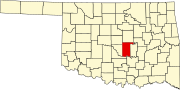
Pottawatomie County is a county located in the U.S. state of Oklahoma. As of the 2020 census, the population was 72,454. Its county seat is Shawnee.

<span class="mw-page-title-main">Brooksville, Kentucky</span> City in Kentucky, United States

Brooksville is a home rule-class city in Bracken County, Kentucky, in the United States. As of the 2010 census, the city's population was 642. It is the county seat of Bracken County.

<span class="mw-page-title-main">Penobscot, Maine</span> Town in the state of Maine, United States

Penobscot is a town in Hancock County, Maine, United States. The Bagaduce River flows through the town. The population was 1,136 at the 2020 census.

<span class="mw-page-title-main">Brooksville, Mississippi</span> Town in Mississippi, United States

Brooksville is a town in Noxubee County, Mississippi, United States. The population was 1,223 at the 2010 census.

<span class="mw-page-title-main">Fallis, Oklahoma</span> Town in Lincoln County, Oklahoma, United States

Fallis is a town in Lincoln County, Oklahoma, United States. The population was 27 at the 2010 census, a decline of 3.6 percent from the figure of 28 in 2000.

<span class="mw-page-title-main">Wellston, Oklahoma</span> Town in Oklahoma, United States

Wellston is a town in Lincoln County, Oklahoma, United States. The population was 788 at the 2010 census.

<span class="mw-page-title-main">Rentiesville, Oklahoma</span> Town in Oklahoma, United States

Rentiesville is a town in McIntosh County, Oklahoma, United States. It was founded in 1903 and named for William Rentie, a local landowner. It was one of 50 all-black towns in Oklahoma and one of 13 that still survives. The population was 128 at the 2010 census, an increase of 25.5 percent from 102 in 2000.

<span class="mw-page-title-main">Summit, Oklahoma</span> Town in Oklahoma, United States

Summit is a town in Muskogee County, Oklahoma, United States. It was originally called South Muskogee when it was platted in 1910, and is one of thirteen all-black towns still surviving at the beginning of the 21st Century. The population was 139 at the 2010 census, a 38.5 percent decline from the figure of 226 recorded in 2000. Summit, is located in Muskogee County six miles southwest of the city of Muskogee. The community retained a post office as early as 1896. Like many of the other Black towns previously mentioned, was a stopover destination on the Missouri, Kansas and Texas Railway and had a depot in the community. It is said that the town may have been named Summit because it was the highest point on the railroad between Arkansas and the North Canadian rivers.

<span class="mw-page-title-main">Castle, Oklahoma</span> Town in Oklahoma, United States

Castle is a town in Okfuskee County, Oklahoma, United States. A post office was established February 25, 1903, and the town was named for the first postmaster, Manford B. Castle. The population was 169 at the 2020 Census.

<span class="mw-page-title-main">Clearview, Oklahoma</span> Town in Oklahoma, United States

Clearview is a town in Okfuskee County, Oklahoma, United States. The population was 41 at the 2020 Census. It was historically an all-black freedmen's town and was platted by the Lincoln Townsite Company and designated as Lincoln.

<span class="mw-page-title-main">Grayson, Oklahoma</span> Town in Oklahoma, United States

Grayson is a town in Okmulgee County, Oklahoma, United States. The population was 127 at the 2020 census.

<span class="mw-page-title-main">Bethel Acres, Oklahoma</span> Town in Oklahoma, United States

Bethel Acres is a town in Pottawatomie County, Oklahoma, United States. The population was 2,895 at the time of the 2010 census, an increase of 5.9 percent from the figure of 2,735 in 2000. It is primarily a bedroom community for people who work in the three nearby larger cities of Shawnee, Tecumseh and Oklahoma City.

<span class="mw-page-title-main">Earlsboro, Oklahoma</span> Town in Oklahoma, United States

Earlsboro is a town in Pottawatomie County, Oklahoma, United States. The population was 594 by the 2020 United States census. It was once called "...the town that whisky built and oil broke."

<span class="mw-page-title-main">Johnson, Oklahoma</span> Town in Oklahoma, United States

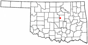
Johnson is a town in north-central Pottawatomie County, Oklahoma, United States. The population was 247 at the 2010 census, a 10.8 percent increase from the figure of 223 in 2000.

<span class="mw-page-title-main">Macomb, Oklahoma</span> Town in Oklahoma, United States

Macomb is a town in Pottawatomie County, Oklahoma, United States. The population was 32 at the 2010 census, which represented a decline of 47.5 percent from the figure of 61 in 2000.

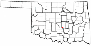
St. Louis is a town in Pottawatomie County, Oklahoma, United States. The population was 121 by the 2020 United States census.

<span class="mw-page-title-main">Tribbey, Oklahoma</span> Town in Oklahoma, United States

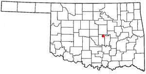
Tribbey is a town in Pottawatomie County, Oklahoma, United States.The community was named for Alpheus M. Tribbey, landowner. The population was 337 by the 2020 United States census.

<span class="mw-page-title-main">Wanette, Oklahoma</span> Town in Oklahoma, United States

Wanette is a town in Pottawatomie County, Oklahoma, United States. The population was 279 at the time of the 2020 Census. Wanette is part of the Purcell-Lexington retail trade area and is within the Greater Oklahoma City Metropolitan Area.

<span class="mw-page-title-main">Lima, Oklahoma</span> Town in Oklahoma, United States

Lima is a town in Seminole County, Oklahoma, United States. It is one of the thirteen remaining historically All-Black towns in the state. The population was 68 at the time of the 2020 census, a 28.3% increase over 2010s figure of 53.

<span class="mw-page-title-main">New Haven, Vermont</span> Town in Vermont, United States

New Haven is a town in Addison County, Vermont, United States. The population was 1,683 at the 2020 census. In addition to the town center, New Haven contains the communities of Belden, Brooksville, New Haven Junction and New Haven Mills.

References

  1. "ArcGIS REST Services Directory". United States Census Bureau. Retrieved September 20, 2022.
  2. 1 2 U.S. Geological Survey Geographic Names Information System: Brooksville, Oklahoma
  3. 1 2 "U.S. Census website". United States Census Bureau . Retrieved January 31, 2008.
  4. CensusViewer: Population of the City of Brooksville, Oklahoma
  5. 1 2 Larry O'Dell. "Brooksville," Encyclopedia of Oklahoma History and Culture. Accessed August 19, 2012
  6. "Census of Population and Housing". Census.gov. Retrieved June 4, 2015.