Brough of Birsay

Last updated

Brough of Birsay
Old Norse nameByrgisey
Meaning of namefort island
Brough of Birsay.jpg
Location
Orkney Islands UK relief location map.jpg
Red pog.svg
Brough of Birsay
Brough of Birsay shown within the Orkney Islands
OS grid reference HY236285
Coordinates 59°08′N3°20′W / 59.14°N 3.33°W / 59.14; -3.33
Physical geography
Island group Orkney
Area16 ha [1]
Highest elevation46 metres (151 feet)
Administration
Sovereign state United Kingdom
Country Scotland
Council area Orkney Islands
Demographics
Population0 [2]
Lymphad3.svg
References [3] [4]

The Brough of Birsay is an uninhabited tidal island off the north-west coast of The Mainland of Orkney, Scotland, in the parish of Birsay. It is located around 13 miles north of Stromness and features the remains of Pictish and Norse settlements as well as a modern lighthouse.

Contents

Geography and geology

The island is accessible on foot at low tide via a largely natural causeway. It is separated from the mainland by a 240-metre (790- foot ) stretch of water at high tide: the Sound of Birsay. [5]

The Norse settlement has been partly removed by coastal erosion, and the cliffs are reinforced by concrete rip-rap to prevent further damage.

Etymology

The Old Norse name for the island was "Byrgisey" which means fort island, and gives the parish its name. Brough, indeed, means fort (for etymology, see broch).

History

Earliest settlement of Christians and Picts

The earliest settlement on the island is thought to have been in the 6th century, perhaps by Christian missionaries. In the 7th and 8th centuries it was a significant Pictish fortress, but by the 9th century the Picts had been displaced by Norsemen. [6] :58

Excavations were first undertaken by Cecil Curle in 1936–1937. [7]

The Pictish settlement is attested by a small well and an important collection of artefacts (now in The Orkney Museum (formerly known as Tankerness House Museum), Kirkwall and in the Museum of Scotland, Edinburgh). Notable among these are a group of moulds for fine metalworking, showing that bronze brooches and other ornaments were being manufactured on the site in the 8th century. The enclosure round the Norse church overlies a Pictish graveyard, and an important Pictish carved stone was found in pieces in this enclosure during site clearance (also on display in Edinburgh: replica on site). The most interesting Pictish artefact found is a stone slab showing three figures and some additional Pictish symbols. It is not known what the subject of this carving is, but it likely shows aristocratic Picts as they wished to be perceived. This early 8th-century slab shows a striking procession of three Picts dressed in long robes and bearing spears, swords and square shields. Above the figures are parts of four Pictish symbols. Two simple cross-incised slabs, likely grave-markers, were also found in the graveyard, and are probably Pictish or early medieval in date (displayed on site). [6] :58 [8] :27

The remains of houses with the church and, on the left, the replica Pictish stone Ruins of village on the Brough of Birsay in summer 2012 (4).JPG
The remains of houses with the church and, on the left, the replica Pictish stone
Breeding colony of fulmar (Fulmarus glacialis) and guillemot (Uria aalge) on the Brough of Birsay Birsay colony.jpg
Breeding colony of fulmar (Fulmarus glacialis) and guillemot (Uria aalge) on the Brough of Birsay

Norse settlement and St Peter's chapel

The extensive remains of an excavated Norse settlement and church overlay the earlier Pictish settlement. Before Kirkwall became the centre of power in the 12th century, Birsay was the seat of the rulers of Orkney. [6] :58

According to the Orkneyinga saga the main residence of the Earl of Orkney, Thorfinn the Mighty (1014–1065), was located in Birsay. At this time the first Bishop of Orkney was appointed and his cathedral, known as "Christchurch," which later housed the remains of St Magnus, probably on the site of the present day St Magnus Kirk, nearby on the Mainland. It was once thought that Earl/Jarl Thorfinn's hall could have been located on the brough but it is today thought to have been nearby on the Mainland. [6] :59

Today, many of the remains of the settlement are visible. The most significant being the remains of a fine, though small Romanesque church. This dates back to the 12th century and was dedicated to St Peter. The church has a semi-circular apse and there are the remains of stone benches for the congregation lining the walls. The red sandstone altar was reconstructed in the 1930s. An enclosure wall surrounding the kirk separated the graveyard from the houses beyond. [6] :58

The church has an interesting shape; probably with a square tower at one end, and a semi-circular apse at the other. There is some evidence of an earlier, possibly Pictish church on the same site. The church was a place of pilgrimage until the Middle Ages. The remains of adjoining buildings round three sides of an open court suggest that it may once have been a small monastery (though there is no documentation for such a foundation). [9]

There were also a number of Norse dwellings, some of them of considerable size indicating substantial wealth. They included longhouses, featuring both heating and drainage systems and some indications that saunas were present. Although not all the houses were likely in use at the same time, there was a significant community living here. [6] :58 The site, and particularly the objects found there, have been central to debates about the nature of Pictish-Norse relations in Northern Scotland.

The site is in the care of Historic Environment Scotland.

Lighthouse

The unmanned Brough of Birsay Lighthouse is on the Brough. [10]

Flora and fauna

Sea bird breeding colonies can be found on the brough.

See also

Related Research Articles

<span class="mw-page-title-main">Orkney</span> Archipelago, county and council area in northern Scotland

Orkney, also known as the Orkney Islands and The Orkneys, is an archipelago in the Northern Isles of Scotland, situated off the north coast of the island of Great Britain. Orkney is 10 miles (16 km) north of the coast of Caithness and has about 70 islands, of which 20 are inhabited. The largest island, the Mainland, has an area of 523 square kilometres (202 sq mi), making it the sixth-largest Scottish island and the tenth-largest island in the British Isles. Orkney's largest settlement, and also its administrative centre, is Kirkwall.

<span class="mw-page-title-main">Kirkwall</span> Town on Orkney, Scotland

Kirkwall is the largest town in Orkney, an archipelago to the north of mainland Scotland.

<span class="mw-page-title-main">Mainland, Orkney</span> Main island of the Orkney Islands, Scotland

The Mainland, also known as Hrossey and Pomona, is the main island of Orkney, Scotland. Both of Orkney's burghs, Kirkwall and Stromness, lie on the island, which is also the heart of Orkney's ferry and air connections.

<span class="mw-page-title-main">Sanday, Orkney</span> Island in Orkney, Scotland

Sanday is one of the inhabited islands of Orkney that lies off the north coast of mainland Scotland. With an area of 50.43 km2 (19.5 sq mi), it is the third largest of the Orkney Islands. The main centres of population are Lady Village and Kettletoft. Sanday can be reached by Orkney Ferries or by plane from Kirkwall on the Orkney Mainland. On Sanday, an on-demand public minibus service allows connecting to the ferry.

<span class="mw-page-title-main">Westray</span> Island of Orkney, Scotland

Westray is one of the Orkney Islands in Scotland, with a usual resident population of just under 600 people. Its main village is Pierowall, with a heritage centre, the 15th-century Lady Kirk church and pedestrian ferry service to nearby Papa Westray island. Westray has a number of archeological sites dating from 3500 BC, and remains of several Norse-Viking settlements. The spectacular sea cliffs around Noup Head are home to thousands of seabirds.

<span class="mw-page-title-main">South Ronaldsay</span> Island in southeast Orkney, Scotland, UK

South Ronaldsay is one of the Orkney Islands off the north coast of Scotland. It is linked to the Orkney Mainland by the Churchill Barriers, running via Burray, Glimps Holm and Lamb Holm.

<span class="mw-page-title-main">Northern Isles</span> Pair of archipelagos near Scotland

The Northern Isles are a chain of islands off the north coast of mainland Scotland. The climate is cool and temperate and highly influenced by the surrounding seas. There are two main island groups: Shetland and Orkney. There are a total of 36 inhabited islands, with the fertile agricultural islands of Orkney contrasting with the more rugged Shetland islands to the north, where the economy is more dependent on fishing and the oil wealth of the surrounding seas. Both archipelagos have a developing renewable energy industry. They share a common Pictish and Norse history, and were part of the Kingdom of Norway before being absorbed into the Kingdom of Scotland in the 15th century. The islands played a significant naval role during the world wars of the 20th century.

<span class="mw-page-title-main">Jarlshof</span> Archeological site in Shetland, Scotland

Jarlshof is the best-known prehistoric archaeological site in Shetland, Scotland. It lies in Sumburgh, Mainland, Shetland and has been described as "one of the most remarkable archaeological sites ever excavated in the British Isles". It contains remains dating from 2500 BC up to the 17th century AD.

<span class="mw-page-title-main">Birsay</span> Parish on the Orkney mainland

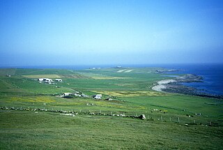
Birsay is a parish in the north west corner of The Mainland of Orkney, Scotland. Almost all the land in the parish is devoted to agriculture: chiefly grassland used to rear beef cattle. There are various ancient monuments in the parish.

<span class="mw-page-title-main">Papa Stronsay</span> Island in Orkney, Scotland

Papa Stronsay is a small island in Orkney, Scotland, lying north east of Stronsay. It is 74 hectares in size, and 13 metres (43 ft) above sea level at its highest point. After being largely abandoned, the island was bought at the end of the 20th century by traditionalist Catholic monks of the Sons of the Most Holy Redeemer, who operate a monastery and farm there.

<span class="mw-page-title-main">Earldom of Orkney</span> Medieval Norse earldom

The Earldom of Orkney was a Norse territory ruled by the earls of Orkney from the ninth century until 1472. It was founded during the Viking Age by Viking raiders and settlers from Scandinavia. In the ninth and tenth centuries it covered the Northern Isles (Norðreyjar) of Orkney and Shetland, as well as Caithness and Sutherland on the mainland. It was a dependent territory of the Kingdom of Norway until 1472, when it was absorbed into the Kingdom of Scotland. Originally, the title of Jarl or Earl of Orkney was heritable.

<span class="mw-page-title-main">Broch of Gurness</span> Iron Age village on Mainland, Orkney, Scotland

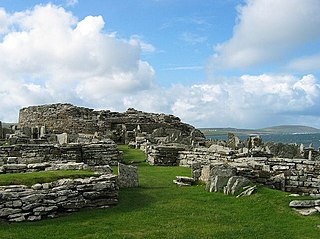
The Broch of Gurness is an Iron Age broch village on the northeast coast of Mainland Orkney in Scotland overlooking Eynhallow Sound, about 15 miles north-west of Kirkwall. It once housed a substantial community.

<span class="mw-page-title-main">Prehistoric Orkney</span> Overview of the prehistoric period on the Orkney Islands, Scotland

Prehistoric Orkney refers only to the prehistory of the Orkney archipelago of Scotland that begins with human occupation. Although some records referring to Orkney survive that were written during the Roman invasions of Scotland, “prehistory” in northern Scotland is defined as lasting until the start of Scotland's Early Historic Period.

Thorulf or Torulf was medieval prelate, a Bishop of Orkney. Although probably a native Scandinavian, he is known only from the account of the German writer Adam of Bremen. Adam reported that he was appointed bishop by Adalbert, Archbishop of Hamburg, the first Orcadian appointee under Hamburg overlordship. Thorulf's period of appointment coincided with the reign of Earl Thorfinn Sigurdsson, alleged builder of the Birsay church and founder of the bishopric of Orkney.

<span class="mw-page-title-main">Scandinavian Scotland</span> 8th- to 15th-century historical period

Scandinavian Scotland was the period from the 8th to the 15th centuries during which Vikings and Norse settlers, mainly Norwegians and to a lesser extent other Scandinavians, and their descendants colonised parts of what is now the periphery of modern Scotland. Viking influence in the area commenced in the late 8th century, and hostility between the Scandinavian earls of Orkney and the emerging thalassocracy of the Kingdom of the Isles, the rulers of Ireland, Dál Riata and Alba, and intervention by the crown of Norway were recurring themes.

<span class="mw-page-title-main">Brough of Birsay Lighthouse</span> Lighthouse

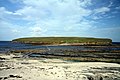
The unmanned Brough of Birsay Lighthouse lighthouse was built in 1925 by David A Stevenson. It is located on the Brough of Birsay, an uninhabited tidal island off the north west coast of Mainland in Orkney, Scotland, in the parish of Birsay.

<span class="mw-page-title-main">Hoxa, Orkney</span> Human settlement in Scotland

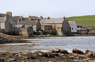
Hoxa is a small settlement on the island of South Ronaldsay in the Orkney Islands north of mainland Scotland. Hoxa is located 1+14 miles (2.0 km) west of St Margaret's Hope at the end of the B9043 road.

Cecil Louisa Curle was a Scottish archaeologist and art historian.

<span class="mw-page-title-main">St Magnus Church, Birsay</span> Medieval church located on the mainlaind of Orkney, Scotland

St Magnus Church, Birsay is a 17th-century church located in the parish of Birsay on Mainland, Orkney in Scotland. Built in 1664 on the site of an earlier, 11th-century church, St Magnus was later expanded in 1760 and 1867. The graveyard surrounding the church dates to the 18th century. The church is now maintained by the St Magnus Church Birsay Trust.

<span class="mw-page-title-main">St Boniface's Church, Papa Westray</span> Historic church located on the island of Papa Westray, Orkney, Scotland

St Boniface's Church, Papa Westray is a historic church and graveyard located on the island of Papa Westray in Orkney, Scotland. The site of the church dates back to the Iron Age and was possibly used later as a Christian monastery. The present church was built in the 12th century and was remodeled in 1710. A 12th-century Norse hogback gravestone lies to the east of the church. Two Pictish cross-slabs were uncovered in the graveyard in the 20th century, and were later moved to museums. Historic Environment Scotland established the site as a scheduled monument in 1959.

References

  1. Rick Livingstone's Tables of the Islands of Scotland (pdf) Argyll Yacht Charters. Retrieved 12 Dec 2011.
  2. National Records of Scotland (15 August 2013). "Appendix 2: Population and households on Scotland's Inhabited Islands" (PDF). Statistical Bulletin: 2011 Census: First Results on Population and Household Estimates for Scotland Release 1C (Part Two) (PDF) (Report). SG/2013/126. Retrieved 14 August 2020.
  3. Haswell-Smith, Hamish (2004). The Scottish Islands. Edinburgh: Canongate. ISBN   978-1-84195-454-7.
  4. Ordnance Survey. OS Maps Online (Map). 1:25,000. Leisure.
  5. Orkneyjar: Ancient seat of Orkney power. Retrieved 1 August 2007.
  6. 1 2 3 4 5 6 Wickham-Jones, Caroline (2012). Monuments of Orkney. Historic Scotland. ISBN   978-1-84917-073-4.
  7. "Obituaries: Cecil Curle". Proceedings of the Society of Antiquaries of Scotland. 117: 1–2. 1987.
  8. Burnet, Andrew, ed. (2012). The Picts. Historic Scotland. ISBN   978-1-84917-034-5.
  9. "Brough of Birsay". Canmore: National Record of the Historic Environment. Retrieved 24 April 2022.
  10. "Brough of Birsay Lighthouse". Northern Lighthouse Board. Archived from the original on 22 February 2014. Retrieved 5 March 2010.

59°08′13″N3°20′07″W / 59.13694°N 3.33528°W / 59.13694; -3.33528