Broughton, Ohio

Last updated

Broughton, Ohio
Broughton town hall from south.jpg
Town hall
OHMap-doton-Broughton.png
Location of Broughton, Ohio
Map of Paulding County Ohio Highlighting Broughton Village.png
Location of Broughton in Paulding County
Coordinates: 41°05′17″N84°32′06″W / 41.08806°N 84.53500°W / 41.08806; -84.53500
Country United States
State Ohio
County Paulding
Township Jackson
Area
[1]
  Total0.22 sq mi (0.56 km2)
  Land0.22 sq mi (0.56 km2)
  Water0.00 sq mi (0.00 km2)
Elevation
[2]
722 ft (220 m)
Population
 (2020)
  Total116
  Density534.56/sq mi (206.23/km2)
Time zone UTC-5 (Eastern (EST))
  Summer (DST) UTC-4 (EDT)
FIPS code 39-09386 [3]
GNIS feature ID2397469 [2]

Broughton is a village in Paulding County, Ohio, United States. The population was 116 at the 2020 census.

Contents

Geography

According to the United States Census Bureau, the village has a total area of 0.22 square miles (0.57 km2), all land. [4]

Demographics

Historical population
CensusPop.Note
1900 226
1910 195−13.7%
1920 111−43.1%
1930 1131.8%
1940 13115.9%
1950 128−2.3%
1960 15319.5%
1970 1551.3%
1980 17110.3%
1990 151−11.7%
2000 1669.9%
2010 120−27.7%
2020 116−3.3%
U.S. Decennial Census [5]

2010 census

As of the census [6] of 2010, there were 120 people, 49 households, and 34 families living in the village. The population density was 545.5 inhabitants per square mile (210.6/km2). There were 53 housing units at an average density of 240.9 per square mile (93.0/km2). The racial makeup of the village was 97.5% White, 1.7% Native American, and 0.8% from other races. Hispanic or Latino of any race were 0.8% of the population.

There were 49 households, of which 24.5% had children under the age of 18 living with them, 63.3% were married couples living together, 4.1% had a female householder with no husband present, 2.0% had a male householder with no wife present, and 30.6% were non-families. 20.4% of all households were made up of individuals, and 8.1% had someone living alone who was 65 years of age or older. The average household size was 2.45 and the average family size was 2.88.

The median age in the village was 50.2 years. 15% of residents were under the age of 18; 7.5% were between the ages of 18 and 24; 17.4% were from 25 to 44; 40% were from 45 to 64; and 20% were 65 years of age or older. The gender makeup of the village was 50.0% male and 50.0% female.

2000 census

As of the census [3] of 2000, there were 166 people, 57 households, and 45 families living in the village. The population density was 768.2 inhabitants per square mile (296.6/km2). There were 59 housing units at an average density of 273.0 per square mile (105.4/km2). The racial makeup of the village was 96.99% White, 0.60% Native American, 0.60% from other races, and 1.81% from two or more races. Hispanic or Latino of any race were 3.01% of the population.

There were 57 households, out of which 42.1% had children under the age of 18 living with them, 61.4% were married couples living together, 8.8% had a female householder with no husband present, and 19.3% were non-families. 17.5% of all households were made up of individuals, and 7.0% had someone living alone who was 65 years of age or older. The average household size was 2.91 and the average family size was 3.26.

In the village, the population was spread out, with 31.9% under the age of 18, 6.6% from 18 to 24, 34.3% from 25 to 44, 16.9% from 45 to 64, and 10.2% who were 65 years of age or older. The median age was 32 years. For every 100 females there were 112.8 males. For every 100 females age 18 and over, there were 109.3 males.

The median income for a household in the village was $34,375, and the median income for a family was $45,625. Males had a median income of $31,250 versus $16,250 for females. The per capita income for the village was $12,808. About 4.1% of families and 5.8% of the population were below the poverty line, including 5.1% of those under the age of eighteen and none of those 65 or over.

Related Research Articles

<span class="mw-page-title-main">Tekonsha, Michigan</span> Village in Michigan, United States

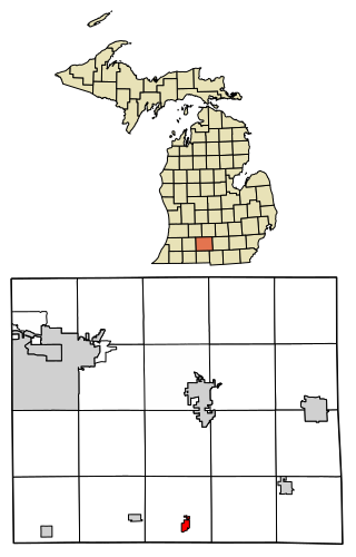
Tekonsha is a village in Tekonsha Township, Calhoun County in the U.S. state of Michigan. It is part of the Battle Creek, Michigan Metropolitan Statistical Area. The population was 653 at the 2020 census.

<span class="mw-page-title-main">Chain-O-Lakes, Missouri</span> Village in Missouri, United States

Chain-O-Lakes is a village in Roaring River Township of southeast Barry County, Missouri, United States. The population was 126 at the 2010 census.

<span class="mw-page-title-main">Wilbur Park, Missouri</span> Village in Missouri, United States

Wilbur Park is a village in St. Louis County, Missouri, United States. The population was 439 at the 2020 census.

<span class="mw-page-title-main">Brookside, Ohio</span> Village in Ohio, United States

Brookside is a village in eastern Belmont County, Ohio, United States. The population was 538 at the 2020 census. It is part of the Wheeling metropolitan area.

<span class="mw-page-title-main">Wayne Lakes, Ohio</span> Village in Ohio, United States

Wayne Lakes is a village in Darke County, Ohio, United States. The population was 693 at the 2020 census.

<span class="mw-page-title-main">Cleves, Ohio</span> City in Ohio, United States

Cleves is a village in Miami Township, Hamilton County, Ohio, United States. Located along the Ohio River, it is a western suburb of Cincinnati. The population was 3,414 at the 2020 census.

<span class="mw-page-title-main">Evendale, Ohio</span> Village in Ohio, United States

Evendale is a village in Hamilton County, Ohio, United States, within the Cincinnati metropolitan area. The population was 2,669 at the 2020 census.

<span class="mw-page-title-main">Mowrystown, Ohio</span> Village in Ohio, United States

Mowrystown is a village in Highland County, Ohio, United States. The population was 385 at the 2020 census.

<span class="mw-page-title-main">St. Louisville, Ohio</span> Village in Ohio, United States

St. Louisville or Saint Louisville is a village in Licking County, Ohio, United States, along the North Fork of the Licking River. The population was 352 at the 2020 census.

<span class="mw-page-title-main">Spencer, Ohio</span> Village in Ohio, United States

Spencer is a village in Spencer Township located in Medina County, Ohio, United States. The population was 684 at the 2020 census.

<span class="mw-page-title-main">Jerusalem, Ohio</span> Village in Ohio, United States

Jerusalem is a village in Monroe County, Ohio, United States. The population was 121 at the 2020 census.

<span class="mw-page-title-main">Chesterville, Ohio</span> Village in Ohio, United States

Chesterville is a village in Morrow County, Ohio, United States, along the Kokosing River. The population was 191 at the 2020 census. Chesterville is southeast of Mount Gilead, the county seat.

<span class="mw-page-title-main">Batesville, Ohio</span> Village in Ohio, United States

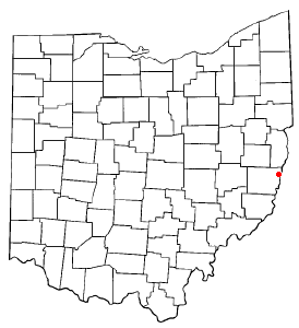
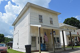
Batesville is a village in Noble County, Ohio, United States. The population was 101 at the 2020 census. Batesville was originally called Williamsburg, and under the latter name was laid out in 1827.

<span class="mw-page-title-main">Cloverdale, Ohio</span> Village in Ohio, United States

Cloverdale is a village in Perry Township, Putnam County, Ohio, United States. The population was 170 at the 2020 census.

<span class="mw-page-title-main">Burbank, Ohio</span> Village in Ohio, United States

Burbank is a village in Wayne County, Ohio, United States, along Killbuck Creek. The population was 296 at the 2020 census.

<span class="mw-page-title-main">Beech Bottom, West Virginia</span> Village in West Virginia, United States

Beech Bottom is a village in Brooke County, West Virginia, United States, situated along the Ohio River. The population was 523 at the 2010 census. It is part of the Weirton–Steubenville metropolitan area.

<span class="mw-page-title-main">Friesland, Wisconsin</span> Village in Wisconsin, United States

Friesland is a village in Columbia County, Wisconsin, United States. The population was 320 at the 2020 census. It is part of the Madison Metropolitan Statistical Area, and was named after Friesland, one of the twelve provinces of the Netherlands.

<span class="mw-page-title-main">Excelsior Estates, Missouri</span> 4th Class City in Missouri in the United States

Excelsior Estates is a village in Clay and Ray counties in the U.S. state of Missouri and part of the Kansas City metropolitan area. The population was 209 at the 2020 census.

<span class="mw-page-title-main">Dorchester, Wisconsin</span> Village in Wisconsin, United States

Dorchester is a village in Clark and Marathon counties in the U.S. state of Wisconsin, along the 45th parallel. It is part of the Wausau, Wisconsin Metropolitan Statistical Area. The population was 876 at the 2010 census. Of this, 871 were in Clark County, and only 5 were in Marathon County.

<span class="mw-page-title-main">Lowell, Wisconsin</span> Village in Wisconsin, United States

Lowell is a village in Dodge County, Wisconsin, United States, along the Beaver Dam River. The population was 340 at the 2010 census. The village is located within the Town of Lowell.

References

  1. "ArcGIS REST Services Directory". United States Census Bureau. Retrieved September 20, 2022.
  2. 1 2 U.S. Geological Survey Geographic Names Information System: Broughton, Ohio
  3. 1 2 "U.S. Census website". United States Census Bureau . Retrieved January 31, 2008.
  4. "US Gazetteer files 2010". United States Census Bureau. Archived from the original on July 2, 2012. Retrieved January 6, 2013.
  5. "Census of Population and Housing". Census.gov. Retrieved June 4, 2015.
  6. "U.S. Census website". United States Census Bureau . Retrieved January 6, 2013.