Brushy Creek, Williamson County, Texas

Last updated

Brushy Creek, Texas
CDP
TXMap-doton-BrushyCreek.PNG
Location of Brushy Creek, Texas
Williamson County BrushyCreek.svg
Coordinates: 30°30′39″N97°44′5″W / 30.51083°N 97.73472°W / 30.51083; -97.73472
Country United States
State Texas
County Williamson
Area
  Total7.0 sq mi (18 km2)
  Land6.93 sq mi (17.9 km2)
  Water0.07 sq mi (0.2 km2)
Elevation
827 ft (252 m)
Population
 (2020)
  Total22,519
  Density3,200/sq mi (1,200/km2)
Time zone UTC-6 (Central (CST))
  Summer (DST) UTC-5 (CDT)
ZIP code
78717
Area code 512
FIPS code 48-10897 [1]
GNIS feature ID1867542 [2]

Brushy Creek is a census-designated place (CDP) in Williamson County, Texas, United States. The population was 22,519 at the 2020 census. [3]

Contents

Geography

Brushy Creek is located at 30°30′39″N97°44′05″W / 30.510970°N 97.734697°W / 30.510970; -97.734697 (30.510970, -97.734697), [4] just west of Round Rock along the shore of Brushy Creek.

According to the United States Census Bureau in 2000, the CDP has a total area of 8.7 square miles (22.6 km2), all land. Prior to the 2010 census, the CDP had parts annexed to the cities of Austin and Round Rock and lost additional area, reducing its total area of 7.0 square miles (18 km2), of which 6.93 square miles (17.9 km2) were then land and 0.07 square miles (0.18 km2) was water. [5] [6]

Demographics

Historical population
CensusPop.Note
1990 5,833
2000 15,371163.5%
2010 21,76441.6%
2020 22,5193.5%
source: [7]
Brushy Creek racial composition as of 2020 [8]
(NH = Non-Hispanic) [lower-alpha 1]
RaceNumberPercentage
White (NH)13,31259.11%
Black or African American (NH)1,1094.92%
Native American or Alaska Native (NH)520.23%
Asian (NH)3,03213.46%
Pacific Islander (NH)170.08%
Some Other Race (NH)1060.47%
Mixed/Multi-Racial (NH)1,2305.46%
Hispanic or Latino 3,66116.26%
Total22,519

As of the 2020 United States census, there were 22,519 people, 5,713 households, and 4,432 families residing in the CDP.

As of the census [1] of 2000, there were 15,371 people, 4,805 households, and 4,252 families residing in the CDP. The population density was 1,764.8 inhabitants per square mile (681.4/km2). There were 4,919 housing units at an average density of 564.8 per square mile (218.1/km2). The racial makeup of the CDP was 82.95% White, 4.08% African American, 0.27% Native American, 6.81% Asian, 0.08% Pacific Islander, 3.71% from other races, and 2.09% from two or more races. Hispanic or Latino of any race were 10.23% of the population.

There were 4,805 households, out of which 57.9% had children under the age of 18 living with them, 80.2% were married couples living together, 6.8% had a female householder with no husband present, and 11.5% were non-families. 8.6% of all households were made up of individuals, and 1.4% had someone living alone who was 65 years of age or older. The average household size was 3.18 and the average family size was 3.39.

In the CDP, the population was spread out, with 35.0% under the age of 18, 4.7% from 18 to 24, 39.1% from 25 to 44, 17.2% from 45 to 64, and 4.0% who were 65 years of age or older. The median age was 32 years. For every 100 females, there were 96.3 males. For every 100 females age 18 and over, there were 93.7 males.

The median income for a household in the CDP was $84,472, and the median income for a family was $85,370 (these figures had risen to $107,465 and $113,523 respectively as of a 2007 estimate [10] ). Males had a median income of $60,409 versus $39,542 for females. The per capita income for the CDP was $28,129. About 1.2% of families and 1.7% of the population were below the poverty line, including 2.0% of those under age 18 and 1.3% of those age 65 or over.

Education

Much of the CDP is in the Round Rock Independent School District while some portions are in the Leander Independent School District. [11]

Elementary schools serving RRISD sections of Brushy Creek include Brushy Creek, [12] Fern Bluff, [13] Great Oaks, [14] Old Town, [15] and Sommer. [16] Middle schools serving RRISD sections include Cedar Valley, Chisholm Trail, Pearson Ranch, and James Garland Walsh. [17] Some RRISD portions are zoned to Round Rock High School and others are zoned to McNeil High School. [18] [19]

Leander ISD sections are zoned to Akin Elementary School, [20] Stiles Middle School, [21] and Vista Ridge High School. [22]

Nearby localities

The following diagram represents localities within a 12 kilometres (7.5 mi) radius of Brushy Creek.

Neighboring localities Blank map.svg
Neighboring localities
Map pointer black.svg Brushy Creek
Dot-yellow.svg Cedar Park (9 km)
Small-city-symbol.svg Jollyville (7 km)
Dot-yellow.svg Round Rock (6 km)
Small-city-symbol.svg Wells Branch (9 km)
Small-city-symbol.svg Windemere (10 km)

Related Research Articles

<span class="mw-page-title-main">Fruit Cove, Florida</span> CDP in Florida, United States

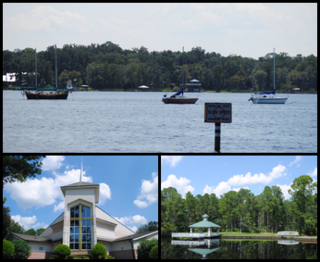
Fruit Cove is a census-designated place (CDP) in St. Johns County, Florida, United States. It is located in the community of St. Johns. The population was 32,143 at the 2020 census.

<span class="mw-page-title-main">Camp Swift, Texas</span> Census-designated place in Texas, United States

Camp Swift is a census-designated place (CDP) in Bastrop County, Texas, United States. The population was 7,943 at the 2020 census. Camp Swift began as a United States Army training base built in 1942. It is named after Major General Eben Swift.

<span class="mw-page-title-main">Circle D-KC Estates, Texas</span> CDP in Texas, United States

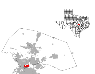
Circle D-KC Estates is a census-designated place (CDP) in Bastrop County, Texas, United States. The population was 2,588 at the 2020 census.

<span class="mw-page-title-main">Wyldwood, Texas</span> CDP in Texas, United States

Wyldwood is a census-designated place (CDP) in Bastrop County, Texas, United States. The population was 3,694 at the 2020 census.

<span class="mw-page-title-main">Homestead Meadows North, Texas</span> Census-designated place in Texas, United States

Homestead Meadows North is a census-designated place (CDP) in El Paso County, Texas, United States. The population was 5,124 at the 2010 census. It is part of the El Paso Metropolitan Statistical Area. The ZIP Code encompassing the CDP area is 79938.

<span class="mw-page-title-main">Sparks, Texas</span> Census-designated place in Texas, United States

Sparks is a census-designated place (CDP) in El Paso County, Texas, United States. The population was 4,529 at the 2010 census. It is part of the El Paso Metropolitan Statistical Area. The ZIP Code encompassing the CDP area is 79928.

<span class="mw-page-title-main">Barrett, Texas</span> Census-designated place in Texas, United States

Barrett, also named Barrett Station, is an unincorporated community and census-designated place (CDP) in Harris County, Texas, United States. The population was 5,223 at the 2020 census. It was founded in 1889 by Harrison Barrett, a former slave.

<span class="mw-page-title-main">Hunters Creek Village, Texas</span> City in Texas, United States

Hunters Creek Village is a city in Harris County, Texas, United States, part of the Greater Houston metropolitan area. The population was 4,385 at the 2020 census. It is part of a collection of upscale residential communities in west Houston known as the Memorial Villages.

<span class="mw-page-title-main">Llano Grande, Texas</span> Census-designated place in Texas

Llano Grande is a census-designated place (CDP) in Hidalgo County, Texas. The population was 3,008 at the 2010 United States Census. It is part of the McAllen–Edinburg–Mission Metropolitan Statistical Area. Llano Grande means "Big Plain" in Spanish. Nearby Llano Grande State Park is popular with bird watchers and the supposed site of many ghost appearances, including the ghosts of historic figures in Texas history.

<span class="mw-page-title-main">Porter Heights, Texas</span> Populated place in Texas, United States

Porter Heights is a census-designated place (CDP) in Montgomery County, Texas, United States. The population was 1,903 at the 2020 census.

<span class="mw-page-title-main">Falcon Heights, Texas</span> CDP in Texas, United States

Falcon Heights is a census-designated place (CDP) in Starr County, Texas, United States. The population was 18 at the 2020 census, down from 53 at the 2010 census.

<span class="mw-page-title-main">Falcon Village, Texas</span> CDP in Texas, United States

Falcon Village is a census-designated place (CDP) in Starr County, Texas, United States. The population was 3 at the 2020 census.

<span class="mw-page-title-main">Fronton, Texas</span> CDP in Texas, United States

Fronton is a census-designated place (CDP) in Starr County, Texas, United States, bordering the Mexican state of Tamaulipas, close to Ciudad Miguel Alemán. The population was 180 at the 2010 census down from 599 at the 2000 census.

<span class="mw-page-title-main">La Rosita, Texas</span> CDP in Texas, United States

La Rosita is a census-designated place (CDP) in Starr County, Texas, United States. The population was 85 at the 2010 census down from 1,729 at the 2000 census. This is because the Census Bureau redefined the CDP.

<span class="mw-page-title-main">Los Alvarez, Texas</span> CDP in Texas, United States

Los Alvarez is a census-designated place (CDP) in Starr County, Texas, United States. The population was 303 at the 2010 census down from 1,434 at the 2000 census.

<span class="mw-page-title-main">Roma Creek, Texas</span> CDP in Texas, United States

Roma Creek is a former census-designated place (CDP) in Starr County, Texas, United States. The population was 350 at the 2010 census down from 610 at the 2000 census.

<span class="mw-page-title-main">Mission Bend, Texas</span> Census-designated place in Texas, United States

Mission Bend is a census-designated place (CDP) around Texas State Highway 6 within the extraterritorial jurisdiction of Houston in Fort Bend and Harris counties in the U.S. state of Texas; Mission Bend is 4 miles (6 km) northwest of the city hall of Sugar Land and 20 miles (32 km) southwest of Downtown Houston. The population was 36,914 at the 2020 census.

Anderson Mill is a neighborhood of Austin and a former census-designated place (CDP) in Travis and Williamson counties in the U.S. state of Texas. The population was 7,199 at the 2010 census.

<span class="mw-page-title-main">Jollyville, Texas</span> Place in Texas, United States

Jollyville is a neighborhood in the northern part of Austin, Texas, United States. In 2010 it was a census-designated place (CDP) in Travis and Williamson counties, but has since been annexed by Austin. The population of the CDP was 16,151 at the 2010 census.

McNeil High School is a public secondary school in an unincorporated area in both Travis and Williamson counties, near Austin, Texas, United States. Serving freshmen, sophomores, juniors, and seniors. The school is part of the Round Rock Independent School District (RRISD), with admission primarily based on the locations of students' homes in the district. Four middle schools feed into McNeil: Cedar Valley, Chisholm Trail, Pearson Ranch and Deerpark. The school colors are navy blue, forest green, and white, and the mascot is the Maverick.

References

  1. 1 2 "U.S. Census website". United States Census Bureau . Retrieved January 31, 2008.
  2. "US Board on Geographic Names". United States Geological Survey. October 25, 2007. Retrieved January 31, 2008.
  3. "Explore Census Data". data.census.gov. Retrieved October 7, 2023.
  4. "US Gazetteer files: 2010, 2000, and 1990". United States Census Bureau. February 12, 2011. Retrieved April 23, 2011.
  5. "Population and Housing Unit Counts, 2010 Census of Population and Housing" (PDF). Texas: 2010. Retrieved January 6, 2017.
  6. "Boundary Map of Brushy Creek, Texas". MapTechnica. Archived from the original on January 6, 2017. Retrieved January 6, 2017.
  7. "CENSUS OF POPULATION AND HOUSING (1790-2000)". U.S. Census Bureau . Retrieved July 17, 2010.
  8. "Explore Census Data". data.census.gov. Retrieved May 24, 2022.
  9. "About the Hispanic Population and its Origin". www.census.gov. Retrieved May 18, 2022.
  10. "Brushy Creek Income Estimates". Archived from the original on February 10, 2020. Retrieved May 3, 2009.
  11. "2010 CENSUS - CENSUS BLOCK MAP: Brushy Creek CDP, TX." U.S. Census Bureau. Retrieved on November 20, 2018. Compare this map to Round Rock ISD and Leander ISD maps. Note that Brushy Creek CDP was previously larger: 2000 Index Map and pages 1, 2, 3, and 4. 1990 U.S. Census map for Williamson County (index map) shows Brushy Creek on pages 50, 51, 60, and 61.
  12. "Brushy Creek." Round Rock Independent School District. August 7, 2013. Retrieved on November 20, 2018.
  13. "Fern Bluff." Round Rock Independent School District. August 8, 2013. Retrieved on November 20, 2018.
  14. "Great Oaks." Round Rock Independent School District. August 8, 2013. Retrieved on November 20, 2018.
  15. "Old Town." Round Rock Independent School District. August 7, 2013. Retrieved on November 20, 2018.
  16. "Sommer." Round Rock Independent School District. August 7, 2013. Retrieved on November 20, 2018.
  17. "Pearson Ranch Middle School Boundary Planning." Round Rock Independent School District. Retrieved on November 19, 2018.
  18. "Round Rock High School." Round Rock Independent School District. August 7, 2013. Retrieved on November 20, 2018.
  19. "McNeil High School." Round Rock Independent School District. August 7, 2013. Retrieved on November 20, 2018.
  20. "2018-2019 Elementary Attendance Zones" and "2019-2010 Elementary Attendance Zones". Leander Independent School District. Retrieved on December 12, 2018. Linked from this page on the Leander ISD site
  21. "2018-2019 Middle Attendance Zones" and "2019-2010 Middle Attendance Zones". Leander Independent School District. Retrieved on December 12, 2018. Linked from this page on the Leander ISD site
  22. "2018-2019 9th-11th Grade High School Attendance Zones" - "2018-2019 12th Grade High School Attendance Zones" - "2019-2010 High School Attendance Zones". Leander Independent School District. Retrieved on December 12, 2018. Linked from this page on the Leander ISD site
  1. Note: the US Census treats Hispanic/Latino as an ethnic category. This table excludes Latinos from the racial categories and assigns them to a separate category. Hispanics/Latinos can be of any race. [9]