Related Research Articles
Hendrickson is an unincorporated community in northern Butler County, Missouri, United States. It is located along Missouri Route O approximately one mile south of U.S. Route 67. It is approximately ten miles north of Poplar Bluff, within the Mark Twain National Forest. The community of Wilby lies three miles to the southeast along Route O. It sits on the east margin of the Black River floodplain. The Missouri Pacific Railway passes the west side of the community along the Black River floodplain.

Dorena is an unincorporated community in southeastern Mississippi County, Missouri, United States. Route 77 and Route 102 intersect here, approximately thirteen miles southeast of East Prairie. Dorena lends its name to the nearby Dorena-Hickman Ferry, which connects Route 77 with the Kentucky side of the Mississippi River.
Osa is an unincorporated community in the northeast corner of Barry County, in the U.S. state of Missouri. The community is on Missouri Route JJ 1.5 miles north of Revisville. Crane in adjacent Stone County is three miles to the east.
Alfalfa Center is an unincorporated community in Mississippi County, in the U.S. state of Missouri.
Belmont is a ghost town in Mississippi County, on the eastern border of the U.S. state of Missouri at the Mississippi River. The GNIS classifies it as a populated place under the name "Belmont Landing".
Catalpa is an unincorporated community in Mississippi County, in the U.S. state of Missouri.
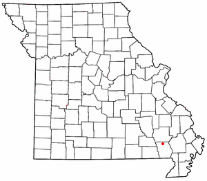
Crosno is a ghost town in Mississippi County, in the U.S. state of Missouri. The GNIS classifies it as a populated place.
Dogwood is an unincorporated community in Mississippi County, in the U.S. state of Missouri.
Fuget is an extinct town in Mississippi County, in the U.S. state of Missouri. The GNIS classifies it as a populated place.
Greenfield is an extinct town in Mississippi County, in the U.S. state of Missouri. The GNIS classifies it as a populated place.
Hallett is an extinct town in Mississippi County, in the U.S. state of Missouri.
Henson is an unincorporated community in Mississippi County, in the U.S. state of Missouri.
Norfolk is an extinct town in Mississippi County, in the U.S. state of Missouri.
Pulltight is an unincorporated community in Mississippi County, in the U.S. state of Missouri.
Rushs Ridge is an extinct town in Mississippi County, in the U.S. state of Missouri. The GNIS classifies it as a populated place.
Samos is an unincorporated community in Mississippi County, in the U.S. state of Missouri. The community was at the intersection of County roads 326 and 321 approximately 4.5 miles southeast of Charleston and 3.5 miles southwest of Wyatt. It was on the St. Louis Southwestern Railroad line.
Texas Bend is an unincorporated community in Mississippi County, in the U.S. state of Missouri.
Three States is an extinct town in Mississippi County, in the U.S. state of Missouri. The GNIS classifies it as a populated place.
Mississippi Township is an inactive township in Mississippi County, in the U.S. state of Missouri.
Tyler is an unincorporated community in Pemiscot County, located in the U.S. state of Missouri. The community is situated on County Road 570, approximately four miles east-southeast of Cooter. The Mississippi River is 1.5 miles to the east, while Cottonwood Point, situated on the bank of the Mississippi, is three miles to the northeast.
References
- ↑ U.S. Geological Survey Geographic Names Information System: Buckeye, Missouri
- 1 2 "Mississippi County Place Names, 1928–1945". The State Historical Society of Missouri. Archived from the original on June 24, 2016. Retrieved November 6, 2016.
- ↑ "Post Offices". Jim Forte Postal History. Retrieved November 6, 2016.
Municipalities and communities of Mississippi County, Missouri, United States | ||
|---|---|---|
| Cities |  | |
| Villages | ||
| Townships | ||
| CDP | ||
| Other communities | ||
| Ghost towns | ||
| Footnotes | ‡This populated place also has portions in an adjacent county or counties | |
36°54′16″N89°29′33″W / 36.90444°N 89.49250°W
| | This Mississippi County, Missouri state location article is a stub. You can help Wikipedia by expanding it. |