Related Research Articles
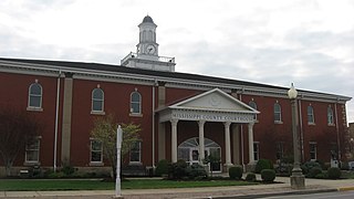
Mississippi County is a county located in the Bootheel of the U.S. state of Missouri, with its eastern border formed by the Mississippi River. As of the 2020 census, the population was 12,577. The largest city and county seat is Charleston. The county was officially organized on February 14, 1845, and was named after the Mississippi River.
Bird's Point is an unincorporated community in Mississippi County, Missouri, United States. It lies on an island or former island in the Mississippi River, near the confluence of the Ohio and Mississippi Rivers and is situated directly across from Cairo, Illinois. This is the point where the U.S. Route 60 bridge connects with Cairo.

Dorena is an unincorporated community in southeastern Mississippi County, Missouri, United States. Route 77 and Route 102 intersect here, approximately thirteen miles southeast of East Prairie. Dorena lends its name to the nearby Dorena-Hickman Ferry, which connects Route 77 with the Kentucky side of the Mississippi River.
Converse is an unincorporated community in Clinton County, in the U.S. state of Missouri.
Alfalfa Center is an unincorporated community in Mississippi County, in the U.S. state of Missouri.
Belmont is a ghost town in Mississippi County, on the eastern border of the U.S. state of Missouri at the Mississippi River. The GNIS classifies it as a populated place under the name "Belmont Landing".
Buckeye is an unincorporated community in Mississippi County in the U.S. state of Missouri.
Catalpa is an unincorporated community in Mississippi County, in the U.S. state of Missouri.
Crosno is a ghost town in Mississippi County, in the U.S. state of Missouri. The GNIS classifies it as a populated place.
Dogwood is an unincorporated community in Mississippi County, in the U.S. state of Missouri.
Fuget is an extinct town in Mississippi County, in the U.S. state of Missouri. The GNIS classifies it as a populated place.
Greenfield is an extinct town in Mississippi County, in the U.S. state of Missouri. The GNIS classifies it as a populated place.
Hallett is an extinct town in Mississippi County, in the U.S. state of Missouri.
Henson is an unincorporated community in Mississippi County, in the U.S. state of Missouri.
Pulltight is an unincorporated community in Mississippi County, in the U.S. state of Missouri.
Rushs Ridge is an extinct town in Mississippi County, in the U.S. state of Missouri. The GNIS classifies it as a populated place.
Three States is an extinct town in Mississippi County, in the U.S. state of Missouri. The GNIS classifies it as a populated place.
Noxall is an unincorporated community in New Madrid County, in the U.S. state of Missouri.
Cottonwood Point is a census-designated place in Pemiscot County, in the U.S. state of Missouri. The community is on the west bank of the Mississippi River with Heloise, Tennessee lying one mile across the river to the southeast.
Tyler is an unincorporated community in Pemiscot County, located in the U.S. state of Missouri. The community is situated on County Road 570, approximately four miles east-southeast of Cooter. The Mississippi River is 1.5 miles to the east, while Cottonwood Point, situated on the bank of the Mississippi, is three miles to the northeast.
References
- ↑ U.S. Geological Survey Geographic Names Information System: Samos, Missouri
- ↑ Missouri Atlas & Gazetteer, DeLorme, 1st ed., 1998, p.69 ISBN 0899332242
- ↑ Charleston, MO-IL, 15 Minute Topographic Quadrangle, USGS, 1954
- ↑ "Post Offices". Jim Forte Postal History. Retrieved November 6, 2016.
- ↑ "Mississippi County Place Names, 1928–1945". The State Historical Society of Missouri. Archived from the original on June 24, 2016. Retrieved November 6, 2016.
Municipalities and communities of Mississippi County, Missouri, United States | ||
|---|---|---|
| Cities |  | |
| Villages | ||
| Townships | ||
| CDP | ||
| Other communities | ||
| Ghost towns | ||
| Footnotes | ‡This populated place also has portions in an adjacent county or counties | |
36°52′05″N89°16′35″W / 36.86806°N 89.27639°W
| | This Mississippi County, Missouri state location article is a stub. You can help Wikipedia by expanding it. |